
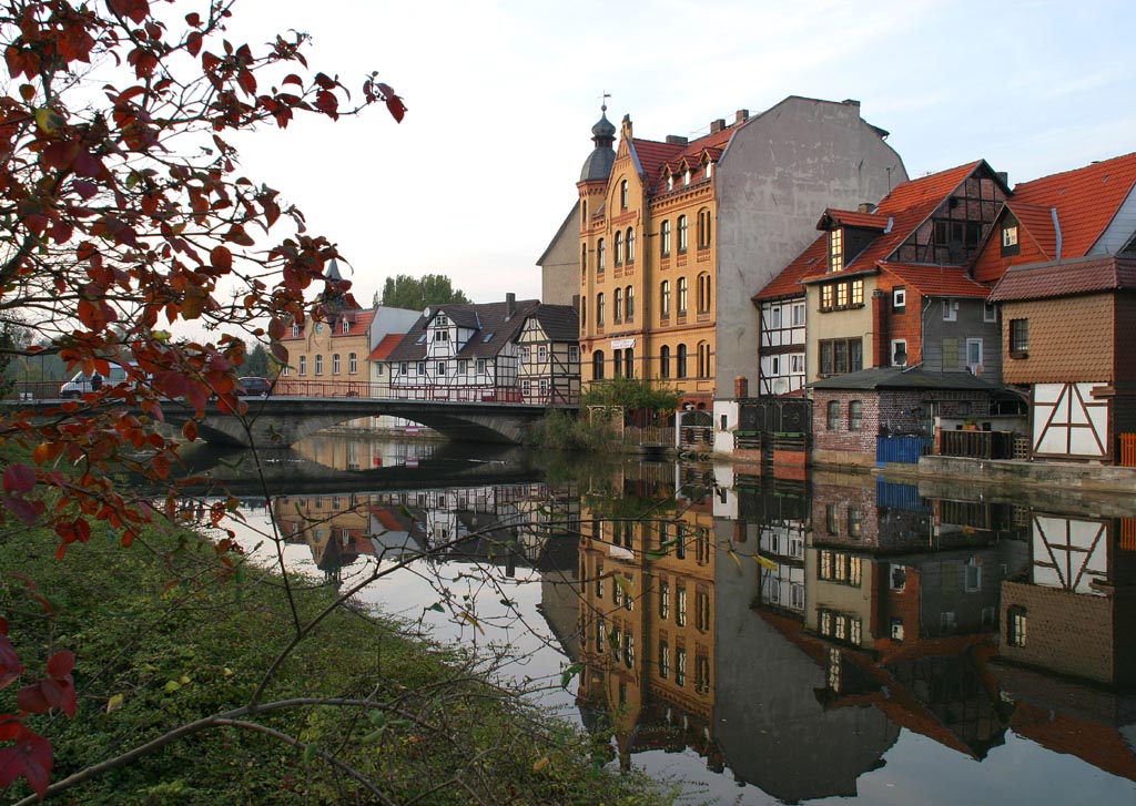


Why visit Eschwege
Townapedia lists 231 museums and landmarks, 23 parks and trails, 86 places to eat, 22 places to stay and 44 attractions in and around town.
Highlights include Feldladen Kanngießer, Hofladen und Kelterei Degenhardt, Karlsturm and Schloss Jestädt.
Weather in Eschwege
Forecast from MET Norway (CC BY 4.0). Full forecast
About Eschwege
Eschwege (German pronunciation: [ˈɛʃveːɡə] ), the district seat of the Werra-Meißner-Kreis, is a town in northeastern Hesse, Germany. In 1971, the town hosted the eleventh Hessentag state festival.
From the Wikipedia article Eschwege (this version), under CC BY-SA 4.0.
Things to do44
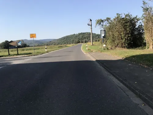
Feldladen Kanngießer
Farm and orchard · 5.0 km
20 Rasenstraße, Wanfried
Tu-Th 10:00-18:00; Fr 10:00-22:30; Sa 07:30-18:00; Su 10:00-18:00
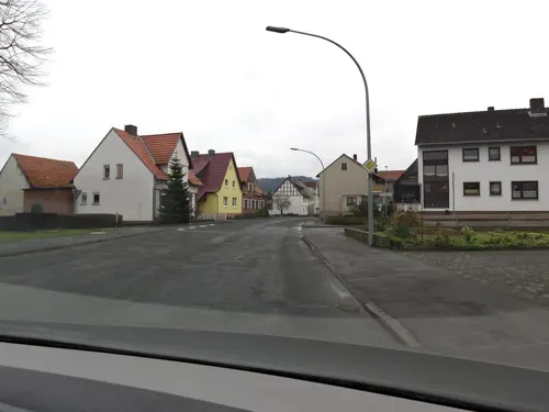
Hofladen und Kelterei Degenhardt
Farm and orchard · 2.3 km
Mo,We,Fr 09:00-18:00; Tu,Th,Su 09:00-13:00




32 more on the map.
Museums and landmarks231

Karlsturm
Monument and historic site · 0.6 km
Remnant of Cyriakus-Stift
1 Sophienplatz, Eschwege


Schloss Grebendorf
Monument and historic site · 2.4 km
15 Sandstraße, Meinhard




219 more on the map.
Parks, trails and playgrounds23

Jestädter Weinberg
Hiking and trails · 5.6 km
Abschnitt der Werra mit Flussauen und angrenzenden Hängen des Weinberg und des Fürstenstein, westlich von Jestädt.


Werraaltarm und Werraaue bei Albungen
Hiking and trails · 6.2 km
Altarm und Flussaue der Werra mit einem durch Kiesabbau entstandenen See, südwestlich von Albungen.




11 more on the map.
Restaurants and cafes86

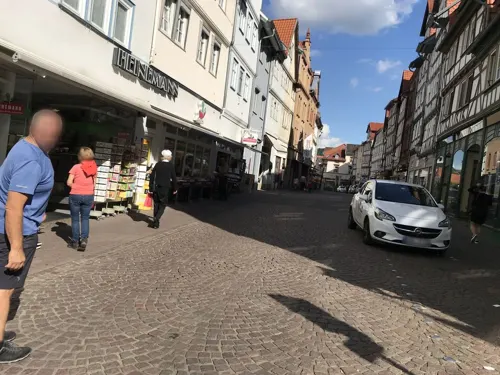
Zur Krone Altstadtgasthof
Restaurant · German, Regional
9 Stad, Eschwege
Tu-Sa 11:30-21:00; Su 11:30-20:00

Ab und Zu
Restaurant · German · 5.2 km
81 Landstraße, Wehretal
Mo-Fr 11:00-14:15,17:00-23:00; Sa 11:00-24:00; PH,Su 10:30-23:00
Guter Gerlach
Bakery
Bakery and cafe without staff
17a Reichensächser Straße, Eschwege
Mo-Su 06:00-21:00
Guter Gerlach
Bakery · 1.1 km
4 Niederhoner Straße, Eschwege
Mo-Fr 06:00-18:00; Sa 06:00-17:00; Su 07:00-17:00; PH off
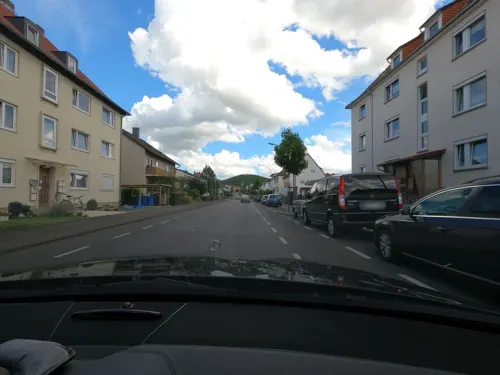
Schubarts Höhe
Restaurant · 1.7 km
4 Schützenweg, Eschwege
May-Oct PH,Tu-Su 11:30-21:00; Nov-Apr PH,Tu-Su 11:30-20:00
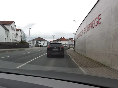
Stadtcafe Bäckerei Wolf
Cafe · 1.1 km
1 Am Bahnhof, Eschwege
Mo-Fr 05:00-18:00; Sa 07:00-16:00; Su 08:00-16:00
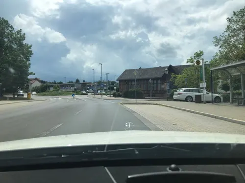


74 more on the map.
History
In 974, Eskinivvach had its first documentary mention. This name stems from an old Germanic language and means “Settlement near the ash trees at the water”. This origin is noteworthy for showing that the town arose before Franks overran the area, which was some time between 500 and 700. As far back as Merovingian times, a Frankish royal court arose here, which kept watch as a border defence over the ford (crossing) on the Werra leading into Thuringia, and which still stood in the 10th and 11th centuries. At this time, Saint Denis was still the foremost saint, having been the Merovingians’ main saint, to whom the church in the Old Town is consecrated.
The first documentary mention is found in a document from Emperor Otto II, in which he bequeathed the royal court and the settlement to his wife Theophanu. Their daughter Sophia founded on the Cyriakusberg about 1000 a canonical foundation for women (in which women did not take vows, but nonetheless lived in a conventlike environment) consecrated to Saint Cyriacus, which existed until the introduction of the Reformation into Hesse in 1527. All that is left of it now, though, is the Karlsturm (tower). Market rights were granted about 1188, and town rights followed by 1249. It was in this time that the groundwork was laid for the cloth- and leathermaking that flourished on into modern times.
From the History section of Eschwege on Wikipedia, under CC BY-SA 4.0.
Where to stay22
Churches and places of worship26
St. Elisabeth
Church · Catholic · 0.7 km
2 Moritz-Werner-Straße, Eschwege
Marktkirche
Church · Protestant · 0.6 km
25 Bei der Marktkirche, Eschwege
Shopping26
Gas and EV charging8
Schools, colleges and libraries16
Healthcare7
Map of Eschwege
250 places. The map loads OpenStreetMap tiles when you open it.
Getting there and nearby towns
Flugplatz Eisenach-Kindel (EIB) is the nearest airport with scheduled flights listed in OpenStreetMap, 37 km away.
- Witzenhausen 22 km northwest, about 22 min by car
- Hessisch Lichtenau 23 km west, about 23 min by car
- Bebra 29 km southwest, about 29 min by car
- Rotenburg an der Fulda 31 km southwest, about 31 min by car
- Kaufungen 32 km west, about 32 min by car
- Melsungen 35 km west, about 35 min by car
- Lohfelden 37 km west, about 37 min by car
- Göttingen 40 km north, about 40 min by car
- Fuldatal 40 km northwest, about 40 min by car
- Kassel 41 km west, about 41 min by car
Drive times are estimates from straight-line distance, not routes.
Local news
Headlines from INDB.
Reviews, tips and questions
Loading what members have shared...
Sources and licences
- GeoNames (CC BY 4.0): population, coordinates, regions and time zone
- Mapillary (see each image): photos
- OpenStreetMap contributors (ODbL 1.0): places, airports, map data
- Wikidata (CC0 1.0): elevation, founding date, time zone, website
- Wikimedia Commons (see each image): photos
- Wikipedia (CC BY-SA 4.0): overview and history text
Photo credits
- Werraansicht, Carsten Vogel, Public domain
- Luisenstraße 18, 1, Eschwege, Werra-Meißner-Kreis, GeorgDerReisende, CC BY-SA 4.0
- Luisenstraße 14, 1, Eschwege, Werra-Meißner-Kreis, GeorgDerReisende, CC BY-SA 4.0
- Luisenstraße, 2, Eschwege, Werra-Meißner-Kreis, GeorgDerReisende, CC BY-SA 4.0
- Luisenstraße 10a, 1, Eschwege, Werra-Meißner-Kreis, GeorgDerReisende, CC BY-SA 4.0
- Luisenstraße 8, 1, Eschwege, Werra-Meißner-Kreis, GeorgDerReisende, CC BY-SA 4.0
- Luisenstraße 10, 1, Eschwege, Werra-Meißner-Kreis, GeorgDerReisende, CC BY-SA 4.0
- Luisenstraße 19, 1, Eschwege, Werra-Meißner-Kreis, GeorgDerReisende, CC BY-SA 4.0
- Luisenstraße 6, 1, Eschwege, Werra-Meißner-Kreis, GeorgDerReisende, CC BY-SA 4.0
- Luisenstraße 4, 1, Eschwege, Werra-Meißner-Kreis, GeorgDerReisende, CC BY-SA 4.0
- Luisenstraße 23 + 23b + 23c, 1, Eschwege, Werra-Meißner-Kreis, GeorgDerReisende, CC BY-SA 4.0
- Luisenstraße 25 - 35, 1, Eschwege, Werra-Meißner-Kreis, GeorgDerReisende, CC BY-SA 4.0
- Luisenstraße 2a, 1, Eschwege, Werra-Meißner-Kreis, GeorgDerReisende, CC BY-SA 4.0
- Luisenstraße 17, 1, Eschwege, Werra-Meißner-Kreis, GeorgDerReisende, CC BY-SA 4.0
- Elsa-Brandström-Straße 4, 1, Eschwege, Werra-Meißner-Kreis, GeorgDerReisende, CC BY-SA 4.0
- Luisenstraße 15, 1, Eschwege, Werra-Meißner-Kreis, GeorgDerReisende, CC BY-SA 4.0
- Luisenstraße, 5, Eschwege, Werra-Meißner-Kreis, GeorgDerReisende, CC BY-SA 4.0
- Humboldtstraße 4, 3, Eschwege, Werra-Meißner-Kreis, GeorgDerReisende, CC BY-SA 4.0
- Luisenstraße 27, 1, Eschwege, Werra-Meißner-Kreis, GeorgDerReisende, CC BY-SA 4.0
- Luisenstraße 23a, 1, Eschwege, Werra-Meißner-Kreis, GeorgDerReisende, CC BY-SA 4.0
- Goldbachstraße 6, 2, Eschwege, Werra-Meißner-Kreis, GeorgDerReisende, CC BY-SA 4.0
- Luisenstraße 13, 1, Eschwege, Werra-Meißner-Kreis, GeorgDerReisende, CC BY-SA 4.0
- Goldbachstraße, 2, Eschwege, Werra-Meißner-Kreis, GeorgDerReisende, CC BY-SA 4.0
- Goldbachstraße, 1, Eschwege, Werra-Meißner-Kreis, GeorgDerReisende, CC BY-SA 4.0
- Luisenstraße 11 + 13, 2, Eschwege, Werra-Meißner-Kreis, GeorgDerReisende, CC BY-SA 4.0
- Alexander-von-Humboldt-Schule, 1, Humboldtstraße 1, Eschwege, Werra-Meißner-Kreis, GeorgDerReisende, CC BY-SA 4.0
- Bushaltestelle Goldbachstraße, 1, Eschwege, Werra-Meißner-Kreis, GeorgDerReisende, CC BY-SA 4.0
- Goldbachstraße 6, 1, Eschwege, Werra-Meißner-Kreis, GeorgDerReisende, CC BY-SA 4.0
- Bushaltestelle Goldbachstraße, 2, Eschwege, Werra-Meißner-Kreis, GeorgDerReisende, CC BY-SA 4.0
- Goldbachstraße 7, 2, Eschwege, Werra-Meißner-Kreis, GeorgDerReisende, CC BY-SA 4.0
- Goldbachstraße 5, 1, Eschwege, Werra-Meißner-Kreis, GeorgDerReisende, CC BY-SA 4.0
- Luisenstraße 11, 1, Eschwege, Werra-Meißner-Kreis, GeorgDerReisende, CC BY-SA 4.0
- Humboldtstraße 6a, 3, Eschwege, Werra-Meißner-Kreis, GeorgDerReisende, CC BY-SA 4.0
- Humboldtstraße 6b, 1, Eschwege, Werra-Meißner-Kreis, GeorgDerReisende, CC BY-SA 4.0
- Alexander-von-Humboldt-Schule, 3, Humboldtstraße 1, Eschwege, Werra-Meißner-Kreis, GeorgDerReisende, CC BY-SA 4.0
- Humboldtstraße 6a, 1, Eschwege, Werra-Meißner-Kreis, GeorgDerReisende, CC BY-SA 4.0
- Luisenstraße 25, 1, Eschwege, Werra-Meißner-Kreis, GeorgDerReisende, CC BY-SA 4.0
- An den Anlagen 20, 3, Eschwege, Werra-Meißner-Kreis, GeorgDerReisende, CC BY-SA 4.0
- Turnhalle der Alexander-von-Humboldt-Schule - Eschwege Humboldtstraße 1 - panoramio, Gunther Falchner, CC BY-SA 3.0
- Luisenstraße 9, 1, Eschwege, Werra-Meißner-Kreis, GeorgDerReisende, CC BY-SA 4.0
- Eschwege bismarckturm, 2micha, CC BY-SA 3.0
- Burg Fuerstenstein - Ostseite, MacElch (Rainer Kunze), CC BY-SA 3.0
- Eschweger Klosterbrauerei - Logistikzentrum und Verwaltung in der Thüringer Straße 19, Eschwege, Eschweger Klosterbrauerei, CC BY-SA 4.0
- Albungen im nordhessischen Werra-Meißner-Kreis - Die evangelische Kirche, Heinz K. S., CC BY-SA 4.0
- Reichensachsen Pfarrkirche 63, GFreihalter, CC BY-SA 3.0
- Eschwege St. Dionys 118, GFreihalter, CC BY-SA 3.0
- Neustaedter Kirche Eschwege, User:Any1s and Christoph Braun, CC0
- Meinhard-Grebendorf - Das alte Keudellsche Schloss, Heinz K. S., CC BY-SA 4.0
- Jestaedt-Schloss-2008, [email protected], CC BY-SA 3.0
- Kiesteich unter der Aue'schen Kugel im nordhessischen Werra-Meißner Kreis, Heinz K. S., CC BY-SA 4.0
- Die Blaue Kuppe im nordhessischen Werra-Meißner Kreis. (2), Heinz K. S., CC BY-SA 4.0
- Naturschutzgebiet Mönchesrieth bei Grebendorf (1), Heinz K. S., CC BY-SA 4.0
- Naturschutz- und Natura 2000-Gebiet Werra-Altarm bei Schwebda (1), Heinz K. S., CC BY-SA 4.0
- Naturschutzgebiet Kiesteich bei Frieda, Heinz K. S., CC BY-SA 4.0
- Aue im nordhessischen Werra-Meißner-Kreis. 01, Heinz K. S., CC BY-SA 4.0
- Höhenweg 1, Neuer Friedhof, Friedhofskapelle Eschwege 20220301 0123, Tilman2007, CC BY-SA 4.0
- St. Elisabeth Church, Eschwege, back-side, EpsilonEridani, CC BY-SA 3.0
- Gesamtansicht der ev. Kirche St. Martin - Eschwege-Niederhone Anger - panoramio, Gunther Falchner, CC BY-SA 3.0
- Blick auf Hitzelrode und das Naturschutzgebiet „Hessische Schweiz bei Meinhard“ (1), Heinz K. S., CC BY-SA 4.0
- Jestaedt-dorfkirche-2008, Nikolas Becker (foto/at/nikolasbecker.de), CC BY-SA 3.0
- Humboldtstraße 1 Eschwege 20220301 0097, Tilman2007, CC BY-SA 4.0
- Sophienplatz 1, Karlsturm Eschwege 20180209 003, Tilman2007, CC BY-SA 4.0
- Eschwege duenzebacher torturm ds wv 08 2009, Dirk Schmidt ( celsius ), CC BY-SA 3.0
- Auer Wasserburg 2, Petronius321, Public domain
- Naturschutzgebiet Jestädter Weinberg im nordhessischen Werra-Meißner Kreis. (1), Heinz K. S., CC BY-SA 4.0
- NSG 1636020 Werraaltarm und Werraaue bei Albungen 2022-03-04 d, Baummapper, CC BY-SA 3.0 de
- Aussichtspunkt Lotzenkopf X5H, Feuermond16, CC BY-SA 4.0
- Ehemaliges Elektrizitätswerk, jetzt "Kulturfabrik e.V. E-Werk" - panoramio, Gunther Falchner, CC BY-SA 3.0
- Grenzweg Meinhard X5H, Feuermond16, CC BY-SA 4.0
- Zinnfigurenkabinett im Ackerbürgerhaus und Kemenate - Eschwege Hospitalstraße 7 - panoramio, Gunther Falchner, CC BY-SA 3.0
- Street-level photo, fuldata, CC BY-SA 4.0
- Street-level photo, fuldata, CC BY-SA 4.0
- Street-level photo, saschahaberkorn, CC BY-SA 4.0
- Street-level photo, nakaner, CC BY-SA 4.0
- Street-level photo, saschahaberkorn, CC BY-SA 4.0
- Street-level photo, saschahaberkorn, CC BY-SA 4.0
- Street-level photo, saschahaberkorn, CC BY-SA 4.0
- Street-level photo, zoegglmeyr, CC BY-SA 4.0
- Street-level photo, s3bax, CC BY-SA 4.0
- Street-level photo, capitano, CC BY-SA 4.0
- Street-level photo, fuldata, CC BY-SA 4.0
- Street-level photo, saschahaberkorn, CC BY-SA 4.0
- Street-level photo, saschahaberkorn, CC BY-SA 4.0
- Street-level photo, fuldata, CC BY-SA 4.0
- Street-level photo, saschahaberkorn, CC BY-SA 4.0
- Street-level photo, fuldata, CC BY-SA 4.0
- Street-level photo, saschahaberkorn, CC BY-SA 4.0
- Street-level photo, zoegglmeyr, CC BY-SA 4.0
- Street-level photo, saschahaberkorn, CC BY-SA 4.0
- Street-level photo, saschahaberkorn, CC BY-SA 4.0
- Street-level photo, fuldata, CC BY-SA 4.0
- Street-level photo, DruideBizeps, CC BY-SA 4.0


Page built November 8, 2026. Spotted a mistake? Tell us or suggest a place.