


Rotenburg an der Fulda, Germany
Rotenburg an der Fulda is a town of 12,937 people in Hesse, Germany.
Why visit Rotenburg an der Fulda
Townapedia lists 152 museums and landmarks, 37 parks and trails, 93 places to eat, 24 places to stay and 56 attractions in and around town.
Highlights include Kirchhof, Mustergeflügelhof Leonhard Häde, Wasserturm and Honet Kaufmann.
Weather in Rotenburg an der Fulda
Forecast from MET Norway (CC BY 4.0). Full forecast
About Rotenburg an der Fulda
Rotenburg an der Fulda (German pronunciation: [ˈʁoːtn̩bʊʁk ʔan deːɐ̯ ˈfʊlda], lit. 'Rotenburg on the Fulda'; officially Rotenburg a.d. Fulda) is a town in Hersfeld-Rotenburg district in northeastern Hesse, in central Germany, situated, as the name says, on the river Fulda.
From the Wikipedia article Rotenburg an der Fulda (this version), under CC BY-SA 4.0.
Things to do56




44 more on the map.
Museums and landmarks152



Landgräfliches Schloss
Monument and historic site
7 Am Schloßtor, Rotenburg an der Fulda


140 more on the map.
Parks, trails and playgrounds37

Im Sand bei Rotenburg
Hiking and trails · 2.0 km
Kiessee mit Ufergehölzen und Wiesen, nördlich der Fulda am nordwestlichen Stadtrand von Rotenburg.

Kiesgrube bei Baumbach
Hiking and trails · 6.0 km
Kiessee mit Auwald und Abschnitt der benachbarten Fulda nördlich von Baumbach.






Waldschwimmbad
Sports field and stadium · 1.4 km
PH,We,Fr-Mo 10:00-20:00; Tu,Th 08:00-20:00

25 more on the map.
Restaurants and cafes93

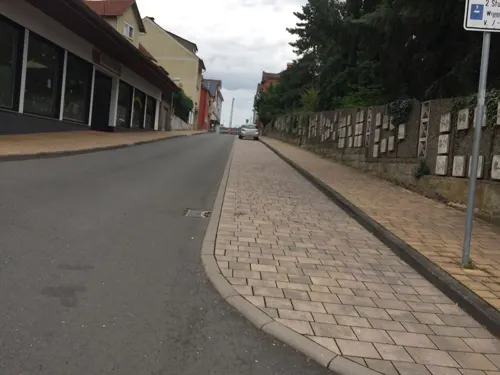
Altes Rathaus
Restaurant · Italian · 5.1 km
12 Rotenburger Straße, Bebra
Tu-Su 11:30-14:30, 17:00-23:00
Da Marco
Restaurant · Italian · 5.5 km
53 Nürnberger Straße, Bebra
Tu-Fr, Su 11:30-14:00, 17:30-23:30; Sa 17:30-23:30
Holzwurmstüberl
Restaurant · German · 6.0 km
7 Breitenbacher Weg, Bebra
We-Sa 17:00-00:00; Su 11:30-14:30, 17:00-00:00
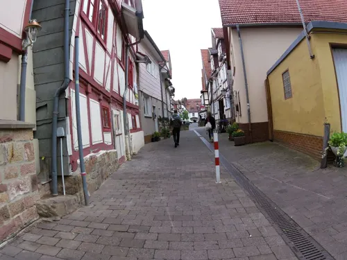
Ristorante Pizzeria Bacco
Restaurant · Italian
28 Altstadtstraße, Rotenburg an der Fulda
Mo,We-Su 11:30-14:30,17:30-23:30
Saigon Place
Restaurant · Vietnamese, German · 5.9 km
3 Friedrich-Ebert-Straße, Alheim
Mo 17:00-23:00, Tu-Fr 17:00-23:00, Sa-Su 11:00-23:00
Biermanufaktur Rotenburg
Restaurant
7 Obertor, Rotenburg an der Fulda
Apr-Sep "täglich"; Oct-Mar Mo off
Mosebergs Brauhaus
Restaurant · 5.5 km
54 Nürnberger Straße, Bebra
Mo-Sa 17:00+; Su 11:30-14:00,17:00+

Alheimer Hütte
Bar and pub · 4.4 km
1 Am Alheimer, Rotenburg an der Fulda
We,Fr 12:00-18:00; Sa 12:00-20:00; Su,PH 10:00-18:00
Am Laterndl
Restaurant · Bavarian
13 Marktplatz, Rotenburg an der Fulda
Mo-Su 11:30-23:00; Fr,Sa 11:30-24:00


81 more on the map.
History
In 769, the outlying centres of Braach and Lispenhausen, along with the now vanished village of Breitingen (which lay somewhere near the Hochmahle) had their first documentary mentions in the Hersfeld Abbey’s directory of holdings. These consisted of six estates and 90 Morgen of land.
The Gisonen were the Abbey’s Vögte (singular: Vogt). They built the first security castle in the Fulda valley once they had come to hold the Vogtei (the right to be Vogt). Around this castle arose a settlement. The Landgraves of Thuringia, who inherited the Vogtei from the Gisonen, built on the Alter Turm (mountain) Rodenberg Castle, which today lies in ruins, but is believed to be the town’s namesake.
The settlement on the Fulda’s left bank, today’s Altstadt (“Old Town”), had its first documentary mention as a town in 1248, and after the Thuringian-Hessian War of Succession in 1264 the town belonged to the Landgraviate of Hesse. The old castle in the valley had supposedly been removed sometime after 1423. In 1470 arose the first Schloss Rotenburg. A great town fire destroyed the Old Town in 1478 along with the newly built Schloss. Between 1627 and 1834, Rotenburg was a residence town of the landgrave family of Hesse-Rotenburg, the so-called Rotenburger Quart.
From the History section of Rotenburg an der Fulda on Wikipedia, under CC BY-SA 4.0.
Where to stay24
der Jugendhof Landkreis Hersfeld-Rotenburg
Motel and hotel · 0.9 km
15 Am Emanuelsberg, Rotenburg an der Fulda
Churches and places of worship26
Evangelisch-methodistische Kirche
Church · Methodist · 5.5 km
23 Friedrichstraße, Bebra
Evangelische Kirche Baumbach
Church · Protestant · 5.2 km
5 Lindengasse, Alheim
Evangelische Kirche Niederellenbach
Church · Protestant · 7.3 km
22 Heinebacher Straße, Alheim
Evangelische Kirche Schwarzenhasel
Church · Protestant · 4.0 km
4 Kirchweg, Rotenburg an der Fulda
Johanneskirchengemeinde Alheim
Church · Protestant · 5.9 km
13 Ludwigsecker Straße, Alheim
Shopping27
Gas and EV charging12
Tankshop Heyer
Gas station · 0.6 km
15 Mündershäuser Straße, Rotenburg an der Fulda
Schools, colleges and libraries20
Healthcare7
Herz-Kreislauf-Zentrum
Hospital · 1.2 km
100 Heinz-Meise-Straße, Rotenburg an der Fulda
Map of Rotenburg an der Fulda
250 places. The map loads OpenStreetMap tiles when you open it.
Getting there and nearby towns
Fritzlar Air Base (FRZ) is the nearest airport with scheduled flights listed in OpenStreetMap, 34 km away.
- Bebra 5 km southeast, about 5 min by car
- Alheim 6 km northwest, about 6 min by car
- Schlitz 38 km south, about 38 min by car
- Kassel 39 km northwest, about 39 min by car
- Witzenhausen 39 km north, about 39 min by car
- Wolfhagen 54 km northwest, about 54 min by car
- Göttingen 62 km north, about 1 h by car
- Schotten 69 km southwest, about 1 h 15 min by car
- Steinau an der Straße 78 km south, about 1 h 15 min by car
- Wächtersbach 88 km south, about 1 h 30 min by car
Drive times are estimates from straight-line distance, not routes.
Local news
Headlines from INDB.
Reviews, tips and questions
Loading what members have shared...
Sources and licences
- GeoNames (CC BY 4.0): population, coordinates, regions and time zone
- Mapillary (see each image): photos
- OpenStreetMap contributors (ODbL 1.0): places, airports, map data
- Wikidata (CC0 1.0): elevation, founding date, time zone, website
- Wikimedia Commons (see each image): photos
- Wikipedia (CC BY-SA 4.0): overview and history text
Photo credits
- Rotenburg - Rodenberg 1, Oliver Abels ( SBT ), CC BY 2.5
- Evangelische Kirche Bebra, Klaus Jesper, CC BY-SA 2.0
- Rotenburg an der Fulda-Schloss-06-Westfluegel-2026-gje, Gerd Eichmann, CC BY 4.0
- Rotenburg Jacobikirche Chor, Oliver Abels ( SBT ), CC BY-SA 3.0
- Alheimer, Jörg Braukmann, CC BY-SA 3.0
- Naturschutzgebiet „Alte Fulda bei Blankenheim“ (3), Heinz K. S., CC BY-SA 4.0
- Naturschutzgebiet „Unterm Siegel bei Bebra“ (2), Heinz K. S., CC BY-SA 4.0
- Die Fulda bei Bebra, Heinz K. S., CC BY-SA 4.0
- Naturschutzgebiet Haselgrund bei Schwarzenhasel (4), Heinz K. S., CC BY-SA 4.0
- Alheimerturm-01, Muck, CC BY-SA 4.0
- Kirche Asmushausen, Lucas Friese, CC BY-SA 3.0
- Stolperstein Baruch Emanuel, 1, Hersfelder Straße 7, Bebra, Landkreis Hersfeld-Rotenburg, GeorgDerReisende, CC BY-SA 4.0
- Stolperstein Rotenburg an der Fulda Brauhausstraße 2 Honet Kaufmann, Gmbo 2013, CC0
- Stolperstein Siegfried Abraham, 1, Nürnberger Straße 18, Bebra, Landkreis Hersfeld-Rotenburg, GeorgDerReisende, CC BY-SA 4.0
- Stolperstein Rotenburg an der Fulda Breitenstraße 16 Adolf Speier, Gmbo 2013, CC0
- Stolperstein Rotenburg an der Fulda Querweingasse 5 Alexander Döllefeld, Gmbo 2013, CC0
- Stolperstein Alfred Katz, 1, Nürnberger Straße 26, Bebra, Landkreis Hersfeld-Rotenburg, GeorgDerReisende, CC BY-SA 4.0
- Stolperstein Baruch Katz, 1, Kirchstraße, Heinebach, Alheim, Landkreis Hersfeld-Rotenburg, GeorgDerReisende, CC BY-SA 4.0
- Stolperstein Rotenburg an der Fulda Breitenstraße 16 Berni Speier, Gmbo 2013, CC0
- Stolperstein Rotenburg an der Fulda Breitenstraße 35 Berta Kaufmann, Gmbo 2013, CC0
- Stolperstein Rotenburg an der Fulda Steinweg 4 Bertha Katz, Gmbo 2013, CC0
- NSG 1632029 Im Sand bei Rotenburg 2021-04-03 c, Baummapper, CC BY-SA 3.0 de
- Naturschutzgebiet „Kiesgrube bei Baumbach“ (1), Heinz K. S., CC BY-SA 4.0
- Naturschutzgebiet Haselgrund bei Schwarzenhasel (1), Heinz K. S., CC BY-SA 4.0
- Naturschutzgebiet „Alte Fulda bei Blankenheim“ (1), Heinz K. S., CC BY-SA 4.0
- Naturschutzgebiet „Unterm Siegel bei Bebra“, Heinz K. S., CC BY-SA 4.0
- Naturschutzgebiet „Im Sand bei Rotenburg“ (2), Heinz K. S., CC BY-SA 4.0
- Street-level photo, zoegglmeyr1, CC BY-SA 4.0
- Street-level photo, fuldata, CC BY-SA 4.0
- Street-level photo, fuldata, CC BY-SA 4.0
- Street-level photo, fuldata, CC BY-SA 4.0
- Street-level photo, zoegglmeyr1, CC BY-SA 4.0
- Street-level photo, fuldata, CC BY-SA 4.0
- Street-level photo, fuldata, CC BY-SA 4.0
- Street-level photo, zoegglmeyr1, CC BY-SA 4.0
- Street-level photo, fuldata, CC BY-SA 4.0
- Street-level photo, fuldata, CC BY-SA 4.0
- Street-level photo, bejotel, CC BY-SA 4.0
- Street-level photo, bejotel, CC BY-SA 4.0
- Street-level photo, fuldata, CC BY-SA 4.0
- Street-level photo, fuldata, CC BY-SA 4.0
- Street-level photo, mfa, CC BY-SA 4.0
- Street-level photo, zoegglmeyr1, CC BY-SA 4.0


Page built November 8, 2026. Spotted a mistake? Tell us or suggest a place.