


Why visit Finsterwalde
Townapedia lists 24 museums and landmarks, 9 parks and trails, 46 places to eat, 7 places to stay and 6 attractions in and around town.
Highlights include Tierpark Finsterwalde, Weltspiegel, Steinkreuz and Besucherbergwerk F60.
Weather in Finsterwalde
Forecast from MET Norway (CC BY 4.0). Full forecast
About Finsterwalde
Finsterwalde (German pronunciation: [fɪnstɐˈvaldə] , Lower Sorbian: Grabin, pronounced [ˈɡrabʲin]) is a town in the Elbe-Elster district (German: Landkreis), in Lower Lusatia, Brandenburg, Germany.
From the Wikipedia article Finsterwalde (this version), under CC BY-SA 4.0.
Things to do6

Tierpark Finsterwalde
Zoo and aquarium · 1.3 km
An der Bürgerheide, Finsterwalde
Feb-Apr 09:00-17:00; May-Sep 09:00-19:00; Oct-Jan 09:00-16:00



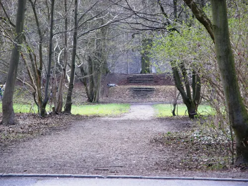
Museums and landmarks24

Steinkreuz
Monument and historic site · 4.0 km
Steinkreuz, neben der B96 in Finsterwalde Massen OT Betten. Eingemeißeltes latainisches Kreuz an einem großen Feldstein.



Steinkreuz
Monument and historic site · 2.5 km
Steinkreuz an der Südwand der Kirche in Nehesdorf (OT von Finsterwalde)

Ehemalige Tuchfabrik
Monument and historic site · 0.8 km
9 Brunnenstraße, Finsterwalde
Wegweiser-Wegstein
Monument and historic site · 5.6 km
Wegestein, Hauptstraße, Abzweig Hennersdorfer Weg in Sonnewalde OT Münchhausen
12 more on the map.
Parks, trails and playgrounds9




Restaurants and cafes46
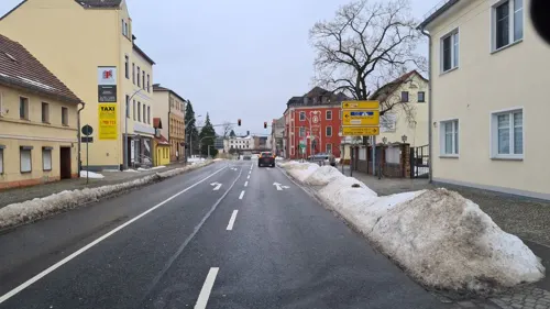
Finsterwalder Brauhaus
Restaurant · German
13 Sonnewalder Straße, Finsterwalde
We-Sa 18:00-24:00; PH off
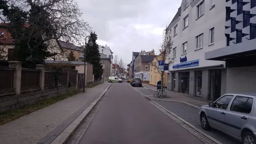

Namaste Restaurant and Pizzeria
Restaurant · Indian, Pizza · 0.8 km
34 Oscar-Kjellberg-Straße, Finsterwalde
PH,Mo-Su 11:00-14:00,17:00-22:30
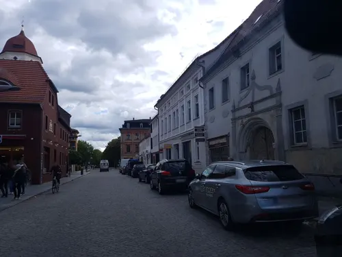


Bubner
Bakery · 1.4 km
69 Rosa-Luxemburg-Straße, Finsterwalde
Mo-Fr 06:00-18:00; Sa 06:00-12:00; Su 07:00-11:00
Gäbler
Bakery · 1.5 km
11 Turmstraße, Massen-Niederlausitz
Mo-Fr 06:00-20:00; Sa 06:00-18:00; Su,PH off


34 more on the map.
History
Finsterwalde was first mentioned in 1288. Up until the beginning of 17th century, a large part of the city's population was still speaking Lower Sorbian. In 1635, Finsterwalde came into the possession of the Electorate of Saxony and from 1815 it became part of the Kingdom of Prussia. From 1815 to 1947, Finsterwalde was part of the Prussian Province of Brandenburg. From 1952 to 1990, it was part of the Bezirk Cottbus of East Germany.
From the History section of Finsterwalde on Wikipedia, under CC BY-SA 4.0.
Where to stay7
Churches and places of worship5
Dorfkirche Eichholz
Church · Protestant · 4.8 km
67 Eichholzer Straße, Heideland
Trinitatiskirche (ev.)
Church · Protestant
3 Am Kirchplatz, Finsterwalde
Königreichssaal Jehovas Zeugen
Church · Jehovahs Witness · 1.3 km
4 Kleine Finsterwalder Straße, Massen-Niederlausitz
Shopping21
Gas and EV charging5
Schools, colleges and libraries11
Municipal Library of Finsterwalde
Library · 0.8 km
2 Geschwister-Scholl-Straße, Finsterwalde
Oberstufenzentrum Elbe-Elster - Sozialwesen
School
Friedrich-Engels-Straße, Finsterwalde
Oscar-Kjellberg-Oberschule Finsterwalde
School · 1.2 km
14 Saarlandstraße, Finsterwalde
Healthcare7
Engel-Apotheke Nord
Clinic and pharmacy · 1.3 km
96 Sonnewalder Straße, Finsterwalde
Map of Finsterwalde
141 places. The map loads OpenStreetMap tiles when you open it.
Getting there and nearby towns
Verkehrslandeplatz Riesa-Göhlis (IES) is the nearest airport with scheduled flights listed in OpenStreetMap, 45 km away.
- Lauchhammer 17 km south, about 17 min by car
- Großräschen 22 km east, about 22 min by car
- Senftenberg 24 km southeast, about 24 min by car
- Luckau 24 km north, about 24 min by car
- Lubnjow 30 km northeast, about 30 min by car
- Lubin 36 km north, about 36 min by car
- Kolkwitz 40 km east, about 40 min by car
- Jüterbog 59 km northwest, about 59 min by car
- Luckenwalde 63 km northwest, about 1 h by car
- Dresden 65 km south, about 1 h by car
Drive times are estimates from straight-line distance, not routes.
Local news
Headlines from INDB.
Reviews, tips and questions
Loading what members have shared...
Sources and licences
- GeoNames (CC BY 4.0): population, coordinates, regions and time zone
- Mapillary (see each image): photos
- OpenStreetMap contributors (ODbL 1.0): places, airports, map data
- Openverse (see each image): photos
- Wikidata (CC0 1.0): elevation, founding date, time zone, website
- Wikimedia Commons (see each image): photos
- Wikipedia (CC BY-SA 4.0): overview and history text
Photo credits
- FI-Rathaus, SchiDD, CC BY-SA 4.0
- Stolpersteine für Jacobsen und Galliner (Finsterwalde), Christian Michelides, CC BY-SA 4.0
- Stolperstein für Jutta Ruth Jacobsen (Finsterwalde), Christian Michelides, CC BY-SA 4.0
- Stolperstein für Emil Galliner (Finsterwalde), Christian Michelides, CC BY-SA 4.0
- Stolperstein für Bruno Jacobsen (Finsterwalde), Christian Michelides, CC BY-SA 4.0
- Stolperstein für Martha Galliner (Finsterwalde), Christian Michelides, CC BY-SA 4.0
- Stolperstein für Hanna Galliner (Finsterwalde), Christian Michelides, CC BY-SA 4.0
- Stolperstein für Dorothea Jacobsen (Finsterwalde), Christian Michelides, CC BY-SA 4.0
- Stolperstein für Heinz Galliner (Finsterwalde), Christian Michelides, CC BY-SA 4.0
- Berliner Straße-Finsterwalde 2012, Niesen, CC BY-SA 3.0
- Finsterwalde, Sängerdenkmal und Berliner Straße, Dguendel, CC BY 4.0
- Finsterwalde, Sängerdenkmal, Dguendel, CC BY 4.0
- Finsterwalde Wasserturm Bahnhof 1, Oberlausitzerin64, CC BY-SA 4.0
- Finsterwalde Wasserturm Bahnhof, Oberlausitzerin64, CC BY-SA 4.0
- Finsterwalde, Häuserzeile am Marktplatz, Dguendel, CC BY 4.0
- Finsterwalde Wasserturm Bhf-01, Radler59, CC BY-SA 4.0
- Finsterwalde Wasserturm Bhf-02, Radler59, CC BY-SA 4.0
- BfFinsterwalde, Global Fish, CC BY-SA 3.0
- Pfarrkirche St. Maria Mater Dolorosa (Finsterwalde) Ostansicht, Assenmacher, CC BY-SA 4.0
- Pfarrkirche St. Maria Mater Dolorosa (Finsterwalde) Gedenktafel Ordensschwestern, Assenmacher, CC BY-SA 4.0
- Pfarrkirche St. Maria Mater Dolorosa (Finsterwalde) 2021 (Alter Fritz) 09, Alter Fritz, CC BY-SA 4.0
- Pfarrkirche St. Maria Mater Dolorosa (Finsterwalde) Ostansicht Detail, Assenmacher, CC BY-SA 4.0
- Pfarrkirche St. Maria Mater Dolorosa (Finsterwalde) Westansicht, Assenmacher, CC BY-SA 4.0
- Pfarrkirche St. Maria Mater Dolorosa (Finsterwalde) Nordanbau, Assenmacher, CC BY-SA 4.0
- Pfarrkirche St. Maria Mater Dolorosa (Finsterwalde) Gedenktafel Pfarrer, Assenmacher, CC BY-SA 4.0
- Pfarrkirche St. Maria Mater Dolorosa (Finsterwalde) Chor, Assenmacher, CC BY-SA 4.0
- Pfarrkirche St. Maria Mater Dolorosa (Finsterwalde) Zugang Nordosten, Assenmacher, CC BY-SA 4.0
- Finsterwalde May2015 img1 Markt, A.Savin, CC BY-SA 3.0
- Pfarrkirche St. Maria Mater Dolorosa (Finsterwalde) Ostseite mit Kirchturm, Assenmacher, CC BY-SA 4.0
- Pfarrkirche St. Maria Mater Dolorosa (Finsterwalde) Westansicht Detail, Assenmacher, CC BY-SA 4.0
- Lichterfeld EE 09-2015 Foerderbruecke F60 img6, A.Savin, CC BY-SA 3.0
- Schloss Finsterwalde 200905 800px, Mätes II., CC BY-SA 3.0
- Finsterwalde Nehesdorf Kirche, Radler59, CC BY-SA 4.0
- Kirche Eichholz 1, Derbrauni, CC BY-SA 4.0
- 20150429010DR Finsterwalde Trinitatiskirche, Jörg Blobelt, CC BY-SA 4.0
- Finsterwalde Bahnbetriebswerk Wasserturm 1, Oberlausitzerin64, CC BY-SA 4.0
- FI-Kath-Kirche1, SchiDD, CC BY-SA 4.0
- FI-Trinitatiskirche, SchiDD, CC BY-SA 4.0
- FI-Gymnasium-3, SchiDD, CC BY-SA 4.0
- DOKI FIWA April 2023 (Alter Fritz) 22, Alter Fritz, CC BY-SA 4.0
- Weltspiegel-Kino Finsterwalde 2012, Niesen, CC BY-SA 3.0
- Finsterwalde-Ascheberg 02, Assenmacher, CC BY-SA 4.0
- Tellerberg 366, lilli2de, CC BY-SA 2.0
- Street-level photo, dsmm, CC BY-SA 4.0
- Street-level photo, dsmm, CC BY-SA 4.0
- Street-level photo, dsmm, CC BY-SA 4.0
- Street-level photo, dsmm, CC BY-SA 4.0
- Street-level photo, dsmm, CC BY-SA 4.0
- Street-level photo, dsmm, CC BY-SA 4.0
- Street-level photo, dsmm, CC BY-SA 4.0
- Street-level photo, dsmm, CC BY-SA 4.0
- Street-level photo, dsmm, CC BY-SA 4.0
- Street-level photo, dsmm, CC BY-SA 4.0
- Street-level photo, dsmm, CC BY-SA 4.0
- Street-level photo, dsmm, CC BY-SA 4.0
- Street-level photo, dsmm, CC BY-SA 4.0
- Street-level photo, dsmm, CC BY-SA 4.0
- Street-level photo, dsmm, CC BY-SA 4.0
- Street-level photo, dsmm, CC BY-SA 4.0


Page built November 8, 2026. Spotted a mistake? Tell us or suggest a place.