


Why visit Geisenheim
Townapedia lists 96 museums and landmarks, 44 parks and trails, 257 places to eat, 38 places to stay and 15 attractions in and around town.
Highlights include Obsthof Hemmes, Hindenburg Bridge, Siegfried's Mechanical Music Cabinet and Rheinhessisches Fahrradmuseum Gau-Algesheim.
Weather in Geisenheim
Forecast from MET Norway (CC BY 4.0). Full forecast
About Geisenheim
Geisenheim (German pronunciation: [ˈɡaɪzn̩ˌhaɪm] ) is a town in the Rheingau-Taunus-Kreis in the Regierungsbezirk of Darmstadt in Hessen, Germany, and is known as Weinstadt (“Wine Town”), Schulstadt (“School Town”), Domstadt (“Cathedral Town”) and Lindenstadt (“Linden Tree Town”).
From the Wikipedia article Geisenheim (this version), under CC BY-SA 4.0.
Travel tips from other travellers: Geisenheim on Wikivoyage (CC BY-SA 4.0).
Things to do15


Hindenburg Bridge
Bridge · 2.2 km
Former train bridge over the Rhine at Rüdesheim, Germany


3 more on the map.
Museums and landmarks96

Siegfried's Mechanical Music Cabinet
Museum · 3.5 km
29 Oberstraße, Rüdesheim am Rhein
Mo-Su 10:00-17:00

Rheinhessisches Fahrradmuseum Gau-Algesheim
Museum · 4.8 km
12 Schlossgasse, Gau-Algesheim
easter-Oct Su[2]: Su,PH 11:00-17:00 || "nach Vereinbarung"

Brömserburg
Monument and historic site · 3.7 km
Stone castle in Rüdesheim, Germany
2 Rheinstraße, Rüdesheim am Rhein

Graues Haus
Monument and historic site · 3.1 km
Das Graue Haus in Oestrich-Winkel zählt zu den ältesten Steinhäusern Deutschlands.
8 Graugasse, Oestrich-Winkel

Adlerturm
Monument and historic site · 3.1 km
Spätgotische Eckturm der alten Stadtbefestigung in Rüdesheim am Rhein

Brömserhof
Monument and historic site · 3.5 km
27 Oberstraße, Rüdesheim am Rhein



Schloss Johannisberg
Monument and historic site · 2.0 km


84 more on the map.
Parks, trails and playgrounds44




Kinder- und Jugendfarm Oestrich-Winkel e.V.
Playground · 2.3 km
15 Adalbert-Stifter-Straße, Oestrich-Winkel
Tu-Fr 15:00-18:00;Sa 11:00-15:00




Rheinwiesen von Oestrich-Winkel und Geisenheim
Hiking and trails · 1.5 km

32 more on the map.
Restaurants and cafes257

Weinlokal Allendorf im Brentanohaus
Restaurant · 2.6 km
2 Am Lindenplatz, Oestrich-Winkel
Mo,Th,Fr 17:00+; Sa,Su,PH 12:00+; Tu,We off

Besucherzentrum auf dem Niederwald
Restaurant · 4.8 km
4 Am Niederwald, Rüdesheim am Rhein
Apr-Oct Th-Tu 11:00-18:00+

Kühn's Mühle
Restaurant · Regional, Indian · 4.8 km
Deutsch-Indisch und Vegetarisch. Küche bis 20:00
116 Gottestal, Oestrich-Winkel
Mo off; Tu-Sa 15:30-21:30; Su 10:30-21:30
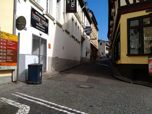
Weinstube - Zum grünen Kranz
Restaurant · Regional · 3.3 km
Wintergarten.
42 Oberstraße, Rüdesheim am Rhein
11:00-21:00

Bischöfliches Weingut Rüdesheim
Brewery and winery · 2.9 km
3 Marienthaler Straße, Rüdesheim am Rhein
Bodega
Restaurant · Spanish · 3.9 km
1 Am Rottland, Rüdesheim am Rhein
Mo,Th-Su 17:00-23:00; Tu-We off
Bootshaus
Restaurant · Regional, International · 0.6 km
2 Am Rheinufer, Geisenheim
We-Su 11:00-22:00; Mo 17:00-22:00
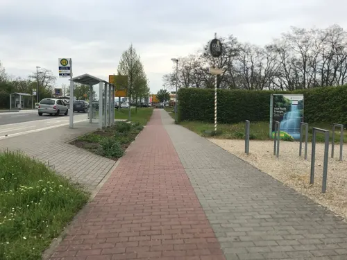
Brauhaus Goldener Engel
Restaurant · German · 4.3 km
1 Neisser Straße, Ingelheim am Rhein
Mo off; PH,Tu-Su 11:00-01:00


245 more on the map.
History
Geisenheim had its first documentary mention in 772 and has belonged since the Middle Ages to the Archbishopric of Mainz and later to the Duchy of Nassau, the Kingdom of Prussia and the state of Hesse. Since 1864, Geisenheim has held town rights.
From the History section of Geisenheim on Wikipedia, under CC BY-SA 4.0.
Where to stay38
Churches and places of worship39
Gustav-Adolf-Kirche
Church · Protestant · 4.0 km
1 Schubertstraße, Ingelheim am Rhein
Kloster unserer lieben Frau Chau Son Nothgottes
Church · Catholic · 3.7 km
2 Nothgottes, Rüdesheim am Rhein
Rochuskapelle
Church · Roman Catholic · 3.6 km
Rochusberg, Bingen am Rhein
St. Jakobus
Church · Roman Catholic · 3.2 km
1 Kellerstraße, Rüdesheim am Rhein
Eibingen Abbey
Church · Catholic · 3.0 km
Klosterweg, Rüdesheim am Rhein
Evangelische Gustav-Adolf-Kirche
Church · Protestant · 4.6 km
3 Schulstraße, Gau-Algesheim
Evangelische Kirche Geisenheim
Church · Protestant
89 Winkeler Straße, Geisenheim
Shopping35
Gas and EV charging17
e-Bike Ladestation
EV charging · 4.6 km
1 Marktplatz / Eingang Kreuzhof, Gau-Algesheim
Elektroauto-Ladestation Bürgerzentrum
EV charging · 4.5 km
1 Paul-Gerhardt-Weg, Oestrich-Winkel
Schools, colleges and libraries30
Integrierte Gesamtschule Kurt Schumacher Ingelheim
School · 4.6 km
30 Albrecht-Dürer-Straße, Ingelheim am Rhein
Healthcare7
Map of Geisenheim
250 places. The map loads OpenStreetMap tiles when you open it.
Getting there and nearby towns
Wiesbaden Army Airfield (WIE) is the nearest airport with scheduled flights listed in OpenStreetMap, 26 km away.
- Klarenthal 20 km northeast, about 20 min by car
- Mainz 22 km east, about 22 min by car
- Wiesbaden 23 km northeast, about 23 min by car
- Ginsheim-Gustavsburg 27 km east, about 27 min by car
- Niedernhausen 32 km northeast, about 32 min by car
- Trebur 32 km east, about 32 min by car
- Königstädten 35 km east, about 35 min by car
- Raunheim 35 km east, about 35 min by car
- Nauheim 36 km east, about 36 min by car
- Kriftel 37 km east, about 37 min by car
Drive times are estimates from straight-line distance, not routes.
Local news
Headlines from INDB.
Reviews, tips and questions
Loading what members have shared...
Sources and licences
- GeoNames (CC BY 4.0): population, coordinates, regions and time zone
- Mapillary (see each image): photos
- OpenStreetMap contributors (ODbL 1.0): places, airports, map data
- Wikidata (CC0 1.0): elevation, founding date, time zone, website, landmarks and historic places
- Wikimedia Commons (see each image): photos
- Wikipedia (CC BY-SA 4.0): overview and history text
Photo credits
- Rheingauer Dom, Geisenheim, Northwest view 20140916 1, DXR, CC BY-SA 3.0 de
- Geisenheim Winkeler Straße 87 Schule 001, Aidexxx, CC BY-SA 4.0
- Geisenheim Winkeler Straße 73 Hofreite Wohnhaus 001, Aidexxx, CC BY-SA 4.0
- Geisenheim Winkeler Straße 73 Hofreite Wohnhaus 002, Aidexxx, CC BY-SA 4.0
- Geisenheim schoenborn 2016, Klaus Graf, CC0
- Geisenheim Winkeler Straße 79 Wegekreuz 001, Aidexxx, CC BY-SA 4.0
- Geisenheim Behlstraße 1 Wohn- und Geschäftshaus 001, Aidexxx, CC BY-SA 4.0
- Geisenheim Behlstraße 4 Wohn- und Geschäftshaus 001, Aidexxx, CC BY-SA 4.0
- Geisenheim Behlstraße 9 Wohn- und Geschäftshaus 001, Aidexxx, CC BY-SA 4.0
- Geisenheim Winkeler Straße 83 Pfarramt 001, Aidexxx, CC BY-SA 4.0
- Geisenheim Winkeler Straße 83 Pfarramt 002, Aidexxx, CC BY-SA 4.0
- Geisenheim Burggraben 5 Hofreite 001, Aidexxx, CC BY-SA 4.0
- Geisenheim Burggraben 3a Alte Apotheke 001, Aidexxx, CC BY-SA 4.0
- Geisenheim Winkeler Straße 57 Frankfurter Hof 001, Aidexxx, CC BY-SA 4.0
- Geisenheim Wohnhauslage Kirchstraße 4, Alfons Tewes, CC BY-SA 4.0
- Geisenheim Stolperstein Kirchstraße 4 Liebmann Strauss, Alfons Tewes, CC BY-SA 4.0
- Geisenheim Stolperstein Kirchstraße 4 Karoline Strauss, Alfons Tewes, CC BY-SA 4.0
- Geisenheim Stolperstein Kirchstraße 4 Alice Strauss, Alfons Tewes, CC BY-SA 4.0
- Geisenheim Winkeler Straße 52 Wohn- und Geschäftshaus 001, Aidexxx, CC BY-SA 4.0
- Römerberg 9, Geisenheim, Blauschrift, CC BY-SA 4.0
- Rheingauer Dom, Geisenheim, Choir 20140902 1, DXR, CC BY-SA 3.0
- Geisenheim Winkeler Straße 72 Villa 001, Aidexxx, CC BY-SA 4.0
- Geisenheim Blaubachstraße 5 Wohnhaus 001, Aidexxx, CC BY-SA 4.0
- Geisenheim Winkeler Straße 74-76 Doppelvilla 002, Aidexxx, CC BY-SA 4.0
- Bischof-Blum-Platz 10 mit Dom, Geisenheim, Blauschrift, CC BY-SA 4.0
- Geisenheim Winkeler Straße 72 Villa 002, Aidexxx, CC BY-SA 4.0
- Geisenheim Behlstraße 21 ehem Zwierleinshof 001, Aidexxx, CC BY-SA 4.0
- Römerberg 10, Geisenheim, Blauschrift, CC BY-SA 4.0
- Rheingauer Dom, Geisenheim, Nave as seen from choir 20140904 1, DXR, CC BY-SA 3.0 de
- Geisenheim Blaubachstraße 8 Fachwerkhaus 001, Aidexxx, CC BY-SA 4.0
- Geisenheim Winkeler Straße 47a Hof der Mainzer Jesuiten 001, Aidexxx, CC BY-SA 4.0
- Geisenheim Winkeler Straße 74-76 Doppelvilla 001, Aidexxx, CC BY-SA 4.0
- Geisenheim Winkeler Straße 78 Villa 001, Aidexxx, CC BY-SA 4.0
- Brömserburg1, Peter Weller at German Wikipedia, CC BY-SA 3.0
- Kloster Eberbach fg01, Fritz Geller-Grimm, CC BY-SA 2.5
- Schloss und Campus der EBS Business School, IdaLovesStockholm, CC BY-SA 4.0
- Bingen Rochusallee 4 Fachhochschule 001, Aidexxx, CC BY-SA 4.0
- Abtei St. Hildegard (Eibingen), Tiggr, CC BY-SA 3.0
- Bingen Rhein Rochuskapelle 2009 4, Manfred Heyde, CC BY-SA 3.0
- Schloss Johannisberg fg02, Fritz Geller-Grimm, CC BY-SA 2.5
- Winkel Hauptstraße 89 Brentanohaus (1 ED 2015), Oliver Abels ( SBT ), CC BY-SA 3.0
- Burg Schwarzenstein1, CCAA2007, CC BY-SA 3.0
- Drosselgasse Old Town Rudesheim am Rhein Germany (2 of 23) (37676226281), Gary Bembridge from London, UK, CC BY 2.0
- GeisenheimStUrsulaSchuleNeubau, Marion Halft, CC BY-SA 3.0
- Eibingen - Kloster Nothgottes (KD.HE 2 03.2015), Oliver Abels, CC BY-SA 4.0
- Gau-algesheim-3-begradigt, Gau-algesheim-3.jpg : Traveler100 derivative work: VinylVictim ( talk ), CC BY-SA 3.0
- GrauesHausOestrichWinkel, Marion Halft, CC BY-SA 3.0
- Internatsschule Schloss Hansenberg, Thomas Heins, Public domain
- GeisenheimRheingauschule, Brühl, Public domain
- RüdesheimRheinStJakobusSW, Brühl, Public domain
- Broemserhof01, Fritz Geller-Grimm, CC BY-SA 3.0
- NSG Rheinwiesen von Oestrich-Winkel und Geisenheim D61 0068, Arnomoni, CC BY-SA 3.0
- Blick von der Germania auf Rüdesheim, Rhein, Rüdesheimer Aue, Rosatinte, CC BY-SA 3.0
- Ebental bei Rüdesheim 003, Christian Pirkl, CC BY-SA 4.0
- Geisenheim - Naturschutzgebiet Geisenheimer Heide, Oliver Abels ( SBT ), CC BY-SA 3.0
- Gau-Algesheim Ev-Kirche Kirchstraße 3, Aidexxx, CC BY-SA 4.0
- Gau-algesheim-1, Traveler100, CC BY-SA 4.0
- GeisenheimEvKircheW, Brühl, Public domain
- Geisenheim - Antoniuskapelle Seitlich der K 630 (KD.HE 2 03.2015), Oliver Abels, CC BY-SA 4.0
- Rüdesheim Adlerturm 253-h, Pedelecs, CC BY-SA 3.0
- Besucherzentrum Niederwald Rüdesheim Rhein (01), Marion Halft, CC BY-SA 4.0
- Fulder Aue-Ilmen Aue- 02, Bodow, CC BY-SA 3.0
- Kirchefreiweinheim, No machine-readable author provided. Hagen Graebner assumed (based on copyright claims)., CC BY-SA 2.5
- Freiweinheim10, No machine-readable author provided. Hagen Graebner assumed (based on copyright claims)., CC BY 3.0
- Rochuskapelle03, Manfred Heyde, CC BY-SA 3.0
- St Hildegard Eibingen, Marion Halft, CC BY-SA 3.0
- Lageskizze der Hindenburgbrücke 1925-04-24, Deutsche Reichsbahn, Public domain
- Asbach-Bad Rüdesheim im Herbst, Gerd Fahrenhorst, CC BY 4.0
- Street-level photo, changchun1, CC BY-SA 4.0
- Street-level photo, miguel_andrade, CC BY-SA 4.0
- Street-level photo, miguel_andrade, CC BY-SA 4.0
- Street-level photo, negro, CC BY-SA 4.0
- Street-level photo, negro, CC BY-SA 4.0
- Street-level photo, negro, CC BY-SA 4.0
- Street-level photo, chuck, CC BY-SA 4.0
- Street-level photo, titr, CC BY-SA 4.0
- Street-level photo, chuck, CC BY-SA 4.0
- Street-level photo, chuck, CC BY-SA 4.0
- Street-level photo, chuck, CC BY-SA 4.0
- Street-level photo, miguel_andrade, CC BY-SA 4.0
- Street-level photo, sdos77, CC BY-SA 4.0
- Street-level photo, chuck, CC BY-SA 4.0
- Street-level photo, jurgenweighardt, CC BY-SA 4.0
- Street-level photo, miguel_andrade, CC BY-SA 4.0
- Street-level photo, clemdoc, CC BY-SA 4.0
- Street-level photo, user4245, CC BY-SA 4.0
- Street-level photo, miguel_andrade, CC BY-SA 4.0
- Street-level photo, user4245, CC BY-SA 4.0
- Street-level photo, miguel_andrade, CC BY-SA 4.0
- Street-level photo, miguel_andrade, CC BY-SA 4.0
- Street-level photo, miguel_andrade, CC BY-SA 4.0
- Street-level photo, miguel_andrade, CC BY-SA 4.0
- Street-level photo, jurgenweighardt, CC BY-SA 4.0
- Street-level photo, teddy73, CC BY-SA 4.0


Page built November 8, 2026. Spotted a mistake? Tell us or suggest a place.