


Geislingen an der Steige, Germany
Geislingen an der Steige is a town of 28,655 people in Baden-Wurttemberg, Germany.
Why visit Geislingen an der Steige
Townapedia lists 51 museums and landmarks, 26 parks and trails, 159 places to eat, 15 places to stay and 47 attractions in and around town.
Highlights include Gloria Kino Center, Ödenturm, Albbähnle and DRK-Landesmuseum Baden-Württemberg.
Weather in Geislingen an der Steige
Forecast from MET Norway (CC BY 4.0). Full forecast
About Geislingen an der Steige
Geislingen an der Steige (German pronunciation: [ˈɡaɪ̯slɪŋən ʔan deːɐ̯ ˈʃtaɪ̯ɡə] , lit. 'Geislingen on the Climb') is surrounded by the heights of the Swabian Alb and embedded in 5 valleys. It is a town in the district of Göppingen in Baden-Württemberg in southern Germany. The name relates to its location "on the climb" (an der Steige) of a trade route over the Swabian Jura mountain range. It is in the southeast of the Stuttgart region about 50 km from Stuttgart and 27 km from Ulm.
From the Wikipedia article Geislingen an der Steige (this version), under CC BY-SA 4.0.
Things to do47



Pomme Jardin
Farm and orchard · 5.0 km
1 Mühlgasse, Gingen an der Fils
open "Verkauf nach Rücksprache"

Milchhütte Mauz
Farm and orchard · 5.7 km
64 Brunnenstraße, Gingen an der Fils
Mo-Fr 06:30-20:00; Sa 06:30-19:00; Su 07:30-19:00


35 more on the map.
Museums and landmarks51


DRK-Landesmuseum Baden-Württemberg
Museum · 1.3 km
72 Heidenheimer Straße, Geislingen an der Steige
Sa [1] 13:00-17:00; Su [2] 13:00-17:00

Schloss Donzdorf
Monument and historic site · 6.9 km
1 Schloss, Donzdorf

Burgruine Spitzenberg
Monument and historic site · 3.3 km
Die um 1080 erbaute klassische mittelalterliche Adelsburg vom Typus einer Gipfelburg wurde 1311/1312 im Reichskrieg gegen Graf Eberhard...


39 more on the map.
Parks, trails and playgrounds26






14 more on the map.
Restaurants and cafes159
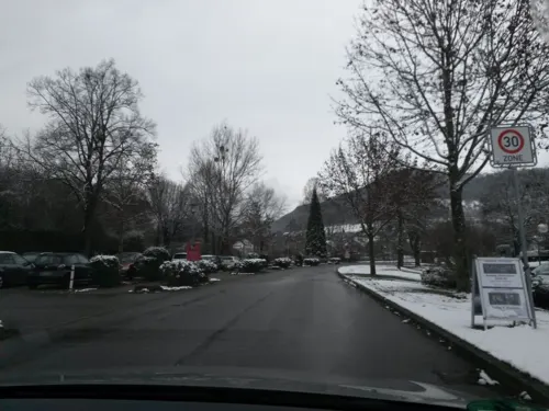
Im Autal
Restaurant · Regional · 4.0 km
Warme Küche bis 21:30 Uhr
27 Hausener Straße, Bad Überkingen
We-Sa 17:00+; Su 11:30-15:00
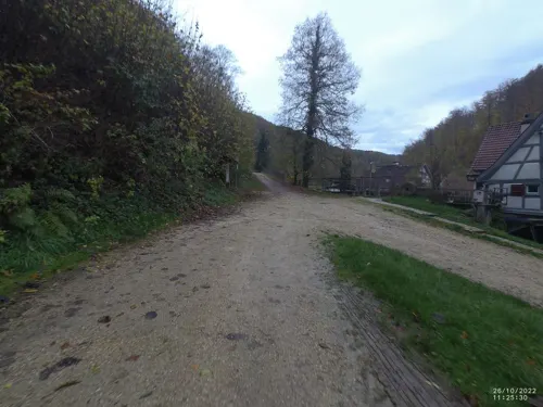
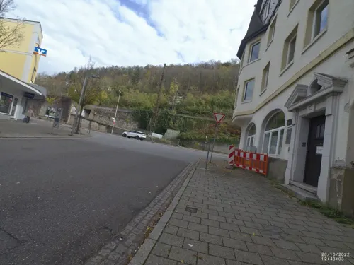
Antica Roma
Restaurant · Italian · 1.5 km
4 Karlstraße, Geislingen an der Steige
Tu-Su 11:00-14:00,17:00-24:00


Bäckerei und Konditorei Kauderer
Cafe · 4.5 km
2 Immenreich, Gingen an der Fils
Mo-Fr 05:15-18:00; Sa 06:00-17:00; Su 07:30-18:00
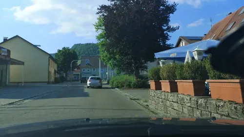
Da Loria
Restaurant · Italian · 6.8 km
7 Reichenbachstraße, Deggingen
Mo 16:30-22:30; We-Sa 16:30-22:30; Su 11:00-14:00,17:00-22:00

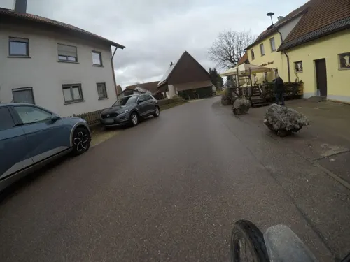
Gasthaus zur Mutter Franzl
Restaurant · Regional · 4.0 km
9 Kuchalb, Donzdorf
Th,Fr 14:00+; Sa 11:30+; Su 11:00+
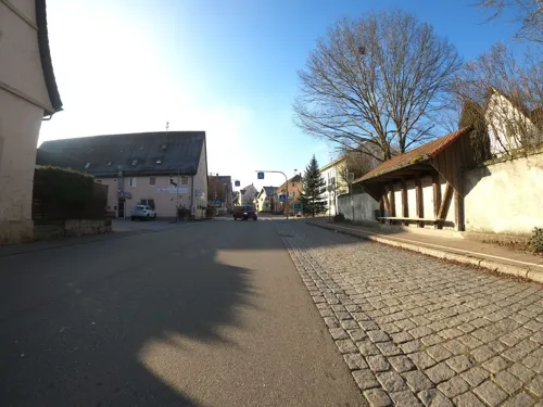
Hörners Landgasthof
Restaurant · Regional · 4.7 km
26 Geislinger Straße, Geislingen an der Steige
Mo,Tu,Fr 17:30-22:00; Sa 11:30-14:00,17:30-22:00; Su 11:00-20:00; We,Th off
Karlene
Cafe · Breakfast · 1.5 km
11 Karlstraße, Geislingen an der Steige
Mo 14:00-17:30; 14:00-17:30; We 09:00-13:00; PH off


147 more on the map.
History
Although the area had settlements since the Bronze Age, Geislingen was founded by the counts of Helfenstein as a transit collection station on the important commercial route between the Rhine valley and the Mediterranean. The fortified Helfenstein castle existed since 1100. Giselingen was first mentioned as civitas in a document dated 1237. From 1396 through 1802, Geislingen was owned by the free and imperial city of Ulm on the Danube. In 1803 Ulm and Geislingen became part of Bavaria, but in a land exchange were incorporated into the Kingdom of Württemberg in 1810. Much older than the "artificial" foundation of Geislingen are two present-day districts, Altenstadt and Rorgensteig. Altenstadt, in the oldest times still called "ze der alten Stadt" or "Altengiselingen", is of Alamannic origin. First traces of settlement go back to the 5th century.
On the site of today's "Lindenhof" stood since the 11th century a St. Michael's church, the original church of Altenstadt and the whole surrounding area. So the name of the later helfenstein Geislingen comes from the older neighboring village. Rorgensteig, situated on the upper Rohrach River, was an old parish village into which the citizens of the town of Geislingen were parishioners until 1393.
From the History section of Geislingen an der Steige on Wikipedia, under CC BY-SA 4.0.
Where to stay15
Schneelaufverein Geislingen, Skihütte
Motel and hotel · 3.0 km
70 Dorfstraße, Geislingen an der Steige
Churches and places of worship49
Siechenkapelle
Place of worship · 1.3 km
352 Stuttgarter Straße, Geislingen an der Steige
Laurentiuskirche
Church · Protestant · 5.7 km
8 Kirchgasse, Amstetten
St.-Vitus-Kirche
Church · Lutheran · 4.6 km
6 Kirchgasse, Geislingen an der Steige
Stadtkirche
Church · Protestant · 1.7 km
1 Kirchplatz, Geislingen an der Steige
Shopping36
Gas and EV charging18
EVF Erdgastankstelle
Gas station · 1.4 km
6 Grube-Karl-Straße, Geislingen an der Steige
Schools, colleges and libraries30
Paul-Kerschensteiner-Schule
School · 3.9 km
10 In den Gassenäckern, Bad Überkingen
Healthcare16
Psychiatrisch-psychotherapeutische Tagesklinik und Institutsambulanz Geislingen
Clinic and pharmacy · 1.9 km
31 Schillerstraße, Geislingen an der Steige
Map of Geislingen an der Steige
250 places. The map loads OpenStreetMap tiles when you open it.
Getting there and nearby towns
Manfred Rommel Airport Stuttgart (STR) is the nearest airport with scheduled flights listed in OpenStreetMap, 45 km away.
- Süßen 8 km northwest, about 8 min by car
- Gerstetten 14 km east, about 14 min by car
- Göppingen 16 km northwest, about 16 min by car
- Laichingen 18 km southwest, about 18 min by car
- Schwäbisch Gmünd 20 km north, about 20 min by car
- Uhingen 20 km northwest, about 20 min by car
- Heubach 20 km northeast, about 20 min by car
- Lorch 22 km northwest, about 22 min by car
- Heidenheim an der Brenz 25 km east, about 25 min by car
- Ulm 28 km southeast, about 28 min by car
Drive times are estimates from straight-line distance, not routes.
Local news
Headlines from INDB.
Reviews, tips and questions
Loading what members have shared...
Sources and licences
- GeoNames (CC BY 4.0): population, coordinates, regions and time zone
- Mapillary (see each image): photos
- OpenStreetMap contributors (ODbL 1.0): places, airports, map data
- Wikidata (CC0 1.0): elevation, founding date, time zone, website
- Wikimedia Commons (see each image): photos
- Wikipedia (CC BY-SA 4.0): overview and history text
Photo credits
- Geislingen-adS-AltesRathaus, Joachim Köhler, CC BY-SA 3.0
- Stolperschwelle WMF-Gebäude (Geislingen an der Steige), Christian Michelides, CC BY-SA 4.0
- WMF - Geislingen an der Steige - panoramio, stimp℮ℓton, CC BY 3.0
- Geislingen an der Steige 2026 &, Wald-Burger8, CC BY-SA 4.0
- Ostlandkreuz Geislingen an der Steige Froschperspektive21032018, Zonk43, CC BY-SA 3.0
- Ödenturm, Thomasxb, CC BY-SA 3.0
- Wallfahrtskirche Ave Maria, Christof Essig, CC BY-SA 3.0
- Burg Bühringen 1, Oliver L. 74, CC0
- Burgruine helfenstein, *m-andi* at German Wikipedia, CC BY-SA 3.0
- Burg Scharfenberg, Dr. Eugen Lehle, CC BY-SA 3.0
- BurgSpitzenberg03, Ziegler175, CC BY-SA 3.0
- Geislingen-adS-EvStadtkirche, Joachim Köhler, CC BY-SA 3.0
- Donzdorf, Schloß, Dr. Eugen Lehle, CC BY-SA 3.0
- Messelstein Luftbild, Volker Gringmuth, CC BY-SA 3.0
- Paul-Kerschensteiner-Schule Bad Überkingen 2025-03-11, MTheiler, CC BY-SA 3.0
- Siechenkapelle, Geislingen an der Steige, Südostansicht, Steffen Höhle, CC BY-SA 3.0
- 170818-2 einer der wasserführenden Autaler Wasserfälle, R.kaelcke, CC BY-SA 4.0
- Rohrachsee, Eugen Lehle, CC BY-SA 3.0
- Stadtbuecherei Geislingen, Langer Luzin, CC BY-SA 4.0
- Felsental Eybach 19, Schwoba-power, CC BY-SA 4.0
- 170818-3 Hausener Wand, Blick vom Autal Richtung Nord, R.kaelcke, CC BY-SA 4.0
- Dalisberg img922, Vux, CC0
- Johanneskirche Gingen an der Fils, Bonjour35, CC BY-SA 4.0
- Amstetten Württemberg Laurentiuskirche SE 2008 10 11, Andreas F. Borchert, CC BY-SA 4.0
- Alb Kirche, Xocolatl, CC BY-SA 4.0
- Kirche St. Vitus Türkheim, Dr. Eugen Lehle, CC BY-SA 3.0
- Aussichtsfels Bismarckfels, Ödenturm, CC BY-SA 4.0
- Geislingen an der Steige - Kornschreiberhaus 1397 links, Alter Bau 1425, Franzfoto, CC BY-SA 3.0
- St.Gallus-Kirche Bad Überkingen 2025-03-11a, MTheiler, CC BY-SA 3.0
- Wallfahrtskirche Ave Maria 2008, Dr. Eugen Lehle, CC BY-SA 3.0
- Burg Bühringen 6, Oliver L. 74, CC0
- Autal mit Autalbach, Klaus Rohwer, CC BY-SA 4.0
- 170818-2 Filstal mit Hausener Wand mit Bad Überkingen, Blick Richtung Nordost, R.kaelcke, CC BY-SA 4.0
- Amstetten-Dorf; Laurentiuskirche, Dr. Eugen Lehle, CC BY-SA 3.0
- 05061-Eybach-1904-Blick auf Eybach-Brück & Sohn Kunstverlag, Brück & Sohn Kunstverlag Meißen, CC0
- 05402-Waldhausen-1904-Kirche und Schulhaus, Bierbrauerei Bantleon-Brück & Sohn Kunstverlag, Brück & Sohn Kunstverlag Meißen, CC0
- 05062-Eybach-1904-Blick auf Eybach-Brück & Sohn Kunstverlag, Brück & Sohn Kunstverlag Meißen, CC0
- Sender Tegelberg 21042014 1, Zonk43, CC0
- Sender Tegelberg 21042014 2, Zonk43, CC0
- Burg Helfenstein Geißlingen (Grundriss) (7124643953), Heribert Pohl --- Thanks for half a million clicks! from Germering bei München, Bayern, CC BY-SA 2.0
- Street-level photo, rausk, CC BY-SA 4.0
- Street-level photo, VIA_CH, CC BY-SA 4.0
- Street-level photo, 5rmft, CC BY-SA 4.0
- Street-level photo, VIA_CH, CC BY-SA 4.0
- Street-level photo, VIA_CH, CC BY-SA 4.0
- Street-level photo, mfa, CC BY-SA 4.0
- Street-level photo, mfa, CC BY-SA 4.0
- Street-level photo, xallace, CC BY-SA 4.0
- Street-level photo, VIA_CH, CC BY-SA 4.0
- Street-level photo, mfa, CC BY-SA 4.0
- Street-level photo, andyna, CC BY-SA 4.0
- Street-level photo, snahollag, CC BY-SA 4.0
- Street-level photo, mfa, CC BY-SA 4.0
- Street-level photo, ray66, CC BY-SA 4.0
- Street-level photo, wegavision, CC BY-SA 4.0
- Street-level photo, mfa, CC BY-SA 4.0
- Street-level photo, mfa, CC BY-SA 4.0
- Street-level photo, wegavision, CC BY-SA 4.0
- Street-level photo, rausk, CC BY-SA 4.0
- Street-level photo, rausk, CC BY-SA 4.0
- Street-level photo, VIA_CH, CC BY-SA 4.0
- Street-level photo, mfa, CC BY-SA 4.0
- Street-level photo, rausk, CC BY-SA 4.0
- Street-level photo, mfa, CC BY-SA 4.0
- Street-level photo, VIA_CH, CC BY-SA 4.0
- Street-level photo, VIA_CH, CC BY-SA 4.0
- Street-level photo, mfa, CC BY-SA 4.0


Page built November 8, 2026. Spotted a mistake? Tell us or suggest a place.