


Why visit Greiz
Townapedia lists 58 museums and landmarks, 58 parks and trails, 113 places to eat, 21 places to stay and 52 attractions in and around town.
Highlights include Göltzschtalbrücke, Imkerei Hofladen, Sommerpalais and Bauernmuseum.
Weather in Greiz
Forecast from MET Norway (CC BY 4.0). Full forecast
About Greiz
Greiz ( gryts; German pronunciation: [ɡʁaɪts] ) is a town in the state of Thuringia, Germany, and is the capital of the district of Greiz. Greiz is situated in eastern Thuringia, 100 kilometres (62 miles) east of the state capital Erfurt, on the White Elster river.
From the Wikipedia article Greiz (this version), under CC BY-SA 4.0.
Things to do52


Imkerei Hofladen
Farm and orchard · 6.9 km
44 Werdauer Straße, Mohlsdorf-Teichwolframsdorf
Mo 09:00-12:00; We-Fr 13:00-18:00; Sa 09:00-12:00; Tu,Su,PH off

Zog'ser Hofladen
Farm and orchard · 5.2 km
55 Zoghaus, Langenwetzendorf
Mo,Tu off; We-Fr 09:00-17:00; Sa,Su,PH off

Hofladen Frantz
Farm and orchard · 7.0 km
16 Naitschau, Langenwetzendorf
Mo-Fr 08:00-18:00; Sa 08:00-12:00; Su,PH off
Bauer Knoll
Farm and orchard · 7.6 km
9 Wellsdorf, Langenwetzendorf
Oct-Apr: Fr[4]

40 more on the map.
Museums and landmarks58




Vogtländisches Bergbaumuseum
Museum · 6.0 km
Das Vogtländische Bergbaumuseum Netzschkau bietet Ihnen einen einzigartigen Einblick in die Geschichte des Bergbaus und zeigt die...
18 Bahnhofstraße, Netzschkau

46 more on the map.
Parks, trails and playgrounds58

Bäderkomplex Aubachtal
Sports field and stadium · 2.1 km
11 Werdauer Straße, Greiz
Mo 14:00-16:30; Tu 06:00-07:30,09:00-12:00,13:30-20:00; We...
Sommerbad Langenwetzendorf
Sports field and stadium · 6.9 km
Am Bad, Langenwetzendorf
Mo-Su 10:00-20:00; Sep 16-Apr 30 off
Waldbad Elsterberg
Sports field and stadium · 5.9 km
27 Tremnitzweg, Elsterberg
Mo-Fr 10:00-20:00; Sa,Su 09:00-20:00


46 more on the map.
Restaurants and cafes113

Cafe CityLife
Cafe · Regional
6 Kirchplatz, Greiz
Mo-Th 09:00-22:00, Fr 09:00-01:00, Sa 13:00-01:00, Su 11:30-17:00

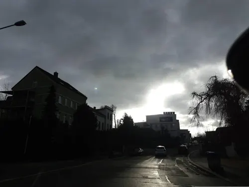
Gasthaus Waldherberge Drei Tannen
Restaurant · German · 6.6 km
2 Jugendherberge, Langenwetzendorf
Th,Fr 18:00+, Sa 11:00+; Su,PH 11:00-17:00
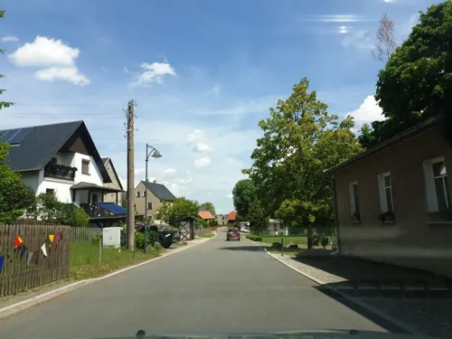
Gasthaus Zur Linde
Restaurant · German, Regional · 7.8 km
47 Wellsdorf, Langenwetzendorf
Mo off; Tu-Sa 16:30-22:00; Su 10:00-13:00,15:30-22:00
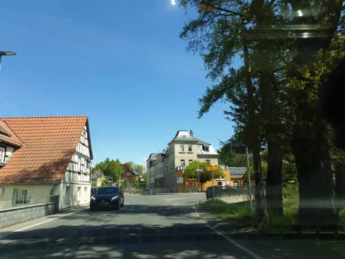
Gasthof Zum Kühlen Morgen
Restaurant · German · 4.9 km
14 Greizer Straße, Mohlsdorf-Teichwolframsdorf
Tu,We 11:00-14:00,17:00-20:30; Fr 11:00-14:00,17:00+; Sa 11:00+;...
Gasthof Zum Schwarzen Bär
Restaurant · German · 6.6 km
3 Dorfstraße, Mohlsdorf-Teichwolframsdorf
Th,Fr 16:00-21:00; Su 11:00-16:00
Greizer Parkgaststätte
Restaurant · German, Regional · 1.0 km
39 Leonhardtstraße, Greiz
Mo,Tu 11:00-18:00; We "nach Absprache"; Th,Fr off; Sa 11:00+; Su...
Oberer Gasthof Brunn
Restaurant · Regional · 7.8 km
42 Dr.-Eckener-Straße, Reichenbach
Sa-Su 11:00-15:00, 17:00-20:00; PH 11:00-15:00
Parkschlößchen
Restaurant · German
72 Parkgasse, Greiz
Mo,Tu off; We 14:00-18:00; Th-Sa 11:00-23:00; Su 11:00-17:00
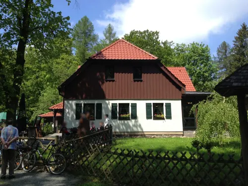


Weidmannsruh
Restaurant · Regional · 7.2 km
1 Weidmannsruh, Werdau
Apr-Sep: Tu-Su 10:00-21:00; Oct-Mar: Tu-Su 11:00-19:00
101 more on the map.
History
As with other nearby settlements, the place name (originally Grouts) is of Slavic origin and means gord. The first documented mention of the settlement dates from 1209. The prime location of Greiz on the confluence of the White Elster river and its tributary Göltzsch helped to make it a fast-growing town. From the 12th century it was governed by advocati (Vögte), but in 1236 it came into the possession of Gera. It was recognized as a town in the 13th century. Later the House of Reuss, a ruling German dynasty whose male members were all named Heinrich, built two castles in Greiz: the "Oberes Schloss" (Upper Castle) and the "Unteres Schloss" (Lower Castle). Both were built by famous architects and are still considered unique. Greiz became the capital of the Principality of Reuss-Greiz until 1918.
The town was wholly destroyed by fire in 1494, and almost totally in 1802.
Between 1934 and 1943, 809 people were forcibly sterilized by Nazis in the district hospital in Wichmannstraße. The local old folk's home and the care home submitted 122 sick people to the euthanasia program Aktion T4.
From the History section of Greiz on Wikipedia, under CC BY-SA 4.0.
Where to stay21
Dorfchronik Heuhotel
Motel and hotel · 7.1 km
41 Waltersdorfer Dorfstraße, Mohlsdorf-Teichwolframsdorf
Zimmervermietung Zum Schwarzen Bär
Motel and hotel · 6.6 km
3 Dorfstraße, Mohlsdorf-Teichwolframsdorf
Churches and places of worship28
Dorfkirche Teichwolframsdorf
Church · Protestant · 7.3 km
Kirchstraße, Mohlsdorf-Teichwolframsdorf
Stadtkirche Mylau
Church · Lutheran · 6.3 km
10 Heubnerring, Reichenbach
Ev.-meth. Zionskirche
Church · Methodist · 7.1 km
19 Am Mühlberg, Mohlsdorf-Teichwolframsdorf
Kirche Waltersdorf
Church · Protestant · 6.9 km
33 Waltersdorfer Dorfstraße, Mohlsdorf-Teichwolframsdorf
Shopping37
Gas and EV charging12
Schools, colleges and libraries28
Healthcare11
Sonnen-Apotheke "Im Blauen Haus"
Clinic and pharmacy · 6.9 km
1 Albert-Schweitzer-Straße, Reichenbach
Apotheke im Spectrum Center
Clinic and pharmacy · 1.9 km
105 Reichenbacher Straße, Greiz
Map of Greiz
250 places. The map loads OpenStreetMap tiles when you open it.
Getting there and nearby towns
Leipzig-Altenburg Airport (AOC) is the nearest airport with scheduled flights listed in OpenStreetMap, 42 km away.
- Reichenbach/Vogtland 8 km southeast, about 8 min by car
- Werdau 15 km northeast, about 15 min by car
- Plauen 18 km south, about 18 min by car
- Auerbach 22 km southeast, about 22 min by car
- Zwickau 22 km east, about 22 min by car
- Crimmitschau 22 km northeast, about 22 min by car
- Wilkau-Haßlau 22 km east, about 22 min by car
- Gera 26 km north, about 26 min by car
- Oelsnitz 27 km south, about 27 min by car
- Meerane 28 km northeast, about 28 min by car
Drive times are estimates from straight-line distance, not routes.
Local news
Headlines from INDB.
Reviews, tips and questions
Loading what members have shared...
Sources and licences
- GeoNames (CC BY 4.0): population, coordinates, regions and time zone
- Mapillary (see each image): photos
- OpenStreetMap contributors (ODbL 1.0): places, airports, map data
- Wikidata (CC0 1.0): elevation, founding date, time zone, website, landmarks and historic places
- Wikimedia Commons (see each image): photos
- Wikipedia (CC BY-SA 4.0): overview and history text
Photo credits
- Greiz - upper castle (aka), André Karwath aka Aka, CC BY-SA 2.5
- Gottesackerkirche Greiz 06, Aschroet, CC0
- Statue Oberes Schloss Greiz, Aschroet, CC0
- Kreuz Stadtkirche Greiz, Aschroet, CC0
- Schachtdeckel in Greiz, Thüringen 2H1A8729WI, Kora27, CC BY-SA 4.0
- Lusthaus Oberes Schloss Greiz, Aschroet, CC0
- View Greiz, Aschroet, CC0
- Wetterfahne Oberes Schloss Greiz, Aschroet, CC0
- Hauptwache Unteres Schloss Greiz, Aschroet, CC0
- Inschrift Stadtkirche Greiz, Aschroet, CC0
- Greizer Schlossgarten und Schlossbrücke -Nordansicht- April 2010, Cmuelle8, CC0
- Brücke unter der Schlossbrücke Greiz -Nordansicht- April 2010, Cmuelle8, CC0
- Hydrant Greiz, Aschroet, CC0
- Krone Unteres Schloss Greiz, Aschroet, CC0
- Osterbrunnen in Greiz, Thüringen 2H1A8557WI, Kora27, CC BY-SA 4.0
- Unteres Schloss Greiz 1 AS, Aschroet, CC0
- Unteres Schloss Greiz 2 AS, Aschroet, CC0
- Lustgarten in Greiz - Vogtland - panoramio, Jürgen Regel, Marian…, CC BY 3.0
- EÜ Brückenstraße in Greiz vor dem Schlossbergtunnel -Südwestansicht- April 2010, Cmuelle8, CC0
- Oberes Schloss Greiz AS, Aschroet, CC0
- Lustgarten und Schlösser in Greiz, Vogtland - panoramio, Jürgen Regel, Marian…, CC BY 3.0
- Greiz, Tunnel unter dem oberen Schloss - panoramio, Jürgen Regel, Marian…, CC BY 3.0
- Luftaufnahme Oberes Schloss Greiz, RealPixelStreet, CC BY-SA 4.0
- Alter Friedhof, Greiz 23, Aschroet, CC0
- Alter Friedhof, Greiz 19, Aschroet, CC0
- Alter Friedhof, Greiz 22, Aschroet, CC0
- Alter Friedhof, Greiz 21, Aschroet, CC0
- Alter Friedhof, Greiz 18, Aschroet, CC0
- Schlossbrücke Greiz -Südostansicht mit Oberem Schloss im Hintergrund- April 2010, Cmuelle8, CC0
- Gottesackerkirche Greiz 04, Aschroet, CC0
- Alter Friedhof, Greiz 20, Aschroet, CC0
- Ernst thaelmann greiz mb, Mark Benecke ( https://de.wikipedia.org/wiki/Benutzer:Markbenecke ), CC BY-SA 3.0 de
- Gottesackerkirche Greiz 03, Aschroet, CC0
- Alter Friedhof, Greiz 17, Aschroet, CC0
- Alter Friedhof, Greiz 16, Aschroet, CC0
- Gottesackerkirche Greiz 05, Aschroet, CC0
- Alter Friedhof, Greiz 15, Aschroet, CC0
- Alter Friedhof, Greiz 14, Aschroet, CC0
- Gottesackerkirche Greiz 07, Aschroet, CC0
- Gottesackerkirche Greiz 08, Aschroet, CC0
- Göltzschtalbrücke 2012, user:UlrichAAB, CC BY 3.0
- Castle Mylau (aka), André Karwath aka Aka, CC BY-SA 2.5
- Netzschkau castle, Fransvannes, CC BY-SA 3.0
- Stadtkirche Greiz, Michael Sander, CC BY-SA 3.0
- Dreifaltigkeitskirche Greiz-Reinsdorf, Jörg Bachmann, CC BY 2.0
- Nitschareuth Kirche, Wikswat, CC BY 3.0
- Gommla, Thuringia 22, Aschroet, CC0
- Göltzschtalbrücke von der Mühle aus 0654, Ermell, CC BY-SA 4.0
- Kirche Waltersdorf, Mohlsdorf-Teichwolframsdorf 2, Aschroet, CC0
- Greiz 2013-05 0742 Greizer Park, Steffen Löwe, CC BY-SA 4.0
- Zionskirche Waltersdorf, Mohlsdorf-Teichwolframsdorf 1, Aschroet, CC0
- Brockau - church 2009 (aka), André Karwath aka Aka, CC BY-SA 2.5
- War memorial Zoghaus 1, Aschroet, CC0
- Katholische Kirche Greiz, Giorno2, CC BY-SA 4.0
- Kuhbergtürme, Rudolf Eberhard Neuber, CC BY-SA 3.0
- Sommerpalais Greiz, Michael Sander, CC BY-SA 3.0
- Station 138 Carlshöhe, Lysippos, CC BY-SA 3.0
- Triangulationspunkt Kuhberg, Dor Jörsch, CC BY-SA 4.0
- Teichwolframsdorf Kirche, Je-str, CC BY 3.0
- Church Mylau - front (aka), André Karwath aka Aka, CC BY-SA 2.5
- Greiz Goetheschule, Greizer2, CC0
- Street-level photo, canislupus, CC BY-SA 4.0
- Street-level photo, canislupus, CC BY-SA 4.0
- Street-level photo, mapillary_le, CC BY-SA 4.0
- Street-level photo, canislupus, CC BY-SA 4.0
- Street-level photo, canislupus, CC BY-SA 4.0
- Street-level photo, canislupus, CC BY-SA 4.0
- Street-level photo, canislupus, CC BY-SA 4.0
- Street-level photo, canislupus, CC BY-SA 4.0
- Street-level photo, canislupus, CC BY-SA 4.0
- Street-level photo, canislupus, CC BY-SA 4.0
- Street-level photo, canislupus, CC BY-SA 4.0
- Street-level photo, canislupus, CC BY-SA 4.0
- Street-level photo, canislupus, CC BY-SA 4.0
- Street-level photo, canislupus, CC BY-SA 4.0
- Street-level photo, canislupus, CC BY-SA 4.0


Page built November 8, 2026. Spotted a mistake? Tell us or suggest a place.