


Hannoversch Münden, Germany
Hann. Münden
Hannoversch Münden is a town of 25,073 people in Lower Saxony, Germany.
Why visit Hannoversch Münden
Townapedia lists 101 museums and landmarks, 47 parks and trails, 99 places to eat, 48 places to stay and 88 attractions in and around town.
Highlights include Werra Viaduct, Hedemünden, Blaue Brücke, Dr. Wolfs Wunderkammer and Fährenpfortenturm - Hagelturm - Natermannturm.
Weather in Hannoversch Münden
Forecast from MET Norway (CC BY 4.0). Full forecast
About Hannoversch Münden
Hann. Münden (German pronunciation: [han ˈmʏndn̩]; short for Hannoversch Münden [haˈnoːfɐʃ ˈmʏndn̩] ) is a town in Lower Saxony, Germany. Münden lies in the district of Göttingen at the confluence of the Fulda and Werra rivers, which join to form the Weser. It has about 24,000 inhabitants (2013).
From the Wikipedia article Hann. Münden (this version), under CC BY-SA 4.0.
Travel tips from other travellers: Hannoversch Münden on Wikivoyage (CC BY-SA 4.0).
Things to do88


Blaue Brücke
Bridge
1889 errichtete Hängebrücke; wegen Instandsetzung bis voraussichtlich Frühjahr 2026 gesperrt

Hühnerfeldberg
Scenic view · 5.0 km
Abraumhalde des Mündener Tunnels der ICE Strecke Hannover - Würzburg, aufgeschütet zwischen 1988 und 1991




76 more on the map.
Museums and landmarks101
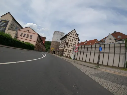

Fährenpfortenturm - Hagelturm - Natermannturm
Monument and historic site


Mittelalterliches Dorf Steinrode
Monument and historic site · 6.5 km
101 Kohlenstraße, Hann. Münden
Su 11:00-16:00
Ruine St. Laurentius
Monument and historic site · 1.0 km
Kirchenruine, 13./14. Jahrhundert, moderne Skulptur 'Pila Bautismal' von Ricardo Brey, 2000


89 more on the map.
Parks, trails and playgrounds47

Freibad Reinhardshagen
Sports field and stadium · 8.9 km
1 Freibad, Reinhardshagen
Mo-Su,PH 10:00-19:00
Hochbad Rattwerder
Sports field and stadium · 1.0 km
3 Auf dem Rattwerder
Mo-Su,PH 07:00-19:30; Sep 10-May 5 off


Bruch an der Eichkanzel im Reinhardswald
Hiking and trails · 7.7 km
Anmoorige Hochfläche im Südteil des Reinhardswaldes.

Bruchwald am Gahrenberg
Hiking and trails · 4.9 km
Wald mit Teichen südöstlich des Gahrenberg, im Südteil des Reinhardswaldes.


Hochmoor Hühnerfeld
Hiking and trails · 5.8 km
Inzwischen Teilfläche des Naturschutzgebiets „Bachtäler im Kaufunger Wald“

Sport- & Golf-Resort Gut Wissmannshof - Course Landefeld (Blau)
Golf course · 5.1 km
1 Wissmannshof, Staufenberg

Termenei bei Wilhelmshausen
Hiking and trails · 6.3 km
Heideflächen und Wald westlich von Wilhelmshausen, am Südrand des Reinhardswaldes.

Historischer Park Holzhausen
Park · 7.8 km
Ein Park mit historischer Lore des Bergbaus und historischem Pflug, die öffentlich dort installiert wurden.
24/7

Kinderspielplatz Bühren
Playground · 7.9 km
Seems open to public
Mo-Su,PH 07:00-20:00
35 more on the map.
Restaurants and cafes99


Antico & Abruzzo
Restaurant · Italian
10 Lange Straße, Hann. Münden
Mo, We-Su 11:30-14:00, 18:00-22:00

Café am Sandmarkt
Cafe · Coffee Shop, Cake, Italian
4 Lange Straße
Mo,We-Sa 09:00-18:00; Su 10:00-18:00
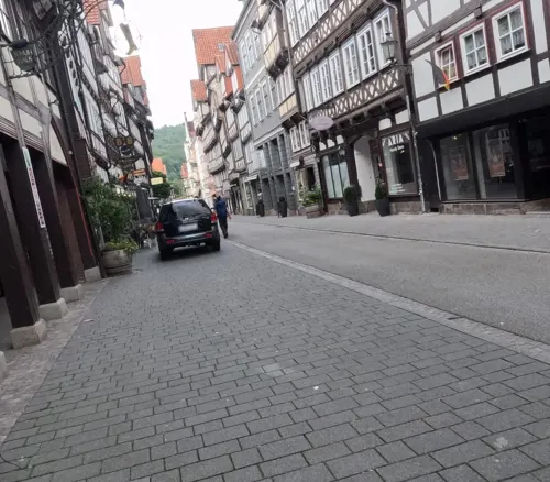
Caruso's Pizza Eck
Restaurant · Pizza
19 Marktstraße, Hann. Münden
Mo-Sa 11:00-23:00; Su,PH 15:00-23:00
Flux
Restaurant · 4.7 km
Biohotel im Werratal
40 Buschweg, Hann. Münden
Tu-Sa 12:00-14:00,18:00-21:00; 2020 Dec 24,2020 Dec 27,2020 Dec 28 off
Jagdhaus Heede
Restaurant · 2.7 km
81 Hermannshäger Straße, Hann. Münden
Mo off; Tu-Sa 17:00+; Su 11:30-15:00,17:00+
Kreta
Restaurant · Greek
6 Ziegelstraße, Hann. Münden
Mo,Tu 11:30-14:00, 17:30-22:00; Th-Su 11:30-14:00, 17:30-22:00
Letzter Heller
Restaurant · Regional · 4.1 km
7 Letzter Heller, Hann. Münden
Fr-We 12:00-14:00,17:30-21:30


Royal India
Restaurant · Indian
89 Lange Straße, Hann. Münden
Mo-Fr 11:00-14:30,17:00-22:00; Sa,Su,PH 11:00-22:00
87 more on the map.
History
The place is first mentioned in the deeds of donation of Gimundi to the abbey of Fulda, in 802. The town's name means "confluence" in old German; the prefix Hannoversch, or "Hanoverian", was added in the 19th century to help distinguish the town from its similarly-named Prussian neighbour, Minden.
City rights might have been granted during the latter half of the 12th century.
The French inventor Denis Papin built a steam-pump-powered paddlewheel boat, probably pedal-driven in 1704, and as a demonstration used it to navigate down the Fulda River from Kassel to Münden in 1707.
Hann. Münden was the site of the Royal Prussian Academy of Forestry: the city's botanical gardens with many different trees were primarily established for this academy. Later the academy was merged into the University of Göttingen, moving to a new building on the main campus in 1970.
From the History section of Hann. Münden on Wikipedia, under CC BY-SA 4.0.
Where to stay48
Churches and places of worship38
Ev. Kirche
Church · Protestant · 9.0 km
1 An der Kirche, Witzenhausen
Evangelische Wehrkirche Vaake
Church · Protestant · 7.8 km
13 Am Weserufer, Reinhardshagen
St.-Elisabeth-Kirche
Church · Roman Catholic
6-8 Böttcherstraße, Hann. Münden
Neuapostolische Kirche Hannoversch Münden
Church · New Apostolic · 0.8 km
15 Fritz-Michalski-Straße, Hann. Münden
Shopping31
Gas and EV charging17
Knauber Gas LNG-Tankstelle Lutterberg
Gas station · 5.1 km
11 Triftstraße, Staufenberg
Schools, colleges and libraries18
Healthcare9
Map of Hannoversch Münden
250 places. The map loads OpenStreetMap tiles when you open it.
Getting there and nearby towns
Kassel Airport (KSF) is the nearest airport with scheduled flights listed in OpenStreetMap, 18 km away.
- Fuldatal 7 km southwest, about 7 min by car
- Vellmar 13 km southwest, about 13 min by car
- Kassel 15 km southwest, about 15 min by car
- Kaufungen 15 km south, about 15 min by car
- Witzenhausen 16 km southeast, about 16 min by car
- Lohfelden 18 km southwest, about 18 min by car
- Rosdorf 20 km northeast, about 20 min by car
- Hofgeismar 20 km northwest, about 20 min by car
- Göttingen 24 km northeast, about 24 min by car
- Baunatal 25 km southwest, about 25 min by car
Drive times are estimates from straight-line distance, not routes.
Local news
Headlines from INDB.
Reviews, tips and questions
Loading what members have shared...
Sources and licences
- GeoNames (CC BY 4.0): population, coordinates, regions and time zone
- Mapillary (see each image): photos
- OpenStreetMap contributors (ODbL 1.0): places, airports, map data
- Wikidata (CC0 1.0): elevation, founding date, time zone, website, landmarks and historic places
- Wikimedia Commons (see each image): photos
- Wikipedia (CC BY-SA 4.0): overview and history text
Photo credits
- 00 8133 Hann. Münden - Niedersachsen, W. Bulach, CC BY-SA 4.0
- Doktor Eisenbarth Langestraße Hannoversch Münden - panoramio, Hiroki Ogawa, CC BY 3.0
- Werratalbrücke Hedemünden von Laubach 2016, Axel Hindemith, CC BY-SA 3.0
- Brackenburg Berg, AxelHH at German Wikipedia, Public domain
- Laurentiuskirchenruine Münden ganz, Axel Hindemith, Public domain
- DE-HE Gahrenberg im Reinhardswald vom Plattenweg 2014-04-25, Michael32710, CC BY-SA 4.0
- Grotefend-gymnasiummuenden, GeorgFriedrichGrotefend, CC BY-SA 3.0
- DE-NI GrosserStaufenberg von der A7 aus 2014-04-22, Michael32710, CC BY-SA 4.0
- HochmoorHuehnerfeld 2014-10-12, Michael32710, CC BY-SA 4.0
- DE-NI Huehnerfeldberg vom Gehegeweg 2014-04-19, Michael32710, CC BY-SA 4.0
- QuarzitschlagplatzVoßküppel, Michael32710, CC BY-SA 4.0
- Hann Münden St. Blasius, Rabanus Flavus, CC0
- HannMünden St Elisabeth 2, Rabanus Flavus, CC0
- 00 8081 Hann.Münden, W. Bulach, CC BY-SA 4.0
- Alte Werrabrücke, 8, Hann. Münden, Landkreis Göttingen, GeorgDerReisende, CC BY-SA 4.0
- Doktorwerder vom Questenberg, Axel Hindemith, CC BY-SA 4.0
- Altetr Packhof 6 2008, Axel Hindemith, Public domain
- Laubach Kapelle, Jan Stubenitzky ( Dehio ), CC BY-SA 3.0
- StPetri Wiershausen 01, Jan Stubenitzky ( Dehio ), CC BY-SA 3.0
- Hann. Münden-City.Wall-Oberes.Tor-Rotunde.01, Unknown author, Public domain
- Stumpfeturm, 1, Hann. Münden, Landkreis Göttingen, GeorgDerReisende, CC BY-SA 4.0
- Ballertasche1993, Christian Fischer, CC BY-SA 4.0
- NSG 1633029 Bruch an der Eichkanzel 2018-07-01 f, Baummapper, CC BY-SA 3.0 de
- Da Giuseppe, Mkkagain, CC0
- StPetri Hilwartshausen, Jan Stubenitzky ( Dehio ), CC BY-SA 4.0
- St. Peter und Paul, 4, Lutterberg, Staufenberg, Landkreis Göttingen, GeorgDerReisende, CC BY-SA 4.0
- Vaaker Kirche 5, JeLuF at German Wikipedia, CC BY-SA 3.0
- Kirche Ziegenhagen, Jan Stubenitzky ( Dehio ), CC BY-SA 3.0 de
- Wilhelmshausen Marienbasilika Apsis von W, Heinrich Stürzl, CC BY-SA 4.0
- Blaue Brücke Münden vom Tanzwerder, Axel Hindemith, CC BY-SA 3.0
- Blaue Brücke Münden vom Tanzwerder Sommer, Axel Hindemith, CC BY-SA 3.0
- Kreuzsteine Buehren 01, Jan Stubenitzky ( Dehio ), CC BY-SA 3.0
- NSG 1633029 Bruch an der Eichkanzel 2018-07-01 g, Baummapper, CC BY-SA 3.0 de
- NSG 1633030 Bruchwald am Gahrenberg 2022-05-22 e, Baummapper, CC BY-SA 3.0 de
- NSG Bachtäler im Kaufunger Wald - Hühnerfeld 2021-03-12 b, Baummapper, CC BY-SA 3.0 de
- NSG 1633017 Termenei bei Wilhelmshausen 2018-04-30 g, Baummapper, CC BY-SA 3.0 de
- Grotefend Gymnasium Münden Nebeneingang, Axel Hindemith, CC BY 3.0
- Hann.Münden St. Blasius 01, ErwinMeier, CC BY-SA 4.0
- NSG 1633001 Urwald Wichmanessen 2020-06-01 c, Baummapper, CC BY-SA 3.0 de
- Stadtbefestigung Münden Stadtmauer und Fährenpfortenturm, Axel Hindemith, CC BY-SA 3.0
- Hann. Münden-City.Wall-Tower.04, Unknown author, Public domain
- Street-level photo, chuck, CC BY-SA 4.0
- Street-level photo, chuck, CC BY-SA 4.0
- Street-level photo, chuck, CC BY-SA 4.0
- Street-level photo, chuck, CC BY-SA 4.0
- Street-level photo, hotteliene, CC BY-SA 4.0
- Street-level photo, cageythree, CC BY-SA 4.0
- Street-level photo, zoegglmeyr, CC BY-SA 4.0
- Street-level photo, dapiang, CC BY-SA 4.0
- Street-level photo, Langfahrer, CC BY-SA 4.0
- Street-level photo, Langfahrer, CC BY-SA 4.0
- Street-level photo, zuse, CC BY-SA 4.0
- Street-level photo, zuse, CC BY-SA 4.0
- Street-level photo, chuck, CC BY-SA 4.0
- Street-level photo, chuck, CC BY-SA 4.0
- Street-level photo, chuck, CC BY-SA 4.0
- Street-level photo, saschahaberkorn, CC BY-SA 4.0
- Street-level photo, zoegglmeyr, CC BY-SA 4.0
- Street-level photo, changchun1, CC BY-SA 4.0


Page built November 8, 2026. Spotted a mistake? Tell us or suggest a place.