


Why visit Herrieden
Townapedia lists 71 museums and landmarks, 11 parks and trails, 43 places to eat, 9 places to stay and 19 attractions in and around town.
Highlights include Theater Ansbach, Eichelberg, Wasserschloß Sommersdorf and Golgathagruppe.
Weather in Herrieden
Forecast from MET Norway (CC BY 4.0). Full forecast
About Herrieden
Herrieden (German pronunciation: [hɛˈʁiːdn̩] ) is a town in the district of Ansbach and situated in the Middle Franconia region of Bavaria, Germany. It lies along the upper Altmühl river, about 9 km (6 mi) southwest of the city of Ansbach, 47 km southwest of the city of Nürnberg, 95 km east of Heilbronn and 144 km northwest of Munich.
From the Wikipedia article Herrieden (this version), under CC BY-SA 4.0.
Things to do19

Theater Ansbach
Cinema and theater · 9.0 km
Building in Ansbach, Middle Franconia, Germany

7 more on the map.
Museums and landmarks71

Wasserschloß Sommersdorf
Monument and historic site · 7.1 km


Ehem. Postkutschenstation
Monument and historic site · 0.7 km
21 Vordere Gasse, Herrieden


Haus 1 und 2
Monument and historic site · 7.1 km
Haus 1 & 2: Allgemeine Psychiatrie und Drogenentzugsstation
59 more on the map.
Parks, trails and playgrounds11



Restaurants and cafes43
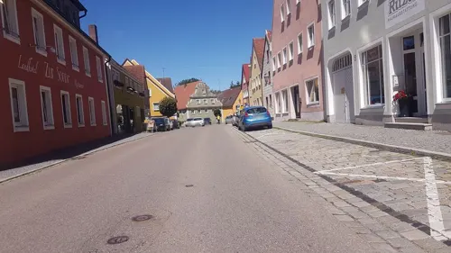
Central Laden
Cafe · Coffee Shop, Breakfast, Cake · 0.7 km
8 Vordere Gasse, Herrieden
Tu 08:00-18:00; We 08:00-14:00; Th,Fr 08:00-18:00; Sa 09:00-15:00;...
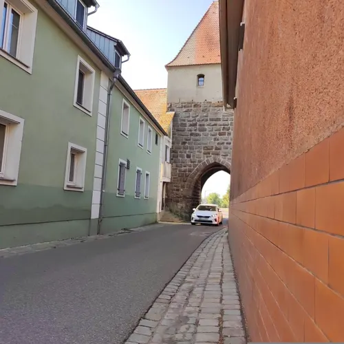

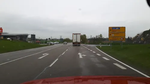
Pizzeria Buon Gusto
Restaurant · Pizza · 7.4 km
3 Im Herrmannshof, Burgoberbach
Mo off; Tu-Th 11:00-20:00; Fr-Sa 11:00-21:00; Su off


Bäckerei Beck
Bakery · 0.7 km
23 Vordere Gasse, Herrieden
Mo-Fr 05:30-18:00; Sa 05:30-12:00; Su,PH off
Bäckerei Beck
Bakery · 6.7 km
18 Weinberger Straße, Aurach
Mo,Sa 06:00-12:00; Tu-Fr 06:00-18:00; Su,PH off
Enzo Pizzeria - Eiscafè
Restaurant · 0.6 km
15 Marktplatz, Herrieden
Mo-Sa 16:00-23:00; Su,PH 15:00-23:00; Tu off
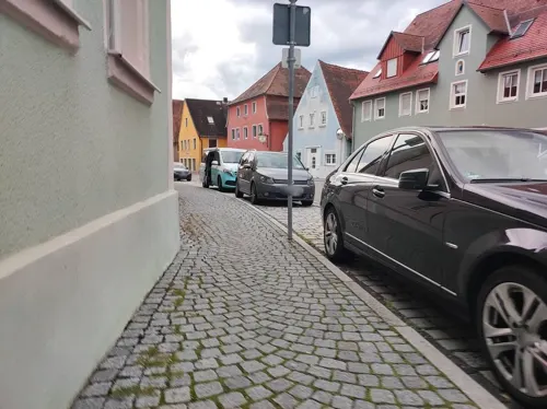


Gasthaus Limbacher
Restaurant · 0.7 km
34 Vordere Gasse, Herrieden
Tu-Sa 11:00-14:00,18:00-23:00; Su,Mo off


La Mira
Bar and pub · 7.6 km
14a Breslauer Straße, Ansbach
Tu-Fr 17:00-24:00, Fr,Sa 17:00-02:00, Su 17:00-24:00
31 more on the map.
Where to stay9
Privatvermieter Popp-Hessenauer
Motel and hotel · 6.0 km
36 Meinhardswinden, Ansbach
Churches and places of worship37
Mariä Heimsuchung
Church · Roman Catholic · 3.2 km
21 Zum Steinbachwald, Herrieden
St. Jakobus der Ältere
Church · Roman Catholic · 6.9 km
5 Pfarrer-Heumann-Straße, Herrieden
St. Laurentius
Church · Roman Catholic · 7.4 km
46 Kirchenallee, Bechhofen
Shopping10
Gas and EV charging15
Schools, colleges and libraries15
Healthcare4
Map of Herrieden
234 places. The map loads OpenStreetMap tiles when you open it.
Getting there and nearby towns
Illesheim Army Heliport (ILH) is the nearest airport with scheduled flights listed in OpenStreetMap, 27 km away.
- Ansbach 10 km northeast, about 10 min by car
- Leutershausen 9 km northwest, about 9 min by car
- Feuchtwangen 15 km southwest, about 15 min by car
- Petersaurach 19 km east, about 19 min by car
- Neuendettelsau 21 km east, about 21 min by car
- Gunzenhausen 23 km southeast, about 23 min by car
- Dinkelsbühl 23 km southwest, about 23 min by car
- Dietenhofen 23 km northeast, about 23 min by car
- Wassertrüdingen 23 km south, about 23 min by car
- Windsbach 23 km east, about 23 min by car
Drive times are estimates from straight-line distance, not routes.
Local news
Headlines from INDB.
Reviews, tips and questions
Loading what members have shared...
Sources and licences
- GeoNames (CC BY 4.0): population, coordinates, regions and time zone
- Mapillary (see each image): photos
- OpenStreetMap contributors (ODbL 1.0): places, airports, map data
- Wikidata (CC0 1.0): elevation, founding date, time zone, website, landmarks and historic places
- Wikimedia Commons (see each image): photos
- Wikipedia (CC BY-SA 4.0): overview and history text
Photo credits
- Herrieden 003, Wolkenkratzer, CC BY-SA 4.0
- Herrieden - Herrnhof 2 - 2, Howwi, CC BY-SA 3.0
- Herrieden Fasching Parade (9525043), U.S. Army USAGA by Jonathan Bell, Public domain
- Herrieden altarbild, Porkus957, CC BY-SA 4.0
- Herrieden Fasching Parade (9525033), U.S. Army USAGA by Jonathan Bell, Public domain
- Herrieden Fasching Parade (9525037), U.S. Army USAGA by Jonathan Bell, Public domain
- Herrieden Jungfernhaus von O, Heinrich Stürzl, CC BY-SA 4.0
- USAG Ansbach and the City of Herrieden, 35 years of partnership (8155759), U.S. Army USAGA by Jacqueline Haderlein, Public domain
- Herrieden Fronfeste von SW, Heinrich Stürzl, CC BY-SA 4.0
- Stadtschloss Herrieden - panoramio, Siegmar S., CC BY-SA 3.0
- Herrieden - Vogteiplatz 8, 10 - 1, Howwi, CC BY-SA 3.0
- Herrieden, Frauenkirche 014, Bybbisch94, Christian Gebhardt, CC BY-SA 4.0
- Herrieden, Frauenkirche 016, Bybbisch94, Christian Gebhardt, CC BY-SA 4.0
- Herrieden, Frauenkirche 015, Bybbisch94, Christian Gebhardt, CC BY-SA 4.0
- Herrieden Fasching Parade (9525036), U.S. Army USAGA by Jonathan Bell, Public domain
- Gestuehl frauenkirche herrieden, Historiograf, CC0
- Herrieden, Frauenkirche 013, Bybbisch94, Christian Gebhardt, CC BY-SA 4.0
- Herrieden - Herrnhof 4, 5 - 1, Howwi, CC BY-SA 3.0
- Herrieden stiftskirche innen 4, Klaus Graf, CC0
- Herrieden stiftskirche innen 1, Klaus Graf, CC0
- Herrieden stiftskirche innen 2, Klaus Graf, CC0
- Herrieden stiftskirche innen 3, Klaus Graf, CC0
- Herrieden stiftskirche innen 5, Klaus Graf, CC0
- Herrieden, ehemalige Propstei 02, Bybbisch94, Christian Gebhardt, CC BY-SA 4.0
- Herrieden - Herrnhof 2 - 1, Howwi, CC BY-SA 3.0
- Herrieden, ehemalige Propstei 01, Bybbisch94, Christian Gebhardt, CC BY-SA 4.0
- Herrieden - Herrnhof 20, 21, 22 - 2, Howwi, CC BY-SA 3.0
- Herrieden - Stadtpfarrkirche St. Veit - 2, Howwi, CC BY-SA 3.0
- Herrieden - Stadtpfarrkirche St. Veit - 2 Detail 1, Howwi, CC BY-SA 3.0
- Herrieden - Herrnhof 10 - Detail 1, Howwi, CC BY-SA 3.0
- Herrieden, Frauenkirche 012, Bybbisch94, Christian Gebhardt, CC BY-SA 4.0
- Theater Promenade Ansbach, Aarp65, CC BY-SA 3.0
- Sachsbach St. Georg 003, Tilman2007, CC BY 3.0
- Thann St. Peter 005, Tilman2007, CC BY 3.0
- Elpersdorf, St. Laurentius-001, Tilman2007, CC BY-SA 3.0
- Herrieden, Vogteiplatz 11-001, Tilman2007, CC BY-SA 3.0
- Schloss Sommersdorf-010, Tilman2007, CC BY-SA 3.0
- HerriedenVeste, Xocolatl, Public domain
- Gasthaus zum Kreuz (Reichenau), Kd6=dra, CC0
- 2011-06 Rauenzell (17), Rensi, CC0
- Elbersroth St. Jakobus der Ältere 2973, Reinhardhauke, CC BY-SA 3.0
- Grossenried, katholische Pfarrkirche St. Laurentius DmD-5-71-115-24 foto6 2016-08-04 16.27, Michielverbeek, CC BY-SA 4.0
- St Martin Herrieden, Metzner, CC BY-SA 3.0
- D-5-71-114-5 Aurach 20220219 0232, Tilman2007, CC BY-SA 4.0
- 2019-07-28 Christuskirche hochkant, Porkus957, CC BY-SA 4.0
- Street-level photo, changchun1, CC BY-SA 4.0
- Street-level photo, changchun1, CC BY-SA 4.0
- Street-level photo, msdess, CC BY-SA 4.0
- Street-level photo, changchun1, CC BY-SA 4.0
- Street-level photo, changchun1, CC BY-SA 4.0
- Street-level photo, msdess, CC BY-SA 4.0
- Street-level photo, yaron, CC BY-SA 4.0


Page built November 9, 2026. Spotted a mistake? Tell us or suggest a place.