


Why visit Hitzacker
Townapedia lists 18 museums and landmarks, 6 parks and trails, 26 places to eat, 17 places to stay and 4 attractions in and around town.
Highlights include Museum im Alten Zollhaus, Hitzacker Archaeological Centre, HIDDO-Freibad Hitzacker and Maujahn.
Weather in Hitzacker
Forecast from MET Norway (CC BY 4.0). Full forecast
About Hitzacker
Hitzacker (German pronunciation: [ˈhɪtsˌʔakɐ] ; Polabian: Ľautťüv) is a town in the Lüchow-Dannenberg district of Lower Saxony, Germany. It is situated on the river Elbe, approx. 8 km north of Dannenberg, and 45 km east of Lüneburg. The 2007 population of Hitzacker was 4,982, and its postal code is 29456.
From the Wikipedia article Hitzacker (this version), under CC BY-SA 4.0.
Travel tips from other travellers: Hitzacker on Wikivoyage (CC BY-SA 4.0).
Things to do4



Museums and landmarks18


Hitzacker Archaeological Centre
Monument and historic site · 0.7 km
Archaeological open-air museum



6 more on the map.
Parks, trails and playgrounds6

HIDDO-Freibad Hitzacker
Sports field and stadium · 0.9 km
3 Rieselweg, Hitzacker (Elbe)
May 15-Aug 31: Mo-Su 10:00-20:00


WSV Hitzacker
Marina and boat launch
Die Einfahrt zum WSV ist schmal und nicht betonnt, sind bei normalem Wasserstand aufgelaufen. Grund steinig. Empfehle Weiterfahrt bis...



Restaurants and cafes26

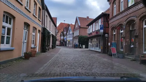
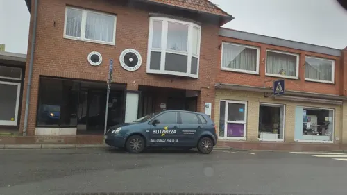
Plaka
Restaurant · Greek
3 Am Langenberg, Hitzacker (Elbe)
We-Mo 18:00-22:00, Su 12:00-14:00
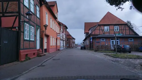
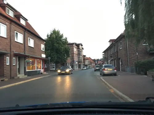


Drawehner-Torschenke
Restaurant · Regional
7 Drawehnertorstraße, Hitzacker (Elbe)

14 more on the map.
History
Man had already settled by around 3000 B.C. at the lake of Hitzackersee and the region has been continuously settled for over three thousand years.
On the Weinberg next to the present old town (Altstadt) Slavs built a castle in the eighth century. As a result, Hitzacker became an important trading centre even before its receiving town rights. Its actual foundation as a town took place in 1258, whereupon the castle lost its significance and was allowed to fall into ruins.
A manuscript referring to Hitzacker dating to 20 January 1376 states the following:
"The dukes, Wenceslas and Albert of Saxony and Lüneburg and Duke Bernard of Brunswick of Lüneburg allow the council of the town of Lüneburg to add the 30 marks of the lot which Lord Ludolf von Tzellenstede undertook to pay on the town's behalf on 13 April next, and the 150 marks of the lot which he also agreed to pay on the following 25 December, as well as the 100 marks of the lot the council paid on behalf of Lords Ordenberg and Siegfried Bock, i.e. 280 marks of the lot and the interest due to be added to the pledge for the castles of Bleckede and Hitzacker and the taxes from Lüneburg and Hitzacker, in the event that the lords do not repay the council on the said days, and vow also not to relieve the council from the pledges before they have repaid the sum pledged and the above money."
From the History section of Hitzacker on Wikipedia, under CC BY-SA 4.0.
Where to stay17
Jugendfreizeitanlage Meudelfitz
Campground · 3.8 km
Bleckeder Landstraße Ortsteil Meudelfitz, Hitzacker (Elbe)
Churches and places of worship5
Shopping8
Gas and EV charging3
Hoyer Automatenstation Hitzacker
Gas station · 1.2 km
26 Dannenberger Straße, Hitzacker (Elbe)
Schools, colleges and libraries4
Healthcare1
Map of Hitzacker
92 places. The map loads OpenStreetMap tiles when you open it.
Getting there and nearby towns
Lübeck Airport (LBC) is the nearest airport with scheduled flights listed in OpenStreetMap, 76 km away.
- Lüchow 22 km south, about 22 min by car
- Hagenow 33 km north, about 33 min by car
- Boizenburg 33 km northwest, about 33 min by car
- Hansestadt Salzwedel 34 km south, about 34 min by car
- Ludwigslust 36 km northeast, about 36 min by car
- Uelzen 38 km southwest, about 38 min by car
- Wieren 39 km southwest, about 39 min by car
- Lüneburg 43 km west, about 43 min by car
- Reppenstedt 47 km west, about 47 min by car
- Wittenberge 50 km east, about 50 min by car
Drive times are estimates from straight-line distance, not routes.
Local news
Headlines from INDB.
Reviews, tips and questions
Loading what members have shared...
Sources and licences
- GeoNames (CC BY 4.0): population, coordinates, regions and time zone
- Mapillary (see each image): photos
- OpenStreetMap contributors (ODbL 1.0): places, airports, map data
- Wikidata (CC0 1.0): elevation, founding date, time zone, website, landmarks and historic places
- Wikimedia Commons (see each image): photos
- Wikipedia (CC BY-SA 4.0): overview and history text
Photo credits
- Hitzacker- Altstadt und Elbaue vom Weinberg-2, Franzfoto, CC BY-SA 3.0
- Hitzacker Weinbergsweg 15 -17, ClausNe, CC BY-SA 4.0
- Zwergenbadegruft in Hitzacker, Gerd Fahrenhorst, CC BY 4.0
- Blick vom Weinberg auf Altstadt von Hitzacker, Gerd Fahrenhorst, CC BY 4.0
- Hitzacker Jeetzelufer 6, ClausNe, CC BY-SA 4.0
- Kneipp-Brunnen in Hitzacker, Gerd Fahrenhorst, CC BY 4.0
- Stadtplan Altstadt Hitzacker - panoramio, Arnold Schott, CC BY-SA 3.0
- Hitzacker Elbstraße 16, ClausNe, CC BY-SA 4.0
- Hitzacker Am Langenberg Friedhof, ClausNe, CC BY-SA 4.0
- Blick vom Weinberg bei Hitzacker auf das Biosphärenreservat und die Altstadt von Hitzacker 01, Andreas Huth, CC BY-SA 4.0
- Blick vom Weinberg bei Hitzacker auf das Biosphärenreservat und die Altstadt von Hitzacker 02, Andreas Huth, CC BY-SA 4.0
- Hitzacker Elbstraße 12, ClausNe, CC BY-SA 4.0
- Himmelsrutsche Hitzacker, Gerd Fahrenhorst, CC BY 4.0
- Hitzacker Elbstraße 09 1, ClausNe, CC BY-SA 4.0
- Bücherschrank Hitzacker, WortWusel, CC0
- Hitzacker Elbstraße 07, ClausNe, CC BY-SA 4.0
- Hitzacker Zollstraße 4, ClausNe, CC BY-SA 4.0
- Hitzacker Wikivoyage Banner, Torsten Bätge, CC BY-SA 3.0
- Hitzacker Hochwasser2006 7072, Torsten Bätge, CC BY-SA 3.0
- Hitzacker Hochwasser 2006, Torsten Bätge, CC BY-SA 3.0
- Hitzacker hochwasser2001, Torsten Bätge, CC BY-SA 3.0
- Hitzacker 3982, Torsten Bätge, CC BY-SA 3.0
- Maujahn1, Christian Fischer, CC BY-SA 3.0
- St. Mary's Church (Kaarßen, Amt Neuhaus), FriedrichFrisch, CC BY-SA 4.0
- Leitstade2, Startx at German Wikipedia, CC BY-SA 2.0 de
- Großsteingrab Wietzetze 3 p1, Stefan Ahlswede, CC BY 4.0
- Church of Hitzacker4, Christian Fischer, CC BY-SA 3.0
- Chapel of Kaarssen2, Christian Fischer, CC BY-SA 3.0
- Church of Tripkau1, Christian Fischer, CC BY-SA 3.0
- Langhaus 1 Hitzacker, Hermann Junghans, CC BY-SA 3.0
- AltesZollhausHitzacker, C.Felder, CC BY-SA 3.0
- NLD Großsteingrab Harlingen 1, Niedersächsisches Landesamt für Denkmalpflege, CC BY-SA 3.0
- Schlösserwahn - panoramio, Ralf Houven, CC BY 3.0
- Hinweisschild der Hochzeitskette - panoramio, Arnold Schott, CC BY-SA 3.0
- Hochzeitskette auf dem Hiddosteg - panoramio, Arnold Schott, CC BY-SA 3.0
- Hochzeitskette auf dem Hiddosteg - panoramio - Arnold Schott, Arnold Schott, CC BY-SA 3.0
- Hochwassermarke 23. August 2002 - panoramio, Arnold Schott, CC BY-SA 3.0
- Fischergang - panoramio, Arnold Schott, CC BY-SA 3.0
- Am Weinberg - panoramio, Arnold Schott, CC BY-SA 3.0
- Am Weinberg - panoramio - Arnold Schott, Arnold Schott, CC BY-SA 3.0
- Blick vom Weinberg bei Hitzacker auf das Biosphärenreservat 1, Andreas Huth, CC BY-SA 4.0
- Street-level photo, hotteliene, CC BY-SA 4.0
- Street-level photo, hotteliene, CC BY-SA 4.0
- Street-level photo, hotteliene, CC BY-SA 4.0
- Street-level photo, hotteliene, CC BY-SA 4.0
- Street-level photo, hotteliene, CC BY-SA 4.0
- Street-level photo, hotteliene, CC BY-SA 4.0
- Street-level photo, hotteliene, CC BY-SA 4.0
- Street-level photo, deleted_user, CC BY-SA 4.0
- Street-level photo, hotteliene, CC BY-SA 4.0
- Street-level photo, hotteliene, CC BY-SA 4.0
- Street-level photo, hotteliene, CC BY-SA 4.0
- Street-level photo, hotteliene, CC BY-SA 4.0
- Street-level photo, hotteliene, CC BY-SA 4.0
- Street-level photo, hotteliene, CC BY-SA 4.0
- Street-level photo, hotteliene, CC BY-SA 4.0
- Street-level photo, hotteliene, CC BY-SA 4.0
- Street-level photo, hotteliene, CC BY-SA 4.0
- Street-level photo, hotteliene, CC BY-SA 4.0
- Street-level photo, hotteliene, CC BY-SA 4.0
- Street-level photo, hotteliene, CC BY-SA 4.0
- Street-level photo, hotteliene, CC BY-SA 4.0
- Street-level photo, SteffonsLG, CC BY-SA 4.0
- Street-level photo, hotteliene, CC BY-SA 4.0


Page built November 9, 2026. Spotted a mistake? Tell us or suggest a place.