


Why visit Uelzen
Townapedia lists 46 museums and landmarks, 30 parks and trails, 105 places to eat, 16 places to stay and 17 attractions in and around town.
Highlights include Obstscheune Tätendorf, Heidemarkt, Hundertwasserbahnhof Uelzen and Wasserturm.
Weather in Uelzen
Forecast from MET Norway (CC BY 4.0). Full forecast
About Uelzen
Uelzen (German: [ˈʏltsn̩] ; Low German: Ülz'n), officially the Hanseatic City of Uelzen (German: Hansestadt Uelzen), is a town in northeast Lower Saxony, Germany, and capital of the district of Uelzen. It is part of the Hamburg Metropolitan Region, a Hanseatic town and an independent municipality.
From the Wikipedia article Uelzen (this version), under CC BY-SA 4.0.
Travel tips from other travellers: Uelzen on Wikivoyage (CC BY-SA 4.0).
Photos of Uelzen


Things to do17
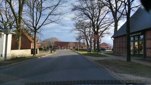
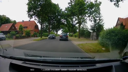



Kippe Hungerpfuhl
Scenic view · 4.2 km
Ausblick in südliche Richtung zur Schleusenanlage Uelzen (2.7 km Entfernung)

5 more on the map.
Museums and landmarks46

Hundertwasserbahnhof Uelzen
Monument and historic site · 1.1 km
1853 errichtetes Steingebäude im englischen Tudor-Stil
1 Friedensreich-Hundertwasser-Platz, Uelzen
Mo-Fr 05:00-21:30; Sa-Su 06:00-21:30

Wasserturm
Monument and historic site · 1.4 km
Wasserturm am Kuhteichweg in Uelzen
1B Kuhteichweg, Uelzen


Großsteingrab Uelzen 1
Monument and historic site · 4.0 km
Rest eines Großsteingrabs, Denkmalatlas Niedersachsen ID:32203187



Gefallenendenkmal
Monument and historic site · 8.8 km
Zentraler Findling zum Gedenken an die Gefallenen des Ersten Weltkriegs; weitere Findlinge auf der Grünanlage erinnern an die Gefallenen...
Grabhügel FStNr. 00003-G212
Monument and historic site · 9.5 km
Hügel mit ca. 12 m Durchmesser und Höhe von noch 1,20 m. Die Hügelränder laufen in das umliegende Gelände aus und der südliche Hügelfuß...
34 more on the map.
Parks, trails and playgrounds30







18 more on the map.
Restaurants and cafes105
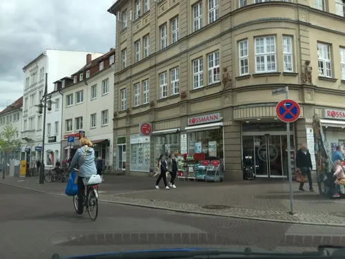
HanseMocca
Cafe · Coffee Shop, Deli
Kaffee,Kuchen,Frühstück und kleine Küche
2 Veerßer Straße, Uelzen
Tu,Th,Fr 09:00-18:00; We,Sa 09:00-14:00
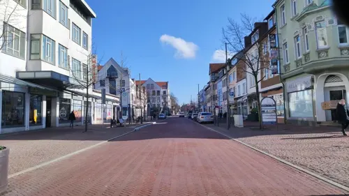
Gude Vibes
Restaurant · Arab, International, Kebab, Turkish
22 Gudesstraße, Uelzen
Tu-Sa 11:30-21:30; Su 12:00-21:00; Mo off
Kruse - Der Lecker Bäcker
Bakery · 1.0 km
13 Sankt-Viti-Straße, Uelzen
Mo-Sa 06:15-20:00, Su 08:00-17:00
Flavor’s – Restaurant & Bar
Restaurant · Indian, International · 0.9 km
Rollstuhlzugang nur Außenbereich.
1 Bahnhofstraße, Uelzen
Tu-Su 11:30-14:30,17:00-22:00

Asado Deli
Cafe · Deli, Tea, Cake, Breakfast, Coffee Shop
49 Lüneburger Straße, Uelzen
Mo-Fr 09:00-18:00; Sa 09:00-18:00; Su 10:00-18:00

Asado Nova
Restaurant · Steak House
49 Lüneburger Straße, Uelzen
Fr,Sa 17:30-22:00; We,Th,Su 17:30-21:00; Tu off; Mo off
Peking Restaurant
Restaurant · Chinese
5 Herzogenplatz, Uelzen
Mo,We-Sa 12:00-14:30, We-Mo,PH 18:00-21:00
Cafe und Restaurant 'Zur Esterholzer Schleuse'
Restaurant · 6.3 km
1 Schleuse-Esterholz, Wrestedt
We-Su 12:00-21:00

Café Mephisto
Bar and pub
9 Achterstraße, Uelzen
Su,PH 14:00-19:00, Mo-Th 10:00-20:00, Fr,Sa 10:00-24:00+
93 more on the map.
History
The town was founded in 1250. In 1270 Duke John of Brunswick-Lüneburg, a Welf who ruled the Principality of Lüneburg from 1252 to 1277, granted Uelzen its town privileges (Stadtrechte). In the Middle Ages it became an active member of the Hanseatic League. The town fortification, built in the 14th century, originally had three gates, a wall, and a moat. Parts of the wall are still standing.
While Uelzen only played a small role in the Hanseatic League, there is evidence that it traded with Livonia and Spain. At the Schnellenmarket, a London trading office purchased Uelzener linen, earthenware pitchers were offered for sale and brewery business flourished. On 21 October 1470, Uelzen was the venue for a Hanseatic League Convention. This was a special honor, as these annual resolutions of the association of cities usually took place in Lübeck.
The town became part of the Electorate of Hanover in 1708, the Kingdom of Westphalia in 1807, the Kingdom of Hanover in 1814, and the Prussian Province of Hanover in 1866.
Uelzen was the site of a Nazi concentration camp that operated in Uelzen until 17 April 1945. The camp was a subcamp of the Neuengamme concentration camp.
Read more of the history
Uelzen was hit by five air raids during World War II, on 18 April 1944, 10 November 1944, 27 November 1944, 22 February 1945 and 7 April 1945. Across these raids, 1362 buildings were destroyed or damaged. The heaviest raid was on 22 February 1945 when 149 people lost their lives and 95 houses were completely destroyed. On 18 April 1944, three civilians were killed and 153 houses were destroyed or damaged. Estimates indicate up to 27% of the town was destroyed at some point during the war.
From the History section of Uelzen on Wikipedia, under CC BY-SA 4.0.
More about Uelzen
Geography
Uelzen lies on the eastern edge of the Lüneburg Heath. The town is a transport hub on the north–south axis from Hamburg to Hanover as well as the east–west axis from Bremen to Berlin. Also of economic importance is its location on the Elbe Lateral Canal. The town is situated on the Ilmenau, and the banks in Uelzen are dotted with small parks wetland areas. Large areas in the vicinity of Uelzen have been set aside as nature parks with moors, woods, lakes, and heathland: the Elbhöhen-Wendland Nature Park, Lüneburg Heath Nature Park and Lower Saxon Elbe Valley Water Meadows Biosphere Reserve.
The following parishes belong to the borough of Uelzen: Groß Liedern, Halligdorf, Hambrock, Hansen, Hanstedt II, Holdenstedt, Kirchweyhe, Klein Süstedt, Masendorf, Mehre, Molzen, Oldenstadt, Riestedt, Ripdorf, Tatern, Veerßen, Westerweyhe, and Woltersburg.
Furthermore, there are four other places that have the status of "special parishes" (Sonstige Ortsteile): Borne, Kl. Liedern, Pieperhöfen, and Oldenstadt-West.
Uelzen has a typical oceanic climate (Köppen: Cfb; Trewartha: Dobk). The average temperature ranges from 1 °C (34 °F) in winter to 18 °C (64 °F) in summer, with precipitation concentrated from May to August. On average, there are 11 days with a maximum temperature of over 30 °C (86 °F) per year, and high temperatures of over 35 °C (95 °F) occur every four years on average.
Economy
The largest sugar beet refinery in the Nordzucker group is in Uelzen. It processes approximately 20,000 tons of sugar beet per day. Other large employers in the town are Nestlé Schöller or the dairy manufacturer Uelzena. Bituminous roofing felts and insulation material has been manufactured in Uelzen by C. Hasse & Sohn Archived 2022-07-11 at the Wayback Machine since 1872.
Arts and culture
Uelzen contains a number of theaters, including the theatre on the Ilmenau, the Jabelmann Events Hall, and the fringe theatre on the Rosenmauer.
Worthy of mention is the Holdenstedt Castle Museum which is the town's local history museum. Permanent exhibitions include furniture from the Middle Ages, a glass collection, artwork by painter Georg Wolf, and archaeological finds from the local area.
From the Wikipedia article Uelzen, under CC BY-SA 4.0.
Notable people from Uelzen
 Eberhard August Wilhelm von ZimmermannGerman scientist and zoologistPhoto: Eberhard August Wilhelm von Zimmermann, Public domain
 Ernest I, Duke of Brunswick-LüneburgPrince of Lüneburg-CellePhoto: Workshop of Lucas Cranach the Elder, Public domain
 Francis, Duke of GifhornGerman princePhoto: The original uploader was Axel..., Public domain
 Theodor ZinckeGerman chemist (1843-1928)Photo: Unknown author Unknown author, Public domain
 Leonhard WächterGerman writer (1762-1837)Photo: Unknown author Unknown author, Public domain
 Mola AdebisiGerman television presenterPhoto: Michael Schilling, CC BY-SA 3.0
 Gesine MeißnerGerman politicianPhoto: Foto-AG Gymnasium Melle, CC BY-SA 3.0
 Caspar LehmannGerman glass and gem engraverPhoto: Uměleckoprůmyslové muzeum v Praze, Public domain
- Friedrich KuhlauDanish composer
- Rebecca HarmsGerman politician
- Walter WallmannGerman politician (1932-2013)
- Theodore KaufmannUnited States painter (1814-1896)
Born in Uelzen, according to Wikidata (CC0). Each name links to its Wikipedia article.
Where to stay16
Churches and places of worship34
Klosterkirche St. Johannes
Church · Lutheran · 1.8 km
6 Klosterstraße, Uelzen
Zum Göttlichen Erlöser
Church · Roman Catholic · 1.0 km
29 Alewinstraße, Uelzen
Adventgemeinde Uelzen Am Stadtwald
Church · Seventh Day Adventist · 2.3 km
1 Peter-Cordes-Weg, Uelzen
Shopping39
Gas and EV charging11
Schools, colleges and libraries14
Healthcare14
Psychiatrische Klink Uelzen - Ambulanz & Tagesklink
Clinic and pharmacy · 1.0 km
Map of Uelzen
250 places. The map loads OpenStreetMap tiles when you open it.
Getting there and nearby towns
Forschungsflughafen Braunschweig-Wolfsburg (BWE) is the nearest airport with scheduled flights listed in OpenStreetMap, 72 km away.
- Stadensen 10 km south, about 10 min by car
- Wieren 11 km southeast, about 11 min by car
- Ebstorf 12 km northwest, about 12 min by car
- Bad Bevensen 13 km north, about 13 min by car
- Bienenbüttel 20 km north, about 20 min by car
- Unterlüß 23 km southwest, about 23 min by car
- Faßberg 28 km west, about 28 min by car
- Wittingen 29 km southeast, about 29 min by car
- Lüneburg 33 km north, about 33 min by car
- Reppenstedt 35 km northwest, about 35 min by car
Drive times are estimates from straight-line distance, not routes.
Towns near Uelzen


Keep exploring
Local news
Headlines from INDB.
Reviews, tips and questions
Loading what members have shared...
Sources and licences
- GeoNames (CC BY 4.0): population, coordinates, regions and time zone
- Mapillary (see each image): photos
- OpenStreetMap contributors (ODbL 1.0): places, airports, map data
- Wikidata (CC0 1.0): elevation, founding date, time zone, website
- Wikimedia Commons (see each image): photos
- Wikipedia (CC BY-SA 4.0): overview and history text
Photo credits
- Uelzen - Hundertwasserbahnhof 08 ies, Frank Vincentz, CC BY-SA 3.0
- Erwin Spindler Ansichtskarte Uelzen, Erwin Spindler, Public domain
- Uelzen Gertrudenkapelle, Hewiha, CC BY-SA 4.0
- Skulptur am Ratsteich Uelzen, Gerd Fahrenhorst, CC BY 4.0
- ME 147 543 Uelzen 2505240910, Clic, CC BY 4.0
- Schmiedestraße 2 Uelzen, Clemensfranz, CC BY-SA 4.0
- Lange Brücke, Uelzen, Gerd Fahrenhorst, CC BY 4.0
- Stolpersteine Helene Lion Gudesstraße 28 Uelzen, Clemensfranz, CC BY-SA 4.0
- Stolpersteine Gudesstraße 28 Uelzen, Clemensfranz, CC BY-SA 4.0
- Stolpersteine Hermann Benjamin Gudesstraße 28 Uelzen, Clemensfranz, CC BY-SA 4.0
- Stolpersteine Meta Benjamin Gudesstraße 28 Uelzen, Clemensfranz, CC BY-SA 4.0
- Schmiedestraße 12 Uelzen, Clemensfranz, CC BY-SA 4.0
- Schmiedestraße 16 Uelzen, Clemensfranz, CC BY-SA 4.0
- Schmiedestraße 16 Tuer Uelzen, Clemensfranz, CC BY-SA 4.0
- Stolperstein Meta Benjamin in Uelzen, Uwe Rohwedder, CC BY-SA 4.0
- Stolperstein Helene Lion in Uelzen, Uwe Rohwedder, CC BY-SA 4.0
- Stolperstein Hermann Benjamin in Uelzen, Uwe Rohwedder, CC BY-SA 4.0
- Uelzen - Ein altes Fachwerkhaus NIK 6212, Nightflyer ( talk ) 22:39, 25 May 2014 (UTC), CC BY 3.0
- Uelzen - Brunnen am Schnellenmarkt NIK 6211, Nightflyer ( talk ) 20:57, 25 May 2014 (UTC), CC BY 3.0
- Brunnen am Schnellenmarkt, Uelzen, Gerd Fahrenhorst, CC BY 4.0
- Uelzen, the town hall, Dguendel, CC BY 3.0
- Gudesstraße 3 Uelzen, Clemensfranz, CC BY-SA 4.0
- Rathaus Uelzen 2, Drc4891 ( Diskussion ), CC BY-SA 3.0 de
- Uelzen - Der Weg der Steine NIK 6152, Nightflyer ( talk ) 22:12, 25 May 2014 (UTC), CC BY 3.0
- Uelzen - Der Weg der Steine NIK 6153, Nightflyer ( talk ) 22:14, 25 May 2014 (UTC), CC BY 3.0
- Rathaus Uelzen 1, Drc4891 ( Diskussion ), CC BY-SA 3.0 de
- Uelzen - Der Weg der Steine NIK 6156, Nightflyer ( talk ) 22:16, 25 May 2014 (UTC), CC BY 3.0
- Uelzen, a row of houses on the Lüneburger Straße, Dguendel, CC BY 3.0
- Empfangsgebäude, Bahnhof Uelzen, Liberaler Humanist, CC BY-SA 3.0
- Niedersachsen, Stadensen, Naturdenkmal ND UE 00072, Carolin Weber, CC BY-SA 4.0
- JastorferSee2020, Titi ger, CC0
- Holdenstedter Teiche - Landkreis Uelzen, Alinikus ( aber eigentlich Ole), CC BY-SA 4.0
- Wrestedt - Großsteingrab Kahlstorf 03 ies, Frank Vincentz, CC BY-SA 3.0
- Kirche-Oldenstadt, Gunther Schendel. Original uploader was Lutero at de.wikipedia, Public domain
- Herzog-Ernst-Gymnasium-2153, Frank Schulenburg, CC BY-SA 4.0
- Uelzen Kirche kath, Kirchenfan, CC0
- Georgskirche zu Kirchweyhe Uelzen, Niklas Günther (Benis2013), CC BY-SA 3.0
- Großsteingrab Barnsen p3, Stefan Ahlswede, CC BY 4.0
- Großsteingrab Westerweyhe, Stefan Ahlswede, CC BY 4.0
- St.-Petri-Kirche Uelzen1, Uelzen1234, CC BY-SA 3.0
- Kirche von außen, JanPom, CC BY-SA 4.0
- Psychiatrische Klinik Uelzen, Eingangsbereich, Gerd Fahrenhorst, CC BY 4.0
- Bobenwald 01, Puusterke, CC BY-SA 4.0
- Christuskirche Molzen südseite, Mariedrögemüller, CC BY-SA 4.0
- Helios-Klinik Uelzen 1, Gerd Fahrenhorst, CC BY 4.0
- Uelzen Wasserturm Kuhteichweg-01, Radler59, CC BY-SA 3.0
- St. Gertrudenkapelle, Kerawo, CC BY-SA 4.0
- Stmarienveerssen, MichaelXXLF, CC BY-SA 3.0
- Uelzen - St. Marien-Kirche, Turm, Oxfordian Kissuth, CC BY-SA 3.0
- Uelzen Grab 1 p1, Stefan Ahlswede, CC BY 4.0
- Holdenstedt Kreuzstein-1, Radler59, CC BY-SA 3.0
- Street-level photo, hotteliene, CC BY-SA 4.0
- Street-level photo, hotteliene, CC BY-SA 4.0
- Street-level photo, hotteliene, CC BY-SA 4.0
- Street-level photo, hotteliene, CC BY-SA 4.0
- Street-level photo, derlipper, CC BY-SA 4.0
- Street-level photo, wendlandosm, CC BY-SA 4.0
- Street-level photo, hotteliene, CC BY-SA 4.0
- Street-level photo, hotteliene, CC BY-SA 4.0
- Street-level photo, hotteliene, CC BY-SA 4.0
- Street-level photo, hotteliene, CC BY-SA 4.0
- Street-level photo, hotteliene, CC BY-SA 4.0
- Street-level photo, hotteliene, CC BY-SA 4.0
- Street-level photo, hotteliene, CC BY-SA 4.0
- Street-level photo, hotteliene, CC BY-SA 4.0
- Street-level photo, derlipper, CC BY-SA 4.0
- Street-level photo, hotteliene, CC BY-SA 4.0
- Street-level photo, TechniPorter, CC BY-SA 4.0
- Street-level photo, hotteliene, CC BY-SA 4.0
- Street-level photo, hotteliene, CC BY-SA 4.0
- Street-level photo, frankvival, CC BY-SA 4.0
- Street-level photo, derlipper, CC BY-SA 4.0
- Street-level photo, hotteliene, CC BY-SA 4.0


Page built November 9, 2026. Spotted a mistake? Tell us or suggest a place.