


Why visit Lüneburg
Townapedia lists 139 museums and landmarks, 28 parks and trails, 226 places to eat, 24 places to stay and 8 attractions in and around town.
Highlights include Theater Lüneburg, Lüneburger Kalkberg, Lüneburg Water Tower and German Salt Museum.
Weather in Lüneburg
Forecast from MET Norway (CC BY 4.0). Full forecast
About Lüneburg
Lüneburg, officially the Hanseatic City of Lüneburg and also known in English as Lunenburg, is a town in the German state of Lower Saxony. It is located about 50 km (31 mi) southeast of another Hanseatic city, Hamburg, and belongs to that city's wider metropolitan region. The capital of the district which bears its name, it is home to roughly 77,000 people. Lüneburg's urban area, which includes the surrounding communities of Adendorf, Bardowick, Barendorf and Reppenstedt, has a population of around 103,000.
From the Wikipedia article Lüneburg (this version), under CC BY-SA 4.0.
Travel tips from other travellers: Lüneburg on Wikivoyage (CC BY-SA 4.0).
Photos of Lüneburg


Things to do8


Lüneburger Kalkberg
Scenic view · 1.3 km
Standort ehem. Burg auf dem Kalkberg

KornKonnection 'KoKo' (ökol. Einkaufsgemeinschaft)
Farm and orchard · 1.2 km
84 Wilschenbrucher Weg, Lüneburg
24/7



Museums and landmarks139

Lüneburg Water Tower
Monument and historic site
Tower in Lüneburg, Germany
1 Am Wasserturm
Mo-Su 10:00-18:00


Kalandhaus
Monument and historic site
Markant ist das gotische Dielenhaus mit hoher Diele im Erdgeschoss und mittigen spitzbogigen Eingang mit drei Nischen geziert von...
Kalandstraße, Lüneburg


Museum Lüneburg
Museum
1 Willy-Brandt-Straße, Lüneburg
Tu,We,Fr 11:00-18:00; Th 11:00-20:00; Sa,Su,PH 10:00-18:00; Dec 24...



127 more on the map.
Parks, trails and playgrounds28



Spielplatz Alfred-Trebchen-Straße
Playground · 1.0 km
dawn-dusk


Ausgleichsfläche
Hiking and trails · 1.5 km
Lebensraum für Zauneidechsen, Ausgleichsfläche für das Baugebiet "An der Wittenberger Bahn"
16 more on the map.
Restaurants and cafes226
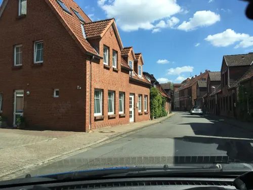
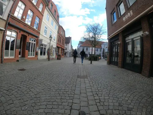
Bar Be Qube
Restaurant · Barbecue · 0.7 km
6 Schröderstraße, Lüneburg
Mo-Sa 08:30-23:00; Su 10:00-23:00
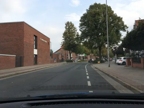
Bombay Place
Restaurant · Indian · 1.0 km
2 Sülztorstraße, Lüneburg
Tu-Fr 11:30-15:00,17:30-24:00, Sa,Su 11:30-24:00
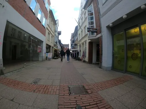

Bar Barossa
Restaurant · Asian, Sushi, Thai · 0.7 km
4 Untere Schrangenstraße, Lüneburg
Tu-Sa 12:00-22:00; Su,PH 15:00-22:00; Mo off
Loving Hut
Restaurant · International
Burger, Döner, Hot-Dog und wechselnde Tagesgerichte. 100% vegan.
5 Lünertorstraße, Lüneburg
Mo-Su,PH 11:00-19:00

Anna's Cafe
Cafe · Breakfast, Cake, Coffee, Sandwich
6 Salzstraße am Wasser, Lüneburg
Mo-Su 09:00-17:00
Gasthausbrauerei & Brennerei Nolte
Restaurant · German · 1.7 km
102 Dahlenburger Landstraße, Lüneburg
We-Th 16:00-22:30; Fr-Sa 16:00-23:00

Happy Billard Lüneburg
Bar and pub
Billiard, Dart und Kicker
6 Bei der Abtspferdetränke, Lüneburg
Jun-Sep Mo-Sa 18:00+; Oct-May Mo-Sa 17:00+
214 more on the map.
History
The first signs of human presence in the area of Lüneburg date back to the time of Neanderthal Man: 56 axes, estimated at 150,000 years old, were uncovered during the construction in the 1990s of the autobahn between Ochtmissen and Bardowick. The site of the discovery at Ochtmissen was probably a Neanderthal hunting location where huntsmen skinned and cut up the animals they had caught.
The area was almost certainly not continuously inhabited at that time, however, due to the various glaciations that lasted for millennia. The first indication of a permanent, settled farming culture in the area was found not far from the site of the Neanderthal discovery in the river Ilmenau between Lüne and Bardowick. This was an axe that is described as a Schuhleistenkeil or "shoe last wedge" due to its shape. It dates to the 6th century BC and is now in the collection of the Lüneburg Museum.
Since the Bronze Age, the Lüneburg hill known as the Zeltberg has concealed a whole range of prehistoric and early historic graves, which were laid out by people living in the area of the present-day town of Lüneburg. One of the oldest finds from this site is a so-called Unetice flanged axe (Aunjetitzer Randleistenbeil) which dates to 1900 BC.
Read more of the history
The land within the town itself has also yielded a number of ice age urns that were already being reported in the 18th century. These discoveries are, however, like those from the Lüneburger Kalkberg — they went into the private collections of several 18th-century scholars and, with a few exceptions, were lost when the scholars died.
Also worth mentioning in this regard are the Lombard Urnfield graves on the Lüneburg Zeltberg and Oedeme from the first few centuries AD. In the Middle Ages, there several discoveries were made on the site of the town, for example on the site of the old village of Modestorpe not far from St. John's Church (Johanniskirche), at the Lambertiplatz near the saltworks and in the old Waterside Quarter.
The ancient town may be that identified as Leufana or Leuphana (Greek: Λευφάνα), a town listed in Ptolemy (2.10) in the north of Germany on the west of the Elbe.
Lüneburg was first mentioned in medieval records in a deed signed on 13 August, 956 AD, in which Otto I, Holy Roman Emperor granted "the tax from Lüneburg to the monastery built there in honour of Saint Michael" (German: den Zoll zu Lüneburg an das zu Ehren des heiligen Michaels errichtete Kloster, Latin: teloneum ad Luniburc ad monasterium sancti Michahelis sub honore constructum). An older reference to the place in the Royal Frankish Annals for 795 states:ad fluvium Albim pervenit ad locum, qui dicitur Hliuni, i.e. "on the river Elbe, at the location, which is called Hliuni") and refers to one of the three core settlements of Lüneburg; probably the castle on the Kalkberg which was the seat of the Billunger nobles from 951. The Elbe-Germanic name Hliuni corresponds to the Lombard word for "refuge site".
From archaeological finds, it is clear that the area around Lüneburg had already been settled (in the museum of the Principality of Lüneburg, for example, there is a whole range of artefacts that were found here) and the saltworks had already started production.
According to tradition, the salt was first discovered by a hunter who observed a wild boar bathing in a pool of water, shot and killed it, and hung the coat up to dry. When it was dry, he discovered white crystals in the bristles — salt. Later he returned to the site of the kill and located the salt pool, the first production of salt on the site took place. In the town hall is a bone preserved in a glass case; legend has it that this is the preserved leg-bone of the boar. It was here that the Lüneburg Saltworks was subsequently established for many centuries.
In spite of its lucrative saltworks, Lüneburg was originally subordinated to the town of Bardowick only a few miles to the north. Bardowick was older and was an important trading post for the Slavs. Bardowick's prosperity – it had seven churches – was based purely on the fact that no other trading centres were tolerated. Only when Bardowick refused to pay allegiance to Henry the Lion it was destroyed by him in 1189, whereupon Lüneburg was given town privileges (Stadtrechte) and developed into the central trading post in the region in place of Bardowick.
The Polabian name for Lüneburg is Glain (written as Chlein or Glein in older German sources), probably derived from glaino (Slavonic: glina) which means "clay". In the Latin texts Lüneburg surfaces not only as the Latinised Lunaburgum, but also as Selenopolis.
As a consequence of the monopoly that Lüneburg had for many years as a supplier of salt within the North German region, a monopoly not challenged until much later by French imports, it very quickly became a member of the Hanseatic League. The League was formed in 1158 in Lübeck, initially as a union of individual merchants, but in 1356 it met as a federation of trading towns at the first general meeting of the Hansetag. Lüneburg's salt was needed in order to pickle the herring caught in the Baltic Sea and the waters around Norway so that it could be preserved for food inland during periods of fasting when fish (not meat) was permitted.
The Scania Market at Scania in Sweden was a major fish market for herring and became one of the most important trade events in Northern Europe in the Middle Ages. Lüneburg's salt was in great demand and the town quickly became one of the wealthiest and most important towns in the Hanseatic League, together with Bergen and Visby (the fish suppliers) and Lübeck (the central trading post between the Baltic and the interior). In the Middle Ages salt was initially conveyed overland up the Old Salt Road to Lübeck. With the opening of the Stecknitz Canal in 1398 salt could be transported by cog from the Lübeck salt warehouses, the Salzspeicher.
From the History section of Lüneburg on Wikipedia, under CC BY-SA 4.0.
More about Lüneburg
Geography
Lüneburg lies on the river Ilmenau, about 30 kilometres (19 mi) from its confluence with the Elbe. The river flows through the town and is featured in its song; it was formerly traversed by cogs taking salt from the town to the other, larger, ports of the Hanseatic League nearby.
To the south of the town stretches the 7,400-square-kilometre (2,857 sq mi) Lüneburg Heath which emerged as a result of widespread tree-felling, forest fires and grazing. The tradition that the heath arose from centuries of logging undertaken to meet the constant need of the Lüneburg salt works for wood is not historically confirmed. More likely, the heath was originally formed by clearances during the Bronze Age. The old town (Altstadt) of Lüneburg lies above a salt dome which is the town's original source of prosperity. However, the constant mining of the salt deposits over which the town stands has also resulted in the sometimes gradual, sometimes dramatically pronounced, sinking of various areas of the town. On the western edge of the town is the Kalkberg, a small hill and former gypsum quarry.
There are several towns, cities, and urban areas around Lüneburg in all directions:
Education
The town has one university, the Leuphana Universität Lüneburg (previously known only as the Universität Lüneburg). The university has more than 9,000 students.
From the Wikipedia article Lüneburg, under CC BY-SA 4.0.
Notable people from Lüneburg
 Niklas LuhmannGerman sociologist, administration expert, and social systems theorist (1927-1998)Photo: Universitätsarchiv St.Gallen (HSG), CC BY-SA 4.0
 Otto the ChildGerman duke of Brunswick-LüneburgPhoto: Hans Bornemann, Public domain
 Henry the Middle, Duke of Brunswick-LüneburgDuke of Brunswick-Lüneburg and Prince of LüneburgPhoto: Brunswick-Lüneburg Court miniaturist..., Public domain
 Katarina WatersGerman-born English professional wrestler and professional wrestling valetPhoto: Katarinasinfamy, CC BY-SA 4.0
 Jenny ElversGerman actressPhoto: Superbass, CC BY-SA 4.0
 Rudolf von BennigsenGerman politician (1824–1902)Photo: Unknown author Unknown author, Public domain
 Jean Armand de LestocqFrench adventurerPhoto: Копия с портрета работы Г.К.Гроота, Public domain
 Ernst EhlersGerman zoologist and university teacher (1835-1925)Photo: August Schmidt, Public domain
 Annegret SoltauGerman photographer (born 1946)Photo: Bernhard Holub, CC BY-SA 4.0
 Gustav WallisGerman botanist (1830-1878)Photo: Unknown author Unknown author, Public domain
- Curt BackebergGerman botanist (1894-1966)
- Johann Abraham Peter SchulzGerman musician and composer (1747-1800)
Born in Lüneburg, according to Wikidata (CC0). Each name links to its Wikipedia article.
Where to stay24
Churches and places of worship24
Shopping62
Gas and EV charging10
Schools, colleges and libraries29
Healthcare16
Map of Lüneburg
250 places. The map loads OpenStreetMap tiles when you open it.
Getting there and nearby towns
Hamburg Finkenwerder Airport (XFW) is the nearest airport with scheduled flights listed in OpenStreetMap, 50 km away.
- Adendorf 4 km northeast, about 4 min by car
- Reppenstedt 4 km west, about 4 min by car
- Bardowick 5 km north, about 5 min by car
- Bienenbüttel 13 km south, about 13 min by car
- Winsen 18 km northwest, about 18 min by car
- Wulfsen 19 km west, about 19 min by car
- Geesthacht 21 km north, about 21 min by car
- Bleckede 22 km east, about 22 min by car
- Bad Bevensen 22 km southeast, about 22 min by car
- Stelle 25 km northwest, about 25 min by car
Drive times are estimates from straight-line distance, not routes.
Towns near Lüneburg


Keep exploring
Local news
Headlines from INDB.
Reviews, tips and questions
Loading what members have shared...
Sources and licences
- GeoNames (CC BY 4.0): population, coordinates, regions and time zone
- Mapillary (see each image): photos
- OpenStreetMap contributors (ODbL 1.0): places, airports, map data
- Wikidata (CC0 1.0): elevation, founding date, time zone, website, landmarks and historic places
- Wikimedia Commons (see each image): photos
- Wikipedia (CC BY-SA 4.0): overview and history text
Photo credits
- Kirche St Johannis Lueneburg, Christian Fischer, CC BY-SA 3.0
- Lünertorstraße 5 Lüneburg, Clemensfranz, CC BY-SA 4.0
- Lüneburg (38972773544), Aleksandr Zykov from Russia, CC BY-SA 2.0
- Lüneburg (25809750748), Aleksandr Zykov from Russia, CC BY-SA 2.0
- Lüneburg, Am Schifferwall 1-4, Tommes, CC BY-SA 4.0
- Lünertorstraße 4 Lüneburg, Clemensfranz, CC BY-SA 4.0
- Lüneburg (38783893295), Aleksandr Zykov from Russia, CC BY-SA 2.0
- Lüneburg, Am Schifferwall 2 (3), Tommes, CC BY-SA 4.0
- Stolperstein Lüneburg Schießgrabenstraße 3 Erich Meinhard Wolfsberg, Gmbo 2013, CC0
- Stolperstein Lüneburg Schießgrabenstraße 3 Günther Moritz Wolfsberg, Gmbo 2013, CC0
- Stolperstein Lüneburg Schießgrabenstraße 3 Grete Wolfsberg, Gmbo 2013, CC0
- Lüneburg-lünerstr01, Nikater, Public domain
- Lüneburg-lünerstr02, Nikater, Public domain
- Stolpersteine Lüneburg Schießgrabenstraße 3, Gmbo 2013, CC0
- Stolpersteinlage Lüneburg Schießgrabenstraße 3, Gmbo 2013, CC0
- Lüneburg Am Werder 10, ClausNe, CC BY-SA 4.0
- Lüneburg Am Werder 01a, ClausNe, CC BY-SA 4.0
- Lüneburg Lünertorstraße 03, ClausNe, CC BY-SA 4.0
- Brunnen Partner von morgen, Am Werder in 21335 Lüneburg (1), Pauli-Pirat, CC BY-SA 4.0
- Brunnen Partner von morgen, Am Werder in 21335 Lüneburg (2), Pauli-Pirat, CC BY-SA 4.0
- Brunnen Partner von morgen, Am Werder in 21335 Lüneburg, Plakette, Pauli-Pirat, CC BY-SA 4.0
- Lüneburg Am Werder 11, ClausNe, CC BY-SA 4.0
- Lüneburg, Germany - panoramio (19), hh oldman, CC BY 3.0
- Lüneburg Lünertorstraße 19, ClausNe, CC BY-SA 4.0
- Lüneburg Lünertorstraße 02, ClausNe, CC BY-SA 4.0
- Lüneburg, Am Schifferwall 2 (2), Tommes, CC BY-SA 4.0
- Lüneburg Lünertorstraße 20, ClausNe, CC BY-SA 4.0
- Am Fischmarkt 5 in 21335 Lüneburg, Pauli-Pirat, CC BY-SA 4.0
- Lünertorstraße 18 Lüneburg, Clemensfranz, CC BY-SA 4.0
- Lüneburg (38972772034), Aleksandr Zykov from Russia, CC BY-SA 2.0
- Lüneburg (38972771494), Aleksandr Zykov from Russia, CC BY-SA 2.0
- Am Fischmarkt in 21335 Lüneburg, Innerortsstraße, Pauli-Pirat, CC BY-SA 4.0
- 173 2015 07 16 Bei der Ratsmühle 19, Friedrich Haag, CC BY-SA 4.0
- Salzmuseum Lüneburg Eingang, Hajotthu, CC BY 3.0
- St. Michaelis Kirche in Lüneburg, DerHexer, CC BY-SA 3.0
- Lüneburg - Heiligengeiststraße - Ostpreußisches Landesmuseum 01 ies, Frank Vincentz, CC BY-SA 3.0
- 2010-06-06-lueneburg-by-RalfR-13, Ralf Roletschek ( talk ) - Fahrradtechnik auf fahrradmonteur.de, CC BY-SA 3.0 de
- Leuphana Building, Gerrit Gutzeit, CC BY-SA 4.0
- Johanneum Lüneburg - Haupteingang aus Richtung Südost, Stonecello, CC BY-SA 4.0
- Seminaris Hotel Lüneburg 3, Seminaris Hotel Lüneburg, CC BY-SA 3.0
- Lüneburg Theater 04, Photo: Andreas Praefcke, CC BY 3.0
- Lueneburg-Rathaus, User:Kolossos, CC BY-SA 3.0
- St. Marien, Lüneburg, Kirchenfan, CC0
- Clamart-Park, StefanK0815, CC BY-SA 3.0
- Landgericht Lüneburg, Motiko98, CC BY 3.0
- Lüneburg, Alte Ratsapotheke, Schaufassade, 2016-08-18, ama fec, Angela M. Arnold, Berlin (=44Pinguine), CC BY-SA 3.0
- Sudhaus der ehemaligen Lüneburger Kronenbrauerei, Ostpreußisches Landesmuseum, CC BY-SA 4.0
- Lüneburg - Kloster Lüne 16 ies, Frank Vincentz, CC BY-SA 3.0
- Seminaris Hotel Lüneburg 2, Seminaris Hotel Lüneburg, CC BY-SA 3.0
- Kalandhaus, façade, Patrice78500, CC BY-SA 4.0
- Adventgemeinde Lüneburg, Gerd Fahrenhorst, CC BY 4.0
- 2010-06-06-lueneburg-by-RalfR-07, Ralf Roletschek ( talk ) - Fahrradtechnik auf fahrradmonteur.de, CC BY-SA 3.0 de
- Lüneburg Nicolaikirche vom Wasserturm, Andreas Praefcke, CC BY 3.0
- Pauluskirche Lüneburg, Nexobas, CC BY-SA 3.0
- Lüneburger Kalkberg mit Feuchtbiotop (2), Puusterke, CC BY-SA 4.0
- Museum Lüneburg, Hinrick Reymers, Skulptur Samson mit dem Löwen, Dguendel, CC BY 4.0
- Kurpark Gradierwerk Park Lüneburg, Clemensfranz, CC BY-SA 4.0
- Street-level photo, hotteliene, CC BY-SA 4.0
- Street-level photo, rydor, CC BY-SA 4.0
- Street-level photo, kodo, CC BY-SA 4.0
- Street-level photo, hotteliene, CC BY-SA 4.0
- Street-level photo, rydor, CC BY-SA 4.0
- Street-level photo, hotteliene, CC BY-SA 4.0
- Street-level photo, Nicknam, CC BY-SA 4.0
- Street-level photo, kodo, CC BY-SA 4.0
- Street-level photo, rydor, CC BY-SA 4.0
- Street-level photo, kodo, CC BY-SA 4.0
- Street-level photo, kodo, CC BY-SA 4.0
- Street-level photo, kodo, CC BY-SA 4.0
- Street-level photo, alex84, CC BY-SA 4.0
- Street-level photo, kodo, CC BY-SA 4.0
- Street-level photo, rydor, CC BY-SA 4.0
- Street-level photo, kodo, CC BY-SA 4.0
- Street-level photo, hotteliene, CC BY-SA 4.0
- Street-level photo, luisakreitmair, CC BY-SA 4.0
- Street-level photo, hotteliene, CC BY-SA 4.0
- Street-level photo, hotteliene, CC BY-SA 4.0


Page built November 9, 2026. Spotted a mistake? Tell us or suggest a place.