


Hockenheim, Germany
Hockenheim is a town of 20,614 people in Baden-Wurttemberg, Germany.
Why visit Hockenheim
Townapedia lists 38 museums and landmarks, 26 parks and trails, 146 places to eat, 12 places to stay and 18 attractions in and around town.
Highlights include Central, Obsthof Hoffmann, Turmuhrenmuseum Neulußheim and Museum Autovision.
Weather in Hockenheim
Forecast from MET Norway (CC BY 4.0). Full forecast
About Hockenheim
Hockenheim (German: [ˈhɔkn̩haɪm] ) is a town in northwest Baden-Württemberg, Germany, about 20 km south of Mannheim and 10 km west of Walldorf. It is located in the Upper Rhine valley on the tourist theme routes "Baden Asparagus Route" (Badische Spargelstraße) and Bertha Benz Memorial Route. The town is widely known for its Hockenheimring, a motor racing course, which has hosted over 30 Formula One German Grand Prix races since 1970.
From the Wikipedia article Hockenheim (this version), under CC BY-SA 4.0.
Travel tips from other travellers: Hockenheim on Wikivoyage (CC BY-SA 4.0).
Things to do18


Obsthof Hoffmann
Farm and orchard · 3.8 km
Hofladen
14 Hockenheimer Straße, Neulußheim
Mo-Fr 08:30-13:00,14:00-18:30;Sa 08:30-13:00
Michaels Scheunenladen
Farm and orchard · 4.7 km
6 Peterstraße, Altlußheim
Tu 15:00-18:00; Fr 09:00-12:00; Sa 09:00-13:00

Schlosstheater Schwetzingen
Cinema and theater · 7.0 km
Palace theatre in Schwetzingen, Germany
Hofladen Janson
Farm and orchard · 3.0 km
Mo-Fr 09:00-12:00, Tu 15:00-18:00, Th 15:00-18:00, Fr 15:00-18:00,...
Obsthof Schmidt Hofladen
Farm and orchard · 4.8 km
21 Rheinhäuser Straße, Altlußheim
Mo 09:00-12:00; Tu-Fr 08:00-12:00; PH closed; Sa 08:00-13:00;...
Schmitt's Spargelhalle
Farm and orchard · 4.0 km
Mo-Fr 08:00-15:00; Sa-Su 08:00-13:00
6 more on the map.
Museums and landmarks38
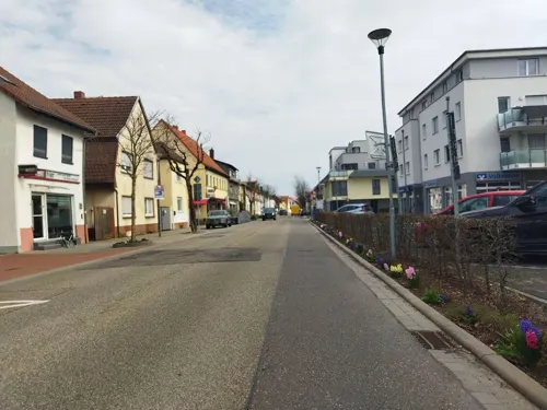
Turmuhrenmuseum Neulußheim
Museum · 4.0 km
8 St. Leoner Straße, Neulußheim
We 16:00-18:00; Su[2] 14:00-18:00




Schwetzingen Palace
Museum · 6.9 km
Palace in Schwetzingen, Germany, formerly the summer residence of the Electors Palatine

Gedenkstein Kilometer 25,0
Monument and historic site · 5.1 km
Gedenkstein Kilometer 25,0 NBS Mannheim - Stuttgart
Jim Clark
Monument and historic site · 3.0 km
Actual location of Jim Clark's fatal accident
26 more on the map.
Parks, trails and playgrounds26

Aquadrom Hockenheim
Sports field and stadium · 1.3 km
41 Beethovenstraße, Hockenheim
Mo-Su 10:00-21:00


Dreieichenbuckel
Playground · 5.0 km
Mo-Su,PH 08:00-12:00,13:30-21:00
Kinderspielplatz Schillerstraße / Lanzstraße
Playground · 4.4 km
Mo-Su 08:00-20:00

14 more on the map.
Restaurants and cafes146
Johanneshof
Restaurant · Regional · 4.4 km
5 Seewaldsiedlung, Hockenheim
Mo,Tu off; We-Sa 10:00-22:30; PH,Su 10:00-20:30
Akropolis
Restaurant · Greek · 3.6 km
63 Hauptstraße, Reilingen
Tu-Fr, Su 11:30-14:00 ;Mo-Su 17:00- 24:00
Artemis
Restaurant · Greek · 4.5 km
19 Hockenheimer Straße, Oftersheim
Mo,We-Sa 11:30-14:00,17:00-23:00; Su 11:30-15:00,17:00-23:00
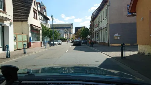
Bella Capri
Restaurant · Italian · 0.6 km
9 Untere Hauptstraße, Hockenheim
Mo-Su 11:30-14:00,17:00-21:00; Th off
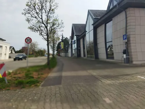
Blautannen
Restaurant · German · 4.3 km
2 Blautannenstraße, Altlußheim
Mo,Th-Su 08:30-14:00, 17:00-21:00; Tu 08:30-14:00; We off

Cavallino
Restaurant · Italian, Italian Pizza · 3.8 km
45 Sankt-Leoner-Straße, Neulußheim
Tu-Su 09:00-14:00, 17:30-18:00
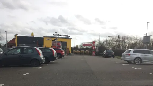
Da Agazi
Restaurant · Schnitzel, Pizza · 1.0 km
8/2 Gleisstraße, Hockenheim
Mo-Fr 11:30-14:00,17:30-23:00; Sa-Su 17:30-23:00
Dalmatino - Restaurant am Ring
Restaurant · German, Mediterranean · 0.8 km
1 Waldstraße, Hockenheim
Tu-Sa 17:00-23:00; Su 11:30-22:00
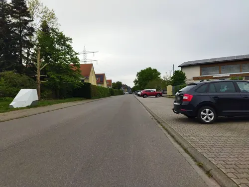
Dolce e Salato
Restaurant · Italian · 5.2 km
4 Walldorfer Straße, Ketsch
Tu-Sa 17:00-23:00, Su 12:00-21:30
Hundehidd
Restaurant · German · 5.2 km
3 Walldorfer Straße, Ketsch
Mo-Fr 12:00-14:00,17:00-21:00; Sa 17:00-21:00; Su 12:00-19:00


La Favola Antica
Restaurant · Italian · 0.7 km
11 Karlsruher Straße, Hockenheim
Tu-Fr 11:30-14:00,17:30-22:00; Sa 17:30-22:00; Su 11:30-14:00,17:30-21:00
134 more on the map.
History
Stamped bricks of the Roman Legio XIV Gemina Martia Victrix were found in 1984 in a brick kiln during an excavation in Hockenheim. The stationing of this legion near Mainz from 71AD until 92AD indicates an early settlement in this area. Hockenheim was first mentioned in 769 as "Ochinheim" in a donation document of the Lorsch Codex, an early monastery gift documentation. The name "Hockenheim" itself appeared first in 1238 in official documents. In the Middle Ages Hockenheim was owned by several alternating local authorities: the castle district Wersau, the Diocese of Speyer during the 12th and 13th century, various Palatinate ("Pfalz") rulers since 1286 and the Electoral Palatinate ("Kurpfalz") since 1462.
In the 17th century Hockenheim was severely devastated twice by French troops, 1644 in the Thirty Years' War and 1674 in the Franco-Dutch War. During this period the former cultivation of hops in the area was partly replaced with tobacco, brought into the country by the French. In 1803 the Electoral Palatinate was dissolved and the village was integrated in Baden. With the growing tobacco crop the village flourished and was awarded town rights on 22 July 1895 by Frederick I, Grand Duke of Baden.
From the History section of Hockenheim on Wikipedia, under CC BY-SA 4.0.
Where to stay12
Erholungsanlage St. Leoner See Hundecampingplatz
Campground · 5.2 km
1 Am St. Leoner See, St. Leon-Rot
Churches and places of worship25
Evangelische Gemeinschaft Hockenheim - Gemeinde zum Leben
Church · Evangelical
13 Luisenstraße, Hockenheim
Evangelische Kirche
Church · Protestant · 3.5 km
52 Hauptstraße, Reilingen
Shopping28
Gas and EV charging20
Schools, colleges and libraries19
Healthcare12
Map of Hockenheim
250 places. The map loads OpenStreetMap tiles when you open it.
Getting there and nearby towns
City-Airport Mannheim (MHG) is the nearest airport with scheduled flights listed in OpenStreetMap, 17 km away.
- Ketsch 5 km north, about 5 min by car
- Oftersheim 5 km northeast, about 5 min by car
- Schwetzingen 7 km north, about 7 min by car
- Walldorf 7 km east, about 7 min by car
- Sandhausen 8 km east, about 8 min by car
- Waghäusel 9 km south, about 9 min by car
- Leimen 10 km east, about 10 min by car
- Nußloch 10 km east, about 10 min by car
- Wiesloch 11 km east, about 11 min by car
- Heidelberg 14 km northeast, about 14 min by car
Drive times are estimates from straight-line distance, not routes.
Local news
Headlines from INDB.
Reviews, tips and questions
Loading what members have shared...
Sources and licences
- GeoNames (CC BY 4.0): population, coordinates, regions and time zone
- Mapillary (see each image): photos
- OpenStreetMap contributors (ODbL 1.0): places, airports, map data
- Wikidata (CC0 1.0): elevation, founding date, time zone, website, landmarks and historic places
- Wikimedia Commons (see each image): photos
- Wikipedia (CC BY-SA 4.0): overview and history text
Photo credits
- Hockenheim Rathaus 20130528, Rudolf Stricker, Attribution
- 20160809Stolpersteine Hockenheim1, AnRo0002, CC0
- 20160809Stolpersteine Hockenheim3, AnRo0002, CC0
- 20160809Stolpersteine Hockenheim5, AnRo0002, CC0
- 20160809Stolpersteine Hockenheim2, AnRo0002, CC0
- 20160809Stolpersteine Hockenheim4, AnRo0002, CC0
- 20170116Hockenheim4, AnRo0002, CC0
- 20170116Hockenheim3, AnRo0002, CC0
- Schwetzingen Schlosstheater Blick vom Parkett 1, Photo: Andreas Praefcke, CC BY 3.0
- Speyer, Museum der Pfalz, Altera levatur, CC0
- Schwetzingen BW 2014-07-22 16-43-37, Berthold Werner, CC BY-SA 3.0
- Speyer Große Himmelsgasse 4 002 2021 02 26, Friedrich Haag, CC BY-SA 4.0
- Aerial image of the Speyer Cathedral (view from the southwest) (cropped), Carsten Steger, CC BY-SA 4.0
- Altlußheim Museum Autovision, Wleiter, CC BY-SA 4.0
- Reilingen evangelische Kirche 20110307, Rudolf Stricker, Attribution
- Hockenheim Evangelische Kirche Langseite114, GFreihalter, CC BY-SA 3.0
- Hockenheim katholische Kirche 20110602, Rudolf Stricker, Attribution
- 20130210Tongrube Neuwiesen3, AnRo0002, CC0
- 20130303St Nikolaus Neulussheim4, AnRo0002, CC0
- Neulussheim Evangelische Kirche 20100719, Rudolf Stricker, Attribution
- Reilingen Sankt-Wendelin-Kirche 20110307, Rudolf Stricker, Attribution
- Museum Autovision NSU Oldtimer, Claus Ableiter, CC BY-SA 4.0
- 20170605Ailanthus altissima1, AnRo0002, CC0
- 20170605Ailanthus altissima2, AnRo0002, CC0
- 20180607Phytolacca acinosa2, AnRo0002, CC0
- 20180607Daucus carota2, AnRo0002, CC0
- 20180607Phytolacca acinosa3, AnRo0002, CC0
- 20180607Phytolacca acinosa1, AnRo0002, CC0
- 20180607Daucus carota1, AnRo0002, CC0
- 20160809Oxalis corniculata2, AnRo0002, CC0
- 20160809Oxalis corniculata3, AnRo0002, CC0
- 20160206Galanthus nivalis1, AnRo0002, CC0
- 20160206Galanthus nivalis2, AnRo0002, CC0
- 20190204Jasminum nudiflorum1, AnRo0002, CC0
- 20190204Jasminum nudiflorum2, AnRo0002, CC0
- 20170224Jasminum nudiflorum2, AnRo0002, CC0
- 20170224Jasminum nudiflorum3, AnRo0002, CC0
- 20170224Jasminum nudiflorum1, AnRo0002, CC0
- 20160227Chaenomeles2, AnRo0002, CC0
- 20160206Chaenomeles2, AnRo0002, CC0
- Street-level photo, ramap, CC BY-SA 4.0
- Street-level photo, changchun1, CC BY-SA 4.0
- Street-level photo, wegavision, CC BY-SA 4.0
- Street-level photo, changchun1, CC BY-SA 4.0
- Street-level photo, mfa, CC BY-SA 4.0
- Street-level photo, wegavision, CC BY-SA 4.0
- Street-level photo, mfa, CC BY-SA 4.0
- Street-level photo, wegavision, CC BY-SA 4.0
- Street-level photo, wegavision, CC BY-SA 4.0
- Street-level photo, mfa, CC BY-SA 4.0
- Street-level photo, poxonline, CC BY-SA 4.0
- Street-level photo, changchun1, CC BY-SA 4.0
- Street-level photo, changchun1, CC BY-SA 4.0
- Street-level photo, mfa, CC BY-SA 4.0
- Street-level photo, wegavision, CC BY-SA 4.0
- Street-level photo, changchun1, CC BY-SA 4.0
- Street-level photo, changchun1, CC BY-SA 4.0
- Street-level photo, wegavision, CC BY-SA 4.0
- Street-level photo, changchun1, CC BY-SA 4.0
- Street-level photo, teddy73, CC BY-SA 4.0
- Street-level photo, beluga, CC BY-SA 4.0
- Street-level photo, knistertoni, CC BY-SA 4.0
- Street-level photo, wegavision, CC BY-SA 4.0
- Street-level photo, changchun1, CC BY-SA 4.0
- Street-level photo, changchun1, CC BY-SA 4.0
- Street-level photo, wegavision, CC BY-SA 4.0
- Street-level photo, nakaner, CC BY-SA 4.0
- Street-level photo, mfa, CC BY-SA 4.0
- Street-level photo, karl_popp, CC BY-SA 4.0
- Street-level photo, wegavision, CC BY-SA 4.0
- Street-level photo, wegavision, CC BY-SA 4.0


Page built November 8, 2026. Spotted a mistake? Tell us or suggest a place.