


Why visit Nußloch
Townapedia lists 30 museums and landmarks, 39 parks and trails, 158 places to eat, 13 places to stay and 14 attractions in and around town.
Highlights include Nußlocher Schafhof, Nußlocher Ziegenkäsehof Hofladen, Heimatmuseum im alten Rathaus and Hospiz Agape.
Weather in Nußloch
Forecast from MET Norway (CC BY 4.0). Full forecast
About Nußloch
is a municipality in the Rhein-Neckar-Kreis (Baden-Württemberg), about 10 km south of Heidelberg. It is on a much traveled tourist route: Bergstraße ("Mountain Road") and Bertha Benz Memorial Route. The hamlet of Maisbach also belongs to Nußloch.
From the Wikipedia article Nußloch (this version), under CC BY-SA 4.0.
Things to do14

Nußlocher Ziegenkäsehof Hofladen
Farm and orchard · 1.5 km
1 Fischweiher, Nußloch
Th-Fr 16:00-18:30; Sa 09:30-16:00; PH off; Dec,Jan off
Obsthof Gefäller
Farm and orchard · 3.5 km
1 Am Apfelbaum, Wiesloch
Mo-Th 09:00-13:00,15:00-18:00; Fr 09:00-18:00; Sa 09:00-13:00


2 more on the map.
Museums and landmarks30



Alte Synagoge
Monument and historic site · 3.5 km
115 Hauptstraße, Sandhausen

Altes Forstamt
Monument and historic site · 3.0 km
43 Heidelberger Straße, Wiesloch

Stadtapotheke
Monument and historic site · 3.2 km
96 Hauptstraße, Wiesloch

Ehemalige Wasserburg (Altwiesloch)
Monument and historic site · 3.1 km


Minnesänger von Wissenlo
Monument and historic site · 3.3 km
Standbild des Heinrich I. Swendinger v. Wissenloch
18 more on the map.
Parks, trails and playgrounds39




Brühlwegdüne
Hiking and trails · 2.5 km
Hier werden in den nächsten Jahren große Freiflächen entstehen. Siehe...



27 more on the map.
Restaurants and cafes158

Rutz
Bakery · 3.4 km
Café und Bäckerei
128 Hauptstraße, Wiesloch
Mo-Fr 06:00-19:00; Sa 06:00-16:00; Su 07:00-17:00

Artemis
Restaurant · Greek · 3.2 km
Biergarten im modernen Innenhof. Sehr authentische und hochwertige griechische Küche.
78 Hauptstraße, Wiesloch
Mo-Su 11:30-14:30; 17:30-24:00

Eiscafé Venezia
Cafe · Ice Cream · 3.4 km
124 Hauptstraße, Wiesloch
Mo-Sa 09:00-22:00; Su,PH 10:00-22:00; Nov-Feb off
GiGi
Restaurant · German, Italian, Persian · 2.0 km
1 Jahnstraße, Leimen
Tu-Fr 17:00-22:30; Sa 11:00-22:30; Su 12:00-18:00
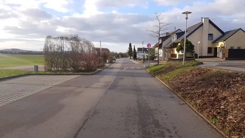
Kiki's Tante Ju
Restaurant · Italian, Mediterranean, German · 3.4 km
10 Lilienthalstraße, Walldorf
Mo off; Tu-Fr 17:00-22:30; Sa-Su,PH 11:00-22:30
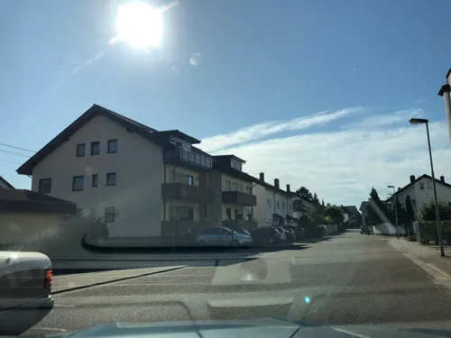
La Vite
Restaurant · Italian · 3.1 km
14 Danziger Straße, Leimen
Mo-Sa 11:30-14:30,17:00-23:00; Tu off; PH,Su 11:30-23:00
Leimener Brauhaus
Restaurant · German, Regional · 2.9 km
6 Rohrbacher Straße, Leimen
Mo-Th 11:00-24:00, Fr-Sa 11:00-02:00, Su 10:00-24:00
Naturfreunde-Vereinsheim Gossenbrunnen
Restaurant · German, Croatian · 3.4 km
60 Heltenstraße, Leimen
Mo,Th-Fr 16:00-22:00; Tu-We off; Sa 12:00-22:00; Su 12:00-21:30
Okami
Restaurant · Vietnamese, Japanese, Sushi · 3.2 km
5-7 Schloßstraße, Wiesloch
Mo-Su 11:00-15:00, 17:00-23:00
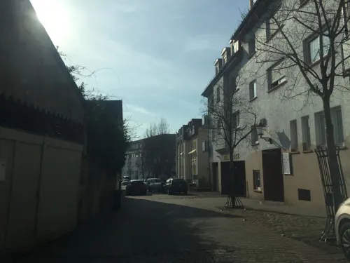


Stather's
Restaurant · German, Regional · 2.7 km
11 Nußlocher Straße, Leimen
Mo-Sa 11:00-13:30, Tu-Su 17:00-22:00
TSG Gaststätte Wiesloch
Restaurant · Austrian, German, International · 3.1 km
5/1 Parkstraße, Wiesloch
Mo-Sa 17:00-23:00; Tu off; Su 11:00-14:00,17:00-23:00
146 more on the map.
History
Nußloch was first mentioned on 31 December 766 in a deed of gift to the Lorsch Abbey. A married couple of strong faith donated a vineyard to the monastery from their property in Nußloch. It has been under the control of the Palatinate at the latest since 1269. The hamlet of Maisbach was annexed on 1 April 1937.
From the History section of Nußloch on Wikipedia, under CC BY-SA 4.0.
Where to stay13
Best Western Plus Palatin Boarding House
Motel and hotel · 3.4 km
12 Ringstraße, Wiesloch
Churches and places of worship22
St.-Bartholomäus-Kirche - alte Katholische Kirche
Church · Catholic · 3.4 km
5 Waldstraße, Sandhausen
Shopping35
Gas and EV charging11
Schools, colleges and libraries28
Healthcare17
Map of Nußloch
250 places. The map loads OpenStreetMap tiles when you open it.
Getting there and nearby towns
City-Airport Mannheim (MHG) is the nearest airport with scheduled flights listed in OpenStreetMap, 21 km away.
- Wiesloch 3 km south, about 3 min by car
- Sandhausen 3 km northwest, about 3 min by car
- Walldorf 4 km southwest, about 4 min by car
- Heidelberg 9 km north, about 9 min by car
- Oftersheim 9 km northwest, about 9 min by car
- Schwetzingen 10 km northwest, about 10 min by car
- Östringen 12 km south, about 12 min by car
- Sinsheim 15 km southeast, about 15 min by car
- Waghäusel 16 km southwest, about 16 min by car
- Schriesheim 17 km north, about 17 min by car
Drive times are estimates from straight-line distance, not routes.
Local news
Headlines from INDB.
Reviews, tips and questions
Loading what members have shared...
Sources and licences
- GeoNames (CC BY 4.0): population, coordinates, regions and time zone
- Mapillary (see each image): photos
- OpenStreetMap contributors (ODbL 1.0): places, airports, map data
- Wikidata (CC0 1.0): elevation, founding date, time zone, website
- Wikimedia Commons (see each image): photos
- Wikipedia (CC BY-SA 4.0): overview and history text
Photo credits
- Nußloch Rathaus 20100620, Rudolf Stricker, Attribution
- Nußloch evangelische Kirche 20100620, Rudolf Stricker, Attribution
- Nußloch Lindenplatz 20100620, Rudolf Stricker, Attribution
- Nußloch alte evangelische Kirche 20100620, Rudolf Stricker, Attribution
- Nußloch - Gerngarten - Zeichen 251, 1971 bis 1992, Radosław Drożdżewski (Zwiadowca21), CC BY-SA 3.0
- Wiesloch Haus mit Hirsch und Jagdmotiven, 4028mdk09, CC BY-SA 3.0
- Hardtwaldstadion, KatB, CC BY-SA 3.0
- Wiesloch-Hospiz, Peter Schmelzle, CC BY-SA 3.0
- Wiesloch Evangelische Stadtkirche 20070327, Rudolf Stricker, Public domain
- Bronner Headline, Johann Philipp Bronner Schule (BeSt), CC BY-SA 4.0
- Leimen evangelische Kirche 20100620, Rudolf Stricker, Attribution
- Ottheinrich Gymnasium Wiesloch, BeSt, CC BY-SA 4.0
- Altwiesloch-Pankratiuskapelle-2012, Peter Schmelzle, CC BY-SA 3.0
- Schlossturm-Wiesloch-2012, Peter Schmelzle, CC BY-SA 3.0
- Wiesloch Stadtapotheke Erste Tankstelle 20100620, Rudolf Stricker, Attribution
- Sandhausen Synagoge, Pitichinaccio, Public domain
- Altwiesloch Burg2, Andreas Rockstein Kurpfalzbilder.de, Public domain
- NSG Zugmantel, Emmy Sophie, CC BY-SA 3.0
- NSG 2168 Nußlocher Wiesen-Feld, Deepbluesea70, CC BY-SA 3.0
- Steinbruch Leimen, Blick von Brücke der L 600 nach Süden in Richtung Leimen, JoPaK, CC BY-SA 4.0
- Sandhausen Bartholomae, 4028mdk09, CC BY-SA 3.0
- Degreif Welle Wiesloch, 4028mdk09, CC BY-SA 3.0
- Brühlwegdüne, Michael Linnenbach, CC BY-SA 4.0
- Leimen katholische Herz-Jesu-Kirche 20100620, Rudolf Stricker, Attribution
- Sandhausen Evangelische Christuskirche 20130602, Rudolf Stricker, CC BY-SA 2.0 de
- Wiesloch Katholische Kirche St.Laurentius 20100620, Rudolf Stricker, Attribution
- BWT Stadion am Hardtwald 2019, Swo73 ( Diskussion ), CC BY-SA 4.0
- Leimen-Mauritiuskirche, Cethegus, Public domain
- Nussloch Katholische Kirche St. Laurentius 20070327, Rudolf Stricker, Public domain
- Nussloch-Evang-Kirche-1, Elz2610, CC BY-SA 4.0
- Nussloch Rathaus 20070327, Rudolf Stricker, Public domain
- Pfarrkirche-Sankt-Laurentius-Nussloch-Kirchplatz-mit-Brunnen, Elz2610, CC BY-SA 4.0
- 20160627Hottonia palustris6, AnRo0002, CC0
- 20160627Hottonia palustris4, AnRo0002, CC0
- 20160627Hottonia palustris1, AnRo0002, CC0
- 20160627Hottonia palustris3, AnRo0002, CC0
- 20160627Hottonia palustris2, AnRo0002, CC0
- 20160627Hottonia palustris5, AnRo0002, CC0
- 20160627Valeriana officinalis, AnRo0002, CC0
- 20170815Nymphaea alba2, AnRo0002, CC0
- Street-level photo, c0rnsnake, CC BY-SA 4.0
- Street-level photo, ramap, CC BY-SA 4.0
- Street-level photo, knistertoni, CC BY-SA 4.0
- Street-level photo, mappy123, CC BY-SA 4.0
- Street-level photo, hdvalentin, CC BY-SA 4.0
- Street-level photo, robffm, CC BY-SA 4.0
- Street-level photo, wegavision, CC BY-SA 4.0
- Street-level photo, wegavision, CC BY-SA 4.0
- Street-level photo, c0rnsnake, CC BY-SA 4.0
- Street-level photo, c0rnsnake, CC BY-SA 4.0
- Street-level photo, knistertoni, CC BY-SA 4.0
- Street-level photo, baldur80, CC BY-SA 4.0
- Street-level photo, ramap, CC BY-SA 4.0


Page built November 8, 2026. Spotted a mistake? Tell us or suggest a place.