


Hohen Neuendorf, Germany
Hohen Neuendorf is a town of 21,893 people in Brandenburg, Germany.
Why visit Hohen Neuendorf
Townapedia lists 85 museums and landmarks, 36 parks and trails, 133 places to eat, 14 places to stay and 10 attractions in and around town.
Highlights include Papiertheater Invisius, Dithmarscher Hofladen, Das Buddhistische Haus and Clara-Zetkin-Gedenkstätte.
Weather in Hohen Neuendorf
Forecast from MET Norway (CC BY 4.0). Full forecast
About Hohen Neuendorf
Hohen Neuendorf (German pronunciation: [ˈhoːən ˈnɔʏənˌdɔʁf] ) is a town in the Oberhavel district, in Brandenburg, Germany. It is located north west of Berlin.
From the Wikipedia article Hohen Neuendorf (this version), under CC BY-SA 4.0.
Things to do10


Dithmarscher Hofladen
Farm and orchard · 4.9 km
5 Zeltinger Platz, Berlin
Tu-Fr 09:00-18:30; Sa 08:30-14:00

Museums and landmarks85




Wasserturm Berlin-Hermsdorf
Monument and historic site · 5.6 km
Wasserturm Friedhof Hermsdorf in Berlin-Frohnau

Dr. Curt Eckstein
Monument and historic site · 4.5 km
Stolperstein für Dr. Curt Eckstein
9 Fasanenweg, Hohen Neuendorf


Oberst Wilhelm Staehle
Monument and historic site · 2.1 km
Oberst Wilhelm Staehle 20.11.1877 - 23.4.1945 Dem Kommandanten der Invalidensiedlung, der wegen seiner Teilnahme am Widerstand gegen das...


73 more on the map.
Parks, trails and playgrounds36

Berliner Golfclub Stolper Heide
Golf course · 3.5 km
18 hole Par 72 East course + 18 hole Par 72 West course + 6 hole academy
PH,Mo-Su 08:00-19:00


Veltinchen
Playground · 4.5 km
11 Parkallee, Velten
We-Fr 14:00-19:00; Sa,Su,PH 10:00-19:00; SH Mo-Su 10:00-19:00; Mo,Tu off





Joseph Brix Felix Genzmer Park
Park · 4.9 km
Geschützte Grünanlage ohne Radfreigabe
24 more on the map.
Restaurants and cafes133
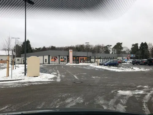
Anno 1900
Bar and pub · 1.7 km
Covid19: Strassenverkauf
25G Schönfließer Straße, Hohen Neuendorf
Tu-Sa 09:00-21:00; Su 09:00-16:00; Mo off

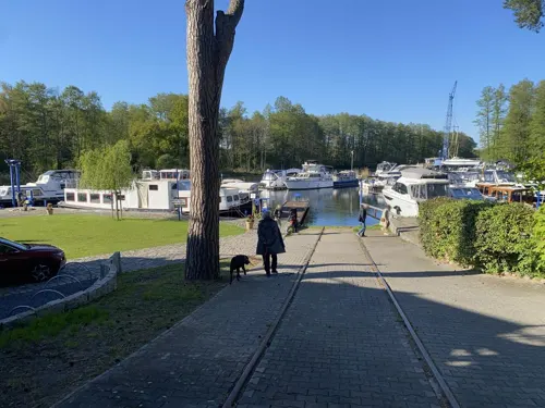
Bella Vista
Restaurant · Italian · 2.4 km
21 Saumweg, Birkenwerder
Mo-Fr 14:00-23:00; Sa-Su 12:00-23:00
Com Viet - Vietnamesisches Restaurant & Sushibar
Restaurant · Vietnamese · 1.3 km
9 Clara-Zetkin-Straße, Birkenwerder
Mo-Sa 11:00-22:00
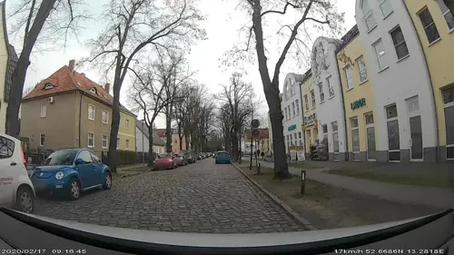

Kaffeehaus Morgenrot
Cafe · Coffee Shop · 1.3 km
1 Scharfschwerdtstraße, Hohen Neuendorf
We-Su 10:00-18:00
Koppelschänke
Bar and pub · Cake, Coffee Shop, Sausage, Tea · 5.6 km
3 Kindelweg
Th-Fr 13:00-20:00; Sa-Su 11:00-20:00
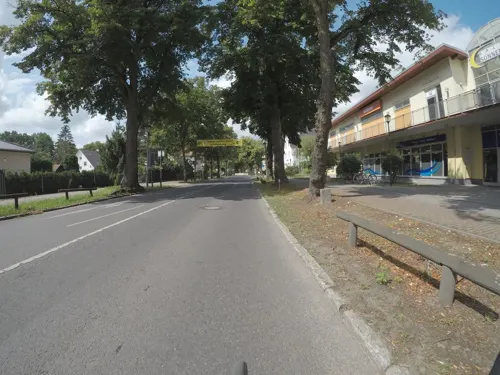
Landhaus Hubertus
Restaurant · German · 2.5 km
46 Invalidensiedlung, Berlin
We-Fr 14:00+; Sa-Su 12:00+
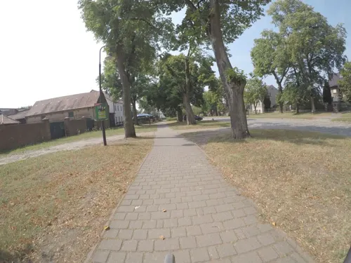


Le My Vietnamesische Küche & Sushi
Restaurant · Vietnamese · 2.4 km
6a Dorfstraße, Hohen Neuendorf
Mo-Su 11:00-22:00
Restaurant am Boddensee
Restaurant · German, Regional · 2.2 km
20 Brieseallee, Birkenwerder
We-Fr 12:00-22:00; Sa,Su 10:00-22:00
Sakura Sushi
Restaurant · Sushi · 5.4 km
15 Oranienburger Chaussee
Mo-Fr 11:00-22:00; Sa-Su 13:00-22:00
121 more on the map.
History
Since the suburban move of Berlin which ended in the late 19th century, allowed by the development of the railway, Hohen Neuendorf was a small town with few residents.
The creation of a train station in Hohen Neuendorf on the North Train from Berlin in the last quarter of the 19th century, thanks to the larger, richer nearby village of Stolpe, led to a quick development of Hohen Neuendorf paralleled to that occurring in Berlin.
With the rising role of Hohen Neuendorf as a commuter village across from Stolpe (which stayed largely agricultural in nature), it was finally with the (mis)placement of the train stop that emphasis on the settlement of Hohen Neuendorf ensued.
The new Hohen Neuendorf station today is frequented by the users of Berlin's S-Bahn (rapid railway), while the old station's building has now been changed into a hotel.
From the History section of Hohen Neuendorf on Wikipedia, under CC BY-SA 4.0.
Where to stay14
Knüppel Privatzimmer
Motel and hotel · 1.4 km
Friedrich-Naumann-Straße, Hohen Neuendorf
Churches and places of worship11
Dorfkirche Hohen Neuendorf
Church · Protestant · 0.8 km
40 Berliner Straße, Hohen Neuendorf
Shopping41
Gas and EV charging16
Schools, colleges and libraries23
Healthcare17
Map of Hohen Neuendorf
250 places. The map loads OpenStreetMap tiles when you open it.
Getting there and nearby towns
Berlin Brandenburg Airport "Willy Brandt" (BER) is the nearest airport with scheduled flights listed in OpenStreetMap, 38 km away.
- Velten 7 km west, about 7 min by car
- Oranienburg 8 km north, about 8 min by car
- Wandlitz 14 km northeast, about 14 min by car
- Berlin 19 km southeast, about 19 min by car
- Nauen 28 km west, about 28 min by car
- Kleinmachnow 30 km south, about 30 min by car
- Teltow 31 km south, about 31 min by car
- Stahnsdorf 33 km south, about 33 min by car
- Potsdam 34 km southwest, about 34 min by car
- Zehdenick 34 km north, about 34 min by car
Drive times are estimates from straight-line distance, not routes.
Local news
Headlines from INDB.
Reviews, tips and questions
Loading what members have shared...
Sources and licences
- GeoNames (CC BY 4.0): population, coordinates, regions and time zone
- Mapillary (see each image): photos
- OpenStreetMap contributors (ODbL 1.0): places, airports, map data
- Wikidata (CC0 1.0): elevation, founding date, time zone, website, landmarks and historic places
- Wikimedia Commons (see each image): photos
- Wikipedia (CC BY-SA 4.0): overview and history text
Photo credits
- Hohen Neuendorf Wasserturm, Oberlausitzerin64, CC BY-SA 4.0
- Himmelspagode Hohen Neuendorf 2025 W, Hans G. Oberlack, CC BY 4.0
- Hohen Neuendorf Himmelspagode lub 2023-07-16, Lukas Beck, CC BY-SA 4.0
- Alte Rathaus Hohen Neuendorf 2019 W, Hans G. Oberlack, CC BY-SA 4.0
- Rathaus-Komplex in Hohen Neuendorf 2019 WSW, Hans G. Oberlack, CC BY-SA 4.0
- Hotel zum Grünen Turm in Hohen Neuendorf 2019 SSW, Hans G. Oberlack, CC BY-SA 4.0
- Clp 20141114 3812 Bf Hohen Neuendorf West Stw How, Christian Liebscher, CC BY-SA 4.0
- Clp 20141114 3816 Bf Hohen Neuendorf West Bstg, Christian Liebscher, CC BY-SA 4.0
- Clp 20141114 3811 Bf Hohen Neuendorf West EG, Christian Liebscher, CC BY-SA 4.0
- Verkleinert Seitenempore Dorfkirche Hohen Neuendorf, Matthias Wiegandt, CC BY-SA 4.0
- Innenansicht Dorfkirche Hohen Neuendorf, Matthias Wiegandt, CC BY-SA 4.0
- Verkleinert Orgelempore Dorfkirche Hohen Neuendorf, Matthias Wiegandt, CC BY-SA 4.0
- Verkleinert Glockenstube Dorfkirche Hohen Neuendorf, Matthias Wiegandt, CC BY-SA 4.0
- Verkleinert Innenansicht Dorfkirche Hohen Neuendorf, Matthias Wiegandt, CC BY-SA 4.0
- Clp 20141114 3821 Bf Hohen Neuendorf West EG, Christian Liebscher, CC BY-SA 4.0
- Clp 20141114 3820 Bf Hohen Neuendorf West Asig 614+616+618, Christian Liebscher, CC BY-SA 4.0
- Berlin-Frohnau Ludwig-Lesser-Park, Assenmacher, CC BY-SA 3.0
- Hohen Neuendorf water tower, Doris Antony , Berlin, CC BY-SA 3.0
- Berlin Wall Potsdamer Platz November 1975 looking east crop, Edward Valachovic https://www.flickr.com/people/fauxaddress/, CC BY-SA 2.0
- Frohnau Edelhofdamm Das Buddhistische Haus-001, Fridolin freudenfett, CC BY-SA 4.0
- Waldgrundschule gebaeude b, JeHoMi, Public domain
- Grundschule niederheide 1, Havelbaude, CC BY-SA 3.0
- Frohnau-Kirchengebäude, N-Lange.de, CC BY-SA 3.0
- St. Hildegard (Berlin), Bodo Kubrak, CC0
- ChurchBorgsdorf20140615, Majara_ut, CC BY-SA 3.0
- Frohnau Ludolfingerplatz-002, Fridolin freudenfett, CC BY-SA 4.0
- 07.07.12.Panorama Frohnau 1, Martin Künzel, Berlin, CC BY-SA 3.0
- Stolperstein Zeltinger Str 65 (Frohn) Karl Neuhof, OTFW , Berlin, CC BY-SA 3.0
- Papertheatre, Rüdiger Koch, CC BY-SA 4.0
- Schönfließ church 2016 NW, Hans G. Oberlack, CC BY-SA 4.0
- Wasserturm Berlin-Frohnau, Tiefenschaerfe, CC BY-SA 4.0
- Frohnau Konzer Platz, Fridolin freudenfett, CC BY-SA 4.0
- Berlin Frohnau Wasserturm Friedhof Hermsdorf, Oberlausitzerin64, CC BY-SA 4.0
- Stolperstein für Dr. Curt Eckstein (Hohen Neuendorf), Christian Michelides, CC BY-SA 4.0
- Stolperstein Ludolfingerweg 35 (Frohn) Margarete Rudolphson, OTFW , Berlin, CC BY-SA 3.0
- Stolperstein Ludolfingerweg 42 (Frohn) Rudolf Herzfeld, OTFW , Berlin, CC BY-SA 3.0
- Denkmal Invalidensiedlung 11 (Frohn) Staehle Denkmal&Franz-Wilhelm Garske&1985, OTFW , Berlin, CC BY-SA 3.0
- Paul-Poser-Platz, Tiefenschaerfe, CC BY-SA 4.0
- BuddhistischesHaus, Josue007, CC BY-SA 3.0
- Länderinstitut für bienenkunde, Havelbaude, CC BY-SA 3.0
- Dorfkirche Pinnow (Hohen Neuendorf) 2016 NW, Hans G. Oberlack, CC BY-SA 4.0
- Hohen Neuendorf Dorfkirche, Matthias Wiegandt, CC BY-SA 4.0
- Kirche Karmel St. Teresa, Feldarbeit, CC BY-SA 4.0
- Street-level photo, mtek, CC BY-SA 4.0
- Street-level photo, mtek, CC BY-SA 4.0
- Street-level photo, A-Kue, CC BY-SA 4.0
- Street-level photo, kartonage, CC BY-SA 4.0
- Street-level photo, carlheinz, CC BY-SA 4.0
- Street-level photo, mtek, CC BY-SA 4.0
- Street-level photo, carlheinz, CC BY-SA 4.0
- Street-level photo, kartonage, CC BY-SA 4.0
- Street-level photo, ruhr11, CC BY-SA 4.0
- Street-level photo, signout, CC BY-SA 4.0
- Street-level photo, kartonage, CC BY-SA 4.0
- Street-level photo, kartonage, CC BY-SA 4.0
- Street-level photo, A-Kue, CC BY-SA 4.0
- Street-level photo, mtek, CC BY-SA 4.0
- Street-level photo, kartonage, CC BY-SA 4.0
- Street-level photo, mtek, CC BY-SA 4.0
- Street-level photo, mtek, CC BY-SA 4.0
- Street-level photo, DBSEV_SBB, CC BY-SA 4.0
- Street-level photo, moenk, CC BY-SA 4.0
- Street-level photo, mar_k83, CC BY-SA 4.0
- Street-level photo, mtek, CC BY-SA 4.0


Page built November 8, 2026. Spotted a mistake? Tell us or suggest a place.