


Why visit Stahnsdorf
Townapedia lists 199 museums and landmarks, 48 parks and trails, 146 places to eat, 17 places to stay and 9 attractions in and around town.
Highlights include Tiergarten Teltow, Neue Kammerspiele, Museum Village Düppel and Heimatmuseum.
Weather in Stahnsdorf
Forecast from MET Norway (CC BY 4.0). Full forecast
About Stahnsdorf
Stahnsdorf (German pronunciation: [ˈʃtaːnsdɔʁf]) is a municipality in the Potsdam-Mittelmark district, in Brandenburg, Germany.
From the Wikipedia article Stahnsdorf (this version), under CC BY-SA 4.0.
Things to do9

Tiergarten Teltow
Zoo and aquarium · 5.0 km
13-19 Kastanienstraße, Teltow
Tu-Su 10:00-17:00; May-Sep: Tu-Su 10:00-18:00

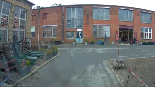
Supergrün
Farm and orchard · 5.3 km
In unserer eigenen Vertikal Farm in Berlin bauen wir für dich sehr gesunde und frische Microgreens mit hoher Nährstoffkonzentration an.
299 Goerzallee, Berlin
Mo-Fr 09:00-15:00





Museums and landmarks199

Museum Village Düppel
Museum · 4.8 km
11 Clauertstraße, Berlin
Mar-Oct Sa-Su 10:00-18:00; Mar-Oct PH 10:00-18:00


Checkpoint Bravo
Museum · 3.2 km
Checkpoint Bravo, Erinnerungs- und Begegnungsstätte Drewitz-Dreilinden
45a Albert-Einstein-Ring, Kleinmachnow
May-Oct Su 11:00-16:00

ehem. Friedhofsbahn
Monument and historic site · 3.0 km
Ehemalige Stahlfachwerkbrücke Teltowkanal, 2018 abgebrochen


Neue Hakeburg
Monument and historic site · 1.7 km
185 Zehlendorfer Damm, Kleinmachnow



187 more on the map.
Parks, trails and playgrounds48

Abenteuerspielplatz "Blauer Daumen"
Playground · 5.3 km
63 In der Aue, Potsdam
Apr-Oct Tu-Sa 14:00-18:00; PH,Mo,Su off




Park Glienicke
Park · 8.7 km
English landscape garden in the southwestern outskirts of Berlin, Germany



SchülerInnen Ruderverband am kleinen Wannsee
Marina and boat launch · 5.3 km
36 more on the map.
Restaurants and cafes146

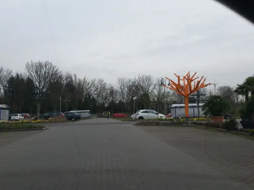
Café Restaurant Bambusgarten
Restaurant · Regional · 3.4 km
Leckere kleine und große Speisen frisch zubereitet ...
2 Asternstraße, Teltow
Mo-Sa 09:00-18:00; Su 10:00-15:00
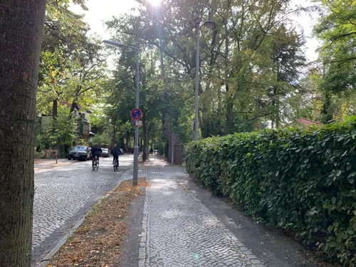
Achter Gedeck
Restaurant · Regional, German, European · 5.0 km
4 Bismarckstraße, Berlin
Sa 10:00-22:00; Tu-Fr 09:00-22:00; Su 10:00-22:00; Mo off
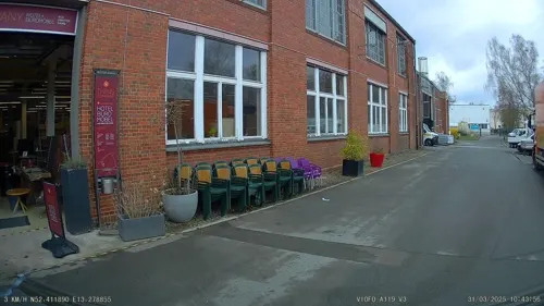
Casino Goerzwerk
Restaurant · International · 5.3 km
299 Goerzallee, Berlin
Mo-Fr 11:30-14:00 || "nach Vereinbarung"

Derby Klause
Bar and pub · 5.2 km
Kneipe, Deutsche/ Berliner Küche
30 Robert-von-Ostertag-Straße, Berlin
Mo-Sa 12:00-24:00; Su 12:00-22:00


134 more on the map.
History
Stahnsdorf in the Margraviate of Brandenburg was first documented in a 1264 purchase contract of Margrave Otto III and the Brandenburg bishop. It originally consisted only of its old village green on a formerly important merchant road from Leipzig in Saxony via Güterfelde and Stahnsdorf, crossing the Bäke creek (the present-day Teltow Canal) at Kleinmachnow, and running northwards to Spandau.
With the construction of the Teltow Canal in the early 20th century, the opening of the large Stahnsdorf South-Western Cemetery in April 1909, the Wilmersdorfer Waldfriedhof and Friedenauer Waldfriedhof in 1913, and the opening of the S-Bahn route from Berlin-Wannsee station in June 1913 the development in a Berlin suburb began. In the following decades, the current site was created by the development of privately owned homes, the connection to Berlin-Lichterfelde by a tram and building a settlement for workers at the Bosch manufactures in Kleinmachnow.
In 1920 the Stahnsdorf Military Cemetery was formalised. It contains 1175 graves, mainly of British POWs who died in captivity. It was designed by Sir Robert Lorimer.
1931 Stahnsdorf WWTP was put into operation, where waste water from the south of Berlin was treated. It was one of the first plants to produce biogas.
From the History section of Stahnsdorf on Wikipedia, under CC BY-SA 4.0.
Where to stay17
Churches and places of worship24
Dorfkirche Sputendorf
Church · Protestant · 4.9 km
24b Wilhelm-Pieck-Straße, Stahnsdorf
Ev. Siedlungskirche Teltow
Church · Protestant · 4.7 km
150 Mahlower Straße, Teltow
Evangelische Kirche Nikolassee
Church · Protestant · 4.9 km
21 Kirchweg, Berlin
Shopping49
Gas and EV charging17
Schools, colleges and libraries41
Öffentliche Bibliothek Kleinmachnow
Library · 2.2 km
10 Adolf-Grimme-Ring, Kleinmachnow
Healthcare24
Map of Stahnsdorf
250 places. The map loads OpenStreetMap tiles when you open it.
Getting there and nearby towns
Berlin Brandenburg Airport "Willy Brandt" (BER) is the nearest airport with scheduled flights listed in OpenStreetMap, 19 km away.
- Teltow 4 km east, about 4 min by car
- Potsdam 10 km west, about 10 min by car
- Berlin 20 km northeast, about 20 min by car
- Zossen 24 km southeast, about 24 min by car
- Zeuthen 28 km east, about 28 min by car
- Velten 34 km north, about 34 min by car
- Wandlitz 43 km north, about 43 min by car
- Strausberg 50 km northeast, about 50 min by car
- Zehdenick 67 km north, about 1 h by car
- Templin 84 km north, about 1 h 30 min by car
Drive times are estimates from straight-line distance, not routes.
Local news
Headlines from INDB.
Reviews, tips and questions
Loading what members have shared...
Sources and licences
- GeoNames (CC BY 4.0): population, coordinates, regions and time zone
- Mapillary (see each image): photos
- OpenStreetMap contributors (ODbL 1.0): places, airports, map data
- Wikidata (CC0 1.0): elevation, founding date, time zone, website, landmarks and historic places
- Wikimedia Commons (see each image): photos
- Wikipedia (CC BY-SA 4.0): overview and history text
Photo credits
- Stahnsdorf town hall, Bernd Schade, CC BY-SA 3.0
- Stahnsdorf - Kirchstrasse - geo.hlipp.de - 35360, Colin Smith on geo.hlipp.de, CC BY-SA 2.0
- Stahnsdorf, Güterfelder Damm. Ecke Bergstraße - panoramio, Alltagsradler Teltow, CC BY 3.0
- Stahnsdorf, verwerflicher Gehwegradweg Güterfelder Damm, kurz nach Einmündung der Bergstraße - panoramio, Alltagsradler Teltow, CC BY 3.0
- Gedenktafel Dorfplatz ggü 11 (Stahnsdorf) Heinrich Zille Lebenslauf, OTFW , Berlin, CC BY-SA 3.0
- Dorfteich - Stahnsdorf (Stahnsdorf Village Pond) - geo.hlipp.de - 35359, Colin Smith on geo.hlipp.de, CC BY-SA 2.0
- Stahnsdorf - Dorfteich (Village Pond) - geo.hlipp.de - 35358, Colin Smith on geo.hlipp.de, CC BY-SA 2.0
- Skulptur Dorfplatz ggü 11 (Stahnsdorf) Zille Göre&Emma-Maria Lange&20134, OTFW , Berlin, CC BY-SA 3.0
- Skulptur Dorfplatz ggü 11 (Stahnsdorf) Zille Göre&Emma-Maria Lange&20136, OTFW , Berlin, CC BY-SA 3.0
- Skulptur Dorfplatz ggü 11 (Stahnsdorf) Zille Göre&Emma-Maria Lange&2013, OTFW , Berlin, CC BY-SA 3.0
- Skulptur Dorfplatz ggü 11 (Stahnsdorf) Zille Göre&Emma-Maria Lange&20135, OTFW , Berlin, CC BY-SA 3.0
- Skulptur Dorfplatz ggü 11 (Stahnsdorf) Zille Göre&Emma-Maria Lange&20133, OTFW , Berlin, CC BY-SA 3.0
- Skulptur Dorfplatz ggü 11 (Stahnsdorf) Zille Göre&Emma-Maria Lange&20132, OTFW , Berlin, CC BY-SA 3.0
- Fruehling in Stahnsdorf (Spring in Stahnsdorf) - geo.hlipp.de - 35357, Colin Smith on geo.hlipp.de, CC BY-SA 2.0
- Stahnsdorf -Fussweg beim Dorfanger (Footpath Near the Village Green) - geo.hlipp.de - 35361, Colin Smith on geo.hlipp.de, CC BY-SA 2.0
- Stahnsdorf - Dorfanger (Village Green) - geo.hlipp.de - 35356, Colin Smith on geo.hlipp.de, CC BY-SA 2.0
- Stolperstein Lindenstr 10 (Stahnsdorf) Hermann Scheidemann, OTFW , Berlin, CC BY-SA 3.0
- Stolperstein Lindenstr 10 (Stahnsdorf) Jeanette Scheidemann, OTFW , Berlin, CC BY-SA 3.0
- Stahnsdorf - Kosmo - geo.hlipp.de - 35352, Colin Smith on geo.hlipp.de, CC BY-SA 2.0
- Stahnsdorf, Bürgersteig Ostseite Lindenstraße kurz vor Einmündung in Bäkedamm - Wilhelm-Külz-Straße - panoramio, Alltagsradler Teltow, CC BY 3.0
- Stahnsdorf - Kuetscher Stuben - geo.hlipp.de - 35353, Colin Smith on geo.hlipp.de, CC BY-SA 2.0
- Stahnsdorf, Lindenstraße kurz vor Einmündung in Bäkedamm - Wilhelm-Külz-Straße - panoramio, Alltagsradler Teltow, CC BY 3.0
- Stahnsdorf - Briefzentrum-Berlin-Suedwest (Berlin South-West Mail Centre) - geo.hlipp.de - 35345, Colin Smith on geo.hlipp.de, CC BY-SA 2.0
- Skulptur Dorfplatz 6 (Stahnsdorf) Hommage für Vadim&Christian Roehl&19922, OTFW , Berlin, CC BY-SA 3.0
- Skulptur Dorfplatz 6 (Stahnsdorf) Hommage für Vadim&Christian Roehl&1992, OTFW , Berlin, CC BY-SA 3.0
- Stahnsdorf - Kriegesdenkmal (War Memorial) - geo.hlipp.de - 35354, Colin Smith on geo.hlipp.de, CC BY-SA 2.0
- Stahnsdorf, Separationsweg am Abzweig von der Ruhlsdorfer Straße - panoramio, Alltagsradler Teltow, CC BY 3.0
- Stahnsdorf - Ruhlsdorfer Strasse - geo.hlipp.de - 35347, Colin Smith on geo.hlipp.de, CC BY-SA 2.0
- Stahnsdorf - Briefzentrum-Berlin-Suedwest (Berlin South-West Mail Centre) - geo.hlipp.de - 35344, Colin Smith on geo.hlipp.de, CC BY-SA 2.0
- Stahnsdorf - Wilhelm-Kuelz-Strasse - geo.hlipp.de - 35355, Colin Smith on geo.hlipp.de, CC BY-SA 2.0
- Stahnsdorf - Teich (Pond) - geo.hlipp.de - 35349, Colin Smith on geo.hlipp.de, CC BY-SA 2.0
- Schleusengarten Stahnsdorf - geo.hlipp.de - 35362, Colin Smith on geo.hlipp.de, CC BY-SA 2.0
- Strandbad Wannsee 07, Axel Mauruszat, CC BY 2.0 de
- Park Babelsberg Herbst, 96dotsperinch, CC BY 2.0
- Klein-Glienicke Kraatzplan, Leopold Kraatz, 1862, Public domain
- PeterPaulNikolskoe, Jensdarup, CC BY-SA 3.0
- Museumdorf Düppel1, Unknown author, CC BY-SA 3.0
- Clp 20060524 VzG 6038 Königsweg, Christian Liebscher ( Platte ), CC BY-SA 3.0
- Kirche Nikolassee (Berlin-Nikolassee), Bodo Kubrak, CC0
- St. Otto (Berlin-Zehlendorf), Bodo Kubrak, CC0
- Zu den heiligen Zwölf Aposteln (Berlin-Schlachtensee), Bodo Kubrak, CC0
- DE-BB-Ruhlsdorf-Dorfkirche-2025, 0000ff, CC BY-SA 4.0
- Teltow-Ruhlsdorf Sputendorfer Straße 1 Grundschule I, Assenmacher, CC BY-SA 3.0
- Baptistenkirche (Wannsee), Bodo Kubrak, CC0
- Kleinmachnow Weinberggymnasium, Unknown author, CC BY-SA 3.0
- Berlin-Zehlendorf Heinrich-Laehr-Park Richtung Norden 02, Assenmacher, CC BY-SA 4.0
- Grosses.Fenn.4, Membeth, CC0
- 20251125 xl 1548-Öffentliche Bibliothek Kleinmachnow, Molgreen, CC BY-SA 4.0
- Zehlendorf Gimpelsteig Helios Klinikum Emil von Behring, Fridolin freudenfett, CC BY-SA 4.0
- Nikolassee Dreilindenstraße Dreilinden-Gymnasium, Fridolin freudenfett (Peter Kuley), CC BY-SA 3.0
- KammerspieleKlm, Andreas Lippold, CC BY-SA 3.0
- Teltow Tiergarten lub 2023-05-10 img16, Lukas Beck, CC BY-SA 4.0
- Mahlower Straße 150 Teltow, Andreas Lippold, CC BY-SA 4.0
- TeltowKircheEucharistia, Andreas Lippold, CC BY-SA 3.0
- Museumsdorf Düppel5, Unknown author, CC BY-SA 3.0
- Kleinmachnow Checkpoint Bravo, GBeckmann, Public domain
- Teltowkanal 03 Stillgelegte Bruecke, A.Savin, CC BY-SA 3.0
- Strassenbahn 96, Lichterfelder, CC BY-SA 3.0
- Stolperstein Teutonenstr 23 (Nikol) Jochen Klepper, OTFW , Berlin, CC BY-SA 3.0
- Hakeburg 2008, JörgDraegerFan at German Wikipedia, CC BY-SA 3.0
- Meilenstein115, eigenes Foto, CC0
- Stolperstein Albertinenstr 31 (Zehld) Charlotte Levy, OTFW , Berlin, CC BY-SA 3.0
- Berlin City Camp 2 - panoramio, Maurice Meeden, CC BY-SA 3.0
- Dorfkirche Kleinmachnow, Lichterfelder, CC BY-SA 3.0
- Kirche Schönow (Berlin-Zehlendorf), Bodo Kubrak, CC0
- Dorfkirche Sputendorf 04, Harald Rossa, CC BY-SA 2.5
- Nikolassee An der Rehwiese-003, Fridolin freudenfett (Peter Kuley), CC BY-SA 3.0
- Jagdschloss Stern Potsdam, The original uploader was Suse at German Wikipedia . ( Original text: -- de:Benutzer:Suse ), CC BY-SA 3.0
- Sankt.Andreas.Teltow, Bautsch, CC0
- Filmuniversität Babelsberg KONRAD WOLF, Online+Verwaltung, CC BY-SA 4.0
- Teltow - Heimatmuseum (Local Museum) - geo.hlipp.de - 29570, Colin Smith on geo.hlipp.de, CC BY-SA 2.0
- Berlin-Wannsee-Potsdamer Yacht Club-02-2023-gje, Gerd Eichmann, CC BY 4.0
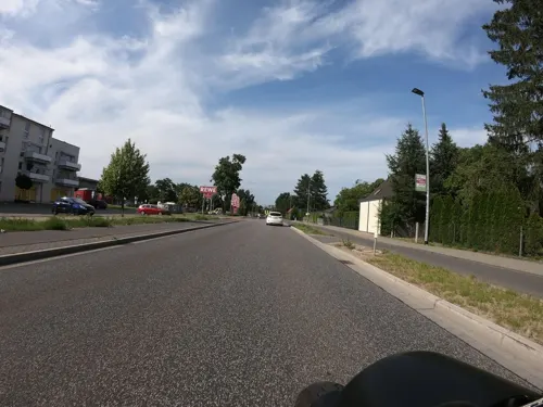
- Street-level photo, alexander2010, CC BY-SA 4.0
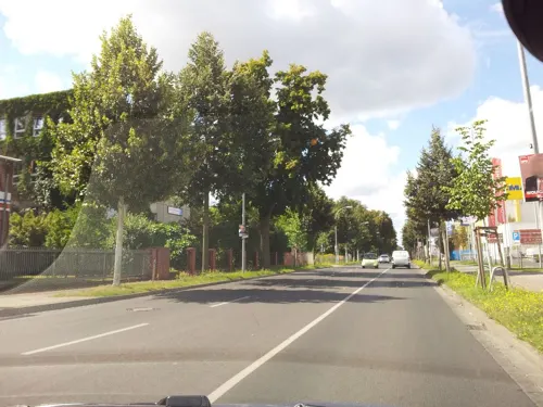
- Street-level photo, b166er, CC BY-SA 4.0
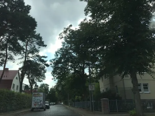
- Street-level photo, tb4711, CC BY-SA 4.0
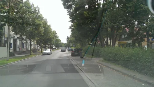
- Street-level photo, alexander2010, CC BY-SA 4.0
- Street-level photo, jenki, CC BY-SA 4.0
- Street-level photo, moenk, CC BY-SA 4.0
- Street-level photo, bufonto, CC BY-SA 4.0
- Street-level photo, moenk, CC BY-SA 4.0
- Street-level photo, kartonage, CC BY-SA 4.0
- Street-level photo, z0rg, CC BY-SA 4.0
- Street-level photo, alexander2010, CC BY-SA 4.0
- Street-level photo, bufonto, CC BY-SA 4.0
- Street-level photo, alexander2010, CC BY-SA 4.0
- Street-level photo, carlheinz, CC BY-SA 4.0
- Street-level photo, eserte, CC BY-SA 4.0
- Street-level photo, eserte, CC BY-SA 4.0
- Street-level photo, suncobalt, CC BY-SA 4.0
- Street-level photo, alexander2010, CC BY-SA 4.0
- Street-level photo, mfa, CC BY-SA 4.0
- Street-level photo, fdmap, CC BY-SA 4.0
- Street-level photo, carlheinz, CC BY-SA 4.0
- Street-level photo, changchun1, CC BY-SA 4.0
- Street-level photo, alexander2010, CC BY-SA 4.0
- Street-level photo, tordans, CC BY-SA 4.0
- Street-level photo, carlheinz, CC BY-SA 4.0


Page built November 8, 2026. Spotted a mistake? Tell us or suggest a place.