


Why visit Hude
Townapedia lists 86 museums and landmarks, 30 parks and trails, 68 places to eat, 14 places to stay and 6 attractions in and around town.
Highlights include Hofgemeinschaft Grummersort, Hofladen Schwarting, Ruine Klosterkirche Hude and Storchenpflegestation Wesermarsch.
Weather in Hude
Forecast from MET Norway (CC BY 4.0). Full forecast
About Hude
Hude (German pronunciation: [ˈhuːdə]) is a municipality in the district of Oldenburg, in Lower Saxony, Germany. It is situated 15 km east of Oldenburg, and 25 km west of Bremen (centre). The population is approximately 15,000 and approximately one third of these people are retired.
From the Wikipedia article Hude, Lower Saxony (this version), under CC BY-SA 4.0.
Things to do6

Hofladen Schwarting
Farm and orchard · 8.6 km
Verkauf von Kartoffeln, Eier, Honig, Fruchtaufstriche
3, Ganderkesee
Mo-Sa 08:00-18:00



Museums and landmarks86


Storchenpflegestation Wesermarsch
Monument and historic site · 7.0 km
6 Storchenweg, Berne
Mo-Su 10:00-18:00


Ehemalige Freilichtbühne "De Stedinge"
Monument and historic site · 3.9 km


Friederikeneiche
Monument and historic site · 4.0 km
Die Friederikeneiche, benannt nach Friederike Elisabeth Amalie von Oldenburg, ist mit einem Alter von etwa 1200 Jahren die älteste heute...

Hude - Wüsting, Ev.- luth. Friedhof Holle
Cemetery · 8.7 km
Kriegsgräberstätte für 4 Soldaten des I. Weltkrieges. Gestorben, soweit bekannt, zwischen dem 16. Juni 1916 und 16. Oktober 1918

Friedenseiche in Bergedorf
Monument and historic site · 8.8 km
Naturdenkmal: freistehende Eiche mit schirmförmiger Krone, Höhe ca. 15 m, Stammumfang 2,90 m, Kronendurchmesser ca. 20 m

74 more on the map.
Parks, trails and playgrounds30


Skulpturenufer
Park · 1.3 km
Das Skulpturenufer ist ein Gemeinschaftsprojekt der Gemeinde Hude im niedersächsischen Landkreis Oldenburg und des in Hude lebenden...

Waldschwimmbad (Naturbad) Hude
Sports field and stadium · 2.1 km
1 Linteler Straße, Hude
Mo-Fr 11:00-20:30; Sa,Su 10:00-19:00





18 more on the map.
Restaurants and cafes68
Vielstedter Bauernhaus
Restaurant · Regional · 3.0 km
1 Am Bauernhaus, Hude
Mo-Sa 15:00+;Th off;Su 12:00+
Backenköhler's Hotel und Akademie
Restaurant · German · 6.7 km
40 Dorfring, Ganderkesee
Su 12:00-21:00
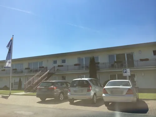
Airfield Restaurant
Restaurant · International · 8.3 km
23 Otto-Lilienthal-Straße, Ganderkesee
Mo-Su 11:30-14:00, 18:00-21:00
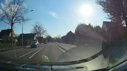
Missyou
Restaurant · Sushi, Chinese · 4.4 km
31 Stedinger Straße, Ganderkesee
Tu-Su 11:30-15:00,17:30-23:00
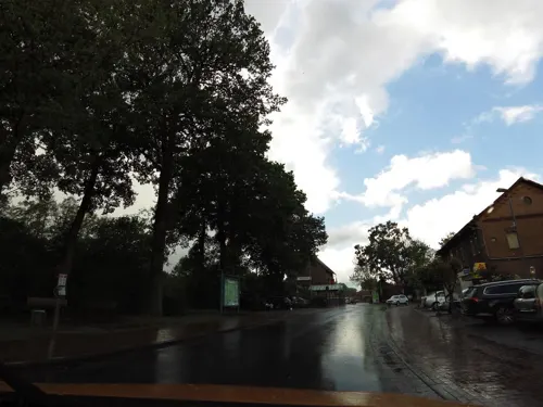
Moritz Wüstenlander Hof
Restaurant · German · 8.9 km
4 Bahnhofstraße, Hude (Oldenburg)
Tu-Su 17:00+; Mo off

Waldschänke Steinkimmen
Restaurant · Regional · 7.3 km
53 Am Sender, Ganderkesee
We-Sa 14:00+, Su 11:00+
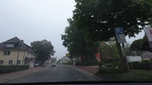
Zorbas
Restaurant · Greek · 1.0 km
40 Parkstraße, Hude
Mo off; Tu-Th 17:00-23:00; Fr 17:00-24:00; Sa 17:00-24:00; Su 12:00-23:00


Bäckerei Meyer Mönchhof
Bakery · 0.6 km
2 Parkstraße, Hude
Mo-Fr 06:00-18:00; Sa 06:00-13:00; Su 07:00-17:00
Grill & Wok Paradies
Restaurant · Chinese · 6.2 km
30 Bissener Weg, Ganderkesee
Mo-Su,PH 11:30-15:00,17:30-23:00
56 more on the map.
Where to stay14
Naturfreundehaus Kimmerheide
Motel and hotel · 8.8 km
34 Am Jugendhof, Ganderkesee
Churches and places of worship18
St. Marienkirche
Church · Lutheran · 8.9 km
36 Neuenhuntorfer Straße, Berne
Herz-Jesu-Kapelle Wüsting
Church · Catholic · 8.8 km
29 Am Klosterkiel, Hude (Oldenburg)
Neuapostolische Kirche
Church · New Apostolic · 9.0 km
1 Am Wiedbusch, Ganderkesee
Shopping23
Gas and EV charging14
Schools, colleges and libraries21
Citizens Service & Public Library
Library · 4.3 km
65 Stedinger Straße, Ganderkesee
Healthcare7
Map of Hude
250 places. The map loads OpenStreetMap tiles when you open it.
Getting there and nearby towns
Bremen Airport (BRE) is the nearest airport with scheduled flights listed in OpenStreetMap, 22 km away.
- Schwanewede 15 km northeast, about 15 min by car
- Oldenburg 17 km west, about 17 min by car
- Wardenburg 19 km west, about 19 min by car
- Ritterhude 20 km northeast, about 20 min by car
- Stuhr 21 km southeast, about 21 min by car
- Bremen 23 km east, about 23 min by car
- Rastede 24 km northwest, about 24 min by car
- Wildeshausen 24 km south, about 24 min by car
- Osterholz-Scharmbeck 25 km northeast, about 25 min by car
- Wiefelstede 29 km northwest, about 29 min by car
Drive times are estimates from straight-line distance, not routes.
Local news
Headlines from INDB.
Reviews, tips and questions
Loading what members have shared...
Sources and licences
- GeoNames (CC BY 4.0): population, coordinates, regions and time zone
- Mapillary (see each image): photos
- OpenStreetMap contributors (ODbL 1.0): places, airports, map data
- Wikidata (CC0 1.0): elevation, founding date, time zone, website
- Wikimedia Commons (see each image): photos
- Wikipedia (CC BY-SA 4.0): overview and history text
Photo credits
- Villa Marienhude, Qwertzu42, CC BY-SA 4.0
- Bahnhof Hude (Oldb) mit RS30 nach Bremen (2025), JoachimKohler-HB, CC BY-SA 4.0
- NWB ET 440 343 Hude, Sascha Gaerdes, CC BY 3.0
- Bahnhofsschild Hude 170511, Clic, CC BY-SA 4.0
- 155 191 in Hude 2016, Billboa, CC BY 3.0
- Vereinigte Volksbank in Hude (Landkreis Oldenburg), JoachimKohler-HB, CC BY-SA 4.0
- Abendliche RS4 der Nordwestbahn im Bahnhof Hude (2024), JoachimKohler-HB, CC BY-SA 4.0
- Abendliche RS4 der NordWestBahn in Hude (2024), JoachimKohler-HB, CC BY-SA 4.0
- Skulpturenufer 00 Infotafel, Gerd Fahrenhorst, CC BY 4.0
- Bardewisch Kirche752v S, Ulamm ( talk ), CC BY-SA 4.0
- Hünensteine 2 (928), Ralf Krebs, CC BY 3.0
- Klosterruine Hude 01, Heinz-Josef Lücking, CC BY-SA 3.0 de
- NSG Nordenholzer Moor, Billboa, CC BY 3.0
- Friederikeneiche, Billboa, CC BY 3.0
- Berne St.-Aegidius West- & Südseite292, Ulamm ( talk ), CC BY-SA 4.0
- Marienkirche-Neuenhuntorf, Tilman Kluge, CC BY-SA 2.5
- Hude St.-Elisabeth-Kirche, Reise Reise, CC BY-SA 4.0
- Friderikeneiche (Hasbruch) im Juni 2015, Billboa, CC BY 3.0
- Dionysius Kirche Holle01, Wemken, CC BY-SA 3.0
- Neuenkoop Arboretum 1, Corradox, CC BY-SA 4.0
- Ganderkesee, St. Hedwig (03), Subbass1, CC BY-SA 4.0
- Berne Kriegerdenkmal, Jens Reiche, CC BY-SA 4.0
- Bookholzberg St. Bernhard kath, Sichi77, CC BY-SA 4.0
- Hude St. Marien kath, Sichi77, CC BY-SA 4.0
- Kloster Hude1, Unknown author, CC BY-SA 3.0
- Hasbruchturm, Billboa, CC BY 3.0
- Berne (Wesermarsch) - Kriegerdenkmal für 1870-71 & Kolonialkriege, JoachimKohler-HB, CC BY-SA 4.0
- Stedingsehre bookholzberg, Matthias Süßen, CC BY 3.0
- ND226 Friedenseiche in Bergedorf, Ralf Krebs, CC BY 3.0
- Klosterhude91, Matthias Süßen, CC BY 3.0
- Bardewisch Kirche757S Seitenschiff v SSO, Ulamm ( talk ), CC BY-SA 4.0
- Großsteingrab Steinkimmen 2 11, Einsamer Schütze, CC BY-SA 3.0
- St. Aegidiuskirche in Berne (2023), JoachimKohler-HB, CC BY-SA 4.0
- Tipula vernalis 382569744, Letizia Weichgrebe, CC0
- Heavy Rain, Faldrian, CC BY 3.0
- How About A Bath, Faldrian, CC BY 3.0
- Just Visiting, Faldrian, CC BY 3.0
- Nice Catch, Faldrian, CC BY 3.0
- Reflection Of A Water Lilly, Faldrian, CC BY 3.0
- Search For Nectar, Faldrian, CC BY 3.0
- Street-level photo, bejotel, CC BY-SA 4.0
- Street-level photo, moenk, CC BY-SA 4.0
- Street-level photo, sajahome, CC BY-SA 4.0
- Street-level photo, moenk, CC BY-SA 4.0
- Street-level photo, StefanS79, CC BY-SA 4.0
- Street-level photo, StefanS79, CC BY-SA 4.0
- Street-level photo, sajahome, CC BY-SA 4.0
- Street-level photo, sajahome, CC BY-SA 4.0
- Street-level photo, moenk, CC BY-SA 4.0
- Street-level photo, moenk, CC BY-SA 4.0
- Street-level photo, moenk, CC BY-SA 4.0
- Street-level photo, moenk, CC BY-SA 4.0
- Street-level photo, StefanS79, CC BY-SA 4.0
- Street-level photo, abmap, CC BY-SA 4.0
- Street-level photo, StefanS79, CC BY-SA 4.0
- Street-level photo, StefanS79, CC BY-SA 4.0
- Street-level photo, VIA_KK, CC BY-SA 4.0
- Street-level photo, VIA_KK, CC BY-SA 4.0
- Street-level photo, StefanS79, CC BY-SA 4.0
- Street-level photo, StefanS79, CC BY-SA 4.0
- Street-level photo, StefanS79, CC BY-SA 4.0
- Street-level photo, StefanS79, CC BY-SA 4.0
- Street-level photo, sajahome, CC BY-SA 4.0
- Street-level photo, bejotel, CC BY-SA 4.0


Page built November 8, 2026. Spotted a mistake? Tell us or suggest a place.