


Why visit Wildeshausen
Townapedia lists 71 museums and landmarks, 24 parks and trails, 65 places to eat, 7 places to stay and 6 attractions in and around town.
Highlights include Spargelhof Mahlstedt, Spargelhof Ulrich, Druckereimuseum and Großsteingrab "Dötlinger Steingrab".
Weather in Wildeshausen
Forecast from MET Norway (CC BY 4.0). Full forecast
About Wildeshausen
Wildeshausen (German pronunciation: [vɪldəsˈhaʊzn̩] ; Low Saxon: Wilshusen) is a town and the capital of the Oldenburg district in Lower Saxony, Germany. It is situated by the river Hunte.
From the Wikipedia article Wildeshausen (this version), under CC BY-SA 4.0.
Things to do6

Spargelhof Mahlstedt
Farm and orchard · 4.1 km
Verkauf von Spargel (Mitte Mai bis Ende Juni); Schnittgrün (ab Oktober) und Weihnachtsbäume (2 Wochen vor Weihnachten)
9 Holzhausen, Wildeshausen
Apr-Jun 09:00-12:00, 14:00-18:00


Gierenberg
Scenic view · 5.4 km
Besondere Hangsituation am Terrassenrand zum Huntetal, Sandheide auf der Kuppe.

Museums and landmarks71


Großsteingrab "Dötlinger Steingrab"
Monument and historic site · 6.2 km
24/7


59 more on the map.
Parks, trails and playgrounds24








Pestruper Moor
Hiking and trails · 2.3 km
Wurzelechtes Niedermoor, das weitgehend von Wald bewachsen ist.
12 more on the map.
Restaurants and cafes65

Am Huntepadd
Restaurant · German · 6.1 km
Seit 2026 "Hotel Huntepadd" mit Cafe, Restaurant und Hotel; früherer Name "Landhotel Dötlingen"
6 Rittrumer Kirchweg, Dötlingen
Mo,We 17:00-21:30; Th 14:00-21:30; Fr,Su 09:00-21:30; Sa 09:00-22:30
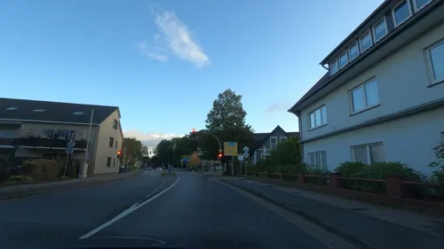
Al-To
Restaurant · Mediterranean · 0.7 km
1 Huntetor, Wildeshausen
Mo-Sa 17:00-23:00; PH,Su 12:00-14:30,17:00-22:00
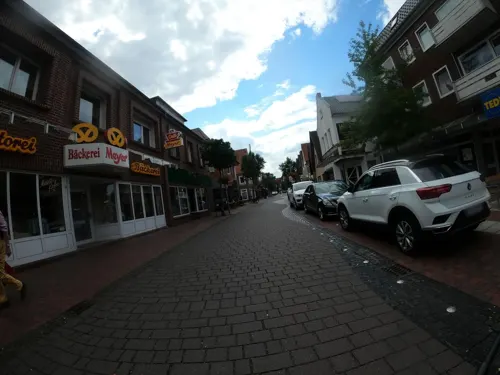
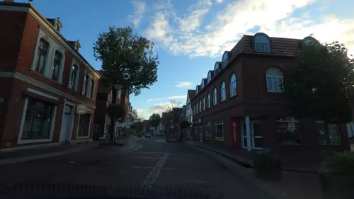
Taiyo
Restaurant · Asian Sushi
2 Sögestraße, Wildeshausen
Tu-Sa 11:00-15:00,17:00-22:00; Su,PH 12:00-15:00,17:00-22:00; Mo off



Landbäckerei Diekhaus
Bakery
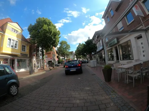
18 Westerstraße, Wildeshausen
Mo-Fr 07:00-18:00; Sa 07:00-13:00; Su 07:30-12:00
53 more on the map.
History
Under the 1648 Peace of Westphalia, which ended the Thirty Years’ War, Sweden acquired large territories in what is now Germany, including Pomerania, Wismar, Bremen-Verden, and Wildeshausen. While Bremen-Verden, Pomerania, and Wismar remained long-term Swedish dominions, Wildeshausen was only briefly under Swedish control.
The Swedish crown granted Wildeshausen to Count Gustav Gustavsson of Vasaborg, an illegitimate son of Gustavus II Adolphus and Margareta Slots, making him a half-brother of the Swedish Queen Kristina.
Gustav had served in the Swedish armed forces during the war and was ennobled as Vasaborg in 1637 (introduced at Riddarhuset in 1647). He also owned several estates in Finland. After receiving Wildeshausen, he moved to Germany and died in the city on 25 October 1653.
His son and successor, Gustav Adolf of Vasaborg, was only a few months old at the time of his father’s death. As an adult, he pursued a military career in Braunschweig-Lüneburg but lost Wildeshausen during the wars of the 1670s.
In 1679, under the Peace of Nijmegen, the Swedish crown ceded Wildeshausen to the Prince-Bishop of Münster, formally in exchange for a loan of 100,000 Riksdaler. The area was later mortgaged to Hanover in 1700. Nevertheless, Gustav Adolf continued to reside in the region and died in Wildeshausen in 1732.
From the History section of Wildeshausen on Wikipedia, under CC BY-SA 4.0.
Where to stay7
Churches and places of worship10
Neuapostolische Kirche Dötlingen
Church · New Apostolic · 6.0 km
5 Goldbergsweg, Dötlingen
Imam Al Harariye Moschee
Place of worship · 2.0 km
14 Daimlerstraße, Wildeshausen
Shopping19
ELAWI Eisenwaren Werkzeuge Langfermann
Hardware store · 1.6 km
53 Visbeker Straße, Wildeshausen
Gas and EV charging12
Schools, colleges and libraries14
Fachschule Heilerziehungspflege Akademie für Rehaberufe Wildeshausen
School · 2.6 km
Healthcare4
Map of Wildeshausen
232 places. The map loads OpenStreetMap tiles when you open it.
Getting there and nearby towns
Flugplatz Varrelbusch (VAC) is the nearest airport with scheduled flights listed in OpenStreetMap, 26 km away.
- Emstek 20 km west, about 20 min by car
- Oldenburg 31 km northwest, about 31 min by car
- Bremen 32 km northeast, about 32 min by car
- Apen 55 km northwest, about 55 min by car
- Kirchlinteln 60 km east, about 1 h by car
- Ostrhauderfehn 61 km northwest, about 1 h by car
- Zetel 66 km northwest, about 1 h by car
- Osnabrück 74 km south, about 1 h 15 min by car
- Bremerhaven 74 km north, about 1 h 15 min by car
- Wilhelmshaven 76 km north, about 1 h 15 min by car
Drive times are estimates from straight-line distance, not routes.
Local news
Headlines from INDB.
Reviews, tips and questions
Loading what members have shared...
Sources and licences
- GeoNames (CC BY 4.0): population, coordinates, regions and time zone
- Mapillary (see each image): photos
- OpenStreetMap contributors (ODbL 1.0): places, airports, map data
- Wikidata (CC0 1.0): elevation, founding date, time zone, website
- Wikimedia Commons (see each image): photos
- Wikipedia (CC BY-SA 4.0): overview and history text
Photo credits
- Wildeshausen Luftaufnahme 2009 069, Fotoflug Wildeshausen, CC BY-SA 3.0
- Baudenkmal Wildeshausen Westertor 5, Gmbo 2013, CC0
- Baudenkmal Wildeshausen Westerstraße 50, Gmbo 2013, CC0
- Baudenkmal Wildeshausen Westertor 8 Straßenfront, Gmbo 2013, CC0
- Baudenkmal Wildeshausen Westertor 8, Gmbo 2013, CC0
- Brunnen in Wildeshausen 2, Gerd Fahrenhorst, CC BY 4.0
- Wildeshausen Luftaufnahme 2009 059, Fotoflug Wildeshausen, CC BY-SA 3.0
- Wildeshausen Luftaufnahme 2009 058, Fotoflug Wildeshausen, CC BY-SA 3.0
- Stolpersteinlage Wildeshausen Sögestraße 16, Gmbo 2013, CC0
- Stolperstein Wildeshausen Sögestraße 16 Arthur Goldstein, Gmbo 2013, CC0
- Stolpersteine Wildeshausen Sögestraße 16, Gmbo 2013, CC0
- Wildeshausen Luftaufnahme 2009 060, Fotoflug Wildeshausen, CC BY-SA 3.0
- Wildeshausen Westerstraße, Corradox, CC BY-SA 4.0
- Baudenkmal Wildeshausen Westerstraße 27, Gmbo 2013, CC0
- Baudenkmal Wildeshausen Westerstraße 25, Gmbo 2013, CC0
- Kleine Strasse 18 in Wildeshausen (1), Krzysztof Golik, CC BY-SA 4.0
- Kleine Strasse 18 in Wildeshausen (2), Krzysztof Golik, CC BY-SA 4.0
- Stolpersteinlage Wildeshausen Westerstraße 24, Gmbo 2013, CC0
- Brunnen in Wildeshausen 1, Gerd Fahrenhorst, CC BY 4.0
- Stolpersteine Wildeshausen Westerstraße 24, Gmbo 2013, CC0
- Stolperstein Wildeshausen Westerstraße 24 Sophie de Haas, Gmbo 2013, CC0
- Stolperstein Wildeshausen Westerstraße 24 Moritz de Haas, Gmbo 2013, CC0
- Skulptur Pferd in Wildeshausen, Gerd Fahrenhorst, CC BY 4.0
- Baudenkmal Wildeshausen Stadtwall Eingang Bahnhofstraße, Gmbo 2013, CC0
- Baudenkmal Wildeshausen Burgstraße St. Peter Kirche, Gmbo 2013, CC0
- Wildeshausen Luftaufnahme 2009 057, Fotoflug Wildeshausen, CC BY-SA 3.0
- St Peter church in Wildeshausen (3), Krzysztof Golik, CC BY-SA 4.0
- Burgstrasse 13 in Wildeshausen, Krzysztof Golik, CC BY-SA 4.0
- St Peter church in Wildeshausen (1), Krzysztof Golik, CC BY-SA 4.0
- St Peter church in Wildeshausen (2), Krzysztof Golik, CC BY-SA 4.0
- Baudenkmal Wildeshausen Burgstraße 11 Straßenfront, Gmbo 2013, CC0
- St Peter church in Wildeshausen (4), Krzysztof Golik, CC BY-SA 4.0
- Baudenkmal Wildeshausen Burgstraße 11, Gmbo 2013, CC0
- St Peter church in Wildeshausen (8), Krzysztof Golik, CC BY-SA 4.0
- Burgstrasse 11 in Wildeshausen (1), Krzysztof Golik, CC BY-SA 4.0
- Burgstrasse 11 in Wildeshausen (2), Krzysztof Golik, CC BY-SA 4.0
- St Peter church in Wildeshausen (7), Krzysztof Golik, CC BY-SA 4.0
- Former town hall in Wildeshausen (2), Krzysztof Golik, CC BY-SA 4.0
- Bargloyer Steinkiste - Gesamtansicht, XenonX3, CC0
- Großsteingrab Gerichtsstätte 03, Einsamer Schütze, CC BY-SA 3.0
- Dötlingen-Teil der zerstörten Großsteingräber, -- Frank Poppe 17:50, 24. Mai 2007 (CEST), Public domain
- Wunderburger Moor, Billboa, CC BY 3.0
- Großsteingrab Thölstedt 04, Einsamer Schütze, CC BY-SA 3.0
- Großsteingrab Mühlensteine 11, Einsamer Schütze, CC BY-SA 3.0
- Varnhorn Schmeersteine, Corradox, CC BY-SA 3.0
- Großsteingrab Glaner Braut 3 06, Einsamer Schütze, CC BY-SA 3.0
- Dötlingen-Kirche-1, -- Frank Poppe 17:39, 24. Mai 2007 (CEST), Public domain
- Alexanderkirche Wildeshausen halfstraight, Jacek79 , adaption Ulamm ( talk ), CC BY-SA 3.0
- St. Peter (Wildeshausen), Volker.Ramsloh ; shifted by Rabanus Flavus, CC BY-SA 3.0
- Druckereimuseum Wildeshausen, Stefan Flöper, CC BY-SA 4.0
- Rechterfeld Kirche, Path2018, CC BY-SA 4.0
- Baudenkmal Wildeshausen Huntetor 8 Villa Hoffmannshöhe, Gmbo 2013, CC0
- ND101 Gierenberg in Dötlingen, Ralf Krebs, CC BY 3.0
- Dötlingen - Großsteingrab Jungsteinzeit 4000-1800 v. Chr. 03, Franzfoto, CC BY-SA 3.0
- LSG OL00025 Birkenbusch, Ralf Krebs, CC BY 3.0
- Pestruper Moor, Billboa, CC BY 3.0
- ArboretumSchild, Ludecus Werner Pickart, CC BY 3.0
- Dorfplatz Kleinenkneten, Billboa, CC BY 3.0
- Street-level photo, camdrive2000, CC BY-SA 4.0
- Street-level photo, VIA_KK, CC BY-SA 4.0
- Street-level photo, camdrive2000, CC BY-SA 4.0
- Street-level photo, hendel, CC BY-SA 4.0
- Street-level photo, camdrive2000, CC BY-SA 4.0
- Street-level photo, DerMaster0815, CC BY-SA 4.0
- Street-level photo, VIA_KK, CC BY-SA 4.0
- Street-level photo, camdrive2000, CC BY-SA 4.0
- Street-level photo, DerMaster0815, CC BY-SA 4.0
- Street-level photo, VIA_KK, CC BY-SA 4.0
- Street-level photo, moenk, CC BY-SA 4.0
- Street-level photo, moenk, CC BY-SA 4.0
- Street-level photo, hendel, CC BY-SA 4.0
- Street-level photo, mjay, CC BY-SA 4.0
- Street-level photo, moenk, CC BY-SA 4.0
- Street-level photo, camdrive2000, CC BY-SA 4.0
- Street-level photo, camdrive2000, CC BY-SA 4.0
- Street-level photo, VIA_KK, CC BY-SA 4.0
- Street-level photo, moenk, CC BY-SA 4.0
- Street-level photo, VIA_KK, CC BY-SA 4.0
- Street-level photo, DerMaster0815, CC BY-SA 4.0
- Street-level photo, VIA_KK, CC BY-SA 4.0
- Street-level photo, hendel, CC BY-SA 4.0


Page built November 8, 2026. Spotted a mistake? Tell us or suggest a place.