


Why visit Kahl am Main
Townapedia lists 95 museums and landmarks, 21 parks and trails, 71 places to eat, 12 places to stay and 2 attractions in and around town.
Highlights include Heimatmuseum, Pulverturm, Marina Lässig and Alzenauer Sande.
Weather in Kahl am Main
Forecast from MET Norway (CC BY 4.0). Full forecast
About Kahl am Main
Kahl am Main (German pronunciation: [ˈkaːl ʔam ˈmaɪn], lit. 'Kahl on the Main'; officially Kahl a.Main) is a municipality in the Aschaffenburg district in the Regierungsbezirk of Lower Franconia (Unterfranken) in Bavaria, Germany. It has around 7,500 inhabitants.
From the Wikipedia article Kahl am Main (this version), under CC BY-SA 4.0.
Things to do2


Museums and landmarks95




Bayerischer Stundenstein (Kilometerstein) im Grenzsteingarten in Kahl am Main
Monument and historic site


83 more on the map.
Parks, trails and playgrounds21

Marina Lässig
Marina and boat launch · 1.2 km
Der Hafen liegt geschützt in einer Bucht und der Wellenschlag der Berufsschifffahrt wird außerdem durch die schmale Hafeneinfahrt (ca....


Cocotal Indoor Spielparadies
Playground · 3.4 km
5 Nordring, Seligenstadt
Mo 14:00-19:00, We-Fr 14:00-19:00; Sa-Su 12:00-19:00

Hallenbad Großkrotzenburg
Sports field and stadium · 2.5 km
8 Schulstraße, Großkrotzenburg
Su 08:00-12:00



9 more on the map.
Restaurants and cafes71
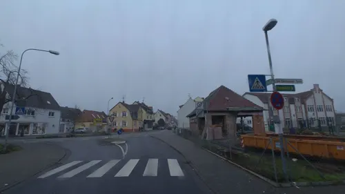
Badehaus – ital. Eiscafé
Cafe · Ice Cream · 3.4 km
45 Steinheimer Straße, Seligenstadt
Mo-Su 10:00-20:00

"Restaurant Poseidon" Zum Schützenhaus
Restaurant · Greek · 1.0 km
46 Goethestraße, Kahl am Main
Tu-Sa 12:00-15:00,17:00-23:00; Su,PH 12:00-22:00
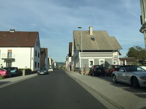
Pizzeria Ristorante Da Pino
Restaurant · Italian · 2.5 km
64 Hauptstraße, Karlstein am Main
Mo 11:00-13:45,17:00-22:30; Tu 11:00-14:00,17:00-23:00; We-Su...
Restaurant und Biergarten 19hundert
Restaurant · German · 3.0 km
65 Friedrich-Ebert-Straße, Hainburg
Mo-Fr 18:00+; Su 18:00-22:00, Su[1] 11:30-14:30; Sa off
Restaurant und Eiscafé Amici
Restaurant · Italian · 3.1 km
15 Berliner Straße, Seligenstadt
Mo-Th 11:00-23:00; Fr-Sa 11:00-24:00; Su 11:00-22:00
Seeterrasse
Restaurant · Italian · 1.3 km
2 Am Campingplatz, Kahl am Main
Tu-Fr 11:00-14:30,17:00-22:00; Sa-Su 11:00-22:00
Sercys
Restaurant · Pizza, Burger, Kebab, Italian · 2.6 km
2 Schulstraße, Großkrotzenburg
Tu-Th 14:00-24:00; Fr,Sa 14:00-27:00; Su 14:00-25:00
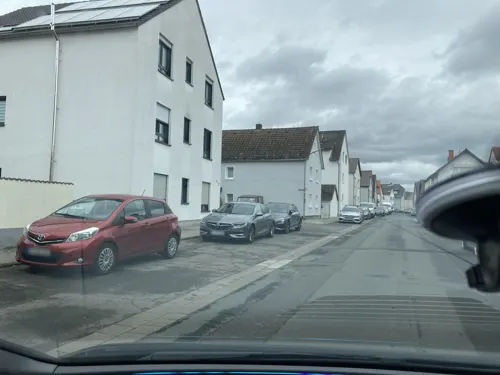
Zum Wiesegiggel
Restaurant · Balkan · 3.0 km
20 Hauptstraße, Seligenstadt
Mo-Sa 17:00-24:00; We 18:00-24:00; Su 11:30-14:30,17:00-23:00

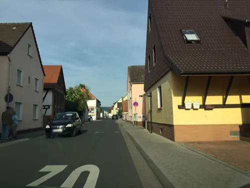


Bäckerei Schatz
Bakery · 2.5 km
28 Hauptstraße, Karlstein am Main
Mo-Sa 06:00-12:30; Su 08:00-11:00; Tu-Fr 14:00-18:00

Eis Henss
Ice cream · 2.7 km
20 Krotzenburger Straße, Hainburg
Mar,Oct: Mo-Sa 12:00-20:00; Mar,Oct: Su, PH 11:00-20:00; Apr,Sep:...
59 more on the map.
Where to stay12
Churches and places of worship12
Shopping24
Gas and EV charging5
Schools, colleges and libraries14
Healthcare8
Rosen Apotheke
Clinic and pharmacy · 2.9 km
42 Wilhelm-Leuschner-Straße, Hainburg
Hausärztliches MVZ Großkrotzenburg
Clinic and pharmacy · 1.2 km
25 Kahler Straße, Großkrotzenburg
Map of Kahl am Main
250 places. The map loads OpenStreetMap tiles when you open it.
Getting there and nearby towns
Frankfurt Airport (FRA) is the nearest airport with scheduled flights listed in OpenStreetMap, 33 km away.
- Seligenstadt 4 km southwest, about 4 min by car
- Alzenau in Unterfranken 5 km northeast, about 5 min by car
- Hanau am Main 10 km northwest, about 10 min by car
- Rodgau 10 km southwest, about 10 min by car
- Kleinostheim 9 km southeast, about 9 min by car
- Rodenbach 9 km north, about 9 min by car
- Erlensee 11 km north, about 11 min by car
- Obertshausen 11 km west, about 11 min by car
- Mömbris 11 km east, about 11 min by car
- Mainaschaff 12 km southeast, about 12 min by car
Drive times are estimates from straight-line distance, not routes.
Local news
Headlines from INDB.
Reviews, tips and questions
Loading what members have shared...
Sources and licences
- GeoNames (CC BY 4.0): population, coordinates, regions and time zone
- Mapillary (see each image): photos
- OpenStreetMap contributors (ODbL 1.0): places, airports, map data
- Wikidata (CC0 1.0): elevation, founding date, time zone, website
- Wikimedia Commons (see each image): photos
- Wikipedia (CC BY-SA 4.0): overview and history text
Photo credits
- Kahler Sandhas, Gabriele Delhey, CC BY-SA 3.0
- Kahl am Main, Grenzsteingarten am Wasserturm, Manfred Schröter, Berga, CC BY-SA 4.0
- Rathaus Kahl am Main, Freak-Line-Community, CC BY-SA 4.0
- Kahl in Kahl am Main, Freak-Line-Community, CC BY-SA 4.0
- Kahl in Kahl am Main (3), Freak-Line-Community, CC BY-SA 4.0
- Kahl am Main, St. Margareta, Orgel (1), Subbass1, CC BY-SA 4.0
- Kahl am Main, St. Margareta, Orgel (2), Subbass1, CC BY-SA 4.0
- Klein-Krotzenburg St. Nikolaus 20110114, Rudolf Stricker, Attribution
- Schloss Emmerichshofen 2016 01-b, Lumpeseggl, CC BY-SA 4.0
- Kahl Kirche (01), Prof. emeritus Hans Schneider (Geyersberg), CC BY 4.0
- Kahl Mainfeldkapellchen Int, KaiBorgeest, CC BY 4.0
- Großwelzheim Kirche (01), Prof. emeritus Hans Schneider (Geyersberg), CC BY 4.0
- Naturschutzgebiet Schifflache bei Großauheim 07, Benedikt Behnke, CC BY-SA 4.0
- Franziskanergymnasium Kreuzburg, Franz Dreier, CC BY-SA 4.0
- Seligenstadt Pulverturm 1280, Reinhardhauke, CC BY-SA 3.0
- Gustav-Adolf-Kirche Klein-Krotzenburg Nordansicht, C. M., CC BY-SA 4.0
- Seligenstadt Kapelle Galgenweg 3, E-W, CC BY-SA 4.0
- Nebenstraße 20, Pfarrkirche St. Laurentius, von Süden Großkrotzenburg 20230402 0106, Tilman2007, CC BY-SA 4.0
- Alzenauer Sande Neufeld, Freak-Line-Community, CC BY-SA 3.0
- Gustavsee2, Freak-Line-Community, CC BY-SA 3.0
- Kahl Bahnhofstr 14 church, KaiBorgeest, CC BY-SA 4.0
- Schloss Emmerichshofen 2016 02, Lumpeseggl, CC BY-SA 4.0
- Klein-Krotzenburg St. Nikolaus 20110113, Rudolf Stricker, Attribution
- Schifflache1, Freak-Line-Community, CC BY-SA 3.0
- NSG Alzenauer Sande, Freak-Line-Community, CC BY-SA 4.0
- Gustavsee, Freak-Line-Community, CC BY-SA 3.0
- Kahl Rathaus (03), Prof. emeritus Hans Schneider (Geyersberg), CC BY 4.0
- Kahl Rathaus (01), Prof. emeritus Hans Schneider (Geyersberg), CC BY 4.0
- Kahl Wasserturm (01), Prof. emeritus Hans Schneider (Geyersberg), CC BY 4.0
- Kahl Rathaus (02), Prof. emeritus Hans Schneider (Geyersberg), CC BY 4.0
- Kahl Hauptstraße 4 (01), Prof. emeritus Hans Schneider (Geyersberg), CC BY 4.0
- Kahl Burgweg Wegkreuz, KaiBorgeest, CC BY 4.0
- Kahl Hauptstraße 5 (03), Prof. emeritus Hans Schneider (Geyersberg), CC BY 4.0
- Kahl Hauptstr 5, KaiBorgeest, CC BY 4.0
- Kahl Hauptstraße 5 (04), Prof. emeritus Hans Schneider (Geyersberg), CC BY 4.0
- Kahl Hauptstraße 5 (01), Prof. emeritus Hans Schneider (Geyersberg), CC BY 4.0
- Kahl Hauptstraße 5 (02), Prof. emeritus Hans Schneider (Geyersberg), CC BY 4.0
- Bodendenkmal D-6-5920-0036, 2, Kahl a. Main, Landkreis Aschaffenburg, User:GeorgDerReisende, CC BY-SA 4.0
- Hanauer Landstraße 34, 1, Kahl a. Main, Landkreis Aschaffenburg, GeorgDerReisende, CC BY-SA 4.0
- Bodendenkmal D-6-5920-0036, 1, Kahl a. Main, Landkreis Aschaffenburg, User:GeorgDerReisende, CC BY-SA 4.0
- Birkenkopf (Spessart), Freak-Line-Community, CC BY-SA 4.0
- Stolperstein Josef Waller, 1, Oberhaagstraße 6, Großkrotzenburg, Main-Kinzig-Kreis, GeorgDerReisende, CC BY-SA 4.0
- Stolperstein Leopold Waller, 1, Steingasse 3, Großkrotzenburg, Main-Kinzig-Kreis, GeorgDerReisende, CC BY-SA 4.0
- Stolperstein Adolf Berberich, 1, Breite Straße 31, Großkrotzenburg, Main-Kinzig-Kreis, GeorgDerReisende, CC BY-SA 4.0
- Street-level photo, schulf, CC BY-SA 4.0
- Street-level photo, m_groebs, CC BY-SA 4.0
- Street-level photo, robffm, CC BY-SA 4.0
- Street-level photo, mfa, CC BY-SA 4.0
- Street-level photo, mfa, CC BY-SA 4.0
- Street-level photo, mfa, CC BY-SA 4.0
- Street-level photo, m_groebs, CC BY-SA 4.0
- Street-level photo, schulf, CC BY-SA 4.0
- Street-level photo, schulf, CC BY-SA 4.0
- Street-level photo, robffm, CC BY-SA 4.0
- Street-level photo, punki, CC BY-SA 4.0
- Street-level photo, robffm, CC BY-SA 4.0
- Street-level photo, chuck, CC BY-SA 4.0
- Street-level photo, schulf, CC BY-SA 4.0


Page built November 9, 2026. Spotted a mistake? Tell us or suggest a place.