


Why visit Rodgau
Townapedia lists 74 museums and landmarks, 60 parks and trails, 217 places to eat, 30 places to stay and 17 attractions in and around town.
Highlights include Hofgut Patershausen, Wildpark Alte Fasanerie Hanau, Heimatmuseum Nieder-Roden and Wasserturm Jügesheim.
Weather in Rodgau
Forecast from MET Norway (CC BY 4.0). Full forecast
About Rodgau
Rodgau (German pronunciation: [ˈʁɔtɡaʊ] ) is a town in the Offenbach district in the Regierungsbezirk of Darmstadt in Hesse, Germany. It lies southeast of Frankfurt am Main in the Frankfurt Rhine Main Region and has the greatest population of any municipality in the Offenbach district. It came into being in 1979 when the greater community of Greater Rodgau was raised to the status of a town, after having been formed through a merger of five formerly self-administering communities in the framework of municipal reform in Hesse in 1977. The current constituent communities’ history reaches back to the 8th century.
From the Wikipedia article Rodgau (this version), under CC BY-SA 4.0.
Photos of Rodgau


Things to do17

Hofgut Patershausen
Farm and orchard · 5.8 km
1 Patershäuser Weg, Heusenstamm
Th 15:00-19:00; Fr,Sa 09:30-13:00


Ackerlei
Farm and orchard · 5.2 km
3 Schachenweg, Seligenstadt
Tu,Th,Fr 09:00-18:30; Sa 09:00-14:00; Su,PH off
Hofladen Hühnerhof Lüft
Farm and orchard · 5.5 km
5 Dr.-Hermann-Neubauer-Ring, Seligenstadt
Mo 14:30-18:00; We 14:30-18:00; Fr 08:30-18:00; Sa 08:30-13:00
Sandhof
Farm and orchard · 1.4 km
3 Westweiler/Außerhalb, Rodgau
Mo-We 09:00-18:00; Th,Fr 09:00-18:30; Sa 09:00-14:00; Su,PH off
Rücker's Hofladen
Farm and orchard · 3.2 km
Verkauf von Obst, Gemüse, Schwein aus eigener Herstelleung
11 Hauptstraße, Heusenstamm
Mo-Fr 08:30-12:00,14:00-18:00; Sa 09:00-12:00; Tu off

Eier Automat 24/7
Farm and orchard · 3.6 km
Eier, Eiernudeln und ein öffentlicher Bücherschrank
24/7
Grimm's Bauernlädchen
Farm and orchard
Tu,Th,Fr 09:00-13:00, Tu,Th 15:00-18:00, Sa 08:00-12:30
5 more on the map.
Museums and landmarks74
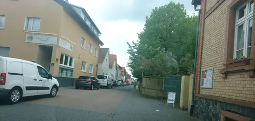
Heimatmuseum Nieder-Roden
Museum · 3.5 km
Museum zur Lokalgeschichte von Nieder-Roden und Umgebung, mit Dauerausstellung, Jahresausstellungen, Events und Museumöffnungen, in der...
32 Schulstraße, Rodgau

Wasserturm Jügesheim
Monument and historic site · 1.0 km
Das Wahrzeichen Rodgaus




Mühle der Wüstung Renigishausen
Monument and historic site · 5.5 km
Mauerreste einer mittelalterlichen/frühneuzeitlichen Mühle
24/7
Wasserwerkspark
Monument and historic site · 6.2 km
Schaubrunnen/Kunst (gehört zu Wasser-Infopark)
50°00'59.8"N 8°48'00.1"E
Galerie im Alten Haus - Kunst & Kultur
Museum · 6.6 km
13 Frankfurter Straße, Seligenstadt
Fr-Su 15:00-18:00
Wasserturm
Monument and historic site · 6.1 km
56 Frankfurter Straße, Seligenstadt
62 more on the map.
Parks, trails and playgrounds60




Cocotal Indoor Spielparadies
Playground · 6.5 km
5 Nordring, Seligenstadt
Mo 14:00-19:00, We-Fr 14:00-19:00; Sa-Su 12:00-19:00

Monte Mare
Sports field and stadium · 5.0 km
19 Badstraße, Obertshausen
Mo-Th 10:00-23:00; Fr,Sa 10:00-24:00, Su,PH 10:00-21:00
48 more on the map.
Restaurants and cafes217
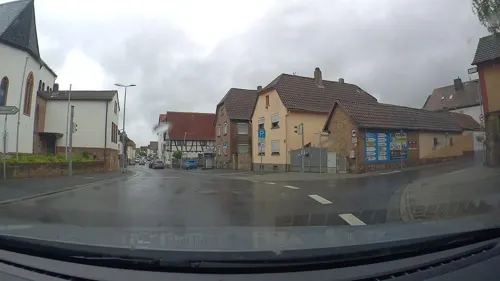
Da Luigi II
Restaurant · Pizza · 2.7 km
Sieht nach hauptsächlichem Lieferservice aus, hat aber wohl Bestuhlung
87 Hauptstraße, Rodgau
Tu-Sa 11:00-14:15,17:00-22:30; Su 15:00-22:30
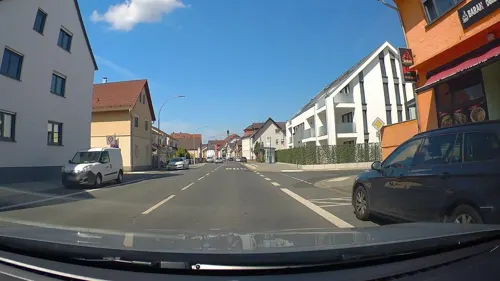
Baran Döner&Pizza
Restaurant · Kebab, Pizza · 5.1 km
78 Seligenstädter Straße, Seligenstadt
Mo-Fr 11:30-22:00; Sa 12:00-22:00; Su 17:00-22:00
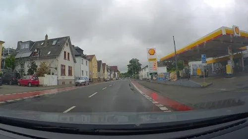
Da Vinci Ristorante Gelateria
Restaurant · Italian, Pizza, Pasta, Fish, Seafood, Ice Cream · 0.9 km
123 Ludwigstraße, Rodgau
Mo-Sa 11:30-23:00; Su 11:30-22:00
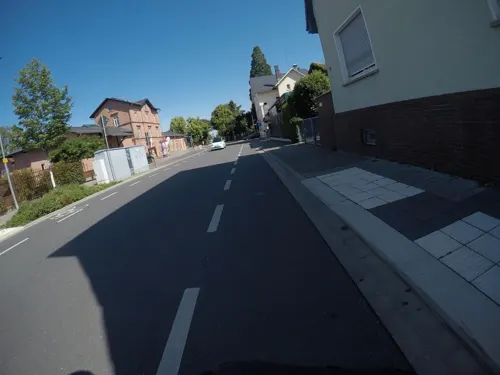
Kleins Brauhaus
Restaurant · German · 6.1 km
´6 Eisenbahnstraße, Seligenstadt
Tu-Sa 17:00-22:00+; Su 12:00-22:00+
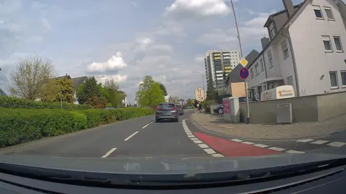
Kupferkanne
Restaurant · Balkan · 5.7 km
3 Robert-Stolz-Straße, Obertshausen
Mo-Su,PH 11:00-14:30,17:00-23:00; We off
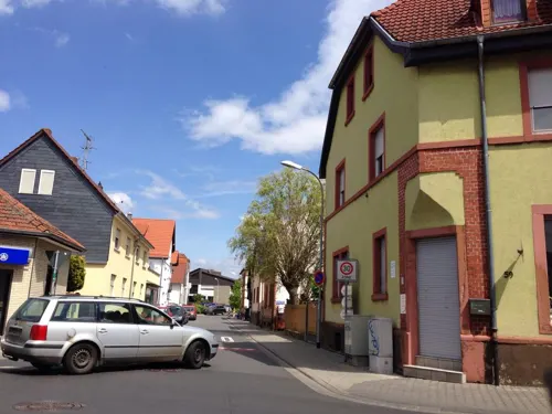
La Dolce Vita
Restaurant · Italian
54 Ludwigstraße, Rodgau
Mo 11:00-23:00; We-Sa 11:00-23:00; Su 11:00-22:00

due amici by Nuivi
Restaurant · Italian
Im due amici by Nuivi im schönen Rodgau, ganz in der Nähe von Frankfurt, erwartet Sie ein stilvolles Ambiente, einen sowohl herzlichen...
22 Vordergasse, Rodgau
Mo,We-Su 16:00-23:00
Bindinggarten-Sportgaststätte
Restaurant · Croatian · 3.1 km
1 Bindingweg, Heusenstamm
Tu,Th,Sa 16:00-23:00; We,Fr 11:30-14:00,16:00-23:00; Su 10:00-23:00
Gasthaus "Zur Guten Quelle"
Restaurant · German · 6.5 km
20 Grabenstraße, Seligenstadt
Mo-Fr 11:30-14:00,17:30-00:00; Sa 17:30-00:00; Su 11:30-00:00

205 more on the map.
History
On 1 January 1977, in the course of municipal reform in Hesse, the greater community of Rodgau came into being as the communities of Weiskirchen, Hainhausen, Jügesheim, Dudenhofen and Nieder-Roden, along with the settlement of Rollwald belonging to Nieder-Roden were amalgamated. The greater community was granted town rights on 15 September 1979. The old cropfield name Rodgau, like Bachgau and Kinziggau belonging to the Maingau, gave the town its name. The original communities have been in existence for hundreds of years.
Today (as at 31 December 2007), Rodgau has 45,236 inhabitants (including 2,035 whose main residence is elsewhere), of whom 22,120 are male and 23,116 female. Foreigners from 52 different nations account for 4,471 inhabitants (9.9%). Those who have lived in Rodgau longer than ten years account for 64.6% of the population.
Read more of the history
Around Saint Peter's Church (Peterskirche) arose the settlement of Wichenkirchen (or Wizzinkirchin) in Frankish times as a Thorpe (one-street village). It had its first documentary mention in 1287 in the Seligenstadt Monastery's accord with the Auheimer Mark. Weiskirchen was at this time Mother Church to the villages of Jügesheim, Hainhausen and Rembrücken. The first landlords, the Lords of Hagenhausen – later of Eppstein – sold the Amt of Steinheim in 1425 along with Weiskirchen, a village belonging to it, to the Archbishop and Elector of Mainz, to whom the village belonged until 1803. With this, Weiskirchen formed an ecclesiastical and economic hub in the Rodgau. When the Auheimer Mark (a communally held parcel of land to which belonged several villages) was divided up in 1786, Weiskirchen received a share of the forest.
After Secularization in 1803, the Amt of Steinheim along with Weiskirchen passed to Hesse. In 1896 the Rodgaubahn (railway) with a railway station in Weiskirchen opened.
In the course of the 19th century, Weiskirchen shifted from a farming village to a worker's community. Of the once well known village with its timber-frame houses very little is left. During National Socialist times, the small Jewish community was driven out. In March 2005, the small, restored former synagogue was ceremoniously reopened as a memorial. Since 1967, the Weiskirchen transmitter, a medium-wave transmitter owned by Hessischer Rundfunk, has been in operation on Weiskirchen's northwestern outskirts on a frequency of 594 kHz although this has now been dismantled.
In 1576, Weiskirchen had 37 households. In 1681, 111 inhabitants lived in 26 households. In 1834, 655 people lived in the village. A century later, in 1939, that figure had risen to 1,740. By 1970, the population had risen to 4,840 inhabitants. In late 2007, the constituent community had 6,115 inhabitants.
As early as 1108, Rodgau's smallest constituent community (with a population today of roughly 3,800) had a documentary mention as the location of a moated castle belonging to the Lords of Hagenhausen, in which it was named as Haginhusen. Remains of this castle still lie under a meadow near the Rodau on today's Burgstraße (road). The Hagenhausen noble family, who after moving to the Taunus began styling themselves the Lords of Eppstein, and writing many a page in mediaeval German history, found themselves holding great importance and power from the 13th century onwards. Four Archbishops of Mainz alone were installed by the Eppsteins. Hainhausen, though, did not benefit from the former lords’ descendants’ lordliness. In 1425, the Lords of Eppstein sold the Amt of Steinheim along with Hainhausen to the Archbishop and Elector of Mainz. Its low point came, as it did for all the surrounding villages too, in the Thirty Years' War, at which time the Plague also raged among the population. The survivors besought the patron saint of Plague sufferers, Saint Roch for help. The end of the deadly epidemic is still celebrated today every year on 16 August with a procession, whose destination was originally the Rochus-Kapelle (“Saint Roch’s Chapel”), consecrated in 1692. Nowadays, though, the newer Rochus-Kirche (“Saint Roch’s Church”), standing at a different site in the heart of the community, serves as the procession's endpoint, and has since the late 19th century. Saint Roch's Church houses as an art history treasure a pietà from the mid 14th century which depicts in sculpture Mary and Jesus after he has been taken down from the Cross. After Secularization in 1803, Hainhausen passed to Hesse.
In 1681, 101 inhabitants lived in 18 households. In 1834, there were 341 inhabitants in Hainhausen. In 1939, this had risen to 835 inhabitants. In 1970, Hainhausen had 2,051 inhabitants. In late 2007 the constituent community had 3,820 inhabitants.
Founded as a clump village, today's constituent community had its first documentary mention in 1261 under the name Guginsheim. One of Charlemagne’s Vögte (singular: Vogt) named Gugin or Guginhart was supposedly the namesake. Other forms of the name used over the course of the Middle Ages were Gugesheym, Gogeßheym, Goginsheym, and Gugesheim. In the local speech, Jügesheim is sometimes still called Giesem today. Jügesheim was founded in Frankish times, or more particularly in Merovingian times (between 481 and 560). Near the old Roman roads in the Maingau woods, which crossed near Jügesheim, the Franks built new military colonies to control the land.
In the Middle Ages, the surrounding woodlands belonged to the Wildbann Dreieich, a royal hunting forest, one of whose 30 Wildhuben (special estates whose owners were charged with guarding the hunting forest) was maintained in Jügesheim. In 1425, the Lords of Eppstein sold the Amt of Steinheim along with Jügesheim to the Archbishop and Elector of Mainz.
From the History section of Rodgau on Wikipedia, under CC BY-SA 4.0.
More about Rodgau
Geography
Rodgau is part of the metropolitan area known as the Rhein-Main-Gebiet in German, one of Germany's economically strongest areas. The fiftieth parallel of north latitude (50°N) passes right through Puiseaux-Platz (square) in Nieder-Roden.
The town lies on the so-called Untermainebene, or Lower Main Plain, the northern outlying part of the Rhine rift. The flat land around Rodgau is set against hillier country in the nearby Spessart, Taunus, Vogelsberg, Odenwald and Bergstraße, which all serve as recreational areas for the people. The state boundary with neighbouring Bavaria runs only a few kilometres away, at the Main.
About a third of the municipal area is made up of woodland, and another third of land under agricultural use and of open water, while the remaining third is built up with residential and commercial areas and transport facilities. The brook, the Rodau, runs for 15 km through the whole municipal area.
Climatically the area is among Germany's mildest and least rainy areas (mean yearly measurements for 1982-2004: 10.5 °C, 639.1 mm).
Rodgau borders in the north on the towns of Heusenstamm and Obertshausen, in the east on the community of Hainburg and the town of Seligenstadt, in the southeast on the town of Babenhausen and the community of Eppertshausen (both in Darmstadt-Dieburg), in the southwest on the town of Rödermark and in the west on the town of Dietzenbach.
Economy
Much as agriculture may have defined life in the formerly self-administering communities until the early 19th century, this changed with creeping industrialization, above all that in Offenbach. Most farmers took work in the nearby cities of Offenbach and Frankfurt and thereafter ran their farms only as a sideline.
In the mid 20th century, many small and midsize businesses in the leatherworking industry set up shop in the Rodgau's communities. Its products – handbags, suitcases, belts, wallets and purses – were made mostly in private homes as a kind of cottage industry. By 1975, this had led to the almost complete disappearance of the farming sideline. In 2004, only eleven farms were still being worked as main income earners, mostly to grow asparagus, and four were still being worked as a sideline.
Besides leatherworking, metalworking also locally became a field of endeavour at roughly the same time to supply belt buckles, suitcase handles and suchlike. Major works were located in Weiskirchen, Jügesheim and Nieder-Roden. Nowadays, though, leatherware manufacturing and metalworking play only a subordinate rôle.
Arts and culture
Forty-nine clubs nurture the town's cultural life with many choir and orchestra concerts, readings, theatrical productions, dance tournaments, art exhibitions and workshops. The town's cultural office yearly offers a theatre season (three subscription series) with well-known artists and the regionally noted art exhibition at the Nieder-Roden community centre.
Two other community centres are found in the constituent communities of Weiskirchen and Dudenhofen.
In the constituent communities of Weiskirchen Jügesheim and Nieder-Roden, “homeland clubs” take it upon themselves to run museums whose collections deal with each community's history. On Friedensstraße in Nieder-Roden is found the region's only DDR-Museum (“East Germany Museum”). This museum offers a detailed overview of what were once the consequences of a divided Germany.
Four cinemas and seven public libraries round the cultural life out.
Since 1979, the €2,500 “Cultural Prize of the Town of Rodgau” (Kulturpreis der Stadt Rodgau) for outstanding performance by a Rodgau artist or project has been given out every year, since 1992 alternating with the “Cultural Promotion Prize” (Kulturförderpreis), specially for young artists.
From the Wikipedia article Rodgau, under CC BY-SA 4.0.
Notable people from Rodgau
- Jennifer HofGerman model
Born in Rodgau, according to Wikidata (CC0). Each name links to its Wikipedia article.
Where to stay30
Churches and places of worship31
St. Josef
Church · Catholic · 6.4 km
2 Pfarrer-Schwahn-Straße, Obertshausen
Anwar-Moschee
Place of worship · Ahmadiyya · 0.8 km
10 Justus-von-Liebig-Straße, Rodgau
Mariä Opferung
Church · Catholic · 3.2 km
30 Hauptstraße, Heusenstamm
St. Margareta
Church · Catholic · 4.6 km
4 Offenbacher Landstraße, Seligenstadt
Freie evangelische Gemeinde Heusenstamm (FeG)
Church · Protestant · 6.2 km
15 Weiskircher Weg, Heusenstamm
Shopping65
Gas and EV charging21
Schools, colleges and libraries27
Healthcare23
Map of Rodgau
250 places. The map loads OpenStreetMap tiles when you open it.
Getting there and nearby towns
Frankfurt Airport (FRA) is the nearest airport with scheduled flights listed in OpenStreetMap, 24 km away.
- Obertshausen 6 km northwest, about 6 min by car
- Seligenstadt 7 km east, about 7 min by car
- Heusenstamm 7 km northwest, about 7 min by car
- Dietzenbach 8 km west, about 8 min by car
- Babenhausen 8 km southeast, about 8 min by car
- Eppertshausen 9 km south, about 9 min by car
- Großkrotzenburg 9 km northeast, about 9 min by car
- Kahl am Main 10 km northeast, about 10 min by car
- Mühlheim am Main 11 km north, about 11 min by car
- Offenbach 12 km northwest, about 12 min by car
Drive times are estimates from straight-line distance, not routes.
Towns near Rodgau


Keep exploring
Local news
Headlines from INDB.
Reviews, tips and questions
Loading what members have shared...
Sources and licences
- GeoNames (CC BY 4.0): population, coordinates, regions and time zone
- Mapillary (see each image): photos
- OpenStreetMap contributors (ODbL 1.0): places, airports, map data
- Wikidata (CC0 1.0): elevation, founding date, time zone, website
- Wikimedia Commons (see each image): photos
- Wikipedia (CC BY-SA 4.0): overview and history text
Photo credits
- Rodgau St Matthias, Unknown author, CC BY-SA 3.0
- Öffentlicher Bücherschrank Rodgau Jügesheim, Kathe, CC BY-SA 4.0
- Rodgau Gratian-Grimm-Strasse 1, E-W, CC BY 4.0
- Rodgau Gratian-Grimm-Strasse 2, E-W, CC BY 4.0
- Rodgau Grabstein Gratian Grimm, E-W, CC BY 4.0
- Rodgau Priestergraeber Juegesheim, E-W, CC BY 4.0
- Öffentlicher Bücherschrank Rodgau Dudenhofen, Kathe, CC BY-SA 4.0
- Anwar-Moschee Rodgau, E-W, CC BY-SA 3.0
- Geschwister-Scholl-Schule Rodgau, Frank Murmann, CC BY 3.0
- Einhardschule, Apfel3748 at de.wikipedia, CC BY-SA 3.0
- Stadt Heusenstamm - Nachtweide von Patershausen (nördlich), GreylanderPhotography, CC BY-SA 4.0
- Heusenstamm Patershausen Grabplatte der Elisabeth Brendel von Homburg, Agridecumantes, Public domain
- Hainburg Kapelle Liebfrauenheide 01, Lumpeseggl, CC BY-SA 3.0
- Bachlauf im Hengster, KUGerhardt, CC BY-SA 4.0
- NSG Hochbruch von Hausen, KUGerhardt, CC BY-SA 4.0
- NSG Gräbenwäldchesfeld von Hausen 2, KUGerhardt, CC BY-SA 4.0
- NSG Niederrodener Lache04, KUGerhardt, CC BY-SA 4.0
- NSG Kies- und Sandgrube von Dudenhofen02, KUGerhardt, CC BY-SA 4.0
- Mooskiefernwald von Dudenhofen03, KUGerhardt, CC BY-SA 4.0
- NSG Langhorst von Hainburg und Seligenstadt01, KUGerhardt, CC BY-SA 4.0
- NSG Kortenbach bei Froschhausen06, KUGerhardt, CC BY-SA 4.0
- St Matthias Nieder-Roden Suedansicht, C. M., CC BY-SA 4.0
- Kath. Kirche Mariä Opferung Rembrücken, Raab, Attribution
- Froschhausen St Margareta Portal, E-W, CC BY-SA 3.0
- Seligenstadt Wendelinuskapelle seitlich, E-W, CC BY-SA 3.0
- Gustav-Adolf-Kirche Weiskirchen, C. M., CC BY-SA 4.0
- Seligenstadt, Mauerstraße, Stadtmauer, Stumpfaul-001, Tilman2007, CC BY-SA 3.0
- St. Josef Obertshausen-Hausen Ostansicht, C. M., CC BY-SA 4.0
- Obertshausen Evangelische Kirche 20070914, Rudolf Stricker, Public domain
- Wasserturm+B45, Presse03, CC BY-SA 3.0
- Totholz im Hengster, KUGerhardt, CC BY-SA 4.0
- Rodgau Wasserturm 07, Unknown author, CC BY-SA 3.0
- Wildpark alte fasanerie (natur), Jonathan Winarske, JonathanWinarske at de.wikipedia, CC BY-SA 3.0 de
- Teich in der Nachtweide.2446, Manfred Rößmann, CC BY-SA 3.0
- Liebfrauenheide Hochformat 2, Carl Möller, CC BY-SA 4.0
- NSG Hochbruch, KUGerhardt, CC BY-SA 4.0
- NSG Gräbenwäldches Feld von Hausen KUG DSC03266, KUGerhardt, CC BY-SA 4.0
- NSG Niederrodener Lache01, KUGerhardt, CC BY-SA 4.0
- NSG Langhorst von Hainburg und Seligenstadt02, KUGerhardt, CC BY-SA 4.0
- NSG Kortenbach bei Froschhausen, KUGerhardt, CC BY-SA 4.0
- Seligenstadt Juedischer-Friedhof Mauer Tafel, Gaia4me, CC BY-SA 4.0
- Street-level photo, poxonline, CC BY-SA 4.0
- Street-level photo, flidolin, CC BY-SA 4.0
- Street-level photo, robffm, CC BY-SA 4.0
- Street-level photo, poxonline, CC BY-SA 4.0
- Street-level photo, stefan005, CC BY-SA 4.0
- Street-level photo, foxman, CC BY-SA 4.0
- Street-level photo, robffm, CC BY-SA 4.0
- Street-level photo, wegavision, CC BY-SA 4.0
- Street-level photo, wegavision, CC BY-SA 4.0
- Street-level photo, poxonline, CC BY-SA 4.0
- Street-level photo, foxman, CC BY-SA 4.0
- Street-level photo, poxonline, CC BY-SA 4.0
- Street-level photo, poxonline, CC BY-SA 4.0
- Street-level photo, foxman, CC BY-SA 4.0
- Street-level photo, wegavision, CC BY-SA 4.0
- Street-level photo, mfa, CC BY-SA 4.0
- Street-level photo, foxman, CC BY-SA 4.0
- Street-level photo, schulf, CC BY-SA 4.0
- Street-level photo, MJ2026, CC BY-SA 4.0
- Street-level photo, MJ2026, CC BY-SA 4.0
- Street-level photo, foxman, CC BY-SA 4.0
- Street-level photo, poxonline, CC BY-SA 4.0


Page built November 9, 2026. Spotted a mistake? Tell us or suggest a place.