


Alzenau in Unterfranken, Germany
Alzenau
Alzenau in Unterfranken is a town of 18,932 people in Bavaria, Germany.
Why visit Alzenau in Unterfranken
Townapedia lists 150 museums and landmarks, 35 parks and trails, 159 places to eat, 22 places to stay and 29 attractions in and around town.
Highlights include Altenmarkskopf, Bauersberg, Backes and Burg Alzenau.
Weather in Alzenau in Unterfranken
Forecast from MET Norway (CC BY 4.0). Full forecast
About Alzenau in Unterfranken
Alzenau (German: [ˈaltsənaʊ] ; until 31 December 2006 officially Alzenau i.UFr.) is a town in the north of the Aschaffenburg district in the Regierungsbezirk of Lower Franconia (Unterfranken) in Bavaria, Germany. Until 1 July 1972, Alzenau was the district seat of the now abolished district of the same name and has a population of around 19,000.
From the Wikipedia article Alzenau (this version), under CC BY-SA 4.0.
Things to do29









17 more on the map.
Museums and landmarks150

Backes
Monument and historic site · 6.5 km
Historischer Dorfbrotbackofen
26 Alzenauer Straße




ehem. Bunker 145
Monument and historic site · 4.5 km
Bunker 145 der Befestigungslinie - "Wetterau-Main-Tauber-Stellung"

ehem. Bunker 146
Monument and historic site · 4.2 km
Bunker 146 der Befestigungslinie - "Wetterau-Main-Tauber-Stellung"

ehem. Bunker 147
Monument and historic site · 4.1 km
Bunker 147 der Befestigungslinie - "Wetterau-Main-Tauber-Stellung"

ehem. Bunker 148
Monument and historic site · 2.4 km
Bunker 148 der Befestigungslinie - "Wetterau-Main-Tauber-Stellung"

ehem. Bunker 149
Monument and historic site · 2.5 km
Bunker 149 der Befestigungslinie - "Wetterau-Main-Tauber-Stellung"

ehem. Bunker 150
Monument and historic site · 2.7 km
Bunker 150 der Befestigungslinie - "Wetterau-Main-Tauber-Stellung"

ehem. Bunker 151
Monument and historic site · 3.1 km
Bunker 151 der Befestigungslinie - "Wetterau-Main-Tauber-Stellung"
138 more on the map.
Parks, trails and playgrounds35


Marina Lässig
Marina and boat launch · 6.0 km
Der Hafen liegt geschützt in einer Bucht und der Wellenschlag der Berufsschifffahrt wird außerdem durch die schmale Hafeneinfahrt (ca....


Hallenbad Großkrotzenburg
Sports field and stadium · 6.2 km
8 Schulstraße, Großkrotzenburg
Su 08:00-12:00

Hangspielplatz Kuckucksnest
Playground · 0.6 km
Bay. Landesgartenschau Alzenau bis 16.8.2015
Mo-Su 09:00-20:00


23 more on the map.
Restaurants and cafes159


Berggasthof Hahnenkamm
Restaurant · German · 3.4 km
Restaurant und Biergarten
1 Hahnenkamm Haus, Alzenau
Tu-Sa 10:00-22:00; Mo off; Su 10:00-19:00

Kahltalmühle
Bar and pub · German · 1.8 km
Im südwestlichen Teil SB, Rest bedient
21 Bahnhofstraße, Alzenau
Apr-Oct
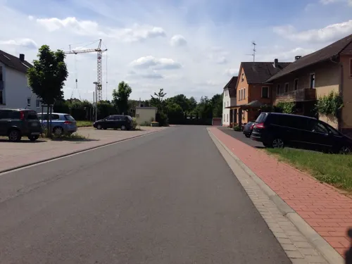
Zum Hahnenkamm
Restaurant · Regional · 3.0 km
"Bis auf weiteres Samstags geschlossen" 12.01.2013
5 Cornillstraße, Alzenau
Mo, Fr-Su, PH 16:00+; We-Th 14:00+
"Restaurant Poseidon" Zum Schützenhaus
Restaurant · Greek · 4.5 km
46 Goethestraße, Kahl am Main
Tu-Sa 12:00-15:00,17:00-23:00; Su,PH 12:00-22:00

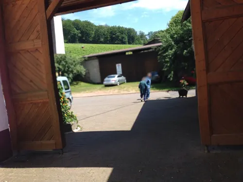
Landgasthof "Zur Rose"
Restaurant · German · 6.5 km
12 Womburgstraße
Tu-Sa 16:30-21:30; Mo closed; Su 11:30-14:00,17:00-21:00
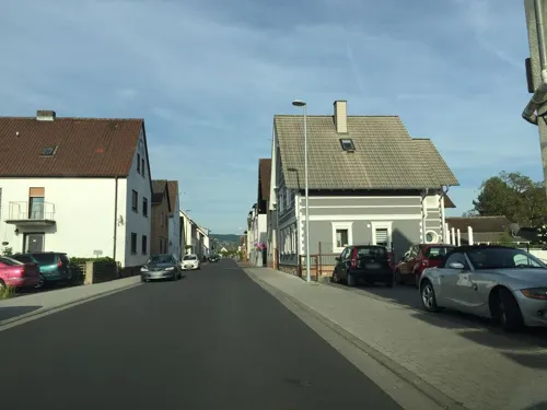


Pizzeria Ristorante Da Pino
Restaurant · Italian · 5.8 km
64 Hauptstraße, Karlstein am Main
Mo 11:00-13:45,17:00-22:30; Tu 11:00-14:00,17:00-23:00; We-Su...
147 more on the map.
History
The area was settled quite early on. There are traces of settlement and graves from Hallstatt times (Iron Age), graves from the Beaker culture (2600 BC) and crematory graves from the Old Urnfield times (about 1000 BC).
In 950 the municipality of Wilmundsheim on the Kahl's left bank had its first documentary mention.
In the 12th century, the Freigericht (“Free Court”) was established by Emperor Friedrich Barbarossa comprising the settlements of Wildmundsheim, Hörstein, Mömbris and Somborn and it was excused taxes and obligatory service. The twigs in the town's coat of arms symbolize this heritage. The Märker, as the townsmen sometimes called themselves, had to defend their autonomy against local noble families’ ambitions; these included the Rannenbergs and the Rienecks, and further pressures came from the Archbishops of Mainz.
These last built Alzenau Castle (Burg Alzenau) on the Kahl's right bank, across from Wilmundsheim, between 1395 and 1399 to protect their local holdings. In 1401, the settlement below this castle was granted town and market rights by King Ruprecht of the Palatinate, although these could not be realized. A few years later, the old centre of Wilmundsheim was destroyed and it was melded with the settlement across the Kahl, whereupon it also took the castle's name.
From the History section of Alzenau on Wikipedia, under CC BY-SA 4.0.
Where to stay22
Churches and places of worship39
Kapelle St. Wendelin
Church · Roman Catholic · 5.6 km
21 Wendelinusstraße, Mömbris
Kuratiekirche St Philippus und Jakobus
Church · Catholic · 4.8 km
52 Freigerichter Straße, Alzenau
Shopping35
Gas and EV charging14
Schools, colleges and libraries20
Bischof-Dr.-Christian-Schreiber-Schule
School · 6.3 km
21 Am Weißen Stein, Freigericht
Healthcare16
Marien Apotheke
Clinic and pharmacy · 5.7 km
19 Hahnenkammstraße, Karlstein am Main
Map of Alzenau in Unterfranken
250 places. The map loads OpenStreetMap tiles when you open it.
Getting there and nearby towns
Frankfurt Airport (FRA) is the nearest airport with scheduled flights listed in OpenStreetMap, 38 km away.
- Rodenbach 7 km north, about 7 min by car
- Mömbris 7 km east, about 7 min by car
- Langenselbold 10 km north, about 10 min by car
- Erlensee 10 km northwest, about 10 min by car
- Goldbach 13 km southeast, about 13 min by car
- Aschaffenburg 14 km southeast, about 14 min by car
- Hösbach 14 km southeast, about 14 min by car
- Großostheim 19 km south, about 19 min by car
- Offenbach 21 km west, about 21 min by car
- Frankfurt am Main 27 km west, about 27 min by car
Drive times are estimates from straight-line distance, not routes.
Local news
Headlines from INDB.
Reviews, tips and questions
Loading what members have shared...
Sources and licences
- GeoNames (CC BY 4.0): population, coordinates, regions and time zone
- Mapillary (see each image): photos
- OpenStreetMap contributors (ODbL 1.0): places, airports, map data
- Wikidata (CC0 1.0): elevation, founding date, time zone, website
- Wikimedia Commons (see each image): photos
- Wikipedia (CC BY-SA 4.0): overview and history text
Photo credits
- Alzenau - Burg Alzenau - 2360, Sven Teschke , Büdingen, CC BY-SA 3.0 de
- Villa Messmer, Alzenau (Außenansicht), BenTisch, CC BY-SA 3.0
- Alzenau Justinuskirche, Gabriele Delhey, CC BY-SA 3.0
- Hahnenkamm4, Freak-Line-Community, CC BY-SA 3.0
- Heidkopf2, Freak-Line-Community, CC BY-SA 3.0
- Schanzenkopf3, Freak-Line-Community, CC BY-SA 3.0
- Spessart-Gymnasium Alzenau, Freak-Line-Community, CC BY-SA 4.0
- Stempelhöhe, Freak-Line-Community, CC BY-SA 3.0
- Antoniusgrotte (Alzenau), Freak-Line-Community, CC BY-SA 3.0
- Altenmarkskopf, Freak-Line-Community, CC BY-SA 4.0
- Scharfenstein (Spessart), Freak-Line-Community, CC BY-SA 4.0
- Bauersberg, Freak-Line-Community, CC BY-SA 3.0
- Alzenau-Michelbach, Laurentiuskirche (02), Prof. emeritus Hans Schneider (Geyersberg), CC BY-SA 3.0
- Rabengrundkopf, Freak-Line-Community, CC BY-SA 4.0
- Hörstein Mömbriser Straße (03), Prof. emeritus Hans Schneider (Geyersberg), CC BY 3.0
- Alzenau Albstadt Kirche 1, Prof. emeritus Hans Schneider (Geyersberg), CC BY-SA 3.0
- Alzenau-Wasserlos - St.-Katharina-Kirche, Sven Teschke , Büdingen, CC BY-SA 3.0 de
- Großwelzheim Kirche (01), Prof. emeritus Hans Schneider (Geyersberg), CC BY 4.0
- Backofen Alzenauer Straße, Freak-Line-Community, CC BY-SA 3.0
- Niederrodenbacher Steinbrüche, Stephan Merkel, CC BY-SA 4.0
- Naturschutzgebiet Schifflache bei Großauheim 07, Benedikt Behnke, CC BY-SA 4.0
- Franziskanergymnasium Kreuzburg, Franz Dreier, CC BY-SA 4.0
- Mainflingen St Kilian, E-W, CC BY-SA 3.0
- Nebenstraße 20, Pfarrkirche St. Laurentius, von Süden Großkrotzenburg 20230402 0106, Tilman2007, CC BY-SA 4.0
- Bunker 145 Michelbach (4), Freak-Line-Community, CC BY-SA 4.0
- Bunker 146 Michelbach (8), Freak-Line-Community, CC BY-SA 4.0
- Bunker 147 Michelbach, Freak-Line-Community, CC BY-SA 4.0
- Bunker 148 Wasserlos (2), Freak-Line-Community, CC BY-SA 4.0
- Bunker 149 Wasserlos, Freak-Line-Community, CC BY-SA 4.0
- Bunker 150 Wasserlos (2), Freak-Line-Community, CC BY-SA 4.0
- Bunker 151 Wasserlos, Freak-Line-Community, CC BY-SA 4.0
- Alzenauer Sande Neufeld, Freak-Line-Community, CC BY-SA 3.0
- Gustavsee2, Freak-Line-Community, CC BY-SA 3.0
- Kahl Bahnhofstr 14 church, KaiBorgeest, CC BY-SA 4.0
- Brücken Wendelinuskapelle, Gabriele Delhey, CC BY-SA 3.0
- Karte Deutsche Westbefestigungen vor Westwall, K. Jähne, Public domain
- Alzenau Brentanostraße (02), Prof. emeritus Hans Schneider (Geyersberg), CC BY 3.0
- Niedersteinbach und Brücken um 1850, Freak-Line-Community, CC BY-SA 3.0
- Schifflache1, Freak-Line-Community, CC BY-SA 3.0
- Einfallsgraben, Freak-Line-Community, CC BY-SA 4.0
- 2014-32 Stehling 02p-026 Trages Schloss, Henson ( Diskussion ), CC BY-SA 3.0 de
- Energiepark (Alzenau), Freak-Line-Community, CC BY-SA 4.0
- Röhrenrutsche Generationenpark Alzenau, Freak-Line-Community, CC BY-SA 4.0
- Street-level photo, flidolin, CC BY-SA 4.0
- Street-level photo, troher15, CC BY-SA 4.0
- Street-level photo, flidolin, CC BY-SA 4.0
- Street-level photo, m_groebs, CC BY-SA 4.0
- Street-level photo, m_groebs, CC BY-SA 4.0
- Street-level photo, ramap, CC BY-SA 4.0
- Street-level photo, m_groebs, CC BY-SA 4.0
- Street-level photo, ziltoidium, CC BY-SA 4.0
- Street-level photo, mfa, CC BY-SA 4.0
- Street-level photo, flidolin, CC BY-SA 4.0


Page built November 8, 2026. Spotted a mistake? Tell us or suggest a place.