


Hanau am Main, Germany
Hanau
Hanau am Main is a town of 88,648 people in Hesse, Germany.
Why visit Hanau am Main
Townapedia lists 64 museums and landmarks, 61 parks and trails, 256 places to eat, 17 places to stay and 7 attractions in and around town.
Highlights include Amphitheater im Schlosspark Phillipsruhe, German Goldsmiths´ House, GrimmsMärchenReich and Heinrich-Fischer-Bad.
Weather in Hanau am Main
Forecast from MET Norway (CC BY 4.0). Full forecast
About Hanau am Main
Hanau (German pronunciation: [ˈhaːnaʊ] ) is a city in Hesse, Germany. It is 25 km east of Frankfurt am Main and part of the Frankfurt Rhine-Main Metropolitan Region. Its railway station is a major junction and it has a port on the river Main, making it an important transport centre. The city is known for being the birthplace of Jakob and Wilhelm Grimm and Franciscus Sylvius.
From the Wikipedia article Hanau (this version), under CC BY-SA 4.0.
Travel tips from other travellers: Hanau am Main on Wikivoyage (CC BY-SA 4.0).
Photos of Hanau am Main


Things to do7



Museums and landmarks64


Historisches Museum Hanau Schloss Philippsruhe
Museum · 1.7 km
45 Philippsruher Allee, Hanau
Tu-Su 11:00-18:00


Ehrensäule
Monument and historic site · 1.3 km
Ehemaliger Wegweiser aus dem Jahr 1775

Museum Schloss Steinheim
Museum · 2.8 km
9 Schloßstraße, Hanau
Sa, Su 11:00-17:00


Schloss Philippsruhe
Monument and historic site · 1.7 km
45 Philippsruher Allee, Hanau

Wasserturm der historischen gräflichen Wasserkunst
Monument and historic site · 1.1 km
34 Philippsruher Allee, Hanau


Hagen castle
Monument and historic site
Archaeological site in Hesse, Germany
52 more on the map.
Parks, trails and playgrounds61


Amerikafeld und Schindkaute bei Steinheim
Hiking and trails · 3.2 km




Golf Club Hanau-Wilhelmsbad
Golf course · 2.3 km
1a Franz-Ludwig-von-Cancrin-Weg, Hanau
Mar Tu-Su 09:00-17:00; Apr Mo-Su 09:00-17:00; May-Oct Mo-Th...

Stammesheim Wildwasser
Park · 1.5 km
Das Vereinsheim der Hanauer Pfadfinder vom Stamm Wildwasser (BdP) mit seinem riesigen Aussengelände. Weitere Infos auf der Webseite
90 Frankfurter Landstraße, Hanau

49 more on the map.
Restaurants and cafes256
Café Huttenhof
Cafe · Ice Cream, Coffee Shop, German · 3.1 km
3 Hans-Sachs-Straße, Hanau
Tu-Sa 09:00-18:00, Su 10:30-18:00
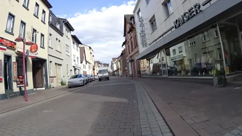
Dalin Döner und Pizza
Restaurant · Fast Food, Pizza, Noodle, Burger, Sandwich, Salad · 3.7 km
44 Hauptstraße, Hanau
Mo,We-Su 11:00-21:30
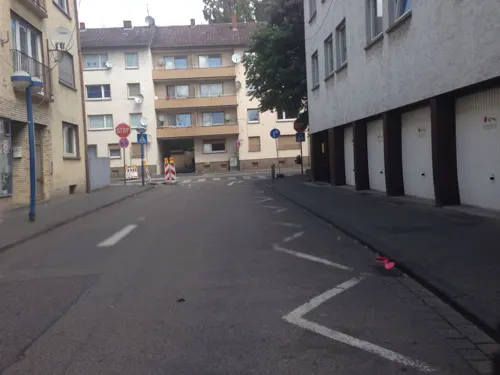
Delphi
Restaurant · Greek
17 Mühlstraße, Hanau
Mo,We-Sa 11:30-14:30,17:30-22:30; Su 11:30-14:30,17:30-22:00
Emma's Steakhaus Hanau
Restaurant · Steak House · 1.5 km
17 Jakob-Rullmann-Straße, Hanau
Mo-Sa 17:30-23:00
Hanauer Bub
Restaurant · Regional · 1.5 km
61 Buchenweg, Hanau
We-Fr 12:00-14:30,17:00-22:00; Sa 16:00-22:00; Su 10:00-15:00; Mo,Tu off
Hofbrauhaus
Restaurant · German · 3.1 km
6 Brauhausstraße, Hanau
May-Sep: Fr-We 11:30-14:00,17:30-23:00; Oct-Apr: Mo-We,Fr,Sa...

Gaststätte Anker
Restaurant · German · 1.4 km
1 Ankergasse, Hanau
Tu-Sa 17:00-22:00; Su 11:30-14:00, 17:00-21:00

244 more on the map.
History
Hanau was first mentioned as a settlement in 1143. It was the site of a castle that used the river Kinzig as a defense. The castle belonged to a noble family that began calling themselves "of Hanau" in the 13th century. A village developed around the castle and it became a town in 1303. As a result of this history, Hanau's main church stood outside its walls in the village of Kinzdorf. The villagers moved into Hanau and Kinzdorf became an abandoned village, leaving only the church. In the 15th century the status of the Hanau parish church was transferred to the church of Mary Magdalene within the town walls.
Shortly after the first town walls were built at the beginning of the 14th century, the town outgrew this limit. Outside the wall, along the road to Frankfurt am Main, a settlement developed (the Vorstadt) that was properly included in the fortifications of Hanau only when Hanau received completely new Renaissance-style fortifications during the first half of the 16th century. These fortifications enclosed three elements: the medieval castle, the town of Hanau, and the Vorstadt.
Read more of the history
In 1597 Count Philipp Ludwig II attracted French Protestant (Huguenots) refugees, who had been admitted to Frankfurt but had only very limited accommodation, to found their own settlement south of Hanau. This happened under the direction of the guardian of the Hanau count, Johann VI von Nassau-Dillenburg, who hoped for significant economic and cultural advances from the settlement of the 'Réfugiés' from south-west France. In return for the assurance of free exercise of their religion, the refugees undertook to become economically active in Hanau. Out of this tradition, goldsmiths are still trained in Hanau. Hanau also was the site of the first workshop to produce faïence (tin-glazed pottery) within Germany. These new citizens were granted privileges and formed their own community, church and administration for the "new town of Hanau" (Neustadt Hanau) wholly separate from the existing community. A stark contrast to the Catholic Church, but also to the Lutheran Church of the time, was the participation of laypeople in church-governing functions, as well as the design of the church, especially the decalogues (boards displaying the Ten Commandments). Each congregation was led by a Consistoire, elected by congregation members for life, which is roughly comparable to today's church council. The descendants of the French Reformed religious refugees have assimilated in Hanau over time.
In contrast to the Huguenots, Walloon and Dutch Calvinist refugees came from an area of what is now the Netherlands, Belgium, and the French Département Nord at the time of Spanish rule, the Spanish Netherlands. With the arrival of the Huguenots, Walloons and Dutch, Hanau's rise to an important business location began. Until 1821, the new town had its own independent community, independent of the old town. The Reformed Walloon-Dutch community still exists today.
Philipp Ludwig II also allowed Jews to settle in Hanau. From 1604 there was a Jewish community again.
It took more than 200 years to amalgamate both. The new town, larger than the old one, was protected by a then very modern fortification in Baroque style, which proved a big asset only a few years later in the Thirty Years' War. The town survived a siege in 1637 with only minor damage.
The new citizens formed the major economic and political power within the County of Hanau and in 1642 played a leading role in the succession of Count Fredrik Casimir of Hanau Lichtenberg into the County of Hanau-Münzenberg, of which Hanau was the capital.
During the Thirty Years' War Hanau was taken by the Swedes in 1631. In 1636 it was besieged by imperial troops but was relieved on the 13 June by William V, Landgrave of Hesse-Kassel, on account of which the inhabitants commemorate that day.
Johann Reinhard III of Hanau-Lichtenberg, the last of the Counts of Hanau, died in 1736. Those parts of his county belonging to the County of Hanau-Münzenberg, which included Hanau, were inherited by the Landgrave of Hesse-Kassel. Due to dynastic troubles within his family, the County of Hesse-Hanau was created a separate state from the Landgraviate until 1786. So Hanau remained the capital for another 50 years. Even after that it became the second-most important town in Hesse-Kassel, after Kassel.
During the Napoleonic Wars, Napoleon I ordered the fortifications of Hanau destroyed. This created a chance for both parts of the town to expand across their former limits. In 1813, the Battle of Hanau took place near the city between French troops and Austro-Bavarian forces; the former won. During the 1820s the administrations of both towns of Hanau merged. The first common mayor, who became lord mayor (Oberbürgermeister), was Bernhard Eberhard. He became prime minister and minister of the interior of the Electorate of Hesse after the Revolution of 1848.
With its preindustrial workshops, Hanau became a nucleus of a heavy industrialisation during the 19th century from within the city (e.g., Heraeus) as well as from outside (e.g., Degussa and Dunlop). This was heavily supported by its development as an important railway interchange of six railway lines, most of them main lines:
1848 Hanau was a centre of the German democratic movement and contributed significantly both in 1830 and in the Revolution of 1848. As part of this movement the German Gymnastic League (Deutscher Turnerbund) was founded here in 1848. Like all of Hesse-Kassel, Hanau was annexed to Prussia in 1866 after its prince-elector took the Austrian side in the Austro-Prussian War. It remained part of Prussia until 1945.
In the late 19th century Hanau became a major garrison town. Due to its interchange of railway lines a large detachment of military railway-engineers as well as other military units were stationed here.
From the History section of Hanau on Wikipedia, under CC BY-SA 4.0.
More about Hanau am Main
Geography
The historic core of Hanau is within a semicircle of the river Kinzig that flows into the river Main just west of the city. Today, after a substantial expansion during the 19th and 20th centuries, it also extends to the river Main. After a restructuring of municipal borders within Hesse in the 1970s, a couple of nearby villages and towns were incorporated. After that change, Hanau for the first time also extended to the south bank of the Main.
On the 0 °C isotherm, Hanau has a humid continental climate as Eastern Germany with warm summer, classified by Köppen as Dfb. In the -3 °C isotherm has oceanic climate (Cfb) with some interior characteristics. Hanau is the westernmost city on the European continent below 200 m at sea level in this category.
Economy
At present, many inhabitants work for the technological group Heraeus, or commute to Frankfurt.
Multiple companies, mostly in the chemical industry, are located in the industrial park named Wolfgang, operated by Evonik Industries.
Nuclear energy company Nukem was headquartered in Hanau, with a nuclear fuel plant in its Wolfgang district, until 1988.
From the Wikipedia article Hanau, under CC BY-SA 4.0.
Notable people from Hanau am Main
 Rudi VöllerGerman footballer and managerPhoto: 9EkieraM1, CC BY-SA 3.0
 Thomas BertholdGerman footballerPhoto: Whitezombie68, CC BY-SA 3.0
 Heinrich KuhlGerman naturalist and zoologist (1797–1821)Photo: Wibowo Djatmiko ( Wie146 ), CC BY-SA 3.0
 Marie of Hesse-KasselQueen consort of Denmark and NorwayPhoto: Jens Juel, Public domain
 Franciscus SylviusDutch physician and chemist of Leyden, NetherlandsPhoto: Rijksmuseum, CC0
- Jacob GrimmGerman philologist, linguist, jurist and mythologist (1785–1863)
- Wilhelm GrimmGerman author, philologist, collector of fairy tales and legends (1786–1859)
- Paul HindemithGerman composer (1895–1963)
- Mërgim MavrajAlbanian footballer
- William II of Hesse-KasselElector of Hesse
- Frederick William, Elector of Hesselast Elector of Hesse-Kassel
- Tayfur HavutçuTurkish association football player (born 1970)
Born in Hanau am Main, according to Wikidata (CC0). Each name links to its Wikipedia article.
Where to stay17
Churches and places of worship36
Gustav-Adolf-Kirche
Church · Lutheran · 3.4 km
17 Paul-Gerhardt-Straße, Hanau
Friedenskirche
Church · Protestant · 1.5 km
48 Philippsruher Allee, Hanau
Shopping65
Gas and EV charging19
Schools, colleges and libraries30
Healthcare26
Map of Hanau am Main
250 places. The map loads OpenStreetMap tiles when you open it.
Getting there and nearby towns
Frankfurt Airport (FRA) is the nearest airport with scheduled flights listed in OpenStreetMap, 29 km away.
- Bruchköbel 5 km north, about 5 min by car
- Erlensee 6 km northeast, about 6 min by car
- Maintal 6 km west, about 6 min by car
- Mühlheim am Main 6 km west, about 6 min by car
- Großkrotzenburg 8 km southeast, about 8 min by car
- Obertshausen 8 km southwest, about 8 min by car
- Rodenbach 9 km east, about 9 min by car
- Kahl am Main 10 km southeast, about 10 min by car
- Langenselbold 10 km northeast, about 10 min by car
- Offenbach 11 km west, about 11 min by car
Drive times are estimates from straight-line distance, not routes.
Towns near Hanau am Main


Keep exploring
Local news
Headlines from INDB.
Reviews, tips and questions
Loading what members have shared...
Sources and licences
- GeoNames (CC BY 4.0): population, coordinates, regions and time zone
- Mapillary (see each image): photos
- OpenStreetMap contributors (ODbL 1.0): places, airports, map data
- Wikidata (CC0 1.0): elevation, founding date, time zone, website, landmarks and historic places
- Wikimedia Commons (see each image): photos
- Wikipedia (CC BY-SA 4.0): overview and history text
Photo credits
- Hanau Bruder Grimm, Unknown author, Public domain
- Town Hall and market place HANAU am Main - panoramio, Frankie Perussault, CC BY-SA 3.0
- Town center HANAU am Main - panoramio, Frankie Perussault, CC BY-SA 3.0
- Hanau Stadtschloss Woerishoffer1, Carl Wilhelm Woerishoffer, Public domain
- Zeichenakademie Hanau, Hans-Michael Kissel, CC BY-SA 3.0
- Bahnbetriebswerk Hanau, Florian Hahn, CC BY-SA 3.0
- Schloss Philippsruhe (Westseite), Jörg Braukmann, CC BY-SA 4.0
- Herbert-Dröse-Stadion-Haupttribuene, Christopher Voitus, CC BY-SA 3.0
- Christuskirche-hanau001, dontworry, CC BY-SA 3.0
- Altstädter Rathaus, Jörg Braukmann, CC BY-SA 4.0
- Hanau-Kesselstadt evangelische Friedenskirche 20101209, Rudolf Stricker, Attribution
- Neue Johanneskirche HU, Reinhard Dietrich, CC0
- Schloss Steinheim Wohngebaeude02, Lumpeseggl, CC BY-SA 3.0
- Lutherkirche HU-Wolfgang 1, E-W, CC BY-SA 4.0
- Gaulschule, Bardo, CC BY-SA 3.0
- Dietesheim Oberwaldsee 3, E-W, CC BY-SA 3.0
- Bismarckturm (Hanau)-01, Muck, CC BY-SA 4.0
- Hanau (20), Schildkröte92, CC BY-SA 4.0
- Amerikafeld und Schindkaute bei Steinheim C, KaiBorgeest, CC BY-SA 4.0
- GrimmsMärchenReich Eröffnung (1), Bodow, CC BY-SA 4.0
- Großauheim 10.4.2011 GustavAdolf3, El. -(Bardo), CC BY-SA 3.0
- Großauheim Paulskirche 20110128, Rudolf Stricker, Attribution
- Hanau Pumpstation, David Liuzzo, CC BY-SA 3.0
- Hanau Ehrensäule, Harald Gärtner, CC BY-SA 3.0
- Frankfurter Tor (Hanau)1, Reinhard Dietrich, CC BY-SA 3.0
- Zeichenakademie Hanau 1, Reinhard Dietrich, CC BY-SA 4.0
- Hanau-Kesselstadt Schloss Philippsruhe 20101209, Rudolf Stricker, Attribution
- Friedenskirche-hanau001, dontworry, CC BY-SA 3.0
- 6 Schwäne und Schwester 2, Reinhard Dietrich, CC BY-SA 4.0
- Entwurf Ausbau Hanau 1597 bunt, Nicolas Gillet ?, Public domain
- Hanau 2 De Merian Hassiae, Unknown author, Public domain
- Hessisches Puppenmuseum außen, Hessisches Puppenmuseum, CC0
- Hanau Heinrich Fischer Bad 2015 01, Lumpeseggl, CC BY-SA 3.0
- Hanau Paul-Gerhardt-Schule 08, E-W, CC BY-SA 4.0
- Naturschutzgebiet Oberwaldsee bei Dietesheim, Plenz, CC BY-SA 4.0
- Klinikum Hanau, 1, Hanau, Main-Kinzig-Kreis, GeorgDerReisende, CC BY-SA 4.0
- GrimmsMärchenReich Eröffnung (3), Bodow, CC BY-SA 4.0
- G-adolf-kirche, Bardo, CC BY-SA 3.0
- Hanau Mariae Namen vorn 20101119, Rudolf Stricker, Attribution
- Hanau Mariae Namen 20101119, Rudolf Stricker, Attribution
- Hanau-Wilhelmsbad - Comoedienhaus - 8466, Sven Teschke , Büdingen, CC BY-SA 3.0 de
- Street-level photo, flidolin, CC BY-SA 4.0
- Street-level photo, flidolin, CC BY-SA 4.0
- Street-level photo, flidolin, CC BY-SA 4.0
- Street-level photo, flidolin, CC BY-SA 4.0
- Street-level photo, flidolin, CC BY-SA 4.0
- Street-level photo, flidolin, CC BY-SA 4.0
- Street-level photo, ramap, CC BY-SA 4.0
- Street-level photo, flidolin, CC BY-SA 4.0
- Street-level photo, flidolin, CC BY-SA 4.0
- Street-level photo, ramap, CC BY-SA 4.0
- Street-level photo, flidolin, CC BY-SA 4.0
- Street-level photo, flidolin, CC BY-SA 4.0
- Street-level photo, flidolin, CC BY-SA 4.0
- Street-level photo, flidolin, CC BY-SA 4.0
- Street-level photo, flidolin, CC BY-SA 4.0
- Street-level photo, flidolin, CC BY-SA 4.0
- Street-level photo, flidolin, CC BY-SA 4.0
- Street-level photo, flidolin, CC BY-SA 4.0
- Street-level photo, flidolin, CC BY-SA 4.0
- Street-level photo, flidolin, CC BY-SA 4.0
- Street-level photo, flidolin, CC BY-SA 4.0
- Street-level photo, flidolin, CC BY-SA 4.0
- Street-level photo, flidolin, CC BY-SA 4.0
- Street-level photo, flidolin, CC BY-SA 4.0
- Street-level photo, flidolin, CC BY-SA 4.0
- Street-level photo, flidolin, CC BY-SA 4.0
- Street-level photo, flidolin, CC BY-SA 4.0
- Street-level photo, flidolin, CC BY-SA 4.0
- Street-level photo, flidolin, CC BY-SA 4.0


Page built November 9, 2026. Spotted a mistake? Tell us or suggest a place.