


Lüdinghausen, Germany
Lüdinghausen is a town of 24,094 people in North Rhine-Westphalia, Germany.
Why visit Lüdinghausen
Townapedia lists 107 museums and landmarks, 84 parks and trails, 167 places to eat, 33 places to stay and 19 attractions in and around town.
Highlights include Dinkelhof, Hof Balster, Haus Kakesbeck and Schloß Senden.
Weather in Lüdinghausen
Forecast from MET Norway (CC BY 4.0). Full forecast
About Lüdinghausen
Lüdinghausen (German pronunciation: [lyːdɪŋˈhaʊzn̩] ; Westphalian: Lünkhusen or Lünksel) is a town in district of Coesfeld in the state of North Rhine-Westphalia, Germany. It is located on the Dortmund-Ems Canal, approx. 25 km south-west of Münster.
From the Wikipedia article Lüdinghausen (this version), under CC BY-SA 4.0.
Travel tips from other travellers: Lüdinghausen on Wikivoyage (CC BY-SA 4.0).
Things to do19

Dinkelhof
Farm and orchard · 2.9 km
Dinkelprodukte und Naturkost nach Hildegard von Bingen
4 Elvert, Lüdinghausen
We,Th 15:00-18:00; Fr 09:00-12:00,15:00-18:00; Sa 10:00-16:00

Kleine Auszeit
Farm and orchard · 2.9 km
Pausenhäuschen mit Getränken, Kaffee, Dinkel-Cookies und Eis, Saisonales Gemüse und Eier, Selbstbedienung
Apr-Oct: 10:00-18:00
7 more on the map.
Museums and landmarks107


Burg Wolfsberg
Monument and historic site
Letztes Gebäude der ehemaligen Burg Wolfsberg
8 Wolfsberger Straße


Burg Botzlar
Monument and historic site · 8.8 km
3 Botzlarstraße, Selm

Lüdinghausen Castle
Monument and historic site
14 Amthaus, Lüdinghausen


95 more on the map.
Parks, trails and playgrounds84



72 more on the map.
Restaurants and cafes167

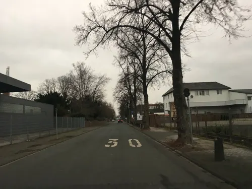
Barbecue Restaurant
Restaurant · Asian · 0.9 km
4 Bahnhofstraße, Lüdinghausen
Tu-Sa 17:00-22:30; Su 12:00-21:30; PH 12:00-23:00
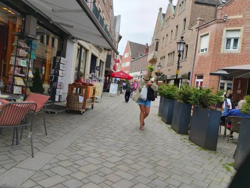
Cafe Indigo
Cafe · German · 1.6 km
7 Berenbrock, Lüdinghausen
Tu,Th,Sa,Su 11:30-19:00; We 09:00-19:00; Mo,Fr off
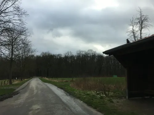
Kleines Cafe am Bauerngolfplatz
Cafe · Ice Cream, Cake, Coffee Shop · 3.8 km
6 Bechtrup, Lüdinghausen
Fr-Su 13:00-17:00
Leo's by Gino
Restaurant · Pizza · 7.9 km
37 Bilholtstraße, Olfen
Mo-Th 12:00-22:00; Fr-Sa 12:00-23:00; Su 12:00-22:00
Restaurant Olympia
Restaurant · Greek · 7.1 km
1 Olfener Straße, Selm
Mo,We-Sa 17:00-23:00; Su 12:00-14:30,17:00-23:00; PH...

Rimini
Restaurant · Italian
6 Freiheit Wolfsberg, Lüdinghausen
Tu-Fr 12:00-14:30,17:00-22:00;Sa 17:00-22:00;Su,PH 12:00-22:00



155 more on the map.
History
Lüdinghausen was founded in the thirteenth century and received its first city charter around 1308. On the first of january 1975 Seppenrade was officially designated as a district of Lüdinghausen.
From the History section of Lüdinghausen on Wikipedia, under CC BY-SA 4.0.
Where to stay33
Churches and places of worship26
Johannes-von-Nepomuk-Kapelle
Church · 6.8 km
21 Schloßstraße, Nordkirchen
Pfarrkirche St. Georg
Church · Catholic · 8.2 km
34 Neustraße, Dülmen
St. Mauritius
Church · Roman Catholic · 6.6 km
1 Mauritiusplatz, Nordkirchen
Shopping54
Gas and EV charging18
Schools, colleges and libraries31
Healthcare13
Map of Lüdinghausen
250 places. The map loads OpenStreetMap tiles when you open it.
Getting there and nearby towns
Dortmund Airport (DTM) is the nearest airport with scheduled flights listed in OpenStreetMap, 30 km away.
- Nordkirchen 6 km southeast, about 6 min by car
- Selm 8 km south, about 8 min by car
- Olfen 8 km southwest, about 8 min by car
- Waltrop 17 km south, about 17 min by car
- Lünen 18 km south, about 18 min by car
- Werne 17 km southeast, about 17 min by car
- Oer-Erkenschwick 19 km southwest, about 19 min by car
- Nottuln 19 km north, about 19 min by car
- Münster 25 km northeast, about 25 min by car
- Recklinghausen 24 km southwest, about 24 min by car
Drive times are estimates from straight-line distance, not routes.
Local news
Headlines from INDB.
Reviews, tips and questions
Loading what members have shared...
Sources and licences
- GeoNames (CC BY 4.0): population, coordinates, regions and time zone
- Mapillary (see each image): photos
- OpenStreetMap contributors (ODbL 1.0): places, airports, map data
- Wikidata (CC0 1.0): elevation, founding date, time zone, website, landmarks and historic places
- Wikimedia Commons (see each image): photos
- Wikipedia (CC BY-SA 4.0): overview and history text
Photo credits
- Lüdinghausen, Ortsansicht -- 2014 -- 7298, Dietmar Rabich, CC BY-SA 4.0
- Burg Vischering Lüdinghausen, Dirk Frerichmann, CC BY-SA 3.0 de
- Selm Burg Botzlar, Unknown author, CC BY-SA 3.0
- 20140412 120702 Burg Kakesbeck (DSC00181), Günter Seggebäing, Coesfeld, CC BY-SA 3.0
- 20140412 120558 Burg Lüdinghausen (DSC00174), Günter Seggebäing, Coesfeld, CC BY-SA 3.0
- Lüdinghausen Burg Wolfsberg, Stahlkocher, CC BY-SA 3.0
- Lüdinghausen, Gymnasium Canisianum -- 2016 -- 3648, Dietmar Rabich, CC BY-SA 4.0
- 20140601 134700 Schloss Sandfort, Olfen (DSC02384), Günter Seggebäing, Coesfeld, CC BY-SA 3.0
- Olfen St. Vitus, Raenmaen, CC BY-SA 3.0
- Nordkirchen-Kapelle-0003, Mbdortmund, CC BY-SA 3.0
- Senden, Schloss Senden -- 2014 -- 7329 -- Ausschnitt, Dietmar Rabich, CC BY-SA 4.0
- Seppenrade, St.-Dionysius-Kirche -- 2013 -- 2841, Dietmar Rabich, CC BY-SA 4.0
- Lüdinghausen, St.-Felizitas-Kirche -- 2014 -- 1736, Dietmar Rabich, CC BY-SA 4.0
- Hiddingsel, St.-Georg-Kirche -- 2013 -- 2769, Dietmar Rabich, CC BY-SA 4.0
- Nordkirchen-Schloss-0021, Mbdortmund, CC BY-SA 3.0
- St. Pankratius Südkirchen, Kühlungsborn, CC BY-SA 3.0
- 20140601 140301 Naturschutzgebiet Hochmoor Borkenberge, Lüdinghausen (DSC02441), Günter Seggebäing, Coesfeld, CC BY-SA 3.0
- 20140412 120159 Burg Vischering (DSC00153), Günter Seggebäing, Coesfeld, CC BY-SA 3.0
- Ev Auferstehungskirche Seppenrade 2019-02-23, Dr. W. Strickling, CC BY-SA 4.0
- 20140412 120735 Burg Kakesbeck (DSC00187), Günter Seggebäing, Coesfeld, CC BY-SA 3.0
- Felizitas10000, Joerg Strotmann, CC BY-SA 3.0
- Nordkirchen-100415-12386-Nepomuk, Mbdortmund, GFDL 1.2
- Schloss Sandfort Sammlung Duncker, C. Hohe, Alexander Duncker (1813-1897), Public domain
- Hiddingsel02, Markus Schweiss, CC BY-SA 3.0
- Senden, Monument 01-01, St. Urbanus, Ottmarsbocholt 2020-03-28-4710, W.Strickling, CC BY-SA 4.0
- Lüdinghausen, Evangelische Kirche -- 2016 -- 3660, Dietmar Rabich, CC BY-SA 4.0
- Brücke über den Gorbach, Gmbo 2013, CC0
- Street-level photo, descilla, CC BY-SA 4.0
- Street-level photo, chateaureblaus, CC BY-SA 4.0
- Street-level photo, descilla, CC BY-SA 4.0
- Street-level photo, mfa, CC BY-SA 4.0
- Street-level photo, descilla, CC BY-SA 4.0
- Street-level photo, descilla, CC BY-SA 4.0
- Street-level photo, descilla, CC BY-SA 4.0
- Street-level photo, awaya, CC BY-SA 4.0
- Street-level photo, chateaureblaus, CC BY-SA 4.0
- Street-level photo, descilla, CC BY-SA 4.0
- Street-level photo, descilla, CC BY-SA 4.0
- Street-level photo, derlipper, CC BY-SA 4.0
- Street-level photo, descilla, CC BY-SA 4.0
- Street-level photo, descilla, CC BY-SA 4.0
- Street-level photo, descilla, CC BY-SA 4.0
- Street-level photo, descilla, CC BY-SA 4.0
- Street-level photo, descilla, CC BY-SA 4.0
- Street-level photo, descilla, CC BY-SA 4.0
- Street-level photo, chateaureblaus, CC BY-SA 4.0
- Street-level photo, changchun1, CC BY-SA 4.0
- Street-level photo, descilla, CC BY-SA 4.0
- Street-level photo, awaya, CC BY-SA 4.0
- Street-level photo, descilla, CC BY-SA 4.0
- Street-level photo, awaya, CC BY-SA 4.0
- Street-level photo, descilla, CC BY-SA 4.0
- Street-level photo, chateaureblaus, CC BY-SA 4.0
- Street-level photo, chateaureblaus, CC BY-SA 4.0
- Street-level photo, peewee32, CC BY-SA 4.0
- Street-level photo, descilla, CC BY-SA 4.0


Page built November 8, 2026. Spotted a mistake? Tell us or suggest a place.