


Why visit Werne
Townapedia lists 105 museums and landmarks, 63 parks and trails, 141 places to eat, 21 places to stay and 27 attractions in and around town.
Highlights include Biohof Schulze Wethmar, Capitol Cinema Center Werne, Stadtmuseum and Haus Reck.
Weather in Werne
Forecast from MET Norway (CC BY 4.0). Full forecast
About Werne
Werne an der Lippe (German pronunciation: [ˈvɛʁnə] ; Westphalian: Wäen) is a town in the Federal state of North Rhine-Westphalia in the Unna district in Germany. It is located on the southern edge of the Münsterland region near the Ruhrgebiet. The population of Werne was about 30,000 in 2024.
From the Wikipedia article Werne (this version), under CC BY-SA 4.0.
Photos of Werne


Things to do27


Hof Brüggemann
Farm and orchard · 6.1 km
Mo,We,Fr 09:00-13:00; Tu,Th 15:00-18:00; Sa 08:00-13:00
La Lando de Alpaca
Farm and orchard · 5.7 km
4 Langenbrock, Nordkirchen
Th 15:00-17:00; "Sowie nach Vereinbarung"


15 more on the map.
Museums and landmarks105


Kulturzentrum Schacht III
Monument and historic site · 2.8 km
7 Zum Schacht III, Bergkamen



93 more on the map.
Parks, trails and playgrounds63



Feuchtgebietskomplex zwischen Landwehrstraße und Datteln-Hamm-Kanal
Hiking and trails · 3.9 km

51 more on the map.
Restaurants and cafes141
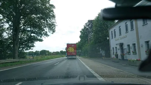
Galgenbach
Restaurant · International · 3.6 km
191 Lünener Straße, Werne
Tu-Fr 17:00-22:00; Sa,Su 11:30-14:30,17:00-22:00; Mo off
Buffet House
Restaurant · Asian · 6.3 km
287 Münsterstraße, Lünen
Mo,Tu,Th-Sa 12:00-15:00,17:30-22:00; Su 12:00-22:00

Restaurant am Yachthafen
Restaurant · Balkan · 2.6 km
Küche fleischlastig (deutsch-balkan, Steaks), Riesenportionen, günstig.
40 Hafenweg, Bergkamen
We-Mo 11:30-22:00; Tu off
Gate to Asia II
Restaurant · Chinese · 4.0 km
4 Urnenfeldstraße, Hamm
Tu-Sa 11:30-14:30,17:30-22:00; Su 11:30-21:00
Im Grünen Winkel
Restaurant · Regional · 2.5 km
12 Im Grünen Winkel, Werne
Mo,We-Fr 16:00-23:00; Sa,Su,PH 11:30-23:00; Tu off
La Strada
Restaurant · Italian, Pizza
37 Bonenstraße, Werne
Tu-Fr 12:00-14:00; Tu-Su 17:00-22:00; PH 17:00-22:00; Mo off
Pizzeria Da Marco
Restaurant · Pizza · 0.7 km
1 St. Johannes, Werne
Mo,We,Th 17:00-21:00; Fr-Su 17:00-22:00; Tu off

129 more on the map.
History
The first Bishop of Münster, Liudger established Werne as a parish by erecting a chapel in the southern parts of the Dreingau ("in pago dreginni"). He acted on orders of Charlemagne who, having finally brought the region under the fold of Francia following the conclusion of the Saxon Wars, was eager to press on with Christianization. The Latin text of the oldest preserved document ("in villa quae dicitur werina"), which dates from 834 and is being kept at the Leiden University Library, indicates that by this time a village had already formed around the chapel.
Traders and peasants continued to accrete throughout the next three centuries. At some point between the years 1192 and 1195, the regional bishopric established a customs agency at Werne and put the place under its direct jurisdiction. The year 1253 found Werne in an alliance (the "Werner Bund") with the cities of Münster, Dortmund, Soest and Lippstadt to defend transit and trading rights relating to a bridge over the Lippe river. In 1470 Werne became a member of the Hanseatic League. A town hall was built from 1512 to 1561.
Read more of the history
The first moves towards a fortification of Werne date to 1302 when a trench was dug around the church; this was improved and extended to protect the entire settlement in 1383, two years before it received town privileges in 1385. After Adolph I, Duke of Cleves had burned Werne to the ground in 1400, the full fortification of the town commenced in 1415. However, this did not prevent occupation, looting and torching of the town on several occasions during the Thirty Years' War and of course it was no help at all against the Black Death, which killed 313 people (out of a population of about 1,000) in 1636 and 1637 while the war still raged. (Parts of the town wall and some of the towers were pulled down in 1779; the last town gate (the "Neutor") was demolished in 1843.)
The Peace of Westphalia, signed in 1648 at the nearby cities of Münster and Osnabrück, had essentially expelled Protestantism from the Werne region. From 1671 to 1673 the Order of Friars Minor Capuchin erected a monastery and, from 1677 to 1681, the Catholic Church. (The Martin Luther Church at the Wichernstraße dates from 1904).
Werne, which had come under the administration of Prussia in 1803 when the Prince-Bishopric of Münster had been dissolved, was attached to the Grand Duchy of Berg by Napoleon in 1806. The Congress of Vienna restored the town to Prussia which incorporated it with other territories into its Province of Westphalia. In 1831 was granted a degree of administrative independence under the Prussian municipal code of 1831.
In 1873 and 1874 the search for coal produced a brine thermal spring, and the Werne Baths were established in 1878. The actual coal mine did not commence operations before 1899; it was operated until 1975. Today the buildings of the "Zeche Werne" have been converted to public meeting places, or are part of a business park.
The railway line Münster-Werne-Dortmund was opened in 1928. It had taken a significant amount of lobbying to get Werne a railway station, which was totally refurbished in 2005.
During the war, 471 citizens of Werne died and 500 more disappeared without trace. The town accommodated nearly 4,000 refugees.
In 1967, a comprehensive urban renewal project began, which was largely completed with the official opening of the pedestrian zone in June 1982.
The new town hall, the restored old town hall, and the new fire station were completed and handed over to the public in 1973 and 1974. The hospital building on Goetheweg, still in use today, was built in 1974.
On 1 January 1975, the municipal reorganization came into effect: The district of Lüdinghausen was dissolved, Werne was assigned to the district of Unna and the administrative region of Arnsberg.
The previously independent municipality of Stockum was incorporated into Werne. The city's population increased to 25,500 with the addition of approximately 4,000 new residents from Stockum.
In 1975, the Werne coal mine closed. Before the start of the coal crisis, it had employed around 4,000 people, and most recently, 2,000.
On 19 March 1976, following a council resolution, the city dropped the suffix "a. d. Lippe" (at the Lippe) and has since been called Werne again, as had been the tradition since the Middle Ages. In 2006, a proposal to reinstate the suffix failed to gain a majority in the city council. However, the suffix "an der Lippe" is to be used primarily in tourism promotion and city marketing activities.
In 1980/81, the Karl Pollender City Museum with the city archives was opened. The city library in the Old Moormann Stone House reopened in 1983. After a complete renovation, the natural brine bath was finally reopened in 1988. In 1991, a graduation tower was built in the city park by the city lake. The old brine bath closed at the beginning of 2015. The old bath was demolished and replaced by a new building, which opened at Easter 2019.
From the History section of Werne on Wikipedia, under CC BY-SA 4.0.
More about Werne
Education
Marga-Spiegel-Schule, comprehensive school since August 2012, named after Marga Spiegel, a holocaust survivor
Kardinal-von-Galen school, catholic primary school in Werne-Stockum
Wiehagenschule, catholic primary school (also open day school)
From the Wikipedia article Werne, under CC BY-SA 4.0.
Notable people from Werne
 Wolfram KurschatGerman cross-country mountain cyclistPhoto: Frank Haug, CC BY 3.0
 Albert von MaybachGerman politician (1822-1904)Photo: Foto Ruchhöft-Plau, CC BY-SA 3.0
 Dennis SonneGerman politicianPhoto: Mike Lindaa, CC BY-SA 4.0
 Heinrich RepkeGerman painter (1877-1962)Photo: Wollmanns, CC BY-SA 4.0
- Dietrich SchwanitzGerman writer (1940-2004)
- Hans-Martin LindeGerman flutist and conductor
- Mehmet KaraTurkish association football player (born 1983)
- Lars MüllerGerman footballer
- Theodor HomannGerman football player and manager (1948-2010)
- Antonie JüngstGerman author (1843-1918)
- Hilde KaufmannGerman jurist (1920–1981)
- Carl von MünstermannGerman engineer (1843-1930)
Born in Werne, according to Wikidata (CC0). Each name links to its Wikipedia article.
Where to stay21
Churches and places of worship39
St. Elisabeth
Church · Roman Catholic · 5.2 km
2 Parkstraße, Bergkamen
Shopping51
Gas and EV charging22
Schools, colleges and libraries35
Healthcare20
Map of Werne
250 places. The map loads OpenStreetMap tiles when you open it.
Getting there and nearby towns
Dortmund Airport (DTM) is the nearest airport with scheduled flights listed in OpenStreetMap, 16 km away.
- Bergkamen 5 km south, about 5 min by car
- Kamen 8 km south, about 8 min by car
- Lünen 9 km southwest, about 9 min by car
- Bönen 12 km southeast, about 12 min by car
- Nordkirchen 11 km northwest, about 11 min by car
- Selm 12 km west, about 12 min by car
- Lanstrop 11 km southwest, about 11 min by car
- Hamm 13 km east, about 13 min by car
- Kurl-Husen 12 km south, about 12 min by car
- Ascheberg 13 km north, about 13 min by car
Drive times are estimates from straight-line distance, not routes.
Towns near Werne


Keep exploring
Local news
Headlines from INDB.
Reviews, tips and questions
Loading what members have shared...
Sources and licences
- GeoNames (CC BY 4.0): population, coordinates, regions and time zone
- Mapillary (see each image): photos
- OpenStreetMap contributors (ODbL 1.0): places, airports, map data
- Wikidata (CC0 1.0): elevation, founding date, time zone, website, landmarks and historic places
- Wikimedia Commons (see each image): photos
- Wikipedia (CC BY-SA 4.0): overview and history text
Photo credits
- Werne-Altes-Rathaus-DSC 0067, Mbdortmund, CC BY-SA 3.0
- Stolpersteine in Werne Infotafel, Gmbo 2013, CC0
- Werne Museum Wärmehäuschen, ABrocke at German Wikipedia, CC BY-SA 3.0
- Germany, Nordrhein-Westfalen, Kreis Unna, Werne, Kirchhof (3), Vincent van Zeijst, CC BY-SA 4.0
- Stolperstein Werne Bonenstraße Partnerschaftsuhr Amalia Victoria Marcus, Gmbo 2013, CC0
- Stolperstein Werne Bonenstraße Partnerschaftsuhr Charlotte Ermann, Gmbo 2013, CC0
- Stolpersteinlage Werne Bonenstraße Partnerschaftsuhr, Gmbo 2013, CC0
- Stolperstein Werne Bonenstraße Partnerschaftsuhr Wilhelm Blumenthal, Gmbo 2013, CC0
- Stolperstein Werne Bonenstraße Partnerschaftsuhr Helene Herz, Gmbo 2013, CC0
- Stolperstein Werne Bonenstraße Partnerschaftsuhr Leo Marcus, Gmbo 2013, CC0
- Stolperstein Werne Bonenstraße Partnerschaftsuhr Anni Marcus, Gmbo 2013, CC0
- Stolpersteine Werne Bonenstraße Partnerschaftsuhr, Gmbo 2013, CC0
- Stolperstein Werne Bonenstraße Partnerschaftsuhr Hans Gustav Marcus, Gmbo 2013, CC0
- Stolperstein Werne Bonenstraße Partnerschaftsuhr Josefine Blumenthal, Gmbo 2013, CC0
- Stolperstein Werne Bonenstraße Partnerschaftsuhr Sara Herz, Gmbo 2013, CC0
- Stolperstein Werne Bonenstraße Partnerschaftsuhr Walter Blumenthal, Gmbo 2013, CC0
- Stolperstein Werne Roggenmarkt 28 Julia Simons, Gmbo 2013, CC0
- Stolperstein Werne Roggenmarkt 28 Jenny Heimann, Gmbo 2013, CC0
- Stolperstein Werne Roggenmarkt 28 Rosa Simons, Gmbo 2013, CC0
- Stolperstein Werne Roggenmarkt 28 Paul Simons, Gmbo 2013, CC0
- Stolpersteine Werne Roggenmarkt 28, Gmbo 2013, CC0
- Stolperstein Werne Roggenmarkt 28 Herz Simons, Icy2008, CC0
- Stolpersteine Werne Roggenmarkt 28 NEU, Icy2008, CC0
- Werne Baudenkmal 12 Haus Kirchhof 15 2021-03-29 0381, Dr. W. Strickling, CC BY-SA 4.0
- Werne Baudenkmal 03 Haus Bonenstr. 28 2021-03-29 0378, Dr. W. Strickling, CC BY-SA 4.0
- Stolpersteinlage Werne Roggenmarkt 28, Gmbo 2013, CC0
- Werne Baudenkmal 19 Haus Roggenmarkt 8 2021-03-29 0388, Dr. W. Strickling, CC BY-SA 4.0
- Stolperstein Werne Bonenstraße 20 Cäcilie Gumpert, Gmbo 2013, CC0
- Stolpersteine Werne Bonenstraße 20, Gmbo 2013, CC0
- Stolperstein Werne Bonenstraße 20 Helena Gumpert, Gmbo 2013, CC0
- Stolperstein Werne Bonenstraße 20 Louis Gumpert, Gmbo 2013, CC0
- Stolperstein Werne Bonenstraße 20 Alwin Lippmann, Gmbo 2013, CC0
- Stolperstein Werne Bonenstraße 20 Rosel Lippmann, Gmbo 2013, CC0
- Stolperstein Werne Bonenstraße 20 Hannelore Lippmann, Gmbo 2013, CC0
- Stolperstein Werne Bonenstraße 20 Inge Lippmann, Gmbo 2013, CC0
- Stolpersteinlage Werne Bonenstraße 20, Gmbo 2013, CC0
- Germany, Nordrhein-Westfalen, Kreis Unna, Werne, Kirchhof (2), Vincent van Zeijst, CC BY-SA 4.0
- Werne Baudenkmal 38 Haus Kirchhof 3 2021-03-29 0383, Dr. W. Strickling, CC BY-SA 4.0
- Cappenberg-Stiftskirche-IMG 1201, Mbdortmund, GFDL 1.2
- Bergkamen Bummannsburg, Reinhard Hunscher, CC BY-SA 2.0 de
- Haus Reck 1, Stahlkocher, CC BY-SA 3.0
- Bergkamen Schacht 3, Reinhard Hunscher, CC BY-SA 2.0 de
- Aerial image of Cappenberg Castle (view from the south), Carsten Steger, CC BY-SA 4.0
- RüntheMarina YachtanlegerB233Brücke, NatiSythen, CC BY-SA 3.0
- Werne-070602 7611-Steinhaus, Mbdortmund, GFDL 1.2
- Werne-Christophorus-DSC 0093Kopie, Mbdortmund, CC BY-SA 3.0
- Museum Bergkamen Oberaden IMGP0497, Smial at de.wikipedia, CC BY-SA 2.0 de
- Marga-Spiegel-Sekundarschule-Gebäude, Velwark, CC BY-SA 4.0
- Oberaden 12, Christian Alexander Tietgen, CC BY 4.0
- Hermann Hertz Stolperstein, MGHI, CC BY-SA 4.0
- Amalie Hertz Stolperstein, MGHI, CC BY-SA 4.0
- Stolperstein August Kühler, MGHI, CC BY-SA 4.0
- Stolperstein Ernst Bronheim, MGHI, CC BY-SA 4.0
- Grete Hertz Stolperstein, MGHI, CC BY-SA 4.0
- Bergkamen, Beversee -- 2014 -- 8863, Dietmar Rabich, CC BY-SA 4.0
- Brauck hamm3, Cku, CC BY-SA 3.0
- Bergkamen Lippeauen, Reinhard Hunscher, CC BY-SA 2.0 de
- Lippe bei bergkamen, Tbachner, Public domain
- Tibaum Hamm4, Cku, CC BY-SA 3.0
- Schilf Teich Cappenberg MG 2690, Stefan Thiesen, CC BY-SA 3.0
- Römerpark Bergkamen Rekonstruktion Holz-Erde-Mauer 1247, Creosoph, CC0
- Street-level photo, saschahaberkorn, CC BY-SA 4.0
- Street-level photo, analuisa, CC BY-SA 4.0
- Street-level photo, analuisa, CC BY-SA 4.0
- Street-level photo, descilla, CC BY-SA 4.0
- Street-level photo, descilla, CC BY-SA 4.0
- Street-level photo, ptks, CC BY-SA 4.0
- Street-level photo, ptks, CC BY-SA 4.0
- Street-level photo, ptks, CC BY-SA 4.0
- Street-level photo, analuisa, CC BY-SA 4.0
- Street-level photo, saschahaberkorn, CC BY-SA 4.0
- Street-level photo, saschahaberkorn, CC BY-SA 4.0
- Street-level photo, analuisa, CC BY-SA 4.0
- Street-level photo, saschahaberkorn, CC BY-SA 4.0
- Street-level photo, ptks, CC BY-SA 4.0
- Street-level photo, ptks, CC BY-SA 4.0
- Street-level photo, poxonline, CC BY-SA 4.0
- Street-level photo, poxonline, CC BY-SA 4.0


Page built November 9, 2026. Spotted a mistake? Tell us or suggest a place.