


Why visit Ludwigsfelde
Townapedia lists 70 museums and landmarks, 17 parks and trails, 82 places to eat, 13 places to stay and 13 attractions in and around town.
Highlights include Dorfstr. 19, Kartoffel - Landhof, Schloss Genshagen and Gutshaus Siethen.
Weather in Ludwigsfelde
Forecast from MET Norway (CC BY 4.0). Full forecast
About Ludwigsfelde
Ludwigsfelde (German pronunciation: [ˌluːtvɪçsˈfɛldə] ) is a town in the north of the district Teltow-Fläming in Brandenburg.
From the Wikipedia article Ludwigsfelde (this version), under CC BY-SA 4.0.
Travel tips from other travellers: Ludwigsfelde on Wikivoyage (CC BY-SA 4.0).
Things to do13




1 more on the map.
Museums and landmarks70

Schloss Genshagen
Monument and historic site · 4.5 km
1 Am Schloss, Ludwigsfelde

Gutshaus Siethen
Monument and historic site · 3.5 km
11 Potsdamer Chaussee, Ludwigsfelde


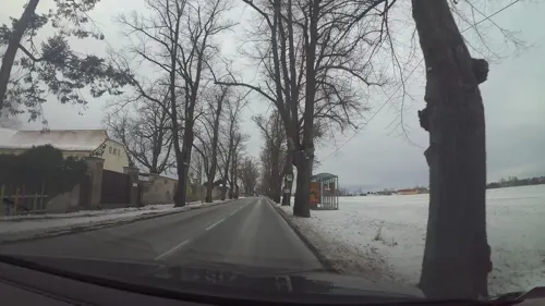
Schule am Wald
Monument and historic site · 8.0 km
Jagdhaus, Inspektorenhaus, Wirtschaftsgebäude und Pavillion
8 Zossener Straße, Ludwigsfelde



ehem. Gutsarbeiterhaus
Monument and historic site · 3.6 km
1a,1b Potsdamer Chaussee, Ludwigsfelde
Goltz’sche Villa
Monument and historic site · 1.3 km
8 Am Alten Krug, Ludwigsfelde
58 more on the map.
Parks, trails and playgrounds17




5 more on the map.
Restaurants and cafes82
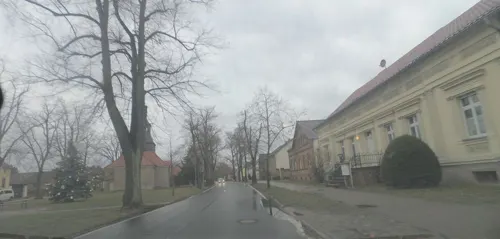
Alter Dorfkrug
Restaurant · German · 7.6 km
19 Dorfaue, Ludwigsfelde
Th 17:00-21:00; Fr 17:00-22:00; Sa 12:00-22:00; Su 12:00-20:00
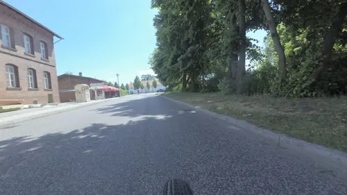
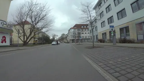
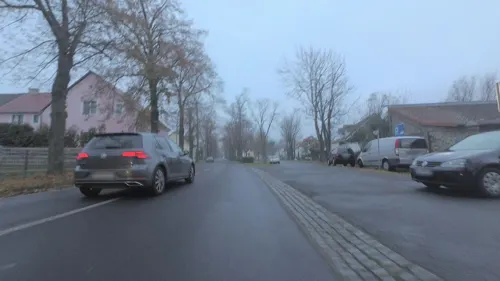
Pizza Musti
Restaurant · Italian, Pizza · 8.7 km
26 Dorfstraße, Blankenfelde-Mahlow
Tu-Fr 11:30-14:30; Tu-Su 16:00-21:00; Su 11:30-14:30

Restaurant Philipsthal
Restaurant · German · 8.4 km
35 Philippsthaler Dorfstraße, Nuthetal
We-Mo 12:00-21:00
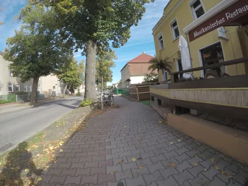
Sabrosito
Restaurant · Mexican · 7.5 km
61 Berliner Straße, Großbeeren
Mo-Th 12:00-23:00; Fr-Sa 12:00-24:00; Su 12:00-23:00
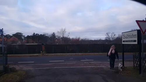
Waldfrieden
Restaurant · German · 2.2 km
2 Großbeerener Landstraße, Ludwigsfelde
Mo-Th,Sa 11:30-22:00; Su 11:00-15:00



70 more on the map.
History
The first settlement in the main town took place at 1750 under Frederick II of Prussia; several villages already existed in the 13th century (Gröben 1170). Ludwigsfelde has been classified as a town since 1965.
From the History section of Ludwigsfelde on Wikipedia, under CC BY-SA 4.0.
Where to stay13
Churches and places of worship25
Dorfkirche Fahlhorst
Church · Protestant · 6.3 km
10 Fahlhorster Dorfstraße, Nuthetal
Dorfkirche Gröben
Church · Protestant · 6.3 km
41 Gröbener Dorfstraße, Ludwigsfelde
Dorfkirche Groß Schulzendorf
Church · Protestant · 7.5 km
32 Dorfaue, Ludwigsfelde
Dorfkirche Siethen
Church · Protestant · 3.7 km
6 Siethener Dorfstraße, Ludwigsfelde
Dorfkirche Wietstock
Church · Protestant · 5.2 km
3 Wietstocker Dorfstraße, Ludwigsfelde
Dorfkirche Märkisch Wilmersdorf
Church · Protestant · 7.3 km
17 Kirchring, Trebbin
Shopping25
Gas and EV charging14
Total Brandenburger Straße
Gas station · 1.2 km
3 Brandenburgische Straße, Ludwigsfelde
Schools, colleges and libraries19
Landesinstitut Brandenburg für Schule und Lehrkräftebildung
School · 2.5 km
1 Struveweg, Ludwigsfelde
Lehr- und Versuchsanstalt für Gartenbau und Arboristik (Standort Großbeeren)
School · 6.7 km
1 Peter-Lenné-Weg, Großbeeren
Healthcare6
Evangelisches Krankenhaus Ludwigsfelde-Teltow
Hospital · 0.9 km
40-44 Albert-Schweitzer-Straße, Ludwigsfelde
Map of Ludwigsfelde
250 places. The map loads OpenStreetMap tiles when you open it.
Getting there and nearby towns
Berlin Brandenburg Airport "Willy Brandt" (BER) is the nearest airport with scheduled flights listed in OpenStreetMap, 18 km away.
- Stahnsdorf 9 km north, about 9 min by car
- Teltow 11 km north, about 11 min by car
- Michendorf 15 km west, about 15 min by car
- Potsdam 17 km northwest, about 17 min by car
- Zossen 16 km southeast, about 16 min by car
- Schönefeld 19 km northeast, about 19 min by car
- Zeuthen 25 km east, about 25 min by car
- Berlin 27 km northeast, about 27 min by car
- Nauen 42 km northwest, about 42 min by car
- Velten 43 km north, about 43 min by car
Drive times are estimates from straight-line distance, not routes.
Local news
Headlines from INDB.
Reviews, tips and questions
Loading what members have shared...
Sources and licences
- GeoNames (CC BY 4.0): population, coordinates, regions and time zone
- Mapillary (see each image): photos
- OpenStreetMap contributors (ODbL 1.0): places, airports, map data
- Wikidata (CC0 1.0): elevation, founding date, time zone, website
- Wikimedia Commons (see each image): photos
- Wikipedia (CC BY-SA 4.0): overview and history text
Photo credits
- (20240829) Ludwigsfelde 06, Roy Zuo, CC BY-SA 4.0
- (20240829) Ludwigsfelde 05, Roy Zuo, CC BY-SA 4.0
- Ludwigsfelde Bundesautobahn A10 lub 2022-12-27 img02 Ludwigsfelder Brücken, Lukas Beck, CC BY-SA 4.0
- Ludwigsfelde - Potsdamer Strasse - geo.hlipp.de - 37889, Colin Smith on geo.hlipp.de, CC BY-SA 2.0
- (20240829) Ludwigsfelde 04, Roy Zuo, CC BY-SA 4.0
- Autobahnbrücke Ludwigsfelde Zentrum - panoramio, Löwe 48, CC BY-SA 3.0
- St. Michael Ludwigsfelde Nordostansicht, Assenmacher, CC BY-SA 4.0
- St. Michael Ludwigsfelde Ostansicht, Assenmacher, CC BY-SA 4.0
- St. Michael Ludwigsfelde Westansicht, Assenmacher, CC BY-SA 4.0
- St. Michael Ludwigsfelde Westturm Südansicht, Assenmacher, CC BY-SA 4.0
- St. Michael Ludwigsfelde Kirchenschiff Südseite, Assenmacher, CC BY-SA 4.0
- St. Michael Ludwigsfelde Südansicht, Assenmacher, CC BY-SA 4.0
- Ludwigsfelde St. Michael lub 2022-12-27, Lukas Beck, CC BY-SA 4.0
- Ludwigsfelde - Street Art - geo.hlipp.de - 37886, Colin Smith on geo.hlipp.de, CC BY-SA 2.0
- Ludwigsfelde Stundeneiche lub 2022-12-27, Lukas Beck, CC BY-SA 4.0
- Ludwigsfelde Rathaus lub 2022-12-27 img02 Weihnachtsbaum, Lukas Beck, CC BY-SA 4.0
- Ludwigsfelde Rathaus lub 2022-12-27 img01, Lukas Beck, CC BY-SA 4.0
- Rathaus Ludwigsfelde (Ludwigsfelde Town Hall) - geo.hlipp.de - 37883, Colin Smith on geo.hlipp.de, CC BY-SA 2.0
- Stadtverwaltung Ludwigsfelde (Ludwigsfelde Town Hall) - geo.hlipp.de - 37884, Colin Smith on geo.hlipp.de, CC BY-SA 2.0
- Ludwigsfelde Rathausstraße lub 2022-12-27, Lukas Beck, CC BY-SA 4.0
- Ludwigsfelde Bundesautobahn A10 lub 2022-12-27 img01, Lukas Beck, CC BY-SA 4.0
- Kristalltherme Ludwigsfelde 1, Digitoxin from Ludwigsfelde, Germany, CC BY 2.0
- Kristalltherme Ludwigsfelde 2, Digitoxin from Ludwigsfelde, Germany, CC BY 2.0
- Kristalltherme Ludwigsfelde 3, Digitoxin from Ludwigsfelde, Germany, CC BY 2.0
- (20240829) Ludwigsfelde 07, Roy Zuo, CC BY-SA 4.0
- Dorfkirche Fahlhorst - Germany - panoramio, Löwe 48, CC BY-SA 3.0
- Schloss Genshagen3, Lienhard Schulz, CC BY-SA 3.0
- DE-BB-Ruhlsdorf-Dorfkirche-2025, 0000ff, CC BY-SA 4.0
- Teltow-Ruhlsdorf Sputendorfer Straße 1 Grundschule I, Assenmacher, CC BY-SA 3.0
- Grossbeeren Turm NO, Doris Antony , Berlin, CC BY-SA 3.0
- Schloss Gueterfelde Suedseite, Lichterfelder, CC BY-SA 3.0
- Dorfkirche Märkisch Wilmersdorf, Assenmacher (shifted by Rabanus Flavus ), CC BY-SA 4.0
- Ludwigsfelde Wietstock Kirche, Clemensfranz, CC BY-SA 3.0
- Dorfkirche Ahrensdorf - Germany - panoramio, Löwe 48, CC BY-SA 3.0
- Kirche Genshagen1, Lienhard Schulz, CC BY-SA 3.0
- Dorfkirche Groß Schulzendorf Nordostansicht, Assenmacher, CC BY-SA 4.0
- Dorfkirche Löwenbruch Südostansicht, Assenmacher, CC BY-SA 4.0
- Dorfkirche Gröben - panoramio, Löwe 48, CC BY-SA 3.0
- Siethen1 Brandenburg, Lienhard Schulz, CC BY 2.5
- Grossbeeren Gedenkturm, Clemensfranz, CC BY 3.0
- Märkisch Wilmersdorf Gutshaus, Clemensfranz, CC BY-SA 3.0
- Gueterfelde palace SW, Doris Antony , Berlin, CC BY-SA 4.0
- Großbeeren 1813, Carl Röchling, Public domain
- Fahlhorst1 church, Lienhard Schulz, CC BY-SA 3.0
- Dorfkirche Nudow A, Schnittwerk, CC BY-SA 4.0
- Dorfkirche Siethen - Deutschland - panoramio, Löwe 48, CC BY-SA 3.0
- Lindenberg - panoramio (4), frankabrut, CC BY-SA 3.0
- Street-level photo, britiger, CC BY-SA 4.0
- Street-level photo, britiger, CC BY-SA 4.0
- Street-level photo, britiger, CC BY-SA 4.0
- Street-level photo, dsmm, CC BY-SA 4.0
- Street-level photo, kartonage, CC BY-SA 4.0
- Street-level photo, britiger, CC BY-SA 4.0
- Street-level photo, britiger, CC BY-SA 4.0
- Street-level photo, britiger, CC BY-SA 4.0
- Street-level photo, moenk, CC BY-SA 4.0
- Street-level photo, britiger, CC BY-SA 4.0
- Street-level photo, britiger, CC BY-SA 4.0
- Street-level photo, kartonage, CC BY-SA 4.0
- Street-level photo, moenk, CC BY-SA 4.0
- Street-level photo, moenk, CC BY-SA 4.0
- Street-level photo, moenk, CC BY-SA 4.0
- Street-level photo, britiger, CC BY-SA 4.0
- Street-level photo, britiger, CC BY-SA 4.0
- Street-level photo, britiger, CC BY-SA 4.0
- Street-level photo, britiger, CC BY-SA 4.0
- Street-level photo, moenk, CC BY-SA 4.0
- Street-level photo, dsmm, CC BY-SA 4.0
- Street-level photo, moenk, CC BY-SA 4.0
- Street-level photo, alexander2010, CC BY-SA 4.0
- Street-level photo, dsmm, CC BY-SA 4.0
- Street-level photo, nicos, CC BY-SA 4.0
- Street-level photo, moenk, CC BY-SA 4.0
- Street-level photo, bufonto, CC BY-SA 4.0
- Street-level photo, britiger, CC BY-SA 4.0
- Street-level photo, moenk, CC BY-SA 4.0


Page built November 8, 2026. Spotted a mistake? Tell us or suggest a place.