


Why visit Schönefeld
Townapedia lists 52 museums and landmarks, 40 parks and trails, 234 places to eat, 38 places to stay and 18 attractions in and around town.
Highlights include Besucherterrasse BER, Lange Brücke, Alte Dorfschule Rudow and Denkmal für die Gefallenen der Gemeinde Bohnsdorf.
Weather in Schönefeld
Forecast from MET Norway (CC BY 4.0). Full forecast
About Schönefeld
Schönefeld (German pronunciation: [ˈʃøːnəfɛlt] , meaning beautiful field) is a suburban municipality in the Dahme-Spreewald district, Brandenburg, Germany. It borders the southeastern districts of Berlin. The municipal area encompasses the old Berlin Schönefeld Airport (SXF) and the new Berlin Brandenburg Airport (BER).
From the Wikipedia article Schönefeld (this version), under CC BY-SA 4.0.
Things to do18

Besucherterrasse BER
Scenic view · 2.8 km
Auf Ebene E4. Zugang über Empore (E2) der Checkin-Ebene E1.
Mo-Su 08:00-22:00


Müggel-Tower
Monument and historic site · 8.8 km
Observation tower and building, Berlin - Treptow-Köpenick, Germany

Parkbühne Wuhlheide
Cinema and theater · 8.6 km
Open-air venue in Berlin




6 more on the map.
Museums and landmarks52

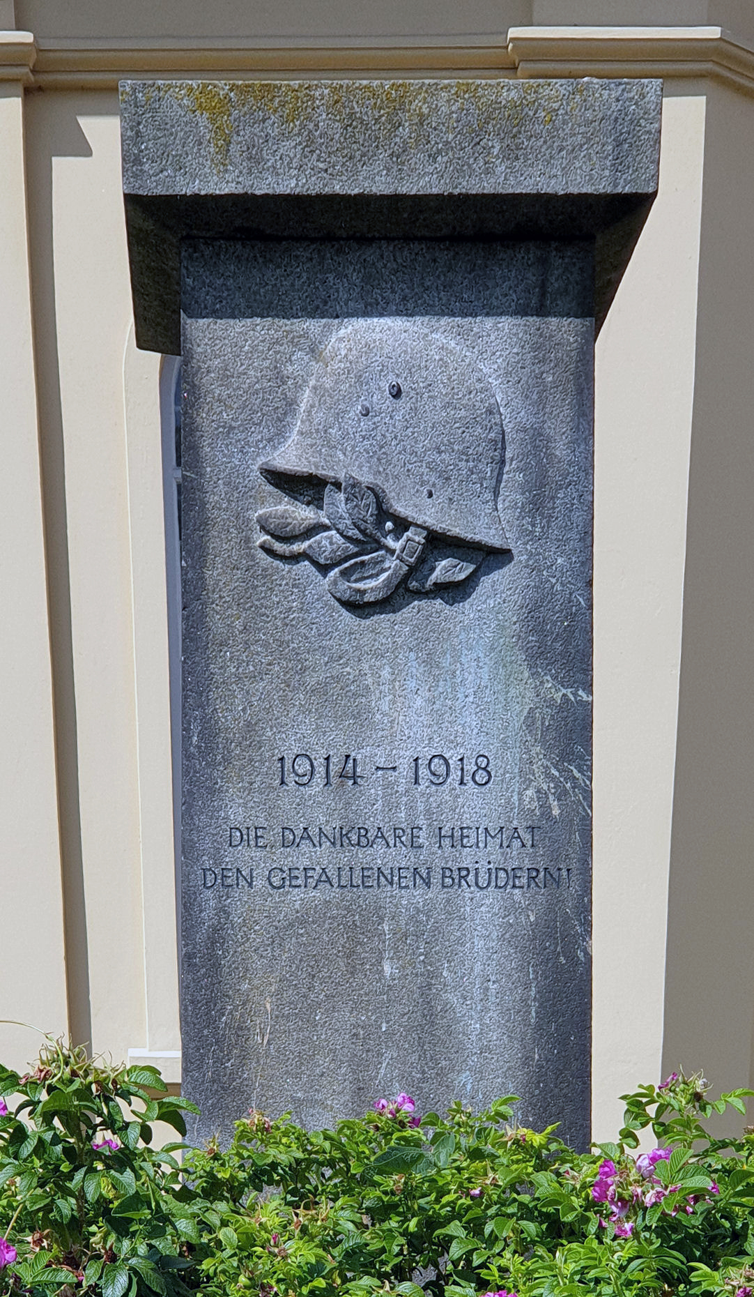
Denkmal für die Gefallenen der Gemeinde Bohnsdorf
Monument and historic site · 3.8 km


Marienfelde refugee transit camp
Monument and historic site · 9.9 km
Refugee transit camp


Nazi Forced Labour Documentation Centre
Monument and historic site · 7.2 km
Museum in Germany


40 more on the map.
Parks, trails and playgrounds40




Volkspark Wuhlheide
Park · 8.8 km
Public forest- and recreation park in Berlin, Germany


28 more on the map.
Restaurants and cafes234

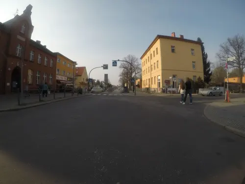
Gaststätte Ebel
Restaurant · German · 4.3 km
1 Semmelweisstraße, Berlin
Mo-Fr 10:00-23:00, Sa 10:00-24:00


Cafe Campus
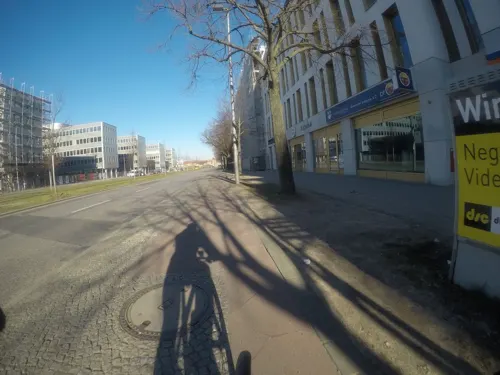
Cafe · Ice Cream, Cake, Coffee Shop, Lunch · 5.5 km
138 Groß-Berliner Damm, Berlin
Mo-Fr 11:00-17:00; Su 13:00-17:00
China Restaurant Panda II
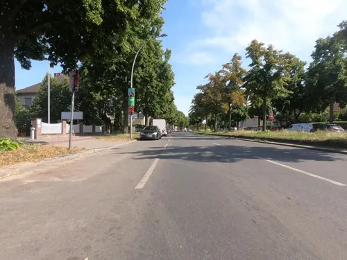
Restaurant · Chinese · 5.2 km
173 Rudower Straße, Berlin
12:00-21:00; Mo off

Da Gatto Nero
Restaurant · Pizza, Italian · 3.6 km
49 Rapunzelstraße, Berlin
Tu-Fr 15:00-23:00; Sa,Su 12:00-23:00


222 more on the map.
History
The first preserved mention of Schönefeld in the Mittelmark territory dates back to 1242. Sconenfelde, then a possession held by the Lords of Selchow, is documented in the 1375 Landbuch (domesday book) of Emperor Charles IV, when he also ruled as Elector of Brandenburg. The village church, rebuilt in 1904/05 according to plans designed by Franz Heinrich Schwechten, includes a large Baroque altar. Waltersdorf and Waßmannsdorf also have village churches dating to the first half of the 13th century.
From 1933 onwards, the Henschel aircraft company moved from Johannisthal Air Field to Schönefeld and had three runways laid out next to the village. More than 14,000 warplanes were built at the site until 1945, when the premises were occupied by the Red Army. In the Großziethen cemetery is a memorial to 200 prisoners of war and forced laborers who died during World War II. The Soviet Air Forces used the air field from 1946, one year later the Soviet Military Administration ordered the buildup of a civil air service supplying East Berlin.
Before German reunification, Schönefeld shared its borders partly with boroughs of former West Berlin (present-day Neukölln and Tempelhof-Schöneberg), and so from 1961 to 1990 it was separated from it by the Berlin Wall.
From the History section of Schönefeld on Wikipedia, under CC BY-SA 4.0.
Where to stay38
Churches and places of worship26
Pfarrkirche Altglienicke
Church · Protestant · 4.4 km
15 Köpenicker Straße, Berlin
Dorfkirche Großziethen
Church · Protestant · 3.8 km
29 Alt Großziethen, Schönefeld
Maria-Hilf-Kirche
Church · Roman Catholic · 4.0 km
2 Cimbernstraße, Berlin
Shopping70
Gas and EV charging29
Schools, colleges and libraries47
Healthcare25
Map of Schönefeld
250 places. The map loads OpenStreetMap tiles when you open it.
Getting there and nearby towns
Berlin Brandenburg Airport "Willy Brandt" (BER) is the nearest airport with scheduled flights listed in OpenStreetMap, 3 km away.
- Zeuthen 9 km southeast, about 9 min by car
- Berlin 16 km northwest, about 16 min by car
- Teltow 15 km west, about 15 min by car
- Zossen 20 km south, about 20 min by car
- Stahnsdorf 19 km west, about 19 min by car
- Potsdam 30 km west, about 30 min by car
- Strausberg 33 km northeast, about 33 min by car
- Wandlitz 39 km north, about 39 min by car
- Velten 40 km northwest, about 40 min by car
- Zehdenick 67 km north, about 1 h by car
Drive times are estimates from straight-line distance, not routes.
Local news
Headlines from INDB.
Reviews, tips and questions
Loading what members have shared...
Sources and licences
- GeoNames (CC BY 4.0): population, coordinates, regions and time zone
- Mapillary (see each image): photos
- OpenStreetMap contributors (ODbL 1.0): places, airports, map data
- Wikidata (CC0 1.0): elevation, founding date, time zone, website, landmarks and historic places
- Wikimedia Commons (see each image): photos
- Wikipedia (CC BY-SA 4.0): overview and history text
Photo credits
- Kirchstraße Kirche Chor Schönefeld, Clemensfranz, CC BY-SA 4.0
- Dorfkirche Schönefeld Westturm Westansicht Juli 2018, Assenmacher, CC BY-SA 4.0
- Dorfkirche Schönefeld Gedenkstein Flugabsturz 3, Assenmacher, CC BY-SA 4.0
- Dorfkirche Schönefeld 2018 05, Clemensfranz, CC BY-SA 4.0
- Dorfkirche Schönefeld 2018 03, Clemensfranz, CC BY-SA 4.0
- Dorfkirche Schönefeld Gedenkstein Flugabsturz 2, Assenmacher, CC BY-SA 4.0
- Dorfkirche Schönefeld 2018 02, Clemensfranz, CC BY-SA 4.0
- Dorfkirche Schönefeld Gedenkstein Flugabsturz 1, Assenmacher, CC BY-SA 4.0
- Dorfkirche Schönefeld Kirchenschiff Nordansicht Pforte, Assenmacher, CC BY-SA 4.0
- Dorfkirche Schönefeld Nordseite Glocke mit Kreuz, Assenmacher, CC BY-SA 4.0
- Dorfkirche Schönefeld Chor Nordansicht, Assenmacher, CC BY-SA 4.0
- Dorfkirche Schönefeld Kirchenschiff Nordansicht, Assenmacher, CC BY-SA 4.0
- Dorfkirche Schönefeld Westturm Westportal, Assenmacher, CC BY-SA 4.0
- Dorfkirche Schönefeld 2018 04, Clemensfranz, CC BY-SA 4.0
- Dorfkirche Schönefeld Ostansicht Juli 2018, Assenmacher, CC BY-SA 4.0
- Kirchstraße Kirche Schönefeld, Clemensfranz, CC BY-SA 4.0
- Dorfkirche Schönefeld Kapelle, Assenmacher, CC BY-SA 4.0
- Dorfkirche Schönefeld Chor und Apsis Südansicht, Assenmacher, CC BY-SA 4.0
- Dorfkirche Schönefeld Südansicht Juli 2018, Assenmacher, CC BY-SA 4.0
- Kirchstraße Kirche Sakristei Schönefeld, Clemensfranz, CC BY-SA 4.0
- Tatort RBB Das Muli Berlin Schönefeld Holiday Inn cc by Denis Apel 23, Denis Apel, CC BY-SA 4.0
- Tatort RBB Das Muli Berlin Schönefeld Holiday Inn cc by Denis Apel 12, Denis Apel, CC BY-SA 4.0
- Tatort RBB Das Muli Berlin Schönefeld Holiday Inn cc by Denis Apel 09, Denis Apel, CC BY-SA 4.0
- Tatort RBB Das Muli Berlin Schönefeld Holiday Inn cc by Denis Apel 17, Denis Apel, CC BY-SA 4.0
- Tatort RBB Das Muli Berlin Schönefeld Holiday Inn cc by Denis Apel 05, Denis Apel, CC BY-SA 4.0
- Tatort RBB Das Muli Berlin Schönefeld Holiday Inn cc by Denis Apel 30, Denis Apel, CC BY-SA 4.0
- Tatort RBB Das Muli Berlin Schönefeld Holiday Inn cc by Denis Apel 28, Denis Apel, CC BY-SA 4.0
- Tatort RBB Das Muli Berlin Schönefeld Holiday Inn cc by Denis Apel 32, Denis Apel, CC BY-SA 4.0
- Tatort RBB Das Muli Berlin Schönefeld Holiday Inn cc by Denis Apel 07, Denis Apel, CC BY-SA 4.0
- Tatort RBB Das Muli Berlin Schönefeld Holiday Inn cc by Denis Apel 04, Denis Apel, CC BY-SA 4.0
- Tatort RBB Das Muli Berlin Schönefeld Holiday Inn cc by Denis Apel 11, Denis Apel, CC BY-SA 4.0
- Tatort RBB Das Muli Berlin Schönefeld Holiday Inn cc by Denis Apel 26, Denis Apel, CC BY-SA 4.0
- Tatort RBB Das Muli Berlin Schönefeld Holiday Inn cc by Denis Apel 18, Denis Apel, CC BY-SA 4.0
- Tatort RBB Das Muli Berlin Schönefeld Holiday Inn cc by Denis Apel 25, Denis Apel, CC BY-SA 4.0
- Tatort RBB Das Muli Berlin Schönefeld Holiday Inn cc by Denis Apel 08, Denis Apel, CC BY-SA 4.0
- Tatort RBB Das Muli Berlin Schönefeld Holiday Inn cc by Denis Apel 24, Denis Apel, CC BY-SA 4.0
- Tatort RBB Das Muli Berlin Schönefeld Holiday Inn cc by Denis Apel 15, Denis Apel, CC BY-SA 4.0
- Tatort RBB Das Muli Berlin Schönefeld Holiday Inn cc by Denis Apel 16, Denis Apel, CC BY-SA 4.0
- Lange Brücke (Berlin-Köpenick)-2009-01, Liralina, CC BY 2.0
- Berlin Müggelturm 3, Andreas Steinhoff, Attribution
- Stubenrauchbrücke 38, Angela Monika Arnold, CC BY-SA 3.0
- Treskowbruecke 54, Angela Monika Arnold, CC BY-SA 3.0
- Marienfelde, Flüchtlingslager, Müller, Simon, CC BY-SA 3.0 de
- Dokumentationszentrum NS-Zwangsarbeit - Baracke 13 Flur, Tim Rademacher, CC BY 3.0
- Festwiese im Britzer Garten, The Exit, Public domain
- Berlin koernerpark, Dieter Brügmann, CC BY-SA 3.0
- 17-03-14-Dorfkirche Schönefeld RalfR-RR7 8146, Ralf Roletschek, GFDL 1.2
- Aerodynamic park Berlin 1, Brücke-Osteuropa, Public domain
- Bohnsdorf Dorfplatz, Fridolin freudenfett (Peter Kuley), CC BY-SA 3.0
- Großziethen Dorfkirche, Axel Mauruszat, CC BY 3.0 de
- Berlin, Gropiusstadt, Dreieinigkeitskirche 03, Beek100, CC BY-SA 3.0
- Aussicht vom Dörferblick in Berlin-Rudow in Richtung Mitte, Assenmacher, CC BY-SA 3.0
- Falkenberg-Bohnsdorf, Global Fish, CC BY-SA 3.0
- Hedwigshoehe Villa, Elmarfis, CC BY-SA 3.0
- Neukoelln6 Mittenwalder Eisenbahn, Lienhard Schulz, CC BY 2.5
- Altglienicke kirche-2010-09-19-1, Dinamik, Public domain
- St. Dominicus (Gropiusstadt), Bodo Kubrak, CC0
- St. Joseph (Berlin-Rudow), Bodo Kubrak, CC0
- Jungfernmühle Berlin Gropiusstadt, Clemensfranz, CC BY-SA 3.0
- GKLandschaft, Global Fish, CC BY-SA 4.0
- Altglienicke Tunnel Rudower Höhe-001, Fridolin freudenfett (Peter Kuley), CC BY-SA 3.0
- Schoenefeld Rotberg Kirche, Clemensfranz, CC BY-SA 3.0
- Walter-Gropius-Schule-Fritz-Erler-Allee-Gropiusstadt-Britz-Buckow-Rudow-Berlin-Neukölln-11-2015, Gunnar Klack, CC BY-SA 4.0
- Maria Hilf (Berlin-Altglienicke), Bodo Kubrak, CC BY-SA 4.0
- NSG Landschaftspark Johannisthal Adlershof - Wiese mit Hinweisschild, Theodor Otto Martha, CC BY-SA 3.0
- Flughafen BER 20260623 Steigenberger Airport Hotel, NutzerAusBerlin, CC0
- Denkmal Dorfplatz (Bohnd) Weltkriegsopfer, OTFW , Berlin, CC BY-SA 3.0
- Lise-Meitner-Schule (OSZ Chemie, Physik und Biologie) in 12351 Berlin-Gropiusstadt B, IgorCalzone1, CC BY-SA 4.0
- UniGardening (Campus Garten) in Berlin-Adlershof, 2025-05-04, Nylki, CC0
- Schallgedämpfter Motorenprüfstand 1933-1935, ReRo, CC BY-SA 3.0
- Stolperstein Schirnerstr 50 (Altgl) Felix Lazarus, OTFW , Berlin, CC BY-SA 3.0
- Grosser Windkanal, Lichterfelder, CC BY-SA 3.0
- Stolperstein Rudower Str 68 (Altgl) Hugo Heilbronn, OTFW , Berlin, CC BY-SA 3.0
- Stolperstein Rudower Str 68 (Altgl) Minna Heilbronn, OTFW , Berlin, CC BY-SA 3.0
- Stolperstein Fleischerstr 6 (Rudow) Otto Laube, OTFW , Berlin, CC BY-SA 3.0
- Altglienicke Coloniapark, Fridolin freudenfett (Peter Kuley), CC BY-SA 3.0
- NSG Johannisthal Adlershof Schafe, Assenmacher, CC BY-SA 3.0
- Selchow church1, Lienhard Schulz, CC BY 2.5
- Rudow Künnekeweg Rudower Höhe, Fridolin freudenfett, CC BY-SA 4.0
- Volkspark Wuhlheide 2021-04-20 05, Leonhard Lenz, CC0
- Altglienicke Semmelweisstraße Gaststätte Ebel, Fridolin freudenfett (Peter Kuley), CC BY-SA 3.0
- Street-level photo, kartonage, CC BY-SA 4.0
- Street-level photo, stefanhrt, CC BY-SA 4.0
- Street-level photo, stefanhrt, CC BY-SA 4.0
- Street-level photo, britiger, CC BY-SA 4.0
- Street-level photo, alexander2010, CC BY-SA 4.0
- Street-level photo, soulcover, CC BY-SA 4.0
- Street-level photo, balgofil, CC BY-SA 4.0
- Street-level photo, elgolfo, CC BY-SA 4.0
- Street-level photo, elgolfo, CC BY-SA 4.0
- Street-level photo, eserte, CC BY-SA 4.0
- Street-level photo, carlheinz, CC BY-SA 4.0
- Street-level photo, carlheinz, CC BY-SA 4.0
- Street-level photo, kartonage, CC BY-SA 4.0
- Street-level photo, atpl_pilot, CC BY-SA 4.0
- Street-level photo, grada, CC BY-SA 4.0
- Street-level photo, eserte, CC BY-SA 4.0
- Street-level photo, DBSEV_SBB, CC BY-SA 4.0


Page built November 8, 2026. Spotted a mistake? Tell us or suggest a place.