


Oberkassel, Germany
Oberkassel is a town of 7,000 people in North Rhine-Westphalia, Germany.
Why visit Oberkassel
Townapedia lists 82 museums and landmarks, 25 parks and trails, 87 places to eat, 12 places to stay and 15 attractions in and around town.
Highlights include Contra-Kreis-Theater, Junges Theater Bonn, Deutsches Museum Bonn and Brückenhofmuseum.
Weather in Oberkassel
Forecast from MET Norway (CC BY 4.0). Full forecast
About Oberkassel
Oberkassel is a suburb in the Bonn municipal district of Beuel in Germany. It lies on the right bank of the Rhine on the edge of the Siebengebirge mountains. Oberkassel has about 7,200 inhabitants.
From the Wikipedia article Oberkassel, Bonn (this version), under CC BY-SA 4.0.
Things to do15

Contra-Kreis-Theater
Cinema and theater · 5.1 km
Oldest privately owned theater in Bonn, Germany

Junges Theater Bonn
Cinema and theater · 4.3 km
Theatre in North Rhine-Westphalia, Germany


Schauspielhaus Bad Godesberg
Cinema and theater · 3.5 km
Theatre in Bad Godesberg, Bonn, Germany


Paffelsberg
Scenic view · 1.8 km
Höchste Erhebung im Stadtgebiet Bonn



3 more on the map.
Museums and landmarks82

Deutsches Museum Bonn
Museum · 2.0 km
Technology museum in Germany
45 Ahrstraße, Bonn
Su, Tu-Fr 10:00-17:00; Sa 12:00-17:00


Landhaus zur Lippe
Monument and historic site
Lippesches Palais
705-707 Königswinterer Straße, Bonn



Beethoven House
Museum · 5.2 km
Museum on and birthplace of Ludwig van Beethoven in Bonn, Germany

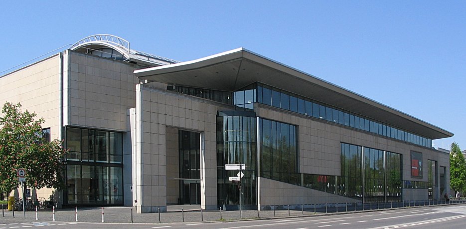
Haus der Geschichte
Museum · 3.4 km
Museum of contemporary history in Bonn, Germany

Kunst- und Ausstellungshalle der Bundesrepublik Deutschland
Museum · 3.1 km
Museum in Bonn, Germany


70 more on the map.
Parks, trails and playgrounds25


Japanischer Garten
Park · 2.1 km
Ein Geschenk der japanischen Regierung zur Bundesgartenschau 1979



Friesdorfer Park
Park · 2.0 km
Teil der ehemaligen gärtnerischen Versuchs- und Lehranstalt (bis ca. 1980)

13 more on the map.
Restaurants and cafes87
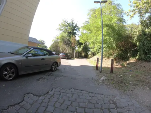

La Flamme
Restaurant · Flambé Cake
Restaurant Flammkuchen
27 Kastellstraße, Bonn
Mo-Fr 16:00-23:00; Sa,Su,PH 12:00-23:00
Dreizehn Linden
Restaurant · Regional · 2.5 km
39 Löwenburgstraße, Bonn
Mo-Tu off; We-Th 17:00-22:00; Fr-Sa 17:00-23:00; Su 17:00-22:00
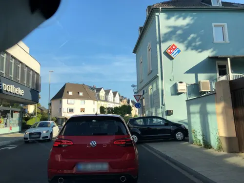
Eis Café Darella
Cafe · Ice Cream, Pizza · 2.0 km
2-10 Mittelstraße, Bonn
Mo-Sa 10:30-21:00; Su 12:00-21:00
Gino‘s Pizzeria-restaurante
Restaurant · Pizza, Italian · 2.1 km
2a Brandenburger Straße
Mo-Sa 18:00-22:00; Su 14:00-22:00

Gut Sülz Weingarten
Restaurant · German · 2.4 km
157 Bachstraße
We-Fr 16:00-22:00; Sa 15:00-22:00; Su 12:00-20:00; Mo,Tu off

Indian Palace
Restaurant · Indian · 2.3 km
126 Gotenstraße, Bonn
Mo-Fr 12:00-14:30,18:00-23:00; Sa,Su 18:00-23:00
Jackie's Travel and Modern Filipino Eatery
Restaurant · Filipino · 2.0 km
108 Wurzerstraße, Bonn
We,Th 12:00-18:00; Fr,Sa 13:00-22:00; Su 13:00-18:00
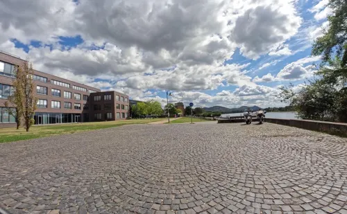
L'Osteria
Restaurant · Italian · 1.2 km
4 Portlandweg, Bonn
Mo-Th 11:30-23:00, Su,PH 12:00-23:00, Fr,Sa 11:30-24:00
Pastis im Steinhaus
Restaurant · French · 1.7 km
13 Turmstraße
Tu-Fr 12:00-14:30, Tu,Fr 15:00-17:00, Th,Fr 18:00-21:00, Sa 10:00-14:00


Restaurant Weinmühle
Restaurant · Regional · 2.3 km
7 Lindenstraße, Königswinter
Mo-Tu Off; We-Fr 16:00-22:00; Sa, Su, PH 12:00-22:00
75 more on the map.
History
Oberkassel was first mentioned as Cassele in 722/723 and as Cassela in 1144. The name Oberkassel refers to a Roman fortification; in the course of time "Römerkastell" (Roman castle) became "Oberkassel". Oberkassel absorbed the previously separate settlements of Berghoven (mentioned for the first time in 873), Büchel (mentioned for the first time in 1202), Broich (mentioned for the first time in 1306) and Meerhausen (mentioned for the first time in 1442).
In 1870 the East Rhine Railway reached Oberkassel and crossed the Rhine by train ferry to the West Rhine Railway. The train ferry was abandoned in 1919.
In 1914, workers in a quarry detected a grave with a 50-year-old man, a 20-25-year-old woman and a dog, which came to be called the Bonn–Oberkassel dog. Carbon-14 datings estimated an age between 13,300 and 14,000 years. A study of the mitochondrial genome sequences in 2013 showed that the animal is indeed Canis lupus familiaris, not a wolf.
From the History section of Oberkassel, Bonn on Wikipedia, under CC BY-SA 4.0.
Where to stay12
Wohnmobilstellplatz Sportplatz Königswinter
Campground · 1.9 km
28 Hauptstraße, Königswinter
Gästehaus Hotel zur Post
Motel and hotel · 2.1 km
311 Königswinterer Straße, Bonn
Churches and places of worship21
Heilig-Kreuz-Kirche
Church · Catholic · 2.0 km
11 Cheruskerstraße, Bonn
Shopping18
Gas and EV charging21
Schools, colleges and libraries13
Elisabeth-Selbert-Gesamtschule
School · 2.4 km
50 Elisabeth-Selbert-Allee, Bonn
Healthcare9
Map of Oberkassel
250 places. The map loads OpenStreetMap tiles when you open it.
Getting there and nearby towns
Cologne Bonn Airport (CGN) is the nearest airport with scheduled flights listed in OpenStreetMap, 17 km away.
- Königswinter 4 km southeast, about 4 min by car
- Bonn 5 km northwest, about 5 min by car
- Sankt Augustin 7 km north, about 7 min by car
- Bad Honnef 9 km southeast, about 9 min by car
- Siegburg 10 km north, about 10 min by car
- Wachtberg 10 km southwest, about 10 min by car
- Troisdorf 11 km north, about 11 min by car
- Hennef (Sieg) 11 km northeast, about 11 min by car
- Alfter 11 km west, about 11 min by car
- Bornheim 14 km northwest, about 14 min by car
Drive times are estimates from straight-line distance, not routes.
Local news
Headlines from INDB.
Reviews, tips and questions
Loading what members have shared...
Sources and licences
- GeoNames (CC BY 4.0): population, coordinates, regions and time zone
- Mapillary (see each image): photos
- OpenStreetMap contributors (ODbL 1.0): places, airports, map data
- Wikidata (CC0 1.0): elevation, founding date, time zone, website, landmarks and historic places
- Wikimedia Commons (see each image): photos
- Wikipedia (CC BY-SA 4.0): overview and history text
Photo credits
- Contra kreis theater bonn eingang 2008, Sir James, CC BY-SA 3.0
- 2018-03-18-bonn-beuel-junges-theater-01, Axel Kirch, CC BY-SA 4.0
- 2011-11-08 Bonn Kennedybruecke Solarzellen, Sir James, CC BY 3.0
- Schauspielhaus Bad Godesberg Bonn 20210919 0005, Tilman2007, CC BY-SA 4.0
- Deutsches Museum Bonn, Hans Weingartz, CC BY-SA 2.0 de
- 20070404 bonn akademischemuseum04, Jean Housen, CC BY-SA 3.0
- Arithmeum von Norden, Stefan Knauf, Public domain
- Beethoven-Haus, Thomas Wolf , www.foto-tw.de, CC BY-SA 3.0 de
- Bonn HausDerGeschichte3, Jpetersen, CC BY-SA 2.0
- Kunst- und Ausstellungshalle der Bundesrepublik Deutschland - Bundeskunsthalle-9245, Raimond Spekking, CC BY-SA 4.0
- Kunstmuseum Bonn-9592, Raimond Spekking, CC BY-SA 4.0
- Außenfassade des Museums Koenig in Bonn, Simbel, CC BY-SA 3.0
- Bonner Münster, Thomas Wolf , www.foto-tw.de, CC BY-SA 3.0 de
- Bonn schwarzrheindorf doppelkirche aussen, Unknown author, CC BY-SA 3.0
- 2004 11 08 - Bonn 006, Filius humanitas, CC BY-SA 3.0
- University-bonn 2005-11-18, Daniel Tibi ( Dti ) | daniel-tibi.de, Public domain
- 2010-06-11-bonn-rheinaue-bismarckturm-10, Axel Kirch, CC BY-SA 4.0
- 2013-09-24 Brückenhofmuseum, Bachstraße 93, Königswinter-Oberdollendorf IMG 1043, Eckhard Henkel, CC BY-SA 3.0 de
- Christuskirche Bad Godesberg Front, Hagman, CC BY-SA 3.0 de
- Elisabeth-Selbert-Gesamtschule außen, PinguDEV, CC0
- 2011-08-16 Bonn Ernst-Kalkuhl-Gymnasium, Sir James, CC BY 3.0
- Kameha Bonn von der Südbrücke, Christian Wolf ( www.c-w-design.de ), CC BY-SA 3.0 de
- Kommende-Ramersdorf-005-17, Wolkenkratzer, CC BY-SA 3.0
- Ennert Forschungsstelle, Geheimnisträgerin, CC BY-SA 3.0
- Bonn Oberkassel - Rabenlay, Kuckstein, Wolkenkratzer, CC BY-SA 3.0
- 2122227-Kuckstein, Dr. Jürgen Wirth, CC BY-SA 3.0
- Bonn Paffelsberg, Leit, Public domain
- Bonn-Plittersdorf, St. Evergislus, Andreasdziewior, CC BY-SA 3.0
- Bonn-Plittersdorf Stimson Memorial Chapel, Hans Weingartz, CC BY-SA 3.0
- Lippisches Landhaus Oberkassel, Tohma, CC BY-SA 3.0
- Heilig Geist Römlinghoven, Tohma, CC BY-SA 4.0
- Kapelle Bonn-Oberkassel, Tohma, CC BY-SA 3.0
- Japanischer Garten in der Bonner Rheinaue, ToLo46, CC BY-SA 4.0
- Leserpark, Bad Godesberg, Blick auf Rhein, Wistula, CC BY-SA 4.0
- Bonn-Hochkreuz Godesberger Allee Maritim Hotel, Christian Thiessen, CC BY-SA 2.0
- Evkircheoberkassel, Hans Weingartz / Leonce49, CC BY 3.0
- Kastellstraße 21, Hagman, CC BY-SA 3.0 de
- Bad Godesberg, Juli 2019, 9, Wistula, CC BY-SA 4.0
- St. Antonius Holtorf, tohma, CC BY-SA 4.0
- Niederdollendorf Hauptstraße Bürgerpark Wegweiser, Leit, CC BY-SA 4.0
- Ennert Holzlar, User Geheimnisträgerin at de.wikipedia, CC BY-SA 3.0
- Rheinaue, Wolkenkratzer, CC BY-SA 3.0
- Bonn-Oberkassel Park Härle1, Hans Weingartz, CC BY-SA 2.0 de
- Juffernberg-von-Vinxel, X-y-z-SU-68, CC BY-SA 4.0
- Bad Godesberg Godesburg Ennert (2), Leit, CC BY-SA 4.0
- 2013-09-24 Gut Sülz, Bachstraße 157, Königswinter-Oberdollendorf IMG 1088, Eckhard Henkel, CC BY-SA 3.0 de
- Bonn-rheinaue-blindengarten-09, Axel Kirch, CC BY-SA 4.0
- Restaurant Indian Palace Bonn, PinguDEV, CC0
- Street-level photo, bernd1960, CC BY-SA 4.0
- Street-level photo, bernd1960, CC BY-SA 4.0
- Street-level photo, mfa, CC BY-SA 4.0
- Street-level photo, countzero5, CC BY-SA 4.0
- Street-level photo, dschuwa, CC BY-SA 4.0
- Street-level photo, dschuwa, CC BY-SA 4.0
- Street-level photo, dschuwa, CC BY-SA 4.0
- Street-level photo, bitnapper, CC BY-SA 4.0
- Street-level photo, koewimm, CC BY-SA 4.0
- Street-level photo, bernd1960, CC BY-SA 4.0
- Street-level photo, bernd1960, CC BY-SA 4.0
- Street-level photo, bernd1960, CC BY-SA 4.0
- Street-level photo, ziltoidium, CC BY-SA 4.0
- Street-level photo, troher15, CC BY-SA 4.0
- Street-level photo, bernd1960, CC BY-SA 4.0
- Street-level photo, dschuwa, CC BY-SA 4.0
- Street-level photo, schwing, CC BY-SA 4.0
- Street-level photo, uwekoch, CC BY-SA 4.0
- Street-level photo, soulcover, CC BY-SA 4.0
- Street-level photo, chuck, CC BY-SA 4.0
- Street-level photo, koewimm, CC BY-SA 4.0
- Street-level photo, schwing, CC BY-SA 4.0
- Street-level photo, mfa, CC BY-SA 4.0
- Street-level photo, changchun1, CC BY-SA 4.0
- Street-level photo, koewimm, CC BY-SA 4.0
- Street-level photo, koewimm, CC BY-SA 4.0


Page built November 9, 2026. Spotted a mistake? Tell us or suggest a place.