


Troisdorf, Germany
Troisdorf is a town of 74,749 people in North Rhine-Westphalia, Germany.
Why visit Troisdorf
Townapedia lists 103 museums and landmarks, 64 parks and trails, 220 places to eat, 12 places to stay and 17 attractions in and around town.
Highlights include Contra-Kreis-Theater, Junges Theater Bonn, Bilderbuchmuseum and Akademisches Kunstmuseum.
Weather in Troisdorf
Forecast from MET Norway (CC BY 4.0). Full forecast
About Troisdorf
Troisdorf (German pronunciation: [ˈtʁoːsdɔʁf] ) is a city in the Rhein-Sieg-Kreis (district), in North Rhine-Westphalia, Germany.
From the Wikipedia article Troisdorf (this version), under CC BY-SA 4.0.
Travel tips from other travellers: Troisdorf on Wikivoyage (CC BY-SA 4.0).
Photos of Troisdorf


Things to do17

Contra-Kreis-Theater
Cinema and theater · 9.1 km
Oldest privately owned theater in Bonn, Germany

Junges Theater Bonn
Cinema and theater · 8.4 km
Theatre in North Rhine-Westphalia, Germany





5 more on the map.
Museums and landmarks103


Beethoven House
Museum · 8.7 km
Museum on and birthplace of Ludwig van Beethoven in Bonn, Germany



Museum für Stadt- und Industriegeschichte (MUSIT)
Museum · 1.5 km
3 Burgallee, Troisdorf
Tu-Fr 11:00-17:00; Sa,Su 10:00-18:00

19 Hochbehälter Troisdorf 03
Monument and historic site · 2.2 km
Hochbehälter Gem.: Sieglar, Flur 19, Flurst. 143/13, Baujahr: 1903
91 more on the map.
Parks, trails and playgrounds64

Tannenbusch Dunes
Park · 9.5 km
Nature reserve in Bonn, North Rhine-Westphalia, Germany






52 more on the map.
Restaurants and cafes220
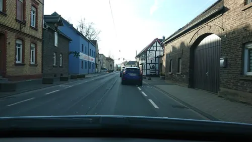
Zur Scheune
Restaurant · German · 3.5 km
66 Rheinstraße, Troisdorf
We-Fr 12:00-14:00 "needs reservation", We-Sa 18:00-21:00; PH,Su...
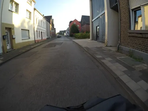
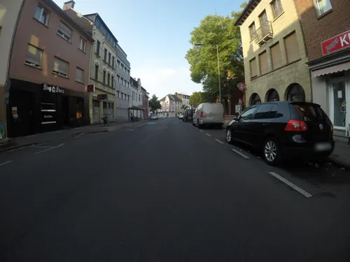
Beef Bra's Troisdorf - Burger Restaurant
Restaurant · Burger, American, Cake, Salad, Dessert, Fries, Wraps · 0.8 km
8 Wilhelmstraße, Troisdorf
Mo-Th,Su 11:00-21:00; Fr,Sa 11:00-22:00
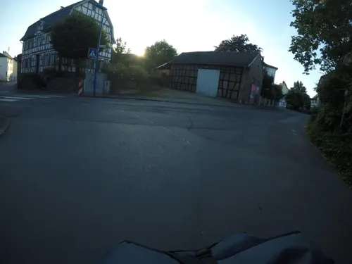
Eiscafe Darella
Cafe · Coffee Shop, Ice Cream · 2.9 km
1-3 Gutenbergstraße, Sankt Augustin
Mo-Sa 10:30-21:00; Su 12:00-21:00
Kaiser Garten
Restaurant · Chinese · 1.8 km
51 Altenrather Straße, Troisdorf
Mo-Fr 11:30-15:00,17:30-23:00; Sa,Su,PH 11:30-23:00
L'Osteria
Restaurant · Italian · 3.0 km
1 Junkersring, Troisdorf
Mo-Th 11:00-23:00; Fr-Sa 11:00-24:00; Su,PH 12:00-23:00


Eiscafe L'incontro
Cafe · Ice Cream, Italian · 1.6 km
Eis, Aperitivi, Cocktails, Antipasti, Pasta, Pizza
Mo-Fr 12:00-19:00; Su 12:00-19:00
Forsthaus Telegraph
Restaurant · Regional · 2.5 km

Klein's Backstube
Bakery · 1.0 km
25, 27 Kölner Straße, Troisdorf
Mo-Fr 06:00-19:00; Sa 06:00-17:00; Su off
208 more on the map.
History
Troisdorf became a free city in 1952. In 1969, the urban area expanded with the annexation of the township of Sieglar and the villages of Altenrath and Friedrich-Wilhelms-Hütte (total population in 1969: about 51,000). The first large settlements in this area go back to the 9th and 10th century (Eschmar and Sieglar 832, Bergheim 987). The first churches in this area were built around 700 AD in Bergheim (St. Lambertus).
Troisdorf is home to about 9,600 foreign nationals. The two most numerous foreign national groups are Turks (3,100) and Greeks (1,600). On June 4, 1972, Troisdorf founded the first advisory council for foreign citizens in Germany. In the years following the Peaceful Revolution and German reunification of 1989/1990 many migrants from Russia and other East European countries settled in Troisdorf.
From the History section of Troisdorf on Wikipedia, under CC BY-SA 4.0.
More about Troisdorf
Geography
Troisdorf is located approximately 22 kilometers south of Cologne and 13 kilometers north east of Bonn.
Troisdorf consists of 12 districts (population as of April 2014):
From the Wikipedia article Troisdorf, under CC BY-SA 4.0.
Notable people from Troisdorf
 Sabine LisickiGerman tennis playerPhoto: si.robi, CC BY-SA 2.0
 Mitchell WeiserGerman association football playerPhoto: Fuguito, CC BY-SA 3.0
 Max HoffGerman kayakerPhoto: Kanuoli, CC BY-SA 3.0
 Sinan BakışTurkish association football player (born 1994)Photo: Ultraslansi, CC BY-SA 3.0
 Elisabeth Winkelmeier-BeckerGerman politician and judgePhoto: Frank Baquet, CC BY-SA 3.0 de
 Sven LehmannGerman politicianPhoto: Raimond Spekking, CC BY-SA 4.0
 Michael BoddenbergGerman politicianPhoto: Martin Kraft, CC BY-SA 4.0
 Deborah SchönebornGerman long-distance runnerPhoto: Stefan Brending ( 2eight ), CC BY-SA 3.0 de
 Tom BuhrowGerman intendant & journalistPhoto: Superbass, CC BY-SA 4.0
- Lena SchönebornGerman modern pentathlete
- Karl-Richard FreyGerman judoka
- Johannes FreyGerman judoka (born 1996)
Born in Troisdorf, according to Wikidata (CC0). Each name links to its Wikipedia article.
Where to stay12
Churches and places of worship40
Sankt Augustinus
Church · Catholic · 2.1 km
16 Kirchstraße, Sankt Augustin
Shopping68
Gas and EV charging18
Schools, colleges and libraries36
Georg-Kerschensteiner-Berufskolleg
School · 2.2 km
4 Kerschensteinerstraße, Troisdorf
Healthcare21
Map of Troisdorf
250 places. The map loads OpenStreetMap tiles when you open it.
Getting there and nearby towns
Cologne Bonn Airport (CGN) is the nearest airport with scheduled flights listed in OpenStreetMap, 7 km away.
- Siegburg 4 km east, about 4 min by car
- Sankt Augustin 5 km southeast, about 5 min by car
- Lohmar 6 km northeast, about 6 min by car
- Wahn-Heide 6 km northwest, about 6 min by car
- Niederkassel 8 km west, about 8 min by car
- Bonn 9 km southwest, about 9 min by car
- Hennef (Sieg) 10 km east, about 10 min by car
- Rösrath 10 km north, about 10 min by car
- Zündorf 10 km northwest, about 10 min by car
- Eil 11 km northwest, about 11 min by car
Drive times are estimates from straight-line distance, not routes.
Towns near Troisdorf


Keep exploring
Local news
Headlines from INDB.
Reviews, tips and questions
Loading what members have shared...
Sources and licences
- GeoNames (CC BY 4.0): population, coordinates, regions and time zone
- Mapillary (see each image): photos
- OpenStreetMap contributors (ODbL 1.0): places, airports, map data
- Wikidata (CC0 1.0): elevation, founding date, time zone, website, landmarks and historic places
- Wikimedia Commons (see each image): photos
- Wikipedia (CC BY-SA 4.0): overview and history text
Photo credits
- Sonnenuntergang - panoramio (38), aachim3, CC BY 3.0
- Bücherschrank Troisdorf Blücherstraße bei der Bushaltestelle, F4b14n 3ul3, CC BY-SA 4.0
- Stadtteilpark Troisdorf-7701, Raimond Spekking, CC BY-SA 4.0
- Stadtteilpark Troisdorf-7700, Raimond Spekking, CC BY-SA 4.0
- Stadtteilpark Troisdorf-7699, Raimond Spekking, CC BY-SA 4.0
- Stadtteilpark Troisdorf-7702, Raimond Spekking, CC BY-SA 4.0
- Bücherschrank Troisdorf Hermann-Ehlers-Straße Lahnstraße, vor dem Parkplatz, F4b14n 3ul3, CC BY-SA 4.0
- Troisdorfer Bahnhof Rückseite, Ocrho, CC0
- Stadtteilhaus im Stadtteilpark Troisdorf-7703, Raimond Spekking, CC BY-SA 4.0
- Stadtteilhaus im Stadtteilpark Troisdorf-7704, Raimond Spekking, CC BY-SA 4.0
- Stadtteilhaus im Stadtteilpark Troisdorf-7705, Raimond Spekking, CC BY-SA 4.0
- Bf-troisdorf, A.Savin, CC BY-SA 3.0
- Blick nach innen, 1988, Selvino Cavezza, CC BY-SA 4.0
- Blick nach innen, 1988, Selvino Cavezza, CC BY-SA 4.0
- Blick nach innen, 1988, Selvino Cavezza, CC BY-SA 4.0
- Stazione di Rialto, 1997, Victor Bonato, CC BY-SA 4.0
- Stazione di Rialto, 1997, Victor Bonato, CC BY-SA 4.0
- Stazione di Rialto, 1997, Victor Bonato, CC BY-SA 4.0
- Gesichtsverlust, Johannes Dröge, CC BY-SA 4.0
- Gesichtsverlust, Johannes Dröge, CC BY-SA 4.0
- Gesichtsverlust, Johannes Dröge, CC BY-SA 4.0
- Gesichtsverlust, Johannes Dröge, CC BY-SA 4.0
- Aufbruch, 1984, Jörg Umrath, CC BY-SA 4.0
- Aufbruch, 1984, Jörg Umrath, CC BY-SA 4.0
- Aufbruch, 1984, Jörg Umrath, CC BY-SA 4.0
- Aufbruch, 1984, Jörg Umrath, CC BY-SA 4.0
- Dicker Mann, 1967 - 1971, Seemann, Karl-Henning, CC BY-SA 4.0
- Dicker Mann, 1967 - 1971, Seemann, Karl-Henning, CC BY-SA 4.0
- 31.03.93 Troisdorf 111194 (50586536507), Phil Richards from London, UK, CC BY-SA 2.0
- Roncallistraße 96, 1, Friedrich-Wilhelms-Hütte, Troisdorf, Rhein-Sieg-Kreis, GeorgDerReisende, CC BY-SA 4.0
- Contra kreis theater bonn eingang 2008, Sir James, CC BY-SA 3.0
- 2018-03-18-bonn-beuel-junges-theater-01, Axel Kirch, CC BY-SA 4.0
- 2011-11-08 Bonn Kennedybruecke Solarzellen, Sir James, CC BY 3.0
- Studiobuehne-su01, A.Savin, CC BY-SA 3.0
- 20070404 bonn akademischemuseum04, Jean Housen, CC BY-SA 3.0
- Arithmeum von Norden, Stefan Knauf, Public domain
- August-Macke-Haus (2026), ArthurMcGill, CC BY-SA 4.0
- Beethoven-Haus, Thomas Wolf , www.foto-tw.de, CC BY-SA 3.0 de
- LVR-LandesMuseum Bonn, Rheinisches Landesmuseum für Archäologie, Kunst- und Kulturgeschichte-2593, Raimond Spekking, CC BY-SA 4.0
- Bonn Rheinisches Malermuseum 2009 04 12, Sir James, CC BY-SA 3.0
- Bonn HICOG-Siedlung Tannenbusch Luftaufnahme, Wolkenkratzer, CC BY-SA 3.0
- Bonner Münster, Thomas Wolf , www.foto-tw.de, CC BY-SA 3.0 de
- Bonn schwarzrheindorf doppelkirche aussen, Unknown author, CC BY-SA 3.0
- 2004 11 08 - Bonn 006, Filius humanitas, CC BY-SA 3.0
- 2020-04-22-sankt-augustin-skulpturenweg-grantham-allee-20-induktion-02, Axel Kirch, CC BY-SA 4.0
- University-bonn 2005-11-18, Daniel Tibi ( Dti ) | daniel-tibi.de, Public domain
- Burg Wissem, Tohma ( talk ) / Marcus Bentfeld, CC BY-SA 3.0
- Trerichsweiher1, Olbertz, CC BY-SA 3.0
- St. Augustinus (Menden) (08), Chris06, CC BY-SA 4.0
- Troisdorf Evang. Johanneskirche 114, Tohma ( talk ) / Sebastian Mehlmacher, CC BY-SA 4.0
- Kreuzkirche (Sieglar) (2), Chris06, CC BY-SA 4.0
- Sankt Augustin Menden Realschule, Timmiboy1984, CC BY-SA 3.0
- Troisdorf St. Hippolytus von Nordosten cropped, Glewe, CC BY 4.0
- Troisdorf-Eschmar St. Peter und Paul Blick von Osten, Glewe, CC BY 3.0
- Troisdorf-West Maria Koenigin Westfront Turm 20220226 a, Glewe, CC BY-SA 3.0
- Troisdorf-Mitte St. Gerhard Nordwestansicht 20220226 cropped, Glewe, CC BY-SA 4.0
- Mordkreuz, B. Puetz, CC BY 3.0
- Street-level photo, countzero5, CC BY-SA 4.0
- Street-level photo, mfa, CC BY-SA 4.0
- Street-level photo, mfa, CC BY-SA 4.0
- Street-level photo, simon1234, CC BY-SA 4.0
- Street-level photo, mfa, CC BY-SA 4.0
- Street-level photo, countzero5, CC BY-SA 4.0
- Street-level photo, uwekoch, CC BY-SA 4.0
- Street-level photo, mfa, CC BY-SA 4.0
- Street-level photo, mfa, CC BY-SA 4.0
- Street-level photo, mfa, CC BY-SA 4.0
- Street-level photo, VIA_DT, CC BY-SA 4.0
- Street-level photo, VIA_DT, CC BY-SA 4.0
- Street-level photo, VIA_DT, CC BY-SA 4.0
- Street-level photo, poxonline, CC BY-SA 4.0
- Street-level photo, VIA_DT, CC BY-SA 4.0
- Street-level photo, poxonline, CC BY-SA 4.0
- Street-level photo, poxonline, CC BY-SA 4.0
- Street-level photo, VIA_DT, CC BY-SA 4.0
- Street-level photo, raymond, CC BY-SA 4.0
- Street-level photo, countzero5, CC BY-SA 4.0
- Street-level photo, poxonline, CC BY-SA 4.0
- Street-level photo, poxonline, CC BY-SA 4.0
- Street-level photo, countzero5, CC BY-SA 4.0
- Street-level photo, poxonline, CC BY-SA 4.0
- Street-level photo, poxonline, CC BY-SA 4.0
- Street-level photo, poxonline, CC BY-SA 4.0
- Street-level photo, deepblue66, CC BY-SA 4.0


Page built November 9, 2026. Spotted a mistake? Tell us or suggest a place.