


Bad Honnef, Germany
Bad Honnef is a town of 25,348 people in North Rhine-Westphalia, Germany.
Why visit Bad Honnef
Townapedia lists 166 museums and landmarks, 30 parks and trails, 157 places to eat, 24 places to stay and 52 attractions in and around town.
Highlights include Wildpark Rolandseck, Der Bioland-Hof, Arp Museum and Nibelungenhalle & Drachenhöhle.
Weather in Bad Honnef
Forecast from MET Norway (CC BY 4.0). Full forecast
About Bad Honnef
Bad Honnef (German pronunciation: [baːt ˈhɔnɛf] ) is a spa town in Germany near Bonn in the Rhein-Sieg district, North Rhine-Westphalia. It is located on the border of the neighbouring state Rhineland-Palatinate. To the north it lies on the slopes of the Drachenfels (“Dragon's Rock”) mountain, part of the Siebengebirge.
From the Wikipedia article Bad Honnef (this version), under CC BY-SA 4.0.
Travel tips from other travellers: Bad Honnef on Wikivoyage (CC BY-SA 4.0).
Things to do52

Wildpark Rolandseck
Zoo and aquarium · 2.7 km
4 Am Kasselbach, Remagen
Mar 15-Nov 15 We-Su 10:00-18:00



Schauspielhaus Bad Godesberg
Cinema and theater · 6.8 km
Theatre in Bad Godesberg, Bonn, Germany



40 more on the map.
Museums and landmarks166


Nibelungenhalle & Drachenhöhle
Museum · 3.5 km
107 Drachenfelsstraße, Königswinter
Apr-Oct: Mo-Su,PH 10:30-18:00

Siebengebirgsmuseum
Museum · 4.3 km
16 Kellerstraße, Königswinter
Tu-Fr 14:00-17:00; Sa 14:00-18:00; Su,PH 11:00-18:00

Stiftung Bundeskanzler-Adenauer-Haus
Museum · 1.7 km
8c Konrad-Adenauer-Straße, Bad Honnef
Tu-Su 10:00-16:30

Haus Steineck
Monument and historic site · 3.8 km
Die Villa war von 1982 bis 2008 im Besitz des Königreichs Saudi-Arabien. Heute in Privatbesitz..
82 Rüdigerstraße, Bonn


Schloß Drachenburg
Monument and historic site · 3.2 km
Mar-Jun: 11:00-18:00; Jul-Aug: 11:00-19:00; Sep-Nov: 11:00-18:00;...


Ulanendenkmal
Monument and historic site · 2.2 km
Für die im Ersten Weltkrieg Gefallenen des Ulanen-Regiments Großherzog Friedrich von Baden (Rheinisches) Nr. 7; Architekt: Emil Fahrenkamp


154 more on the map.
Parks, trails and playgrounds30


Villa Leonhart
Park · 4.5 km
330 Hauptstraße, Königswinter
08:00-19:00 open "summer" || 09:00-17:00 open "winter"





18 more on the map.
Restaurants and cafes157


Felder's am Winzerhäuschen
Restaurant · 3.4 km
100 Drachenfelsstraße, Königswinter
We-Su 12:00-18:00 || "nach Vereinbarung"

Milchhäuschen
Restaurant · 3.2 km
1 Elsigerfeld, Königswinter
Th, Fr 11:00-17:00; Mo-We off; Sa, Su 10:00-17:00

Altes Fährhaus
Restaurant · Regional · 4.0 km
4 Rheinallee, Königswinter
Apr-Oct Fr,Sa 11:00-23:00; Apr-Oct PH,Su 11:00-21:00; Apr-Oct...

Berggasthaus auf dem Ölberg
Restaurant · German · 4.6 km
100 Oelbergringweg, Königswinter
We-Fr 10:00-20:00 "ab 1.April nur Mo off"; Sa,PH -1 day...
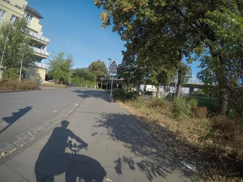
Bestell Dich Glücklich Goes Sushi
Restaurant · Sushi · 4.5 km
34 Bahnhofstraße, Königswinter
Mo,We-Fr 11:00-14:00, Mo,We-Fr 17:00-22:00, Sa 15:00-22:00, Su,PH...
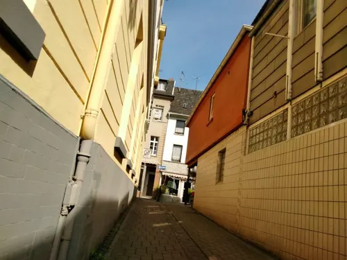

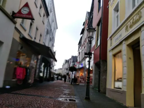


Hokkaido Sushi- und Grillrestaurant
Restaurant · Japanese · 4.3 km
5 Drachenburgstraße, Bonn
Mo-Su,PH 12:00-22:30
La Tavola dei Sapori
Restaurant · Italian
35 Hauptstraße, Bad Honnef
Mo-Sa 12:00-14:30,17:30-22:00; We off; Su, PH 17:00-22:00
145 more on the map.
Where to stay24
Churches and places of worship42
Annakapelle
Church · Catholic · 0.9 km
84 Rommersdorfer Straße, Bad Honnef
Kapelle der unbefleckten Emfängnis Mariens
Church · Roman Catholic · 1.8 km
16 Brunnenstraße, Remagen
Marienkapelle
Church · Catholic · 1.9 km
37a Rhöndorfer Straße, Bad Honnef
St. Severin-Kirche
Church · Catholic · 3.2 km
178 Mainzer Straße, Bonn
Shopping36
Gas and EV charging19
Schools, colleges and libraries23
GGS "Drachenfelsschule" Niederbachem
School · Catholic, Evangelic · 3.6 km
2 Langenbergsweg, Wachtberg
Healthcare15
Map of Bad Honnef
250 places. The map loads OpenStreetMap tiles when you open it.
Getting there and nearby towns
Cologne Bonn Airport (CGN) is the nearest airport with scheduled flights listed in OpenStreetMap, 26 km away.
- Königswinter 5 km northwest, about 5 min by car
- Wachtberg 9 km west, about 9 min by car
- Bonn 14 km northwest, about 14 min by car
- Meckenheim 14 km west, about 14 min by car
- Sankt Augustin 15 km north, about 15 min by car
- Hennef (Sieg) 15 km north, about 15 min by car
- Siegburg 17 km north, about 17 min by car
- Troisdorf 19 km north, about 19 min by car
- Rheinbach 20 km west, about 20 min by car
- Bornheim 21 km northwest, about 21 min by car
Drive times are estimates from straight-line distance, not routes.
Local news
Headlines from INDB.
Reviews, tips and questions
Loading what members have shared...
Sources and licences
- GeoNames (CC BY 4.0): population, coordinates, regions and time zone
- Mapillary (see each image): photos
- OpenStreetMap contributors (ODbL 1.0): places, airports, map data
- Wikidata (CC0 1.0): elevation, founding date, time zone, website, landmarks and historic places
- Wikimedia Commons (see each image): photos
- Wikipedia (CC BY-SA 4.0): overview and history text
Photo credits
- Bad Honnef Drachenfels2, Leit, Public domain
- Stolpersteins Jakob Levy, Rosa Levy, Erich Levy, Blondine Levy, Linzer Straße, Am Saynschen Hof, Bad Honnef, Josef 'Jupp' Schugt (aka 'Penpen'), CC BY 4.0
- Bad Honnef Kirchstraße 20 (2), Leit, CC BY-SA 4.0
- Baudenkmal Bad Honnef Kirchstraße 20, Tohma, CC BY-SA 4.0
- Bad Honnef Am Saynschen Hof 27 Einfahrt, Image-Improver Bonn, CC BY-SA 4.0
- Bad Honnef Stolpersteine Linzer Straße, Leit, CC BY-SA 4.0
- Bad Honnef Am Saynschen Hof 27 Linzer Straße 6, Image-Improver Bonn, CC BY-SA 4.0
- Bad Honnef Hauptstraße 74 (2), Leit, CC BY-SA 4.0
- Bad Honnef Linzer Straße 18, Image-Improver Bonn, CC BY-SA 4.0
- 2021-06-03 Kirchstraße 9, Bad Honnef DSC00289, Eckhard Henkel, CC BY-SA 4.0
- Bad Honnef Hauptstraße 76 (2), Leit, CC BY-SA 2.0 de
- Bad Honnef Hauptstraße 74 (1), Leit, CC BY-SA 2.0 de
- Bad Honnef Hauptstraße 68, Leit, CC BY-SA 2.0 de
- Bad Honnef Kirchstraße 7, Leit, CC BY-SA 2.0 de
- Bad Honnef Mülheimer Straße 15, Leit, CC BY-SA 4.0
- Bad Honnef Kirchstraße 8, Leit, CC BY-SA 2.0 de
- Bad Honnef Kirchstraße Synagoge, Leit, CC BY-SA 4.0
- St. Johann Baptist Bad Honnef, Tohma ( talk ), CC BY-SA 4.0
- Vogelbrunnen Bad Honnef, User:tohma, CC BY-SA 4.0
- Sankt Johann Baptist Bad Honnef, Tohma ( talk ), CC BY-SA 4.0
- Bad Honnef Bloom - panoramio, ekeidar, CC BY-SA 3.0
- Bad Honnef Rathausplatz Datierung, Leit, CC BY-SA 4.0
- Ludendorff Bridge from Erpeler Ley, U.S. Army Signal Corps, National Archives, Public domain
- Schauspielhaus Bad Godesberg Bonn 20210919 0005, Tilman2007, CC BY-SA 4.0
- Aerial image of Schloss Drachenburg (view from the northeast), Carsten Steger, CC BY-SA 4.0
- Insel Nonnenwerth DE 2015, barit, CC BY-SA 2.0
- Museum Arp2, Fusslkopp, CC BY-SA 3.0
- 20130816 Drachenfels, Dmitry Tonkonog and Ksenia Fedosova, CC BY-SA 3.0
- Asberg (Westerwald) Blick Broderkonsberg Siebengebirge (2), Leit, CC BY-SA 4.0
- Petersberger Bittweg, Tohma, CC BY-SA 4.0
- 2022-04-28 Erlöserkirche, Bad Honnef DSC00737, Eckhard Henkel, CC BY-SA 3.0 de
- 2013-03-26 Winzerhäuschen, Königswinter IMG 4734, Eckhard Henkel, CC BY-SA 3.0 de
- Villa Leonhart Koenigswinter, Tohma, CC BY-SA 4.0
- Haus rheinfrieden, Helmut Klöckner, Public domain
- 2013-08-20 Haus Steineck, Rüdigerstraße 82, Bonn, Ansicht von der Rheinseite (Nord-Ost) IMG 5094, Eckhard Henkel, CC BY-SA 3.0 de
- Bad-honnef-FH01, A.Savin, CC BY-SA 3.0
- Leyberg, Wander.Blog, CC BY-SA 4.0
- Loewenburger Hof, Tohma ( talk ), CC BY-SA 4.0
- 2021-06-09 Marienkapelle, Rhöndorf DSC00307, Eckhard Henkel, CC BY-SA 4.0
- Königswinter Milchhäuschen 3, Adrian Thomale, CC BY-SA 3.0
- Nibelungenhalle Koenigswinter, Tohma ( talk ), CC BY-SA 4.0
- Hoelterhoffstift Physikzentrum Bad Honnef, Tohma, CC BY-SA 4.0
- Schloss Hagerhof, Tohma, CC BY-SA 4.0
- Siebengebirgsgymnasium Eingang, Sanni-Malin, CC BY 3.0
- Siebengebirgsmuseum, Tohma, CC BY-SA 4.0
- Bad Honnef Anna-Kapelle, Tohma, CC BY-SA 4.0
- 2022-04-28 St. Johann Baptist (Bad Honnef) DSC00769, Eckhard Henkel, CC BY-SA 3.0 de
- St Mariä Heimsuchung, Rhöndorf-0960, Raimond Spekking, CC BY-SA 4.0
- Rolandswerth Mariä Unbefleckte Empfängnis, Leit, CC BY-SA 4.0
- Sophienhof Ittenbach, tohma, CC BY-SA 4.0
- Rhoendorf Uhlans memorial, Leit, Public domain
- 2014-07-31 Blick auf den Drachensteinpark IMG 5663, Eckhard Henkel, CC BY-SA 3.0 de
- Bad Honnef Katholisches Krankenhaus im Siebengebirge, Leit, CC BY-SA 4.0
- St. Martinskapelle Selhof 2, Tohma, CC BY-SA 4.0
- 2015 Dächelsberg, ehemaliger Steinbruch, Xonn, CC BY-SA 3.0
- Meckenheimer Straße 45, Hagman, CC BY-SA 3.0 de
- Bad Godesberg Rüngsdorf St. Hildegard, Leit, CC BY-SA 2.0 de
- Königswinter Maritim, Rolf Heinrich, Köln, CC BY-SA 3.0
- Bad Honnef Rhein-Klinik, Leit, CC BY-SA 2.0 de
- Stolpersteins Adolf Aron, Klara Salm, Julius Samuel, Camilla Stuwe, Rommersdorfer Straße 22, Bad Honnef, Josef 'Jupp' Schugt (aka 'Penpen'), CC BY 4.0
- Totale vom Rodderberg, Patrick Ch. Apfeld, CC BY 3.0
- NSG Siebengebirge - Asberg (Westerwald), GreylanderPhotography, CC BY-SA 4.0
- Unkel Henkel-Park 518, Reinhardhauke, CC BY-SA 3.0
- 2026-04-05 Bad Honnef-Rhoendorf Sitz Stiftung, Ocrho, CC0
- Nibelungenhalle 2017, Al-bigtwin, CC BY-SA 4.0
- Innenansicht der Christuskirche Königswinter 2012, Adippold, CC BY-SA 3.0
- Blick vom Aussichtsturm des Wildpark Rolandseck, Slick, CC0
- Yachthafen Oberwinter, Regenfänger von Eberhard Bosslet-6669, Raimond Spekking, CC BY-SA 4.0
- Altes Fährhaus Königswinter, Tohma ( talk ), CC BY-SA 4.0
- Street-level photo, schwing, CC BY-SA 4.0
- Street-level photo, bernd1960, CC BY-SA 4.0
- Street-level photo, dschuwa, CC BY-SA 4.0
- Street-level photo, countzero5, CC BY-SA 4.0
- Street-level photo, mfa, CC BY-SA 4.0
- Street-level photo, schwing, CC BY-SA 4.0
- Street-level photo, raymond, CC BY-SA 4.0
- Street-level photo, mfa, CC BY-SA 4.0
- Street-level photo, wolly79, CC BY-SA 4.0
- Street-level photo, schwing, CC BY-SA 4.0
- Street-level photo, bernd1960, CC BY-SA 4.0
- Street-level photo, bernd1960, CC BY-SA 4.0
- Street-level photo, countzero5, CC BY-SA 4.0
- Street-level photo, bernd1960, CC BY-SA 4.0
- Street-level photo, schwing, CC BY-SA 4.0
- Street-level photo, schwing, CC BY-SA 4.0
- Street-level photo, schwing, CC BY-SA 4.0
- Street-level photo, bernd1960, CC BY-SA 4.0
- Street-level photo, dschuwa, CC BY-SA 4.0
- Street-level photo, raymond, CC BY-SA 4.0
- Street-level photo, dschuwa, CC BY-SA 4.0
- Street-level photo, mfa, CC BY-SA 4.0


Page built November 8, 2026. Spotted a mistake? Tell us or suggest a place.