


Siegburg, Germany
Siegburg is a town of 39,135 people in North Rhine-Westphalia, Germany, founded in 1064.
Why visit Siegburg
Townapedia lists 131 museums and landmarks, 33 parks and trails, 219 places to eat, 11 places to stay and 11 attractions in and around town.
Highlights include Studiobühne Siegburg, Michaelsberg, Stadtmuseum Siegburg and Siegessäule.
Weather in Siegburg
Forecast from MET Norway (CC BY 4.0). Full forecast
About Siegburg
Siegburg (German pronunciation: [ˈziːkbʊʁk] ; i.e. fort on the Sieg river; Ripuarian: Sieburch) is a city in the district of Rhein-Sieg-Kreis in North Rhine-Westphalia, Germany. It is located on the banks of the rivers Sieg and Agger, 10 kilometres (6.2 mi) from the former seat of West German government Bonn and 26 kilometres (16 mi) from Cologne. The resident population of the city was 42,204 as of December 2025.
From the Wikipedia article Siegburg (this version), under CC BY-SA 4.0.
Travel tips from other travellers: Siegburg on Wikivoyage (CC BY-SA 4.0).
Photos of Siegburg


Things to do11




Studiobühne
Cinema and theater
Eingang befindet sich auf der Etage 6a und ist über das Parkhaus Mitte, mit und ohne Aufzug zu erreichen.

Museums and landmarks131

Stadtmuseum Siegburg
Museum
46 Markt
Tu-Sa 10:00-17:00; Su 10:00-18:00



Atelier und Galerie Jürgen Schmitz
Museum
21 Ringstraße, Siegburg
"Besichtigung nach telefonischer Vereinbarung"
Pumpwerk
Museum · 1.2 km
65 Bonner Straße
We 11:00-16:00, Th 13:00-18:00, Fr 11:00-15:00; Su[1,3] 13:00-16:00
119 more on the map.
Parks, trails and playgrounds33






21 more on the map.
Restaurants and cafes219
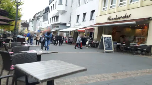
Capablanca (Zz. außen nur Getränke)
Restaurant · Italian, International
16-19 Markt, Siegburg
Mo-We 09:00-24:00, Fr-Sa 09:00-02:00, Su 11:00-23:00
Latino im Nordbahnhof
Restaurant · Regional
Bar/Café/Restaurant im ehem. Bahnhofsgebäude von 1887
4c Kronprinzenstraße, Siegburg
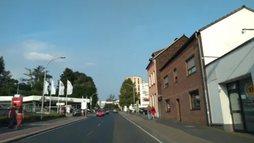
Chinesische Mauer
Restaurant · Chinese · 0.6 km
83-87 Zeithstraße, Siegburg
Mo-Sa 11:30-15:00,17:30-23:00; Su,PH 11:30-23:00
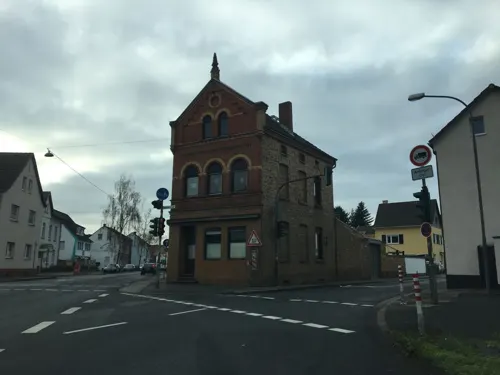
Dionysos
Restaurant · Greek · 1.9 km
60 Bonner Straße, Sankt Augustin
Mo-Sa 17:30-03:00; Su,PH 11:30-14:45,17:30-03:00
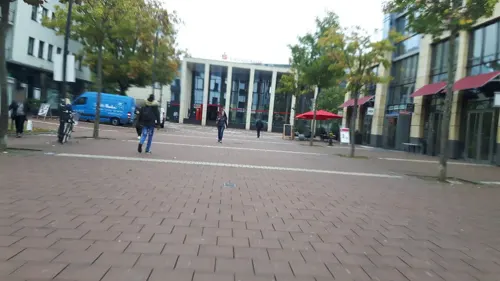
Eiscafé Garibaldi
Ice cream · Ice Cream · 0.6 km
15 Neue Poststraße, Siegburg
Apr-Oct: Mo-Sa 10:00-22:00; Apr-Oct: Su 10:00-22:00; Nov-Mar:...

Kasserolle
Restaurant · German · 1.1 km
Hotel u. Restaurant
64 Seidenbergstraße, Siegburg
Mo-Sa 17:30-24:00, Su,PH 11:30-15:00

207 more on the map.
History
Archbishop-Elector Anno II of Cologne founded a Benedictine monastery in 1064, known as Michaelsberg Abbey, on top of the hill also called the Michaelsberg. A settlement that arose from that was first mentioned as a city in 1182. Siegburg reached the height of its prosperity in the 15th and 16th century. It is famous for its pottery, especially for the Siegburg pitchers (Siegburger Krüge).
Siegburg has been the county seat of the Rhein-Sieg-Kreis since 1816.
Siegburg's synagogue was destroyed on Kristallnacht, signaling the demise of its Jewish community.
From the History section of Siegburg on Wikipedia, under CC BY-SA 4.0.
More about Siegburg
Geography
Siegburg is located approximately 8 kilometres (5.0 mi) east of the river Rhine, at the confluence where the Agger joins the Sieg, in the southeast corner of the Cologne Lowland. Neighbouring towns include Troisdorf, Lohmar, Sankt Augustin and Hennef. The nearby cities of Cologne and Bonn are easily accessible through good transport links. The highest point of the urban area is 220 metres (720 ft) above sea level (NHN) in the Braschoß area and the lowest point is just under 54 metres (177 ft) above sea level at the mouth of the Agger.
From the Wikipedia article Siegburg, under CC BY-SA 4.0.
Notable people from Siegburg
 Wolfgang OverathGerman footballerPhoto: Bert Verhoeff for Anefo, CC0
 Karl Ferdinand WimarGerman-American painter (1828-1862)Photo: Karl Ferdinand Wimar, Public domain
 Eva ViehmannGerman mathematicianPhoto: Ivonne Vetter, CC BY-SA 2.0 de
 Noah BitschGerman karatekaPhoto: Martin Rulsch , Wikimedia Commons, CC BY-SA 4.0
 Patricia HanebeckGerman footballerPhoto: Michael Frey ( Michael Frey ), CC BY-SA 3.0
 Gerald HeereGerman politicianPhoto: Sven Brauers, CC BY-SA 3.0 de
 Peter KurthGerman politicianPhoto: Raimond Spekking, CC BY-SA 4.0
 Björn FrankenGerman politicianPhoto: Wolkenkratzer, CC BY-SA 4.0
 Anja-Nina BahrmannGerman singer and opera singerPhoto: Anja Nina Bahrmann, CC BY-SA 4.0
- Engelbert HumperdinckGerman composer (1854–1921)
- Ludwig RadermacherGerman-born Austrian classical philologist
- Ruth RehmannGerman writer (1922–2016)
Born in Siegburg, according to Wikidata (CC0). Each name links to its Wikipedia article.
Where to stay11
Churches and places of worship38
Evangeliums-Christen-Baptistengemeinde Sankt Augustin
Church · Baptist · 1.8 km
2-4 An der Ziegelei, Sankt Augustin
Shopping59
Gas and EV charging22
Schools, colleges and libraries37
Healthcare20
Map of Siegburg
250 places. The map loads OpenStreetMap tiles when you open it.
Getting there and nearby towns
Cologne Bonn Airport (CGN) is the nearest airport with scheduled flights listed in OpenStreetMap, 9 km away.
- Sankt Augustin 3 km south, about 3 min by car
- Troisdorf 4 km west, about 4 min by car
- Lohmar 4 km north, about 4 min by car
- Hennef (Sieg) 6 km southeast, about 6 min by car
- Wahn-Heide 10 km northwest, about 10 min by car
- Oberkassel 10 km south, about 10 min by car
- Bonn 11 km southwest, about 11 min by car
- Rösrath 11 km north, about 11 min by car
- Niederkassel 12 km west, about 12 min by car
- Königswinter 14 km south, about 14 min by car
Drive times are estimates from straight-line distance, not routes.
Towns near Siegburg


Keep exploring
Local news
Headlines from INDB.
Reviews, tips and questions
Loading what members have shared...
Sources and licences
- GeoNames (CC BY 4.0): population, coordinates, regions and time zone
- Mapillary (see each image): photos
- OpenStreetMap contributors (ODbL 1.0): places, airports, map data
- Wikidata (CC0 1.0): elevation, founding date, time zone, website, landmarks and historic places
- Wikimedia Commons (see each image): photos
- Wikipedia (CC BY-SA 4.0): overview and history text
Photo credits
- Stolperstein Selma Levy, Kaiserstraße 46, Siegburg, Josef 'Jupp' Schugt (aka 'Penpen'), CC BY 4.0
- Stolpersteins Leo Levy, Erna Levy, Henriette Vorreuter, Kaiserstraße 63, Siegburg, Josef 'Jupp' Schugt (aka 'Penpen'), CC BY 4.0
- Stolpersteine Siegburg Kaiserstraße 63, Migebert, CC BY-SA 3.0
- Stolperstein Siegburg Kaiserstraße 63 Henriette Vorreuter, Migebert, CC BY-SA 3.0
- Stolperstein Siegburg Kaiserstraße 63 Erna Levy, Migebert, CC BY-SA 3.0
- Stolperstein Siegburg Kaiserstraße 63 Leo Levy, Migebert, CC BY-SA 3.0
- Stolperstein Siegburg Kaiserstraße 63 Wilhelmine Walter, Migebert, CC BY-SA 3.0
- Stolperstein Siegburg Kronprinzenstraße 11 Rosa Falkenstein (cropped), Josef 'Jupp' Schugt (aka 'Penpen'), CC BY 4.0
- Stolperstein Siegburg Kronprinzenstraße 11 Ilse Falkenstein (cropped), Josef 'Jupp' Schugt (aka 'Penpen'), CC BY 4.0
- Stolperstein Siegburg Kronprinzenstraße 11 Albert Falkenstein (cropped), Josef 'Jupp' Schugt (aka 'Penpen'), CC BY 4.0
- Stolpersteins Albert Falkenstein, Rosa Falkenstein, Ilse Falkenstein, Kronprinzenstraße 11, Siegburg, Josef 'Jupp' Schugt (aka 'Penpen'), CC BY 4.0
- Stolperstein Fanny Linz, Ankergasse 9, Siegburg, Josef 'Jupp' Schugt (aka 'Penpen'), CC BY-SA 4.0
- Stolperstein Oskar Hoffmann, Kronprinzenstraße 16, Siegburg (cropped), Josef 'Jupp' Schugt (aka 'Penpen'), CC BY 4.0
- Stolperstein Oskar Hoffmann, Kronprinzenstraße 16, Siegburg, Josef 'Jupp' Schugt (aka 'Penpen'), CC BY 4.0
- Stolpersteins Hans Lion, Kronprinzenstraße 16, Siegburg (cropped), Josef 'Jupp' Schugt (aka 'Penpen'), CC BY 4.0
- Stolpersteins Walter Lion, Hans Lion, Kronprinzenstraße 16, Siegburg (cropped), Josef 'Jupp' Schugt (aka 'Penpen'), CC BY 4.0
- Stolpersteins Walter Lion, Hans Lion, Kronprinzenstraße 16, Siegburg, Josef 'Jupp' Schugt (aka 'Penpen'), CC BY 4.0
- Stolperstein Ilse Fröhlich, Kaiserstraße 20, Siegburg, Josef 'Jupp' Schugt (aka 'Penpen'), CC BY 4.0
- Stolpersteins Albert Neumann, Karoline Neumann, Kaiserstraße 20, Siegburg, Josef 'Jupp' Schugt (aka 'Penpen'), CC BY 4.0
- Synagogue (Siegburg) foto-5, Velopilger, CC0
- Stolpersteinlage Siegburg Brauhof, Tomtom10, CC BY-SA 4.0
- Synagogue (Siegburg) foto-4, Velopilger, CC0
- 20190623CafeBaltikaSiegburg.Reader-02, Velopilger, CC BY-SA 4.0
- Synagogue (Siegburg) foto-3, Velopilger, CC0
- Synagogue (Siegburg) foto-1, Velopilger, CC0
- Synagogue (Siegburg) foto-2, Velopilger, CC0
- Stolpersteinlage Siegburg Holzgasse 23, Tomtom10, CC BY-SA 4.0
- Stolpersteinlage Siegburg Holzgasse 28, Tomtom10, CC BY-SA 4.0
- Stolperstein Siegburg Holzgasse 32 Rosalie Wallerstein, Tomtom10, CC BY-SA 4.0
- Stolpersteine Siegburg Holzgasse 28, Tomtom10, CC BY-SA 4.0
- Stolperstein Siegburg Holzgasse 28 Max Gottlieb, Tomtom10, CC BY-SA 4.0
- Stolperstein Siegburg Holzgasse 23 Berta Levy, Tomtom10, CC BY-SA 4.0
- Stolperstein Siegburg Holzgasse 32 Benjamin Wallerstein, Tomtom10, CC BY-SA 4.0
- Stolpersteinlage Siegburg Holzgasse 32, Tomtom10, CC BY-SA 4.0
- Stolpersteine Siegburg Holzgasse 32, Tomtom10, CC BY-SA 4.0
- Stolperstein Siegburg Holzgasse 28 Kurt Gottlieb, Tomtom10, CC BY-SA 4.0
- Stolperstein Siegburg Holzgasse 32 Cäcilia Unger, Tomtom10, CC BY-SA 4.0
- Stolperstein Siegburg Holzgasse 31 Leopold Müller, Tomtom10, CC BY-SA 4.0
- Stolperstein Siegburg Holzgasse 31 Adela Müller, Tomtom10, CC BY-SA 4.0
- Stolperstein Siegburg Holzgasse 31 Eduard Fröhlich, Tomtom10, CC BY-SA 4.0
- Studiobuehne-su01, A.Savin, CC BY-SA 3.0
- 2020-04-22-sankt-augustin-skulpturenweg-grantham-allee-20-induktion-02, Axel Kirch, CC BY-SA 4.0
- Luftbild Siegburg, Unknown author, Public domain
- Abtei michaelsberg-2005 12 25, Daniel Tibi ( Dti ) | daniel-tibi.de, Public domain
- Wolsberge, Olbertz, CC BY-SA 3.0
- Siegburg Siegessaeule, Olbertz, CC BY-SA 3.0
- St. Martinus Niederpleis P1110039, Stefan Knauf, Public domain
- Sankt Servatius Siegburg 2, Olbertz 19:39, 10. Jul. 2011 (CEST), CC BY-SA 3.0
- Stallenberger-Fischteicherp, Travus, CC BY-SA 3.0
- Trerichsweiher1, Olbertz, CC BY-SA 3.0
- 2010-01-25 Siegburg Stadtmuseum Schnee, Sir James, CC BY 3.0
- Anno Gymnasium Siegburg, Irgendwer Irgendwie, CC BY-SA 4.0
- Gymnasium Siegburg Alleestraße-2703, Raimond Spekking, CC BY-SA 4.0
- St. Georg Buisdorf PA230157, Stefan Knauf, Public domain
- NRW NSG Siegaue nahe Auel CDDA 389900, Bagheera-mine, CC BY-SA 4.0
- Kinderklinik Sankt Augustin, Stefan Knauf, Public domain
- Troisdorf-Mitte St. Gerhard Nordwestansicht 20220226 cropped, Glewe, CC BY-SA 4.0
- 2020-06-29-sankt-augustin-skulpturenweg-theater-in-der-schule-02, Axel Kirch, CC BY-SA 4.0
- Schulzentrum Niederpleis, Westeingang, Lilly Bo Gray, CC BY-SA 4.0
- FH Sankt Augustin3, Stefan Knauf, Public domain
- Wiederauferstehungskirche Siegburg, Olbertz at German Wikipedia, CC BY-SA 3.0
- StAn-Pestkreuz, X-y-z-SU-68, CC BY-SA 4.0
- Im Wald 3, Olli1188, CC BY-SA 3.0
- Stolperstein Siegburg Brauhof Salomon Seelig, Tomtom10, CC BY-SA 4.0
- Street-level photo, mfa, CC BY-SA 4.0
- Street-level photo, mfa, CC BY-SA 4.0
- Street-level photo, changchun1, CC BY-SA 4.0
- Street-level photo, poxonline, CC BY-SA 4.0
- Street-level photo, uwekoch, CC BY-SA 4.0
- Street-level photo, uwekoch, CC BY-SA 4.0
- Street-level photo, changchun1, CC BY-SA 4.0
- Street-level photo, changchun1, CC BY-SA 4.0
- Street-level photo, poxonline, CC BY-SA 4.0
- Street-level photo, changchun1, CC BY-SA 4.0
- Street-level photo, changchun1, CC BY-SA 4.0
- Street-level photo, changchun1, CC BY-SA 4.0
- Street-level photo, chuck, CC BY-SA 4.0
- Street-level photo, raymond, CC BY-SA 4.0
- Street-level photo, VIA_DT, CC BY-SA 4.0
- Street-level photo, poxonline, CC BY-SA 4.0
- Street-level photo, uwekoch, CC BY-SA 4.0
- Street-level photo, poxonline, CC BY-SA 4.0
- Street-level photo, poxonline, CC BY-SA 4.0
- Street-level photo, klaus, CC BY-SA 4.0
- Street-level photo, DieserLars, CC BY-SA 4.0
- Street-level photo, VIA_DT, CC BY-SA 4.0
- Street-level photo, VIA_DT, CC BY-SA 4.0
- Street-level photo, VIA_DT, CC BY-SA 4.0
- Street-level photo, VIA_DT, CC BY-SA 4.0
- Street-level photo, VIA_DT, CC BY-SA 4.0
- Street-level photo, mfa, CC BY-SA 4.0
- Street-level photo, changchun1, CC BY-SA 4.0
- Street-level photo, changchun1, CC BY-SA 4.0
- Street-level photo, zuse, CC BY-SA 4.0
- Street-level photo, mfa, CC BY-SA 4.0
- Street-level photo, changchun1, CC BY-SA 4.0
- Street-level photo, changchun1, CC BY-SA 4.0


Page built November 9, 2026. Spotted a mistake? Tell us or suggest a place.