


Wachtberg, Germany
Wachtberg is a town of 20,032 people in North Rhine-Westphalia, Germany.
Why visit Wachtberg
Townapedia lists 100 museums and landmarks, 43 parks and trails, 91 places to eat, 10 places to stay and 27 attractions in and around town.
Highlights include Bauernhof Schimmel, Grafschafter Krautfabrik Werksverkauf, Jägerkreuz and Jakobskreuz.
Weather in Wachtberg
Forecast from MET Norway (CC BY 4.0). Full forecast
About Wachtberg
Wachtberg (German pronunciation: [ˈvaxtbɛʁk]) is a municipality in the Rhein-Sieg district, of North Rhine-Westphalia, Germany. It is situated approximately 15 km south of Bonn. In December 2025 the Wachtberg municipality had 20,230 inhabitants.
From the Wikipedia article Wachtberg (this version), under CC BY-SA 4.0.
Things to do27

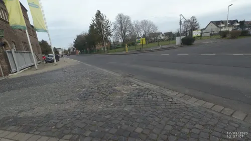
Grafschafter Krautfabrik Werksverkauf
Farm and orchard · 6.0 km
22-26 Wormersdorfer Straße, Meckenheim
Mo-Th 08:00-16:00; Fr-Su off
Bioland Hofladen Dorothee Hochgürtel
Farm and orchard · 4.4 km
1b Auf dem Acker, Wachtberg
Sa 11:00-13:00

Schauspielhaus Bad Godesberg
Cinema and theater · 6.7 km
Theatre in Bad Godesberg, Bonn, Germany

Hofladen Ockenfels
Farm and orchard · 3.8 km
4 Weißer Weg, Wachtberg
Mo-Sa 09:00-17:30

15 more on the map.
Museums and landmarks100


Stella Rheni
Monument and historic site · 5.8 km
18 Elisabethstraße, Bonn

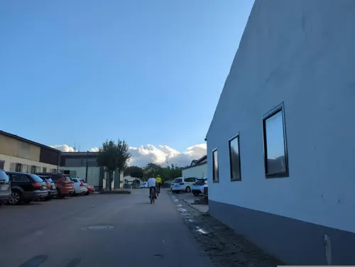
Burg Münchhausen
Monument and historic site · 4.6 km
1 Burg Münchhausen, Wachtberg

Burg Odenhausen
Monument and historic site · 2.0 km
39 Oberdorfstraße, Wachtberg


Kunst- und Ausstellungshalle der Bundesrepublik Deutschland
Museum · 9.1 km
Museum in Bonn, Germany


Schloss Drachenburg
Museum · 8.5 km
19th century villa in Königswinter, Germany

Dickbaumskreuz
Monument and historic site · Catholic · 5.5 km
Das Kreuz dienste als Wegemarke zu Zeiten des Kurfürsten Clemens August. Das Kreuz zeigt das gekrönte kurfürstliche Wappen.
88 more on the map.
Parks, trails and playgrounds43







31 more on the map.
Restaurants and cafes91
Bonner Eiszeit
Cafe · Ice Cream, Coffee Shop, Waffles · 5.1 km
2-10 Akazienweg, Bonn
Tu-Su 10:00-19:00

Da Nando e Francesco
Restaurant · Italian · 5.8 km
39 Klosterbergstraße, Bonn
Mo-Sa 17:30-22:30; Su 11:30-14:30, 17:30-22:00; We off
El Patio Heiderhöfchen
Restaurant · Spanish · 4.8 km
4 Sommerbergweg, Bonn
Su,Mo,We,Th 17:00-22:00; Fr,Sa 17:00-23:00; Tu off
Gaststätte Waldesruh
Restaurant · German, Cake, Ice Cream · 1.8 km
62 Dorfstraße, Wachtberg
Mo-Sa 12:00+; Su 11:00+
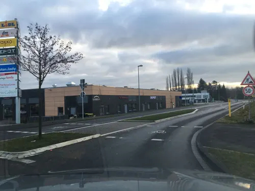
L'Osteria
Restaurant · Italian · 2.1 km
6 Bernareggio-Platz, Wachtberg
Mo-Sa 12:00-22:00; Su,PH 12:00-22:00
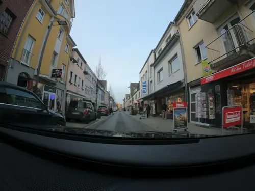
La Taverna
Restaurant · Indian · 5.7 km
80 Hauptstraße, Meckenheim
Su-Mo, We-Fr 11:30-14:30, 17:00-22:30; Sa 17:00-22:30
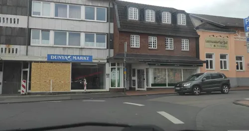
Lannesdorfer Hof
Restaurant · Croatian · 6.1 km
1 Lannesdorfer Straße, Bonn
Tu-Sa 17:00-22:00; Su,PH 11:00-14:00,17:00-22:00; Mo off
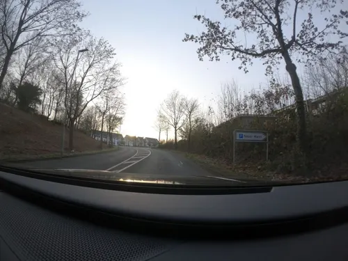
Reis Haus Asian Fusion
Restaurant · Asian · 4.3 km
28-30 Neuer Markt, Meckenheim
PH,Fr-Su 11:00-21:30; Tu-Th 11:00-15:00,16:00-21:30
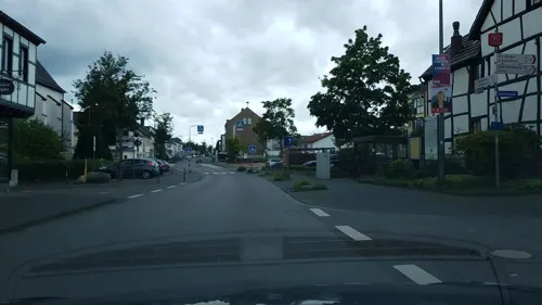
Türkmen's Pizza & Kebabhaus
Restaurant · Turkish · 3.3 km
83 Töpferstraße, Wachtberg
We-Su 11:30-21:30


Vellini - Restaurant & Bar
Restaurant · German, Regional, Burger, Pasta, Pizza, Seafood, Steak, Tapas · 6.0 km
32 Bahnhofstraße, Meckenheim
Mo-Sa 09:00-23:00, Su 10:00-23:00
79 more on the map.
Where to stay10
Churches and places of worship48
Antoniuskapelle
Church · Roman Catholic · 2.8 km
Antoniusweg, Wachtberg
Heilige Drei Könige
Church · Catholic · 4.3 km
23 Dreikönigenstraße, Wachtberg
St. Georg
Church · Roman Catholic · 4.3 km
15 Oevericher Straße, Wachtberg
St. Venantius-Kapelle
Church · Catholic · 5.7 km
28 Reichsstraße, Bonn
Shopping33
Gas and EV charging16
Schools, colleges and libraries33
GGS "Drachenfelsschule" Niederbachem
School · Catholic, Evangelic · 5.6 km
2 Langenbergsweg, Wachtberg
Healthcare18
Map of Wachtberg
250 places. The map loads OpenStreetMap tiles when you open it.
Getting there and nearby towns
Cologne Bonn Airport (CGN) is the nearest airport with scheduled flights listed in OpenStreetMap, 26 km away.
- Bonn 11 km north, about 11 min by car
- Wesseling 23 km north, about 23 min by car
- Weilerswist 22 km northwest, about 22 min by car
- Zündorf 26 km north, about 26 min by car
- Zülpich 32 km west, about 32 min by car
- Köln 35 km north, about 35 min by car
- Bergisch Gladbach 39 km north, about 39 min by car
- Leverkusen 45 km north, about 45 min by car
- Waldbröl 45 km northeast, about 45 min by car
- Koblenz 46 km southeast, about 46 min by car
Drive times are estimates from straight-line distance, not routes.
Local news
Headlines from INDB.
Reviews, tips and questions
Loading what members have shared...
Sources and licences
- GeoNames (CC BY 4.0): population, coordinates, regions and time zone
- Mapillary (see each image): photos
- OpenStreetMap contributors (ODbL 1.0): places, airports, map data
- Wikidata (CC0 1.0): elevation, founding date, time zone, website, landmarks and historic places
- Wikimedia Commons (see each image): photos
- Wikipedia (CC BY-SA 4.0): overview and history text
Photo credits
- Burg-Gudenau-004, Wolkenkratzer, CC BY-SA 3.0
- Villip (Wachtberg), Kirche St. Simon und Judas Thaddäus, Dguendel, CC BY 4.0
- 2021-08-30-wachtberg-ehrenmal-16, Axel Kirch, CC BY-SA 4.0
- 2021-08-30-wachtberg-ehrenmal-22, Axel Kirch, CC BY-SA 4.0
- 2021-08-30-wachtberg-ehrenmal-04, Axel Kirch, CC BY-SA 4.0
- 2021-08-30-wachtberg-ehrenmal-09, Axel Kirch, CC BY-SA 4.0
- 2021-08-30-wachtberg-ehrenmal-24, Axel Kirch, CC BY-SA 4.0
- 2021-08-30-wachtberg-ehrenmal-17, Axel Kirch, CC BY-SA 4.0
- 2021-08-30-wachtberg-ehrenmal-07, Axel Kirch, CC BY-SA 4.0
- 2021-08-30-wachtberg-ehrenmal-25, Axel Kirch, CC BY-SA 4.0
- 2021-08-30-wachtberg-ehrenmal-05, Axel Kirch, CC BY-SA 4.0
- 2021-08-30-wachtberg-ehrenmal-14, Axel Kirch, CC BY-SA 4.0
- 2021-08-30-wachtberg-ehrenmal-12, Axel Kirch, CC BY-SA 4.0
- 2021-08-30-wachtberg-ehrenmal-13, Axel Kirch, CC BY-SA 4.0
- 2021-08-30-wachtberg-ehrenmal-20, Axel Kirch, CC BY-SA 4.0
- 2021-08-30-wachtberg-ehrenmal-02, Axel Kirch, CC BY-SA 4.0
- 2021-08-30-wachtberg-ehrenmal-10, Axel Kirch, CC BY-SA 4.0
- 2021-08-30-wachtberg-ehrenmal-23, Axel Kirch, CC BY-SA 4.0
- 2021-08-30-wachtberg-ehrenmal-15, Axel Kirch, CC BY-SA 4.0
- 2021-08-30-wachtberg-ehrenmal-01, Axel Kirch, CC BY-SA 4.0
- 2021-08-30-wachtberg-ehrenmal-18, Axel Kirch, CC BY-SA 4.0
- 2021-08-30-wachtberg-ehrenmal-11, Axel Kirch, CC BY-SA 4.0
- 2021-08-30-wachtberg-ehrenmal-06, Axel Kirch, CC BY-SA 4.0
- 2021-08-30-wachtberg-ehrenmal-21, Axel Kirch, CC BY-SA 4.0
- Schauspielhaus Bad Godesberg Bonn 20210919 0005, Tilman2007, CC BY-SA 4.0
- Deutsches Museum Bonn, Hans Weingartz, CC BY-SA 2.0 de
- Kunst- und Ausstellungshalle der Bundesrepublik Deutschland - Bundeskunsthalle-9245, Raimond Spekking, CC BY-SA 4.0
- Aerial image of Schloss Drachenburg (view from the northeast), Carsten Steger, CC BY-SA 4.0
- Alt St. Martin Muffendorf (2), Hagen von Eitzen, CC BY-SA 3.0
- Arzdorf(Wachtberg)Antoniuskapelle397, Reinhardhauke, CC BY-SA 3.0
- Burg Odenhausen Luftbild 01, MFSG, CC BY-SA 3.0
- Fritzdorf(Wachtberg) St.Georg Turm527, GFreihalter, CC BY-SA 3.0
- Fritzdorf Windmühle, Springfield911 at German Wikipedia, CC BY-SA 3.0
- Kottenforst09, The original uploader was Harri Beau at German Wikipedia ., CC BY-SA 3.0 de
- Adendorf(Wachtberg)St.Margareta401, GFreihalter, CC BY-SA 3.0
- Aloisiuskolleg, A.Savin, CC BY-SA 3.0
- Our School, I.B.I.S. Independent Bonn International School Tulpenbaumweg 42 D-53177 Bonn, CC BY-SA 4.0
- Wolfskreuz Kottenforst 02, Hagman, CC BY-SA 3.0 de
- Kirche Heilige Drei Könige Oberbachem von Süden 2012, Xonn, CC BY-SA 3.0
- 2015 Dächelsberg, ehemaliger Steinbruch, Xonn, CC BY-SA 3.0
- Stella Rheni-01-Nordfassade, Muck, CC BY-SA 4.0
- Bonn, St. Venantius, Hagen von Eitzen, CC BY-SA 3.0
- Naturschutzgebiet Steinbruch Lyngsberg Wald, GeoBonn, CC BY-SA 4.0
- 2025 Friedenskirche (Meckenheim im Rheinland) (1), Chris06, CC BY-SA 4.0
- 2013-09-02 Evangelische Immanuelkirche, Tulpenbaumweg 2, Bonn-Heiderhof, Blickrichtung Nordwest IMG 0974, Eckhard Henkel, CC BY-SA 3.0 de
- St. Martin in Muffendorf ( Bonn-Bad Godesberg), Diwalt, CC0
- 2021-08-25-bonn-flerzheimer-allee-holzkreuz-jaegerkreuz-02, Axel Kirch, CC BY-SA 4.0
- Kaolingrube oedingen4, Sozi, Public Domain
- Pond Frogs (Pelophylax), Karsten von Berg, CC BY-SA 4.0
- Aerial image of Burg Gudenau (view from the northeast), Carsten Steger, CC BY-SA 4.0
- Witterschlick Dickbaumskreuz (01), Prof. emeritus Hans Schneider (Geyersberg), CC BY 3.0
- Street-level photo, bitnapper, CC BY-SA 4.0
- Street-level photo, derzornigemarkus, CC BY-SA 4.0
- Street-level photo, Lowiekse, CC BY-SA 4.0
- Street-level photo, VIA_KK, CC BY-SA 4.0
- Street-level photo, coha, CC BY-SA 4.0
- Street-level photo, private, CC BY-SA 4.0
- Street-level photo, bitnapper, CC BY-SA 4.0
- Street-level photo, VIA_DT, CC BY-SA 4.0
- Street-level photo, VIA_KK, CC BY-SA 4.0
- Street-level photo, coha, CC BY-SA 4.0
- Street-level photo, wolly79, CC BY-SA 4.0
- Street-level photo, bonnsoir, CC BY-SA 4.0
- Street-level photo, derzornigemarkus, CC BY-SA 4.0
- Street-level photo, wolly79, CC BY-SA 4.0
- Street-level photo, stili, CC BY-SA 4.0
- Street-level photo, changchun1, CC BY-SA 4.0
- Street-level photo, changchun1, CC BY-SA 4.0
- Street-level photo, VIA_DT, CC BY-SA 4.0
- Street-level photo, Lowiekse, CC BY-SA 4.0
- Street-level photo, coha, CC BY-SA 4.0
- Street-level photo, VIA_DT, CC BY-SA 4.0
- Street-level photo, VIA_DT, CC BY-SA 4.0
- Street-level photo, pepu0815, CC BY-SA 4.0
- Street-level photo, VIA_DT, CC BY-SA 4.0
- Street-level photo, coha, CC BY-SA 4.0
- Street-level photo, changchun1, CC BY-SA 4.0


Page built November 8, 2026. Spotted a mistake? Tell us or suggest a place.