


Why visit Ovelgönne
Townapedia lists 19 museums and landmarks, 19 parks and trails, 73 places to eat, 22 places to stay and 12 attractions in and around town.
Highlights include Centraltheater Brake, Oberfeuer Großerpater, Handwerksmuseum Ovelgönne and Hermann-Allmers-Haus.
Weather in Ovelgönne
Forecast from MET Norway (CC BY 4.0). Full forecast
About Ovelgönne
Ovelgönne (German pronunciation: [ˈoːfl̩ˌɡœnə]) is a municipality in the district of Wesermarsch, in Lower Saxony, Germany. It is situated approximately 27 km northeast of Oldenburg, and 40 km northwest of Bremen. The municipality of Ovelgönne has its administration in the village of Oldenbrok and not in the homonymous village of Ovelgönne.
From the Wikipedia article Ovelgönne (this version), under CC BY-SA 4.0.
Things to do12



Harrier Kaje
Scenic view · 4.9 km
Fahrradrastpunkt mit sehr guter Aussicht auf Strom und Hafen

Museums and landmarks19


Hermann-Allmers-Haus
Museum · 7.3 km
1 Mittelstraße, Hagen im Bremischen
Su 13:00-17:00
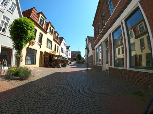
Schiffahrtsmuseum der Oldenburgischen Unterweser Borgstede & Becker (Haus2)
Museum · 4.5 km
9 Breite Straße, Brake (Unterweser)
Apr-Oct: Tu-Su 10:00-17:00; Nov-Mar Tu-Sa 11:00-17:00, Su...



Bollwerk
Monument and historic site · 8.3 km
Kleine Ausstellung in einem ehemaligen Bauwagen.
7 more on the map.
Parks, trails and playgrounds19





Schützenverein Rönnelmoor
Sports field and stadium · 8.9 km
3 Am Freibad, Jade

7 more on the map.
Restaurants and cafes73

Charisma
Restaurant · Greek · 4.2 km
53 Breite Straße, Brake (Unterweser)
Su-Th 17:30-22:00; Fr,Sa 17:30-23:00; Tu off
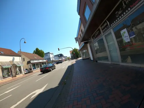
Duc d'Alben
Restaurant · Regional, Burger · 4.1 km
71 Breite Straße, Brake (Unterweser)
Tu-Su 17:00-23:00;Mo off
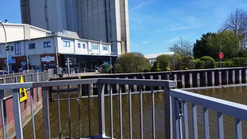



aipi.cafe
Cafe · Coffee Shop · 4.2 km
Firmeninternes Mini-Internet-Café für Kunden und Mitarbeiter.
38 Bahnhofstraße, Brake (Unterweser)
"nach Vereinbarung"

#datenschutz.bar
Bar and pub · 4.2 km
Nicht öffentliche Bar von aipi - nur für Geschäftskunden
38 Bahnhofstraße, Brake (Unterweser)
"nach Vereinbarung"

Bäckermeister Haferkamp GmbH
Bakery · 5.1 km
118 Kirchenstraße, Brake
Mo-Sa 06:30-19:00; Su 07:30-12:00
Hahnenknooper Mühle
Cafe · Regional · 6.9 km
19 Rodenkircherwurp, Stadland
Landbäckerei Tönjes im Netto
Bakery · 6.5 km
10B Marktstraße, Stadland
Mo-Fr 07:00-19:00; Sa 07:00-18:00
61 more on the map.
History
Ovelgönne has its origins in the "Oevelgünne" fortress which was constructed by Count Johann V of Oldenburg (1482–1526) at the end of June 1514 in order to enforce his rule over the surrounding area.
In 1583, Ovelgönne was given additional fortifications. From 1628 to 1631, Imperial Troops were quartered at Ovelgönne during the Thirty Years' War.
From the History section of Ovelgönne on Wikipedia, under CC BY-SA 4.0.
Where to stay22
Churches and places of worship16
St. Bartholomäus-Kirche Golzwarden
Church · Lutheran · 3.1 km
21 Raiffeisenstraße, Brake
Friedrichskirche Hammelwarden
Church · Lutheran · 5.9 km
Hammelwarder Straße, Brake
St. Johanniskirche Sandstedt
Church · Evangelisch · 7.1 km
Marktstraße, Hagen im Bremischen
Shopping20
Fahrradwerkstatt Zweiraddiele Norbert Lang
Shop · 5.2 km
170a Lange Straße, Brake
Gas and EV charging8
Schools, colleges and libraries19
Healthcare8
Map of Ovelgönne
216 places. The map loads OpenStreetMap tiles when you open it.
Getting there and nearby towns
JadeWeserAirport (WVN) is the nearest airport with scheduled flights listed in OpenStreetMap, 30 km away.
- Brake (Unterweser) 4 km east, about 4 min by car
- Schwanewede 17 km southeast, about 17 min by car
- Nordenham 18 km north, about 18 min by car
- Rastede 18 km southwest, about 18 min by car
- Varel 20 km west, about 20 min by car
- Loxstedt 21 km northeast, about 21 min by car
- Wiefelstede 22 km southwest, about 22 min by car
- Bremerhaven 26 km northeast, about 26 min by car
- Oldenburg 26 km southwest, about 26 min by car
- Hude 26 km south, about 26 min by car
Drive times are estimates from straight-line distance, not routes.
Local news
Headlines from INDB.
Reviews, tips and questions
Loading what members have shared...
Sources and licences
- GeoNames (CC BY 4.0): population, coordinates, regions and time zone
- Mapillary (see each image): photos
- OpenStreetMap contributors (ODbL 1.0): places, airports, map data
- Wikidata (CC0 1.0): elevation, founding date, time zone, website, landmarks and historic places
- Wikimedia Commons (see each image): photos
- Wikipedia (CC BY-SA 4.0): overview and history text
Photo credits
- 2012-05-28 Fotoflug Cuxhaven Wilhelmshaven DSCF9787, Martina Nolte, CC BY-SA 3.0 de
- Jade-Hochschule, Wilhelmshaven, Gerd Fahrenhorst, CC BY-SA 3.0
- Außenansicht, Jan Wendrich, CC BY-SA 2.0 de
- Rodenkirchen Orgel 52416373, Dennis Wubs, CC BY-SA 3.0
- Ostfriesland msu-0779, User:Matthias Süßen, CC BY-SA 3.0
- Sandstedt old range rear 6559, Ein Dahmer, CC BY-SA 4.0
- Bartholomäuskirche Brake Golzwarden, Brakemc, CC BY-SA 3.0
- Sandstedt range rear 6565, Ein Dahmer, CC BY-SA 4.0
- Grosserpater range rear 6573, Ein Dahmer, CC BY-SA 4.0
- Grosserpater range front 6590, Ein Dahmer, CC BY-SA 4.0
- Ovelgönne Kirche, BlankeVla, CC BY 3.0
- St. Marien Kirche Brake, Ludger Sunder-Plassmann, CC BY-SA 4.0
- Kirche Oldenbrock-Mittelort, ClausNe, CC BY-SA 4.0
- Kirche Wersabe 1, ClausNe, CC BY-SA 4.0
- Hermann-Allmers-Haus, Jan-Christian Voos, CC BY-SA 3.0
- Weserinsel Harriersand bei Brake (49691084657), Federal Waterways Engineering and Research Institute, CC BY 2.0
- Harriersand range rear 6589, Ein Dahmer, CC BY-SA 4.0
- Sandstedt Leuchtturm Oberfeuer alt, Oberlausitzerin64, CC BY-SA 4.0
- Harriersand range front 6585, Ein Dahmer, CC BY-SA 4.0
- Soldatendenkmal, Brake 0362, Gerd Fahrenhorst, CC BY 4.0
- Brake 2012 (10), Soluvo, CC BY-SA 4.0
- Friedrichskirche in Hammelwarden, Helmut Behrends, Freesenweg 41, D-26131 Oldenburg, CC BY-SA 3.0 de
- Stadtkirche (Brake) Foto 3, Gerd Fahrenhorst, CC BY 4.0
- 2012-05-28 Fotoflug Cuxhaven Wilhelmshaven DSCF9792, Martina Nolte, CC BY-SA 3.0 de
- Mitteldeichstraße 31, Centraltheater, Brake, Gerd Fahrenhorst, CC BY 4.0
- Handwerksmuseum Ovelgönne Apotheke Lizenz HMO 2022, HWMOvelgoenne, CC BY-SA 4.0
- Street-level photo, VIA_KK, CC BY-SA 4.0
- Street-level photo, changchun1, CC BY-SA 4.0
- Street-level photo, changchun1, CC BY-SA 4.0
- Street-level photo, changchun1, CC BY-SA 4.0
- Street-level photo, VIA_KK, CC BY-SA 4.0
- Street-level photo, VIA_KK, CC BY-SA 4.0
- Street-level photo, VIA_KK, CC BY-SA 4.0


Page built November 9, 2026. Spotted a mistake? Tell us or suggest a place.