


Pasewalk, Germany
Pasewalk is a town of 12,120 people in Mecklenburg-Vorpommern, Germany, founded in 1201.
Why visit Pasewalk
Townapedia lists 20 museums and landmarks, 8 parks and trails, 22 places to eat and 6 places to stay in and around town.
Highlights include Lokschuppen Pasewalk and Museum Stadt Pasewalk.
Weather in Pasewalk
Forecast from MET Norway (CC BY 4.0). Full forecast
About Pasewalk
Pasewalk (German: [ˈpaːzəvalk] ) is a town in the Vorpommern-Greifswald district, in the state of Mecklenburg-Vorpommern in north-eastern Germany. Located on the Uecker river, it is the capital of the former Uecker-Randow district, and the seat of the Uecker-Randow-Tal Amt, of which it is not part.
From the Wikipedia article Pasewalk (this version), under CC BY-SA 4.0.
Museums and landmarks20




Feuerwehrmuseum Pasewalk
Museum · 1.1 km
33 Torgelower Straße, Pasewalk
Su 14:00-18:00


8 more on the map.
Parks, trails and playgrounds8





Restaurants and cafes22

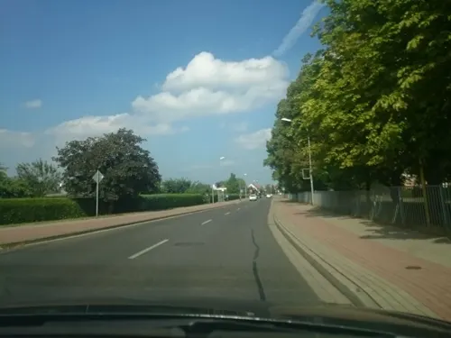
Donna Isabelle
Restaurant
21 Stettiner Straße
Tu-Th 11:00-14:00,17:00-21:00; PH,Fr-Su 11:30-14:00,17:00-21:00; Mo off
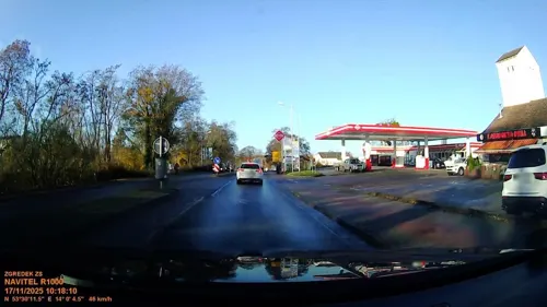
Kapadokya Grill
Restaurant · Turkish · 0.8 km
7 Stettiner Chaussee, Pasewalk
Mo-Su 10:00-22:00



Backstube & Café "Zur Alten Mühle"
Cafe
Mo-Fr 11:00-20:30; Sa 15:00-20:30; Su 12:00-20:30
10 more on the map.
Where to stay6



WasserWanderRastplatz Kunstgarten Pasewalk
Campground · 0.6 km
Zeltplatz für Wasserwanderer und Fahrradfahrer Geöffnet von Mai bis Oktober
5 An der Uecker
Mo-Su 08:00-12:00,18:00-20:00

"Herberge auf Rädern" beim "Lokschuppen Pomerania e.V."
Motel and hotel · 1.4 km
14 Speicherstraße, Pasewalk
History
Pasewalk became a town during the 12th century and was soon a member of the Hanseatic League. In 1359 it passed to the Duke of Pomerania. Frequently ravaged during the wars which devastated the district, it was plundered several times by Imperial troops during the Thirty Years' War. In the Peace of Westphalia in 1648 it was given to Sweden. In 1657 it was burned down by the Poles, in 1676 it was conquered by Brandenburg, and in 1713 it was burned down by the Russians. In 1720, in the Peace of Stockholm, it passed from Sweden to Prussia. In the early 18th century, a commune of French Huguenots was established in the town. It was part to the Prussian Province of Pomerania from 1720 until 1945. In 1760, the Battle of Pasewalk was fought, won by the Swedes.
From the History section of Pasewalk on Wikipedia, under CC BY-SA 4.0.
Churches and places of worship9
Shopping14
Gas and EV charging5
Schools, colleges and libraries7
Healthcare5
Map of Pasewalk
96 places. The map loads OpenStreetMap tiles when you open it.
Getting there and nearby towns
Heringsdorf Airport (HDF) is the nearest airport with scheduled flights listed in OpenStreetMap, 43 km away.
- Rollwitz 4 km south, about 4 min by car
- Torgelow 14 km north, about 14 min by car
- Prenzlau 23 km south, about 23 min by car
- Ueckermünde 26 km north, about 26 min by car
- Schwedt (Oder) 53 km south, about 53 min by car
- Templin 54 km southwest, about 54 min by car
- Angermünde 55 km south, about 55 min by car
- Wolgast 62 km north, about 1 h by car
- Zehdenick 73 km southwest, about 1 h 15 min by car
- Eberswalde 76 km south, about 1 h 15 min by car
Drive times are estimates from straight-line distance, not routes.
Local news
Headlines from INDB.
Reviews, tips and questions
Loading what members have shared...
Sources and licences
- GeoNames (CC BY 4.0): population, coordinates, regions and time zone
- Mapillary (see each image): photos
- OpenStreetMap contributors (ODbL 1.0): places, airports, map data
- Wikidata (CC0 1.0): elevation, founding date, time zone, website
- Wikimedia Commons (see each image): photos
- Wikipedia (CC BY-SA 4.0): overview and history text
Photo credits
- Pasewalk-Kaufhaus-IMG 1970, Mr. Pommeroy, CC BY-SA 4.0
- Pasewalk-Kaufhaus-IMG 1971, Mr. Pommeroy, CC BY-SA 4.0
- 2009-06-20-pasewalk-by-RalfR-18, Ralf Roletschek ( talk ), GFDL 1.2
- Pasewalk - panoramio (2), jens@storchenhof-pap…, CC BY-SA 3.0
- Pasewalk, Haus Marktstraße 22, Dguendel, CC BY 3.0
- Pasewalk, Klosterstraße und Europaschule Oskar-Picht-Gymnasium, Dguendel, CC BY 3.0
- Pasewalk-Gedenktafel-Jüdische-Gemeinde-IMG 6119, Mr. Pommeroy, CC BY-SA 4.0
- Pasewalk-Gedenktafel-Jüdische-Gemeinde-IMG 6118, Mr. Pommeroy, CC BY-SA 4.0
- Pasewalk - panoramio (3), Alexander Lemke, CC BY 3.0
- Pasewalk, Ueckerstraße und Haus Ueckerstraße 23, Dguendel, CC BY 3.0
- Pasewalk-Neue-Apotheke-(1895)-IMG 6380, Mr. Pommeroy, CC BY-SA 4.0
- 2009-06-20-pasewalk-by-RalfR-17, Ralf Roletschek ( talk ), GFDL 1.2
- Pasewalk-Alte-Post-Anbau-(DDR)-IMG 2031, Mr. Pommeroy, CC BY-SA 4.0
- Pasewalk-Alte-Post-(Detail)-IMG 2030, Mr. Pommeroy, CC BY-SA 4.0
- Pasewalk-Alte-Post-IMG 6120, Mr. Pommeroy, CC BY-SA 4.0
- Pasewalk-Alte-Post-IMG 2014, Mr. Pommeroy, CC BY-SA 4.0
- Pasewalk-Alte-Post-IMG 2029, Mr. Pommeroy, CC BY-SA 4.0
- 17309 Pasewalk, Germany - panoramio (8), Alexander Lemke, CC BY 3.0
- 17309 Pasewalk, Germany - panoramio (7), Alexander Lemke, CC BY 3.0
- Pasewalk-Schule-Baustraße-Ecke-Klosterstraße-IMG 2059, Mr. Pommeroy, CC BY-SA 4.0
- Pasewalk Stadtbibliothek, Ephraim Stillberg, CC BY-SA 3.0
- Amtsgericht Pasewalk - panoramio, Alexander Lemke, CC BY 3.0
- 2009-06-20-pasewalk-by-RalfR-47, Ralf Roletschek, GFDL 1.2
- Pasewalk-Museum-Prenzlauer-Tor-und-Nebengebäude-IMG 6131, Mr. Pommeroy, CC BY-SA 4.0
- Pasewalk Oskar Picht Gymnasium, Ephraim Stillberg, CC BY-SA 3.0
- Pasewalk Nikolaikirche Blick von St. Marien, Assenmacher, CC BY-SA 4.0
- Pasewalk Villa Knobelsdorff Kommandeurshaus 01, Assenmacher, CC BY-SA 4.0
- Dorfkirche Dargitz Nordwestansicht, Assenmacher, CC BY-SA 4.0
- 2009-06-20-pasewalk-by-RalfR-22, Ralf Roletschek, GFDL 1.2
- MühlentorPasewalk, Lupi82 (at de.wikipedia ), Public domain
- PulverturmPasewalk, Lupi82, Public domain
- Altes Trafohaus Papendorf - panoramio, jens@storchenhof-pap…, CC BY-SA 3.0
- KiekindeMarkPasewalk, Lupi82 (at de.wikipedia ), Public domain
- PrenzlauerTorPasewalkFeldseite, Lupi82 (at de.wikipedia ), Public domain
- Pasewalk Wasserturm 2021, Oberlausitzerin64, CC BY-SA 4.0
- Kirche Viereck - panoramio, jens@storchenhof-pap…, CC BY-SA 3.0
- Pasewalk-St.-Otto-Kirche-(Nordosten)-IMG 6123 (cropped), Mr. Pommeroy, CC BY-SA 4.0
- Pasewalk-St.-Otto-Kirche-(Nordosten)-IMG 6123, Mr. Pommeroy, CC BY-SA 4.0
- Stolperstein Hugo,Frieda Translateur, ZellmerLP, CC BY-SA 4.0
- Stolperstein Siegbert Sänger, ZellmerLP, CC BY-SA 4.0
- Pasewalk-Bürgerpark-Liebesgrotte-IMG 2096 07, Mr. Pommeroy, CC BY-SA 4.0
- Pasewalk-Alter-Friedhof-IMG 6158 04, Mr. Pommeroy, CC BY-SA 4.0
- Pasewalk, neues Lindenbad, Schulze, CC BY-SA 3.0 de
- Street-level photo, msdess, CC BY-SA 4.0
- Street-level photo, rainerup, CC BY-SA 4.0
- Street-level photo, d3mol3k, CC BY-SA 4.0
- Street-level photo, masterofnoroad, CC BY-SA 4.0
- Street-level photo, masterofnoroad, CC BY-SA 4.0
- Street-level photo, lienus96, CC BY-SA 4.0
- Street-level photo, branllewelyn, CC BY-SA 4.0
- Street-level photo, zoegglmeyr, CC BY-SA 4.0
- Street-level photo, masterofnoroad, CC BY-SA 4.0


Page built November 8, 2026. Spotted a mistake? Tell us or suggest a place.