


Why visit Angermünde
Townapedia lists 61 museums and landmarks, 18 parks and trails, 56 places to eat, 33 places to stay and 56 attractions in and around town.
Highlights include Tierpark Angermünde, Hofladen Brodowin, NABU Naturerlebniszentrum Blumberger Mühle and Museum Angermünde.
Weather in Angermünde
Forecast from MET Norway (CC BY 4.0). Full forecast
About Angermünde
Angermünde (German pronunciation: [aŋɐˈmʏndə] ) is a town in the district of Uckermark in the state of Brandenburg, in north-eastern Germany. It is about 43 miles (69 km) northeast of Berlin, the capital of Germany.
From the Wikipedia article Angermünde (this version), under CC BY-SA 4.0.
Things to do56

Tierpark Angermünde
Zoo and aquarium · 1.2 km
12b Puschkinallee, Angermünde
Apr-Oct: 10:00-18:00; Nov-Feb: 10:00-17:00; Mar 10:00-17:00
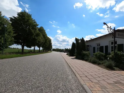
Hofladen Brodowin
Farm and orchard · 11.4 km
89 Brodowiner Dorfstraße, Chorin
Apr-Oct 09:00-18:00; Nov-Mar 10:00-17:00
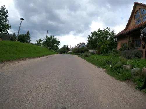
Hof Schwalbennest
Farm and orchard · 11.7 km
3 Pehlitz, Chorin
Apr 01-Sep 30 Th-Mo 09:00-17:00; Oct 01-Mar 31 Mo,Th,Fr...


Hemme Milch Hofladen
Farm and orchard · 4.2 km
Milch, Käse, Butter, Joghurt, Molke und noch viel mehr
4 Heideweg, Angermünde
Hofladen Grumsiner Brennerei
Farm and orchard · 8.4 km
3 Wirtschaftshof, Angermünde
Mo-Fr 10:00-14:00; Sa 13:00-17:00
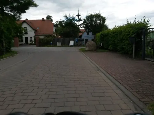
Hofladen Seenfischerei
Farm and orchard · 0.9 km
1 Bleiche, Angermünde
Mo-Fr 09:00-17:00; Sa,Su,PH off

44 more on the map.
Museums and landmarks61

NABU Naturerlebniszentrum Blumberger Mühle
Monument and historic site · 3.2 km
2 Blumberger Mühle
Mo-Su 09:00-18:00

Museum Angermünde
Museum
17 Hoher Steinweg, Angermünde
Apr-Oct: Mo-Fr 09:00-18:00; Apr-Oct: Sa-Su 10:00-17:00; Nov-Mar:...

Geologischer Garten Stolzenhagen
Museum · 10.0 km
7 Elsengrund, Lunow-Stolzenhagen
Apr-Sep 09:00-20:00; Oct-Mar 09:00-18:00



Wasserturm
Monument and historic site
Wasserturm am Bahnhofsvorplatz Angermünde
5 Bahnhofsplatz, Angermünde

Burg Stolpe
Monument and historic site · 8.7 km
So genannter „Grützpott“, Ruine der Turmburg Stolpe aus dem 12. Jahrhundert, bewallter Burgfried bzw. Donjon mit 18 Meter Außendurchmesser

Ella Freundlich, geb.Steinecke
Monument and historic site · 0.7 km
Stolperstein für Ella Freundlich, geb.Steinecke

Eva Freundlich
Monument and historic site · 0.7 km
Stolperstein für Eva Freundlich

Gerhard Gerson
Monument and historic site · 0.6 km
Stolperstein vor Grundstück Jägerstraße 1 (vormals Jägerstraße 2) für Gerhard Gerson

Günter Gerson
Monument and historic site · 0.6 km
Stolperstein vor Grundstück Jägerstraße 1 (vormals Jägerstraße 2) für Günter Gerson
49 more on the map.
Parks, trails and playgrounds18


UNESCO-Weltnaturerbe „Alte Buchenwälder Deutschlands“ – Teilgebiet Grumsin
Hiking and trails · 7.6 km



Geopark Eiszeitland am Oderrand Sperlingsherberge
Sports field and stadium · 10.5 km
24/7

Kernzone Naturschutzgebiet Poratzer Moränenlandschaft
Hiking and trails · 13.0 km
6 more on the map.
Restaurants and cafes56

Alles Absicht
Cafe · Pizza, German, Cake · 8.8 km
2 Am Kanal, Angermünde
Fr 17:00-22:00; Sa 12:00-20:00; Su 12:00-16:30; Oct 01-Apr 14 off...
Cafe & Konditorei Striegler
Cafe · Ice Cream
63 Berliner Straße, Angermünde
Tu-Fr 09:00-12:30,13:30-17:00; Sa 09:00-12:00; Mo,Su,PH off
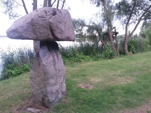
Café Seeblick
Cafe · Regional, Ice Cream · 1.1 km
13 Am Krötenberg, Angermünde
Tu-Th 15:00-21:00; Fr 15:00-22:00; Sa 09:30-12:30,15:00-22:00; Su...
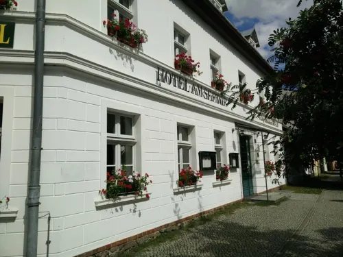
Restaurant zum Hungerstein
Restaurant · Regional · 0.7 km
25 Jägerstraße, Angermünde
Mo-Fr 16:00-22:00; Sa,Su,PH 11:30-22:00
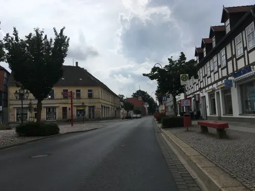
Ristorante & Pizzeria
Restaurant · Pizza
61 Berliner Straße, Angermünde
Mo-Fr 11:00-14:00,17:00-22:00; Sa,Su 11:00-22:00
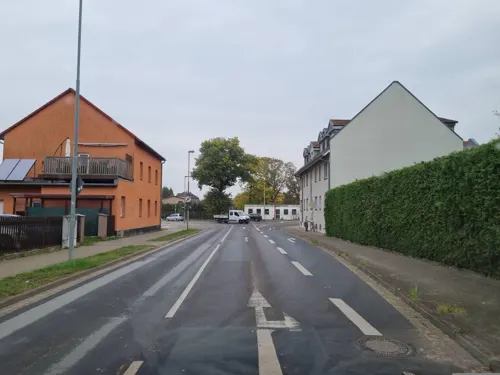
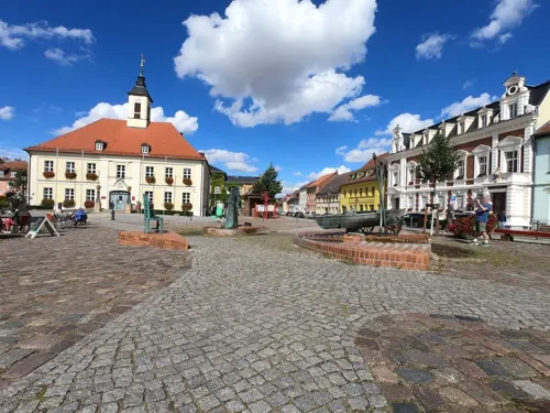
Stadtcafé Hilde & Heinz
Cafe · Breakfast, Cake, Coffee Shop
17 Rosenstraße, Angermünde
Mo-Su,PH 07:00-17:00
Taj Mahal - Indisches Restaurant
Restaurant
Indisches Restaurant
23 Markt, Angermünde
Mo-Su 11:00-23:00

Brotmeisterei Steinecke
Bakery · 1.2 km
36 Schwedter Straße, Angermünde
Mo-Fr 06:30-18:30; Su 07:00-10:30; PH off


44 more on the map.
History
The town was the site of a 1420 victory of Frederick I of Brandenburg over the Pomeranians. Since 1687, French Huguenots settled in the town, and the Holy Spirit Chapel served as the French church.
From 1815 to 1947, Angermünde was part of the Prussian Province of Brandenburg. In the 19th century, the town was the seat of a Prussian circle in the Province of Brandenburg and linked to Berlin by the railway to Stettin (now Szczecin, Poland). Angermünde station then served as the junction for branch lines servicing Prenzlau, Bad Freienwalde, and Schwedt. During World War II, the Germans operated five forced labour subcamps of the Stalag III-C prisoner-of-war camp in the town.
From 1947 to 1952, Angermünde was part of the State of Brandenburg, from 1952 to 1990 of the Bezirk Frankfurt of East Germany and since 1990 again of Brandenburg.
From the History section of Angermünde on Wikipedia, under CC BY-SA 4.0.
Where to stay33
Natur- und Familiencampingplatz Pehlitzwerder
Campground · 11.4 km
1 Am Pehlitzwerder, Chorin OT Pehlitz
Churches and places of worship36
Dorfkirche Felchow
Church · Protestant · 7.8 km
29 Pinnower Ende, Schwedt/Oder
Dorfkirche Görlsdorf
Church · Protestant · 5.5 km
17 Parkstraße, Angermünde
Ev. Dorfkirche Schmargendorf
Church · Protestant · 4.6 km
2 Rotdornstraße, Angermünde
Stadtkirche Greiffenberg
Church · Protestant · 8.7 km
6 Kirchstraße, Angermünde
Shopping15
Gas and EV charging3
Schools, colleges and libraries13
Healthcare4
Map of Angermünde
250 places. The map loads OpenStreetMap tiles when you open it.
Getting there and nearby towns
Berlin Brandenburg Airport "Willy Brandt" (BER) is the nearest airport with scheduled flights listed in OpenStreetMap, 80 km away.
- Schwedt (Oder) 20 km east, about 20 min by car
- Eberswalde 23 km southwest, about 23 min by car
- Prenzlau 35 km north, about 35 min by car
- Templin 35 km west, about 35 min by car
- Zehdenick 45 km west, about 45 min by car
- Bernau bei Berlin 46 km southwest, about 46 min by car
- Wandlitz 47 km southwest, about 47 min by car
- Strausberg 49 km south, about 49 min by car
- Oranienburg 58 km southwest, about 58 min by car
- Berlin 67 km southwest, about 1 h by car
Drive times are estimates from straight-line distance, not routes.
Local news
Headlines from INDB.
Reviews, tips and questions
Loading what members have shared...
Sources and licences
- GeoNames (CC BY 4.0): population, coordinates, regions and time zone
- Mapillary (see each image): photos
- OpenStreetMap contributors (ODbL 1.0): places, airports, map data
- Wikidata (CC0 1.0): elevation, founding date, time zone, website, landmarks and historic places
- Wikimedia Commons (see each image): photos
- Wikipedia (CC BY-SA 4.0): overview and history text
Photo credits
- Sowjetische Ehrenmal Angermünde, Clemensfranz, CC BY-SA 3.0
- Sowjetisches Ehrenmal Friedenspark Angermünde 03, Clemensfranz, CC BY-SA 4.0
- Sowjetisches Ehrenmal Friedenspark Angermünde 02, Clemensfranz, CC BY-SA 4.0
- Sowjetische Ehrendenkmal Berliner Straße Angermünde, Clemensfranz, CC BY-SA 4.0
- Angermünde Berliner Tor Findling, Assenmacher, CC BY-SA 4.0
- Sowjetisches Ehrenmal Friedenspark Angermünde 01, Clemensfranz, CC BY-SA 4.0
- Tranformatorhaus Berliner Straße Angermünde, Clemensfranz, CC BY-SA 4.0
- Heilig-Geist-Kapelle Süden Angermünde, Clemensfranz, CC BY-SA 4.0
- Stadtbefestigung Angermünde 2017 03, Clemensfranz, CC BY-SA 4.0
- Berliner Straße Angermünde with snow 2025-01-12 02, Leonhard Lenz, CC0
- Berliner Straße Angermünde with snow 2025-01-12 01, Leonhard Lenz, CC0
- Bahnhof Angermünde with snow 2025-01-12 02, Leonhard Lenz, CC0
- Bahnhof Angermünde with snow 2025-01-12 01, Leonhard Lenz, CC0
- Angermünde (50817660963), Markus Trienke, CC BY-SA 2.0
- Angermünde Berliner Straße 2 Goldenes Lamm, Pesti02, CC BY-SA 3.0
- Angermünde 14 Meridian, Clemensfranz, CC BY-SA 3.0
- Berliner Straße 2 Angermünde 2017, Clemensfranz, CC BY-SA 4.0
- Angermünde (50818500377), Markus Trienke, CC BY-SA 2.0
- Heilig Geist Kapelle Angermünde, Clemensfranz, CC BY-SA 3.0
- Heilig-Geist-Kapelle Nord Angermünde, Clemensfranz, CC BY-SA 4.0
- Angermünde Berliner Straße 2a, Pesti02, CC BY-SA 3.0
- Angermünde (50817659338), Markus Trienke, CC BY-SA 2.0
- 2012 09 15 Infozentrum BlumbergerMuehle, Kds11, CC BY-SA 3.0
- 18-06-06-Fotoflug-Uckermark RRK4006, Ralf Roletschek, GFDL 1.2
- AngermuendeKloster 04 16 01 jiw, Uckermaerker, CC BY-SA 4.0
- Grumsiner Forst bei Luisenfelde, Andreas Wendt, CC BY-SA 3.0
- StMarienKirche04 jiw, Uckermaerker, CC BY-SA 4.0
- Angermuende Goerlsdorf church, Doris Antony , Berlin, CC BY-SA 3.0
- Felchow06 10 05, Uckermaerker, CC BY-SA 4.0
- Dobberzin, Feldsteinkirche, Rauenstein, CC BY-SA 3.0
- Dorfkirche Schmargendorf, Jonas Rogowski, CC BY-SA 3.0
- Museum Angermünde 2022, Birkho, CC BY-SA 4.0
- Martinskirche Angermünde 2018 NE, Hans G. Oberlack, CC BY-SA 4.0
- Dorfkirche Greiffenberg (Uckermark) 2018 SW, Hans G. Oberlack, CC BY-SA 4.0
- 2018 07 Brodowin IMG 3147, Daniela Kloth, GFDL 1.2
- TurmStützkow2, Global Fish, CC BY-SA 4.0
- Krankenhaus Angermünde, GLG-Gesundheit, CC BY-SA 4.0
- 2021 05 11 Parsteinsee DJI 0951, Daniela Kloth, GFDL 1.2
- Angermuende Bahnhofsplatz Wasserturm, Oberlausitzerin64, CC BY-SA 4.0
- Stolperstein-Ella-Freundlich-Angermünde, Axel Mauruszat, CC BY-SA 4.0
- Stolperstein-Eva-Freundlich-Angermünde, Axel Mauruszat, CC BY-SA 4.0
- Stolperstein-Gerhard-Gerson-Angermünde, Axel Mauruszat, CC BY-SA 4.0
- Stolperstein-Günter-Gerson-Angermünde, Axel Mauruszat, CC BY-SA 4.0
- 2021 05 11 Parsteinsee DJI 0958, Daniela Kloth, GFDL 1.2
- MariaHimmelfahrt05 jiw, Uckermaerker, CC BY-SA 3.0
- Angermünde - Evang.-luth. Martinskirche (SELK), Bear62, CC BY 3.0
- 2010-03-05-angermuende-by-RalfR-34, Ralf Roletschek ( talk ) - Fahrradtechnik auf fahrradmonteur.de, GFDL 1.2
- Angermuende Klosterkirche, Doris Antony , Berlin, CC BY-SA 4.0
- Fachklinik Wolletzsee, GLG-Gesundheit, CC BY-SA 4.0
- Stegelitz Grab 2 Hügel, Arnold-Moßell, CC BY-SA 4.0
- FahrradkircheGlambeck jiw, Uckermaerker, CC BY-SA 3.0
- Street-level photo, carlheinz, CC BY-SA 4.0
- Street-level photo, rausk, CC BY-SA 4.0
- Street-level photo, Langfahrer, CC BY-SA 4.0
- Street-level photo, carlheinz, CC BY-SA 4.0
- Street-level photo, carlheinz, CC BY-SA 4.0
- Street-level photo, carlheinz, CC BY-SA 4.0
- Street-level photo, dsmm, CC BY-SA 4.0
- Street-level photo, mar_k83, CC BY-SA 4.0
- Street-level photo, rausk, CC BY-SA 4.0
- Street-level photo, carlheinz, CC BY-SA 4.0
- Street-level photo, carlheinz, CC BY-SA 4.0
- Street-level photo, moenk, CC BY-SA 4.0
- Street-level photo, carlheinz, CC BY-SA 4.0
- Street-level photo, rausk, CC BY-SA 4.0
- Street-level photo, macsico, CC BY-SA 4.0
- Street-level photo, Langfahrer, CC BY-SA 4.0
- Street-level photo, Langfahrer, CC BY-SA 4.0
- Street-level photo, carlheinz, CC BY-SA 4.0
- Street-level photo, rausk, CC BY-SA 4.0
- Street-level photo, rausk, CC BY-SA 4.0
- Street-level photo, rausk, CC BY-SA 4.0
- Street-level photo, dsmm, CC BY-SA 4.0


Page built November 8, 2026. Spotted a mistake? Tell us or suggest a place.