


Schwedt (Oder), Germany
Schwedt/Oder
Schwedt (Oder) is a town of 33,730 people in Brandenburg, Germany.
Why visit Schwedt (Oder)
Townapedia lists 28 museums and landmarks, 32 parks and trails, 53 places to eat, 20 places to stay and 13 attractions in and around town.
Highlights include Uckermärkische Bühnen Schwedt, Beobachtungsturm Süd Fliegender Kranich, Berlischky-Pavillon and Schloss Criewen.
Weather in Schwedt (Oder)
Forecast from MET Norway (CC BY 4.0). Full forecast
About Schwedt (Oder)
Schwedt (or Schwedt/Oder; German: [ˈʃveːt] ) is a town in Brandenburg, in northeastern Germany. With the official status of a Große kreisangehörige Stadt (major district town), it is the largest town of the Uckermark district, located near the river Oder, which forms the border with Poland.
From the Wikipedia article Schwedt (this version), under CC BY-SA 4.0.
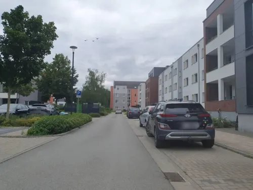
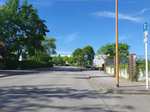
Photos of Schwedt (Oder)


Things to do13





1 more on the map.
Museums and landmarks28

Berlischky-Pavillon
Monument and historic site
28 Lindenallee, Schwedt/Oder


Schlossruine Hohenlandin
Monument and historic site · 10.6 km
7a Landiner Schlossstraße, Schwedt/Oder

Wasserturm
Monument and historic site · 0.6 km
Bahnhof Schwedt mit Güterboden, Lokomotivschuppen, Wasserturm

Ehemalige Seifenfabrik
Monument and historic site
44 Vierradener Straße, Schwedt/Oder

Tabakmuseum Vierraden
Museum · 4.0 km
14 Breite Straße, Schwedt/Oder
Apr-Sep: Th-Su 10:00-17:00 || "nach Vereinbarung"; PH off
Stadtmuseum Schwedt
Museum
17 Jüdenstraße, Schwedt/Oder
Mo-Fr 10:00-17:00; Su 14:00-16:00

16 more on the map.
Parks, trails and playgrounds32

Lower Oder Valley National Park
Park · 1.7 km
National park in Brandenburg, Germany





Seesportclub Schwedt e.V.
Marina and boat launch · 1.2 km
11 Am Holzhafen, Schwedt/Oder

20 more on the map.
Restaurants and cafes53
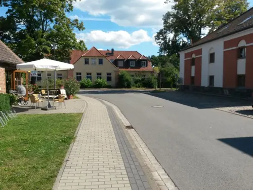
Anitas Eisstube
Cafe · Ice Cream · 6.6 km
2 Am Speicher, Schwedt/Oder
Sa 12:00-17:00; Su 14:00-17:00; Mo-Fr 13:00-17:00
Restaurant Athen
Restaurant · 0.9 km
1 Heinersdorfer Damm, Schwedt/Oder
Mo,We-Fr 17:00-22:00, Sa,Su 11:00-14:00, Sa,Su 17:00-22:00
El Greco
Restaurant · Greek
18 Dr.-Theodor-Neubauer-Straße, Schwedt/Oder
Th,Su-Tu 11:00-14:30,17:00-22:00; Fr,Sa 11:00-17:00,16:30-23:00

BrauWerk
Restaurant · German
1 Louis-Harlan-Straße, Schwedt/Oder
Mo-Th 16:00-22:00; Fr 16:00-23:00; Sa 11:00-23:00
Gasthaus Jägerhof
Restaurant · German
47 Vierradener Straße, Schwedt/Oder
Tu-Su 10:30-14:30, 17:00-23:00
Gaststätte "Zur Linde"
Restaurant · Regional · 6.6 km
21 Bernd von Arnim Straße, Schwedt/Oder
Tu-Su 11:30+ || "sowie nach Vereinbarung"
Hoi An
Restaurant · Japanese, Vietnamese
30a Friedlieb-Ferdinand-Runge-Straße, Schwedt/Oder
Tu-Sa 07:00-21:00
Dolce Vita
Restaurant · Italian · 1.5 km
137A Berliner Straße, Schwedt/Oder
Tu-Su,PH 11:00-14:30,17:00-22:30
41 more on the map.
History
After the Migration Period, the area had been settled by Polabian Slavs. From 937 onwards the lands of the Slavic Ukrani tribes in the west were subdued by the Saxon forces of Margrave Gero and incorporated into his vast Marca Geronis, while the lands east of the Oder were held by Pomeranian tribes under sovereignty of the newly formed Duchy of Poland ruled by Duke Mieszko I. The Saxon Northern March was lost in the Great Slav Rising of 983, and not before 1147 the Saxon count Albert the Bear again invaded the lands on the Oder river, which remained disputed between the newly established Margraviate of Brandenburg and the Pomeranian dukes.
The settlement of Schwedt was first mentioned in a 1265 deed. In the course of the Brandenburg–Pomeranian conflict, the Brandenburg margrave Louis II the Roman ceded it to Duke Barnim III of Pomerania in 1354. It was again besieged by the first Hohenzollern margrave Frederick I in 1434, but to no avail. In 1481 the Thuringian counts of Hohnstein acquired the estates; they granted town privileges to Schwedt as well as to neighbouring Vierraden and introduced the Protestant Reformation.
Read more of the history
The rise of Schwedt came to an end with the extinction of the Hohnstein counts in 1609 and the disastrous Thirty Years' War, when the town on the road from Stettin (Szczecin) to Berlin was plundered several times. In 1631 King Gustavus Adolphus of Sweden, after landing in Pomerania, camped here on his way to the Battle of Breitenfeld. Six years later the Swedish field marshal Johan Banér set the town on fire, after its citizens refused to capitulate.
In the 1680s, a commune of French Huguenots was established in the town. During the Great Northern War, the Treaty of Schwedt was signed in the town.
From 1815 to 1945, Schwedt was part of the Prussian Province of Brandenburg.
Near the end of World War II, over two months of heavy fighting destroyed an estimated 85 percent of the town, including the Schwedt Castle. The Soviet Army occupied Schwedt on April 26, 1945, two weeks before the final defeat of Nazi Germany. From 1945 to 1952, Schwedt was part of the state of Brandenburg and from 1952 to 1990 of the Bezirk Frankfurt of East Germany. During the 1960s, the government of the DDR expanded housing and encouraged people to move to Schwedt, a trend that ended with German reunification. Since 1990, Schwedt is again part of the State of Brandenburg.
From the History section of Schwedt on Wikipedia, under CC BY-SA 4.0.
More about Schwedt (Oder)
Geography
Schwedt is situated in the east of the historic Uckermark region stretching from the Oder to the Havel River. It is situated on a sandur at the western edge of the Oder floodplain running along the German-Polish border, which in 1995 was declared as the Lower Oder Valley National Park nature reserve. Across the river and the border, about 10 km (6.2 mi) to the southeast, is the Polish town of Chojna. The nearest German towns are Angermünde (about 18 km (11 mi) to the west) and Gartz (18 km (11 mi) down the Oder).
In a 1974 municipal reform, the neighbouring village of Heinersdorf was incorporated into Schwedt, followed by Blumenhagen, Gatow and Kunow in 1993, by Kummerow in 1998, by Criewen and Zützen in 2001, Stendell in 2002, the former town Vierraden in 2003, Schöneberg in January 2021 and Berkholz-Meyenburg, Mark Landin and Passow in April 2022. With 360.73 km2 (139.28 mi2) Schwedt is among the 10 largest German municipalities by area (9th as of Nov. 2023).
Gartz (Germany), Penkun (Germany), Szczecin (Poland), Gryfino (Poland), Cedynia (Poland), Chojna (Poland), Mieszkowice (Poland), Moryń (Poland), Trzcińsko-Zdrój (Poland), Myślibórz (Poland), Pyrzyce (Poland).
From the Wikipedia article Schwedt, under CC BY-SA 4.0.
Notable people from Schwedt (Oder)
 Margravine Friederike of Brandenburg-SchwedtGerman noblePhoto: Johann Heinrich Wilhelm Tischbein, Public domain
 Duke Eugen of WürttembergGerman duke (1758–1822)Photo: Johann Heinrich Schröder, Public domain
 Leonhard Graf von BlumenthalPrussian field marshal (1810-1900)Photo: Kunst-Verlag der Photographischen..., Public domain
 Julia RichterGerman rowerPhoto: Mike Fay, CC BY 2.0
 Margravine Elisabeth Louise of Brandenburg-SchwedtPrussian princess (1738-1820)Photo: Anna Rosina de Gasc, Public domain
 Margravine Philippine of Brandenburg-SchwedtGerman noble (1745-1800)Photo: Johann Heinrich Tischbein, Public domain
 Jörg HoffmannGerman swimmerPhoto: Matthias Hiekel, CC BY-SA 3.0 de
 Jan VandreyGerman sprint canoeistPhoto: Jonas de Carvalho from Rio de Janeiro, Brasil, CC BY-SA 2.0
- Britta SteffenGerman swimmer
- Sebastian BrendelGerman canoeist
- Philipp BoyGerman gymnast
- Frederick Henry, Margrave of Brandenburg-SchwedtMargrave of Brandenburg-Schwedt (1709-1788)
Born in Schwedt (Oder), according to Wikidata (CC0). Each name links to its Wikipedia article.
Where to stay20
Churches and places of worship17
Dorfkirche Kunow
Church · Protestant · 8.8 km
36 Kunower Dorfstraße, Schwedt/Oder
Sankt Mariä Himmelfahrt
Church · Roman Catholic
49 Vierradener Straße, Schwedt/Oder
Kościół pw. Świętej Jadwigi Śląskiej
Church · Roman Catholic · 6.5 km
Dorfkirche Heinersdorf
Church · Lutheran · 6.2 km
45 Lange Straße, Schwedt/Oder
Dorfkirche Niederlandin
Church · Protestant · 9.6 km
3 An der Kirche, Schwedt/Oder
Shopping28
Gas and EV charging8
Schools, colleges and libraries13
Healthcare7
Map of Schwedt (Oder)
219 places. The map loads OpenStreetMap tiles when you open it.
Getting there and nearby towns
Flughafen Neubrandenburg-Trollenhagen (FNB) is the nearest airport with scheduled flights listed in OpenStreetMap, 89 km away.
- Angermünde 20 km west, about 20 min by car
- Wriezen 39 km south, about 39 min by car
- Eberswalde 40 km southwest, about 40 min by car
- Prenzlau 40 km northwest, about 40 min by car
- Templin 52 km west, about 52 min by car
- Pasewalk 53 km north, about 53 min by car
- Biesenthal 54 km southwest, about 54 min by car
- Strausberg 60 km southwest, about 1 h by car
- Seelow 59 km south, about 59 min by car
- Bernau bei Berlin 63 km southwest, about 1 h by car
Drive times are estimates from straight-line distance, not routes.
Towns near Schwedt (Oder)


Keep exploring
Local news
Headlines from INDB.
Reviews, tips and questions
Loading what members have shared...
Sources and licences
- GeoNames (CC BY 4.0): population, coordinates, regions and time zone
- Mapillary (see each image): photos
- OpenStreetMap contributors (ODbL 1.0): places, airports, map data
- Wikidata (CC0 1.0): elevation, founding date, time zone, website, landmarks and historic places
- Wikimedia Commons (see each image): photos
- Wikipedia (CC BY-SA 4.0): overview and history text
Photo credits
- 18-06-06-Fotoflug-Uckermark RRK3940, Ralf Roletschek, GFDL 1.2
- 18-06-06-Fotoflug-Uckermark RRK3924, Ralf Roletschek, GFDL 1.2
- 18-06-06-Fotoflug-Uckermark RRK3944, Ralf Roletschek, GFDL 1.2
- SchwedtOder, Wasserturm und Turmhotel, Rauenstein, CC BY-SA 3.0
- Widuchowa Kirche, Mazbln, CC BY-SA 3.0
- Schwedt, Lindenstraße 28, Magatt, CC BY-SA 3.0
- Kościółek w Zatoni Dolnej - panoramio, 7alaskan, CC BY-SA 3.0
- Criewen church, Doris Antony , Berlin, CC BY-SA 3.0
- Herrenhaus Oder Seite Criewen Schwedt Oder, Clemensfranz, CC BY-SA 4.0
- Kirche, Kunower Straße 36, Kunow, Florian Koppe, CC BY-SA 3.0
- Dorfkirche Heinersdorf, Schwedt 2019 NW, Hans G. Oberlack, CC BY-SA 4.0
- AKU Luftbild1, Das Bild wurde durch einen Mitarbeiter der Abteilung Öffentlichkeitsarbeit des Asklepios Klinikums Uckermark aufgenommen. Es wurde mir ausdrücklich zur bedingungslosen Veröffentlichung in der..., CC BY 4.0
- Niederlandin 02 12 01, Uckermaerker, CC BY-SA 4.0
- Hohenfelde, Kirche, Rauenstein, CC BY-SA 2.0
- Dorfkirche Berkholz (bei Schwedt) 2021 NNE, Hans G. Oberlack, CC BY-SA 4.0
- TurmStützkow2, Global Fish, CC BY-SA 4.0
- Vierraden, Burgruine und Hungerturm, Magatt, CC BY-SA 3.0
- Ognica gmina Widuchowa kosciol, Kapitel, Public domain
- Uckermärkische Bühnen Schwedt, Udo Krause ( Nul0000 ), original uploader was Nul0000 at de.wikipedia, CC BY-SA 3.0
- Schwedt Wasserturm, Oberlausitzerin64, CC BY-SA 4.0
- Mark Landin Schlossruine Hohenlandin, Oberlausitzerin64, CC BY-SA 4.0
- Schwedt Lokschuppen mit Wasserstation, Oberlausitzerin64, CC BY-SA 4.0
- Schwedt, Stadtmühle, Magatt, CC BY-SA 3.0
- Schwedt, Evangelische Kirche St. Katharinen, Ostseite, Magatt, CC BY-SA 3.0
- Vierraden church 2015 S, Hans G. Oberlack, CC BY-SA 4.0
- Schwedt, Katholische Kirche, Haupteingang, Magatt, CC BY-SA 3.0
- Schwedt, Berlischky-Pavillon, Rauenstein, CC BY-SA 3.0
- Kunow, Kirche, Rauenstein, CC BY-SA 3.0
- Widuchowa kosciol NSPJ (1), Kapitel, CC BY-SA 4.0
- SchwedtOder Stadtpark Erdkugel Cornelia und Axel Schulz (1), Assenmacher, CC BY-SA 4.0
- Schwedt-Oder - Kirche St. Mariä Himmelfahrt 01, Architraveller, CC BY-SA 4.0
- SchwedtOder Stadtpark Brunnen Mutter Erde mit Bronzeplastiken von Cornelia Schulz, Assenmacher, CC BY-SA 4.0
- Sportplatz Dreiklang - panoramio, Maurice Meeden, CC BY-SA 3.0
- Schwedt - sala koncertowa - panoramio, rysnal, CC BY-SA 3.0
- SchwedtOder Stadtpark Mongolische Kamelreiter Axel Schulz, Assenmacher, CC BY-SA 4.0
- SchwedtOder Stadtpark Erdkugel Cornelia und Axel Schulz (2), Assenmacher, CC BY-SA 4.0
- SchwedtOder Stadtpark Afrikanischer Hiob Joachim Jastram, Assenmacher, CC BY-SA 4.0
- SchwedtOder Stadtpark Gedenkstein Dragoner, Assenmacher, CC BY-SA 4.0
- SchwedtOder Stadtpark Maler und Modell Peter Fritzsche, Assenmacher, CC BY-SA 4.0
- SchwedtOder Stadtpark Mongolische Großmutter Axel Schulz, Assenmacher, CC BY-SA 4.0
- Widok na Odrę ze Wzgórza Baszta, Federacja Zielonych "GAJA", CC BY-SA 4.0
- Street-level photo, rausk, CC BY-SA 4.0
- Street-level photo, carlheinz, CC BY-SA 4.0
- Street-level photo, Harry_Canyon, CC BY-SA 4.0
- Street-level photo, Harry_Canyon, CC BY-SA 4.0
- Street-level photo, Harry_Canyon, CC BY-SA 4.0
- Street-level photo, account_not_used_anymore__952631, CC BY-SA 4.0
- Street-level photo, eserte, CC BY-SA 4.0
- Street-level photo, account_not_used_anymore__952631, CC BY-SA 4.0
- Street-level photo, Harry_Canyon, CC BY-SA 4.0
- Street-level photo, account_not_used_anymore__952631, CC BY-SA 4.0
- Street-level photo, masterofnoroad, CC BY-SA 4.0
- Street-level photo, dsmm, CC BY-SA 4.0
- Street-level photo, changchun1, CC BY-SA 4.0
- Street-level photo, Harry_Canyon, CC BY-SA 4.0
- Street-level photo, rausk, CC BY-SA 4.0


Page built November 9, 2026. Spotted a mistake? Tell us or suggest a place.