


Why visit Pattensen
Townapedia lists 46 museums and landmarks, 52 parks and trails, 156 places to eat, 36 places to stay and 10 attractions in and around town.
Highlights include Lütgeharms Hofladen, Kampfelder Hof, Luftfahrtmuseum Laatzen-Hannover e.V. and Mausoleum Graf Carl von Alten.
Weather in Pattensen
Forecast from MET Norway (CC BY 4.0). Full forecast
About Pattensen
Pattensen (German: [ˈpatn̩zn̩] ) is a town in the district of Hanover, in Lower Saxony, Germany. It is situated approximately 12 km (7 mi) south of Hanover.
From the Wikipedia article Pattensen (this version), under CC BY-SA 4.0.
Things to do10

Lütgeharms Hofladen
Farm and orchard · 0.6 km
13 Braunschweiger Straße, Pattensen
Th-Fr 09:00-12:00, 15:00-18:00



Museums and landmarks46
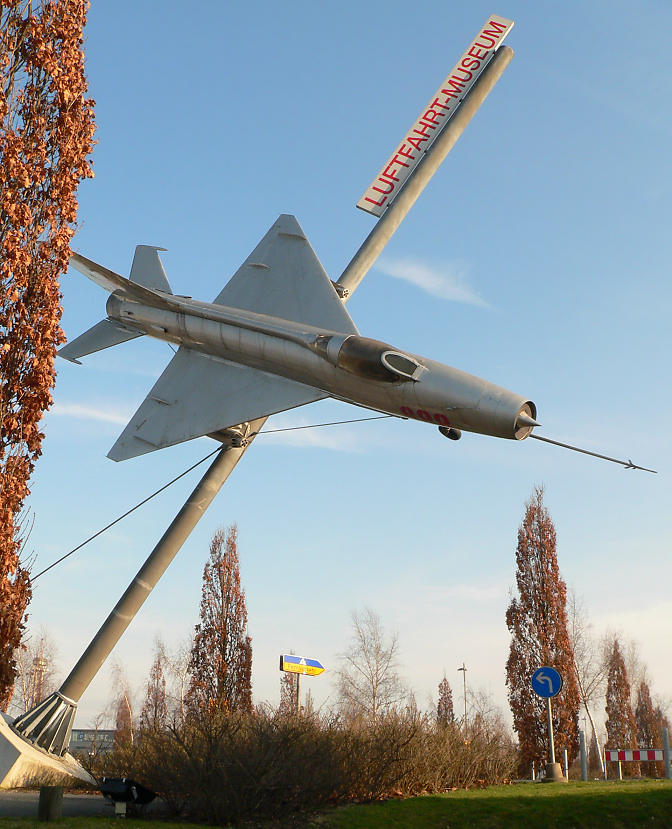

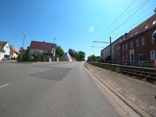
Kunstkreis Laatzen
Museum · 4.7 km
368 Hildesheimer Straße
Tu 13:00-15:00; Su 11:00-13:00; PH off; Mo,We,Th-Sa off || "Nach...

Schloß Gestorf
Monument and historic site · 6.7 km
14 Neustadtstraße, Springe




Gefallenen- und Vertriebenendenkmal
Monument and historic site · 4.0 km



34 more on the map.
Parks, trails and playgrounds52

Linderter und Stamstorfer Holz
Hiking and trails · 5.6 km
Das NSG ist gleichzeitig auch FFH-Schutzgebiet (EU-Nr.: DE-3724-332)


aquaLaatzium
Sports field and stadium · 5.5 km
Tu-Th 07:00-22:00; Mo 11:00-22:00; Fr,Sa 09:00-22:00; Su 09:00-20:00



Innerstebad Sarstedt
Sports field and stadium · 6.8 km
7 Steinstraße, Sarstedt
Tu-Sa 06:00-20:00; Su 08:00-20:00; Mo 10:00-20:00



40 more on the map.
Restaurants and cafes156
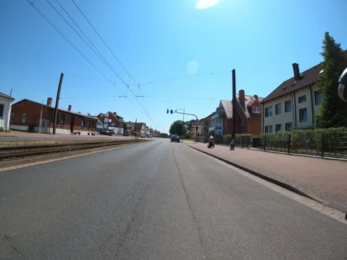
Inos Taverne
Restaurant · Greek · 5.1 km
196 Hildesheimer Straße, Laatzen
Tu-Sa 16:30-22:30; Su 12:00-14:30,16:30-22:30; Mo off

Lebenstraum
Restaurant · Mediterranean, Coffee Shop · 5.7 km
Café - Restaurant - Bar
2a Pettenkoferstraße, Laatzen
Mo-Th 09:00-23:00; Fr-Sa 09:00-24:00; Su,PH 10:00-20:00
Mimi Restaurant Laatzen
Restaurant · Vietnamese, Sushi · 5.0 km
Vietnamesische Küche, Sushi-Bar
11 Am Kamp, Laatzen
Mo-Su 11:30-22:00
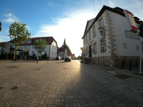
Athos
Restaurant · Greek · 5.4 km
5 Göttinger Landstraße, Pattensen
Mo-We 17:00-23:00; Th-Su,PH 12:00-14:30,17:30-23:00
Bacchus
Restaurant · Greek · 4.1 km
102A Göttinger Straße, Hemmingen
Mo-We 17:00-22:00; Th-Sa 12:00-15:00,17:00-22:00; Su 12:00-22:00
Il Tartufo
Restaurant · Italian · 5.2 km
12 Ahornstraße, Laatzen
Mo-Fr 11:00-15:00,17:00-22:00; Tu off; We off; Sa...


Konstantinos
Restaurant · Greek · 6.1 km
49 Hildesheimer Straße, Laatzen
Mo 17:00-22:30; Tu-Fr 12:00-14:00,17:00-22:30; Sa 17:00-22:30;...
Lehaha
Restaurant · Chinese · 6.8 km
420 Hildesheimer Straße, Hannover
Mo-Fr 12:00-15:00,17:30-22:00; Sa 12:00-22:30; Su,PH 12:00-22:00
144 more on the map.
History
Pattensen was first mentioned in a document in 986, nevertheless, the first people probably settled in the old town between the 6th and 8th century.
In the 13th century, Graf Ludolf II. von Hallermund built the Pattensen Castle to monitor the important trade routes that crossed the city in north–south and west–east directions. From the middle of the 13th century, the city belonged to the Principality of Lüneburg. The city was of strategic military importance, so that it was heavily fortified and enlarged as a result. In the area of the present town of Pattensen, also the Calenberg Castle and the Koldingen Castle were built in these times. In 1433, Pattensen became part of the Principality of Calenberg. During the Reformation the city was the seat of an archdeacon under the leadership of the superintendent Antonius Corvinus. At that time the city was often the venue for church synods and state parliament meetings.
From the History section of Pattensen on Wikipedia, under CC BY-SA 4.0.
Where to stay36
Churches and places of worship36
Siebenten-Tags-Adventisten
Church · Seventh Day Adventist · 6.7 km
426 Hildesheimer Straße, Hannover
Shopping54
Gas and EV charging26
Schools, colleges and libraries24
Technische Informationsbibliothek und Universitätsbibliothek Hannover
Library · 5.1 km
2 Bremer Straße
Healthcare17
Map of Pattensen
250 places. The map loads OpenStreetMap tiles when you open it.
Getting there and nearby towns
Hannover Airport (HAJ) is the nearest airport with scheduled flights listed in OpenStreetMap, 23 km away.
- Sarstedt 7 km southeast, about 7 min by car
- Wettbergen 9 km northwest, about 9 min by car
- Ronnenberg 10 km northwest, about 10 min by car
- Hannover 12 km north, about 12 min by car
- Wennigsen 13 km west, about 13 min by car
- Sehnde 15 km east, about 15 min by car
- Ahlem 14 km northwest, about 14 min by car
- Springe 16 km southwest, about 16 min by car
- Hildesheim 18 km southeast, about 18 min by car
- Seelze 19 km northwest, about 19 min by car
Drive times are estimates from straight-line distance, not routes.
Local news
Headlines from INDB.
Reviews, tips and questions
Loading what members have shared...
Sources and licences
- GeoNames (CC BY 4.0): population, coordinates, regions and time zone
- Mapillary (see each image): photos
- OpenStreetMap contributors (ODbL 1.0): places, airports, map data
- Wikidata (CC0 1.0): elevation, founding date, time zone, website, landmarks and historic places
- Wikimedia Commons (see each image): photos
- Wikipedia (CC BY-SA 4.0): overview and history text
Photo credits
- Pattensen Dammstrasse, Unknown author, CC BY-SA 3.0
- Göttinger Straße 16 Pattensen, Clemensfranz, CC BY-SA 3.0
- Göttinger Straße 12 Pattensen, Clemensfranz, CC BY-SA 4.0
- Talstraße 3 Pattensen, Clemensfranz, CC BY-SA 4.0
- Wirtschaftsgebäude, 3, Auf der Burg 2, Pattensen, Region Hannover, GeorgDerReisende, CC BY-SA 4.0
- Scheune, 3, Auf der Burg 3, Pattensen, Region Hannover, GeorgDerReisende, CC BY-SA 4.0
- Talstraße 5 Pattensen, Clemensfranz, CC BY-SA 4.0
- Talstraße 10 Pattensen, Clemensfranz, CC BY-SA 4.0
- Wirtschaftsgebäude, 1, Auf der Burg 2, Pattensen, Region Hannover, GeorgDerReisende, CC BY-SA 4.0
- Rathaus Pattensen, Clemensfranz, CC BY-SA 3.0
- Talstraße 22 Pattensen Mitte, Clemensfranz, CC BY-SA 3.0
- Steinstraße 40 Pattensen, Clemensfranz, CC BY-SA 3.0
- Gedenkstein Brücke Pattensen, Clemensfranz, CC BY-SA 3.0
- Burgwall Burg Pattensen, Clemensfranz, CC BY-SA 4.0
- Marktstraße 1 Pattensen, Clemensfranz, CC BY-SA 3.0
- Steinstraße 17, 5, Pattensen, Region Hannover, GeorgDerReisende, CC BY-SA 4.0
- Steinstraße 17, 3, Pattensen, Region Hannover, GeorgDerReisende, CC BY-SA 4.0
- Göttinger Straße 35 Pattensen, Clemensfranz, CC BY-SA 4.0
- Steinstraße 17, 4, Pattensen, Region Hannover, GeorgDerReisende, CC BY-SA 4.0
- Steinstraße Pattensen, Clemensfranz, CC BY-SA 3.0
- Talstraße 24 Pattensen Mitte, Clemensfranz, CC BY-SA 3.0
- Steinstraße 17 Pattensen, Clemensfranz, CC BY-SA 3.0
- Volksbank-Pattensen-Marienstrasse, Den man tau, CC BY-SA 4.0
- Stolperstein Hermann Neufeld Pattensen, Clemensfranz, CC BY-SA 3.0
- Stolperstein Hans-Moritz Neufeld Pattensen, Clemensfranz, CC BY-SA 3.0
- Talstraße 26 Pattensen, Clemensfranz, CC BY-SA 4.0
- Pattensen Ratskeller, Clemensfranz, CC BY-SA 3.0
- Marktstraße 5 Pattensen, Clemensfranz, CC BY-SA 3.0
- Steinstraße 18 Pattensen, Clemensfranz, CC BY-SA 3.0
- Marktplatz 2 Pattensen, Clemensfranz, CC BY-SA 3.0
- Pattensen Marktplatz 3, Clemensfranz, CC BY-SA 3.0
- Stolperstein Martin Cohn Pattensen, Clemensfranz, CC BY-SA 3.0
- Talstraße 7 Pattensen, Clemensfranz, CC BY-SA 3.0
- Marktplatz 5 Pattensen, Clemensfranz, CC BY-SA 3.0
- Marktplatz 4 Pattensen, Clemensfranz, CC BY-SA 3.0
- Marktplatz 7 Pattensen, Clemensfranz, CC BY-SA 3.0
- Marktplatz 6 Pattensen, Clemensfranz, CC BY-SA 3.0
- Marktplatz 11 Pattensen, Clemensfranz, CC BY-SA 3.0
- Marktplatz 12 Pattensen, Clemensfranz, CC BY-SA 3.0
- Kapelle Alt-Laatzen IMG 3415, losch, Attribution
- NSG Alte Leine 09, Lotte76, CC BY-SA 3.0
- 2015 GEO 600, Oge oval, CC BY-SA 4.0
- Leine bei Koldingen, Den man tau, CC BY-SA 3.0
- Park-Der-Sinne Buehne, Silberchen, CC BY 2.5
- Naturschutzgebiet Sundern Auwald, Axel Hindemith, CC BY 3.0
- Luftfahrmuseum MIG21, Axel Hindemith, Public domain
- Wolfsberg-Luedersen, Den man tau, CC BY-SA 3.0
- Weg ins Linderter und Stamstorfer Holz, Den man tau, CC BY-SA 4.0
- Von Alten Mausoleum im Sundern Seitenansicht innen, Axel Hindemith, CC BY 3.0
- Gestorf Herrenhaus Eingang, Arieswings, CC BY-SA 4.0
- St. Lukas (Pattensen), Clemensfranz (shifted by Rabanus Flavus ), CC BY-SA 4.0
- KRH Klinikum Agnes Karll Laatzen, Lennart Dreyer, CC BY-SA 4.0
- Pattensen Huepede Kirche, Clemensfranz, CC BY 2.5
- Jeinsen St. Georg 01, ErwinMeier, CC BY-SA 4.0
- Gestorf-Neustadtstrasse 31, Den man tau, CC BY-SA 4.0
- Kapelle in Alt-Hemmingen (Hemmingen) IMG 6144, Losch at German Wikipedia, CC BY-SA 3.0
- Ehrenmal Hüpede Pattensen, Clemensfranz, CC BY-SA 4.0
- Ohlendorf - Bruchweg - Ehrenmal, Den man tau, CC BY-SA 3.0
- Kapelle in Harkenbleck (Hemmingen) IMG 5983, Losch at German Wikipedia, CC BY-SA 3.0
- Gefallenen-Ehrenmal Hiddestorf, Den man tau, CC BY-SA 3.0
- Wilkenburg - Gefallenenehrenmal, Den man tau, CC BY-SA 4.0
- Gestorf-Hannoversche Strasse 42, Den man tau, CC BY-SA 4.0
- Springe Gestorf Kirche mit Kriegerdenkmal, Clemensfranz, CC BY 2.5
- Insektenauge (A. Rimkus) 4, Gerd Fahrenhorst, CC BY 4.0
- Leine Hotel Pattensen, Restaurant zur Lüchte, Gerd Fahrenhorst, CC BY 4.0
- Immanuel-Kirche in Alt-Laatzen, Den man tau, CC BY-SA 4.0
- St.Marienkirche Grasdorf IMG 3929, Losch at German Wikipedia, Attribution
- 20230320 Pavilion of Hope Expo 2000 02, Flocci Nivis, CC BY 4.0
- Pattensen-Neuapostolische Kirche, Den man tau, CC BY-SA 4.0
- Stadtbahn Hannover Laatzen aquaLaatzium 2307090843, Clic, CC BY-SA 4.0
- Street-level photo, Langfahrer, CC BY-SA 4.0
- Street-level photo, Langfahrer, CC BY-SA 4.0
- Street-level photo, Langfahrer, CC BY-SA 4.0
- Street-level photo, Langfahrer, CC BY-SA 4.0
- Street-level photo, cageythree, CC BY-SA 4.0
- Street-level photo, Langfahrer, CC BY-SA 4.0
- Street-level photo, hotteliene, CC BY-SA 4.0
- Street-level photo, Langfahrer, CC BY-SA 4.0
- Street-level photo, Langfahrer, CC BY-SA 4.0
- Street-level photo, Langfahrer, CC BY-SA 4.0
- Street-level photo, Langfahrer, CC BY-SA 4.0
- Street-level photo, Langfahrer, CC BY-SA 4.0
- Street-level photo, Langfahrer, CC BY-SA 4.0
- Street-level photo, Langfahrer, CC BY-SA 4.0
- Street-level photo, live, CC BY-SA 4.0
- Street-level photo, Langfahrer, CC BY-SA 4.0
- Street-level photo, Langfahrer, CC BY-SA 4.0
- Street-level photo, Langfahrer, CC BY-SA 4.0
- Street-level photo, Hightower-, CC BY-SA 4.0
- Street-level photo, Langfahrer, CC BY-SA 4.0
- Street-level photo, Langfahrer, CC BY-SA 4.0
- Street-level photo, raspberry, CC BY-SA 4.0


Page built November 8, 2026. Spotted a mistake? Tell us or suggest a place.