


Why visit Peißenberg
Townapedia lists 13 museums and landmarks, 11 parks and trails, 27 places to eat, 6 places to stay and 9 attractions in and around town.
Highlights include Hoher Peißenberg, Bergbaumuseum Peißenberg, Kriegerdenkmal and Marcello Fun Arena.
Weather in Peißenberg
Forecast from MET Norway (CC BY 4.0). Full forecast
About Peißenberg
Peißenberg (German pronunciation: [ˈpaɪsn̩bɛʁk]) is a municipality in the Weilheim-Schongau district, in Bavaria, Germany. It is situated 7 km southwest of Weilheim in Oberbayern.
From the Wikipedia article Peißenberg (this version), under CC BY-SA 4.0.
Things to do9




Museums and landmarks13





Modell-Bahn-Club Pfaffenwinkel e.V.
Monument and historic site · 1.1 km
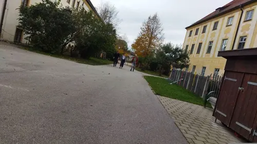
Museum Polling
Museum · 4.6 km
Sammlung zur religiösen Kunst und Volksfrömmigkeit, der Naturkunde, der Malerei und der ländlichen Alltagskultur
Die Bockerlbahner - Minidampf Eisenbahnanlage -
Monument and historic site · 1.1 km
Trachtenvereinsheim "d'Ammerbergler"
Monument and historic site · 4.6 km
Trachtenheim Polling (seit 1985 Trachtenheim; im 18. Jhdt. Klosterschmiede; danach Kistlerei für Klostergartenobst; beherbergt "D'Ammerbergler")
14a Kirchplatz, Polling
1 more on the map.
Parks, trails and playgrounds11

Marcello Fun Arena
Playground · 2.9 km
8-10 Max-Planck-Straße, Peißenberg
Tu-Fr 13:00-18:00; Sa-Su 10:00-19:00; PH 10:00-19:00


Verein für Gartenbau und Landespflege e.V. Polling (am Krautgarten)
Park · 5.1 km
Restaurants and cafes27

Ammer Forum / Ammer Klause / Ammer Hostel im Naturfreundehaus Weilheim
Cafe · Bistro, Coffee Shop, Regional · 4.9 km
36 Holzhofstraße, Weilheim in Oberbayern
closed

Bayerischer Rigi
Restaurant · Regional · 4.2 km
2 Matthäus-Günther-Platz, Hohenpeißenberg
Mo off; Nov-Mar Tu-Fr 09:00-18:00; Nov-Mar PH,Sa-Su 09:00-20:00;...
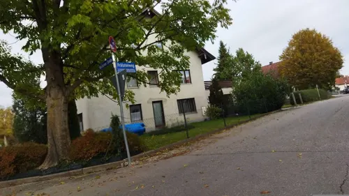
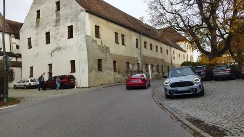


Ristorante pizzeria la torre
Restaurant · Italian, Pizza · 4.8 km
22 Hauptstraße, Hohenpeißenberg
We-Mo 11:30-14:30,17:30-22:30

Eiscafé Dolimiti
Ice cream · 0.8 km
116 Hauptstraße, Peißenberg
Su 10:30-22:30; Mo-Sa 09:30-23:00
Campingstüberl Ammertal
Restaurant · 2.2 km
Tu-Th 17:00-21:30, Fr 12:00-14:30, Fr 17:00-21:30, Sa,Su,PH...
15 more on the map.
Where to stay6
Churches and places of worship20
Wallfahrtskirche Mariä Himmelfahrt
Church · Catholic · 4.3 km
6 Matthäus-Günther-Platz, Hohenpeißenberg
St. Johannes Baptist
Church · Roman Catholic · 0.7 km
10 Hauptstraße, Peißenberg
St. Michael
Church · Roman Catholic · 1.5 km
Sankt Michael, Peißenberg
St. Nikolaus
Church · Roman Catholic · 4.4 km
2 Sankt Nikolaus, Oberhausen
Shopping15
Gas and EV charging5
Schools, colleges and libraries4
Healthcare5
Map of Peißenberg
115 places. The map loads OpenStreetMap tiles when you open it.
Getting there and nearby towns
Sonderflughafen Oberpfaffenhofen (OBF) is the nearest airport with scheduled flights listed in OpenStreetMap, 35 km away.
- Weilheim 8 km northeast, about 8 min by car
- Peiting 11 km west, about 11 min by car
- Schongau 13 km west, about 13 min by car
- Penzberg 24 km east, about 24 min by car
- Wolfratshausen 29 km northeast, about 29 min by car
- Starnberg 30 km northeast, about 30 min by car
- Puchheim 44 km northeast, about 44 min by car
- Planegg 43 km northeast, about 43 min by car
- Schwabmünchen 48 km northwest, about 48 min by car
- Munich 53 km northeast, about 53 min by car
Drive times are estimates from straight-line distance, not routes.
Local news
Headlines from INDB.
Reviews, tips and questions
Loading what members have shared...
Sources and licences
- GeoNames (CC BY 4.0): population, coordinates, regions and time zone
- Mapillary (see each image): photos
- OpenStreetMap contributors (ODbL 1.0): places, airports, map data
- Wikidata (CC0 1.0): elevation, founding date, time zone, website
- Wikimedia Commons (see each image): photos
- Wikipedia (CC BY-SA 4.0): overview and history text
Photo credits
- Peißenberg GO-1, Gras-Ober, CC BY-SA 3.0
- Bergbaumuseum Peißenberg (1), Stefan Karl, CC BY-SA 4.0
- Peißenberg, Blick von Aich auf den Ort, Dguendel, CC BY 4.0
- Peißenberg, Blick von Aich auf den Hohen Peißenberg, Dguendel, CC BY 4.0
- Peißenberg, die Wallfahrtskirche Maria Aich, Dguendel, CC BY 4.0
- Peißenberg, Wallfahrtskirche Maria Aich, die Altäre, Dguendel, CC BY 4.0
- Peißenberg, Wallfahrtskirche Maria Aich, Seitenaltar, Dguendel, CC BY 4.0
- Bergbaumuseum Peißenberg (2), Stefan Karl, CC BY-SA 4.0
- Hohenpeißenberg Panorama, Thmsfrst, Public domain
- St-Georgs-Kapelle, Peißenberg, J. Geldsetzer at de.wikipedia, Public domain
- HoherPeissenberg1, Daniel Leclercq, Public domain
- Burgstall Willenberg GO-4, Gras-Ober, CC BY-SA 3.0
- Polling (bei Weilheim) Heilig Kreuz von W, Heinrich Stürzl, CC BY-SA 4.0
- Polling - Oderding - Kirche v O, Flodur63, CC BY-SA 4.0
- Sankt Nikolaus Kirche GO-1, Gras-Ober, CC BY-SA 3.0
- Peißenberg St. Johannes Baptist 691, GFreihalter, CC BY-SA 3.0
- Sankt Miachel, Oberboarisch, CC BY-SA 4.0
- Polling - Grasla - Kapelle St Margaretha v NO 170923 - 02, Flodur63, CC BY-SA 4.0
- HoherPeissenbergWinter, Thmsfrst, Public domain
- AMX-13-latrun-2, No machine-readable author provided. Bukvoed assumed (based on copyright claims)., CC BY 2.5
- Peissenberg Maria Aich, Dark Avenger, CC BY-SA 3.0
- Mariä Himmelfahrt um 1926, Walther Matzdorff, Public domain
- Kloster Polling, Allie_Caulfield, CC BY 2.0
- St Martin Oderding, Klaus Littmann, CC BY-SA 4.0
- St. Nikolaus (Sankt Nikolaus, Oberhausen) 2, Ricardalovesmonuments, CC BY-SA 4.0
- Gasthof zur Post - panoramio, Lutz_ek, CC BY-SA 3.0
- St. Anna (Schöffau) Innenraum 1, Ricardalovesmonuments, CC BY-SA 4.0
- Sulzerbach, Wasquewhat, CC BY 4.0
- Michelsbach, Wasquewhat, CC BY 4.0
- Deutz MAH914G (BHS 71 B W), Joachim Lutz, CC BY-SA 4.0
- KM Cn2t 1948 KC7A (17578 B W), Joachim Lutz, CC BY-SA 4.0
- KM Cn2t 1948 KC7A (17578 C W), Joachim Lutz, CC BY-SA 4.0
- Deutz MLH332G (46335 C W), Joachim Lutz, CC BY-SA 4.0
- Deutz MAH914G (55957 A W), Joachim Lutz, CC BY-SA 4.0
- Deutz MLH332G (46335 A W), Joachim Lutz, CC BY-SA 4.0
- Deutz MAH914G (BHS 71 A W), Joachim Lutz, CC BY-SA 4.0
- Deutz MLH332G (46335 B W), Joachim Lutz, CC BY-SA 4.0
- Street-level photo, ramap, CC BY-SA 4.0
- Street-level photo, ramap, CC BY-SA 4.0
- Street-level photo, changchun1, CC BY-SA 4.0
- Street-level photo, changchun1, CC BY-SA 4.0
- Street-level photo, ramap, CC BY-SA 4.0
- Street-level photo, ramap, CC BY-SA 4.0
- Street-level photo, changchun1, CC BY-SA 4.0
- Street-level photo, ramap, CC BY-SA 4.0
- Street-level photo, ramap, CC BY-SA 4.0
- Street-level photo, ramap, CC BY-SA 4.0


Page built November 8, 2026. Spotted a mistake? Tell us or suggest a place.