


Why visit Püttlingen
Townapedia lists 207 museums and landmarks, 29 parks and trails, 181 places to eat, 12 places to stay and 16 attractions in and around town.
Highlights include Theater Saarbrücken, Kühlberg, Freilichtmuseum Viktoriastollen Engelfangen and Saarländisches Uhrenmuseum.
Weather in Püttlingen
Forecast from MET Norway (CC BY 4.0). Full forecast
About Püttlingen
Püttlingen (pronounced [ˈpʏtlɪŋən] ) is a town in Saarland, Germany, 10 km northwest of Saarbrücken.
From the Wikipedia article Püttlingen (this version), under CC BY-SA 4.0.
Things to do16

Theater Saarbrücken
Cinema and theater · 10.0 km
State Theatre and Opera of Saarland in Saarbrücken, Germany

Kühlberg
Scenic view · 3.0 km
Bezeichnung ist Kühlberg, nicht Kyllberg wie der Straßenname vermuten lässt

4 more on the map.
Museums and landmarks207

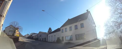

Schreinerlehrwerkstatt
Monument and historic site · 4.8 km
Ehemaliges Magazingebäude der Grube Von der Heydt,
49 Von-der-Heydt, Saarbrücken

Altes Rathaus
Monument and historic site · 4.6 km
1 Bismarckstraße, Völklingen


ehem. kath. Pfarrhaus
Monument and historic site · 2.0 km
26 Sprenger Straße, Püttlingen

Friederiken-Schienenweg
Monument and historic site · 3.0 km
Wäre 1819 beinahe die erste dampfgetriebene Eisenbahnstrecke in Deutschland geworden

Gefallene 1866 & 1870/71
Monument and historic site · 3.6 km
Sandsteinstele mit Namen der Gefallen 1870/71


Himbert / Rupp
Monument and historic site · 2.1 km
Sanssteinkreuz mit Metalkruzifix und Statue auf Steinsockel

Viktoria II
Monument and historic site · 1.0 km
Ende der Förderung 1963. Schacht noch in Betrieb mit Seilfahrt für Wasserhaltung bis 2013. Ende 2013 teilverfüllt (Betonstopfen).
195 more on the map.
Parks, trails and playgrounds29


Stadtwald Völklingen
Hiking and trails · 2.9 km
Köllertal zwischen Völklingen und Püttlingen

Bolzplatz Albertstraße
Playground · 4.0 km
08:00-21:00; PH 08:00-21:00




17 more on the map.
Restaurants and cafes181
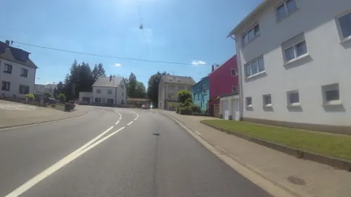
Cafe Benjamico
Cafe · Coffee Shop, Breakfast, Cafe, Cake · 4.9 km
1 Salbacher Straße, Riegelsberg
Tu-Su,PH 09:00-17:00; Mo off
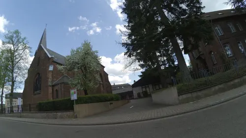
Café Ottilie
Cafe · Breakfast, Frühstücksbuffet, Cake, Torten, Regional, Tea · 4.7 km
2 Buchschacher Straße, Riegelsberg
Mo-Fr 09:00-19:00, Sa 09:00-13:00, Su 09:00-18:00
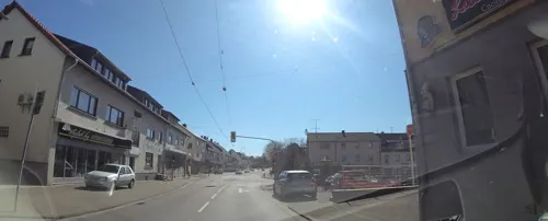
Roj Kebab
Restaurant · Kebab, Pizza, Pasta · 4.7 km
1 Etzenhofer Straße, Riegelsberg
Mo-Fr 11:00-22:30; Sa,Su,PH 13:00-22:00

Don Camillo
Restaurant · Pizza · 4.7 km
Mo-Su 11:30-14:00,17:30-23:30; Sa 17:30-23:30; Tu off; PH Tu...
Wein & Ambiente
Brewery and winery · 4.9 km
1a Salbacher Straße, Riegelsberg
Th,Fr 09:00-12:00,15:00-18:30; Sa 09:00-12:00; Mo-We,Su off
Christel‘s Stübchen
Restaurant · Chicken · 2.0 km
32 Hauptstraße, Püttlingen
Mo-Sa 17:00-23:00; We off; Su 11:00-13:00,16:30-23:00


Ristorante Tassemo
Restaurant · Italian, Pakistani · 4.5 km
Mo,We,Th,Fr 11:30-14:00,17:30-22:30;Sa 17:30-23:00;Su...

169 more on the map.
Where to stay12
Churches and places of worship40
Evangelische Kirche
Church · Protestant · 4.7 km
Buchschacher Straße, Riegelsberg
Shopping39
Gas and EV charging18
Schools, colleges and libraries28
Healthcare14
Map of Püttlingen
250 places. The map loads OpenStreetMap tiles when you open it.
Getting there and nearby towns
Saarbrücken Airport (SCN) is the nearest airport with scheduled flights listed in OpenStreetMap, 18 km away.
- Riegelsberg 4 km northeast, about 4 min by car
- Völklingen 4 km southwest, about 4 min by car
- Schwalbach 5 km west, about 5 min by car
- Wadgassen 8 km west, about 8 min by car
- Saarwellingen 10 km northwest, about 10 min by car
- Saarlouis 10 km west, about 10 min by car
- Saarbrücken 11 km southeast, about 11 min by car
- Quierschied 12 km east, about 12 min by car
- Sulzbach 12 km east, about 12 min by car
- Eppelborn 14 km northeast, about 14 min by car
Drive times are estimates from straight-line distance, not routes.
Local news
Headlines from INDB.
Reviews, tips and questions
Loading what members have shared...
Sources and licences
- GeoNames (CC BY 4.0): population, coordinates, regions and time zone
- Mapillary (see each image): photos
- OpenStreetMap contributors (ODbL 1.0): places, airports, map data
- Wikidata (CC0 1.0): elevation, founding date, time zone, website, landmarks and historic places
- Wikimedia Commons (see each image): photos
- Wikipedia (CC BY-SA 4.0): overview and history text
Photo credits
- Püttlingen Ansicht 05, atreyu, CC BY-SA 3.0
- Hexenturm Püttlingen 01, Anna16, CC BY-SA 4.0
- Hexenturm Püttlingen 02, Anna16, CC BY-SA 4.0
- Schlösschen Püttlingen 01, Anna16, CC BY-SA 4.0
- Schlösschen Püttlingen 02, Anna16, CC BY-SA 4.0
- Püttlingen, das Rathaus, Dguendel, CC BY 3.0
- Püttlingen, Rathausplatz und Sparkasse, Dguendel, CC BY 3.0
- 20201031 Bahnhofstraße 49 Püttlingen, Flocci Nivis, CC BY 4.0
- Püttlingen, die Straße "Am Marktplatz", Dguendel, CC BY 3.0
- 20201031 Bahnhof Püttlingen 02, Flocci Nivis, CC BY 4.0
- Püttlingen, Kirche St. Sebastian, der Kirchgarten, Dguendel, CC BY 3.0
- Püttlingen, Blick zur Kirche St. Bonifatius, Dguendel, CC BY 3.0
- Püttlingen, die Liebfrauenkirche, Dguendel, CC BY-SA 3.0
- Püttlingen, Kirche St. Sebastian, die Orgel, Dguendel, CC BY 3.0
- Püttlingen, Kirche St. Sebastian, das Taufbecken, Dguendel, CC BY 3.0
- Püttlingen, Kirche St. Sebastian, die Kanzel, Dguendel, CC BY 3.0
- Püttlingen, die Kirchgartenstraße, Blick zur Bergehalde Viktoria, Dguendel, CC BY 3.0
- Püttlingen, Haus Steinkreuzstraße 5, Dguendel, CC BY 3.0
- Püttlingen, die Kirche St. Sebastian, Mariensäule, Dguendel, CC BY 3.0
- Püttlingen, die Kirche St. Sebastian, Dguendel, CC BY 3.0
- Marienkapelle Püttlingen im Jahr 2009, Rock4vier, CC BY-SA 3.0
- Saarbruecken-StaatsTheater2, Hugo, Public domain
- SaarbrückenStJohann1, Lokilech, CC BY-SA 3.0
- Ludwigskirche, Wolfgang Staudt, CC BY 2.0
- Comeniushaus, Anna16, CC BY-SA 3.0
- Universität des Saarlandes, Saarbrücken, 2005, The original uploader was CAPTN HIRNI at German Wikipedia ., CC BY-SA 3.0
- Völklingen Versöhnungskirche 01, atreyu, CC BY-SA 3.0
- Hermann-Neuberger-Stadion Völklingen Saarland, Amber16, CC BY-SA 3.0
- 20201031 Herz-Jesu-Kirche Köllerbach 05, Flocci Nivis, CC BY 4.0
- Köllerbach Martinskirche 05, atreyu, CC BY-SA 3.0
- Altenkessel St. Johannes Baptista 01, atreyu, CC BY-SA 3.0
- Altenkessel-Rockershausen St. Elisabeth 01, atreyu, CC BY-SA 3.0
- Altes Rathaus Voelklingen, A. Josef Dernbecher, CC BY-SA 3.0
- Riegelsberg Evangelische Kirche 02, atreyu, CC BY-SA 3.0
- Riegelsberg Josefskirche, atreyu, CC BY-SA 3.0
- 20210521 Naturschutzgebiet Heidhübel, Flocci Nivis, CC BY 4.0
- 20201206 Bergehalde Viktoria 14, Flocci Nivis, CC BY 4.0
- Eichengruppe Stadtwald Völklingen 06, Flocci Nivis, CC BY 4.0
- 20200124St. Michael Völklingen, Flocci Nivis, CC BY-SA 4.0
- 20200124 Bürgerpark Völklingen 02, Flocci Nivis, CC BY-SA 4.0
- 20200124Kleinsche Anlage 02, Flocci Nivis, CC BY-SA 4.0
- 20200124Schillerpark Völklingen, Flocci Nivis, CC BY-SA 4.0
- 20200124Kleinsche Anlage 05, Flocci Nivis, CC BY-SA 4.0
- Albert Einstein Gymnasium Völklingen 01, Flocci Nivis, CC BY-SA 4.0
- 20200119 Grube Luisenthal 06, Flocci Nivis, CC BY 4.0
- 20200119 Schachtanlage Viktoria III 02, Flocci Nivis, CC BY 4.0
- 20200725 Wildpark Völklingen 04, Flocci Nivis, CC BY 4.0
- 20201031 Kreuzkapelle Püttlingen 06, Flocci Nivis, CC BY 4.0
- Heinestraße 5 Völklingen, Flocci Nivis, CC BY 4.0
- 20201031 Katholisches Pfarrhaus Köllerbach 02, Flocci Nivis, CC BY 4.0
- 20120429Von der Heydt42, AnRo0002, CC0
- Dampfwagen Geislautern, Unknown. Forst uploader was Flodur44 at de.wikipedia, Public domain
- Püttlingen Hexenturm 01, atreyu, CC BY-SA 3.0
- Wegekreuz Himbert Rupp 01, Flocci Nivis, CC BY 4.0
- Viktoriaschacht 2, Zecke64, CC BY-SA 3.0
- Ev Kirche, Altenkessel Bild1, Alf van Beem, Public domain
- Eingangsbereich SHG-Kliniken Völklingen, Marc André Stiebel, CC BY 3.0
- Street-level photo, teddy73, CC BY-SA 4.0
- Street-level photo, teddy73, CC BY-SA 4.0
- Street-level photo, teddy73, CC BY-SA 4.0
- Street-level photo, teddy73, CC BY-SA 4.0
- Street-level photo, teddy73, CC BY-SA 4.0
- Street-level photo, teddy73, CC BY-SA 4.0
- Street-level photo, soulcover, CC BY-SA 4.0
- Street-level photo, teddy73, CC BY-SA 4.0
- Street-level photo, teddy73, CC BY-SA 4.0
- Street-level photo, teddy73, CC BY-SA 4.0
- Street-level photo, teddy73, CC BY-SA 4.0
- Street-level photo, teddy73, CC BY-SA 4.0
- Street-level photo, teddy73, CC BY-SA 4.0
- Street-level photo, teddy73, CC BY-SA 4.0
- Street-level photo, teddy73, CC BY-SA 4.0
- Street-level photo, teddy73, CC BY-SA 4.0
- Street-level photo, teddy73, CC BY-SA 4.0
- Street-level photo, teddy73, CC BY-SA 4.0
- Street-level photo, teddy73, CC BY-SA 4.0
- Street-level photo, teddy73, CC BY-SA 4.0
- Street-level photo, changchun1, CC BY-SA 4.0
- Street-level photo, teddy73, CC BY-SA 4.0
- Street-level photo, map24, CC BY-SA 4.0
- Street-level photo, teddy73, CC BY-SA 4.0
- Street-level photo, lokilech, CC BY-SA 4.0
- Street-level photo, teddy73, CC BY-SA 4.0


Page built November 8, 2026. Spotted a mistake? Tell us or suggest a place.