


Why visit Völklingen
Townapedia lists 215 museums and landmarks, 25 parks and trails, 177 places to eat, 9 places to stay and 8 attractions in and around town.
Highlights include Hermann und Dorothea, Hühnerscheerberg, Völklingen Ironworks and ehem. Redemptoristenkloster Heiligenborn.
Weather in Völklingen
Forecast from MET Norway (CC BY 4.0). Full forecast
About Völklingen
Völklingen (German pronunciation: [ˈfœlklɪŋən] ; French: Vœlklange, Moselle Franconian: Välglinge) is a town in the district of Saarbrücken, in Saarland, Germany. It is situated on the river Saar, approx. 10 km west of Saarbrücken, and directly borders France.
From the Wikipedia article Völklingen (this version), under CC BY-SA 4.0.
Photos of Völklingen


Things to do8




Museums and landmarks215

Völklingen Ironworks
Museum · 1.1 km
75-79 Rathausstraße, Völklingen
Mar 25-Nov 04: 10:00-19:00; Nov 05-Apr 13: 10:00-18:00

ehem. Redemptoristenkloster Heiligenborn
Monument and historic site · Catholic · 4.3 km
3 Klosterweg, Bous

Altes Rathaus
Monument and historic site
1 Bismarckstraße, Völklingen


Friederiken-Schienenweg
Monument and historic site · 3.8 km
Wäre 1819 beinahe die erste dampfgetriebene Eisenbahnstrecke in Deutschland geworden

Gefallene 1866 & 1870/71
Monument and historic site · 0.9 km
Sandsteinstele mit Namen der Gefallen 1870/71



203 more on the map.
Parks, trails and playgrounds25


Stadtwald Völklingen
Hiking and trails · 1.4 km
Köllertal zwischen Völklingen und Püttlingen



Bolzplatz Albertstraße
Playground · 3.3 km
08:00-21:00; PH 08:00-21:00


13 more on the map.
Restaurants and cafes177
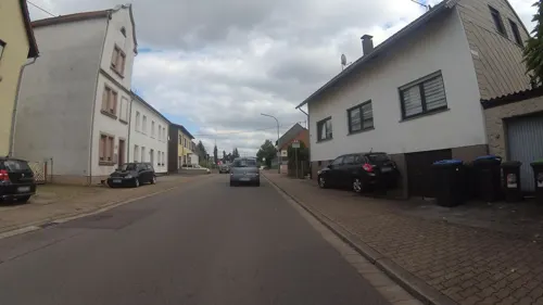
Gio
Restaurant · Italian · 3.8 km
76 Schulstraße, Wadgassen
We-Mo 12:00-14:00,18:00-22:00;Sa18:00-22:00
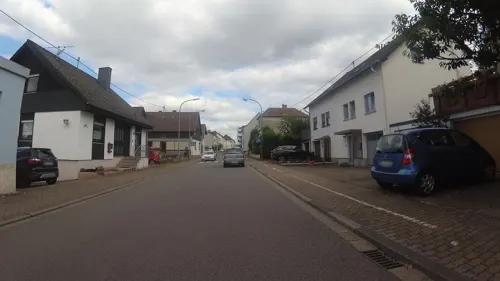
Bisttalstube
Restaurant · German · 3.9 km
32 Am Rothenberg, Wadgassen
Tu-Su 11:30-14:30,18:00-22:00
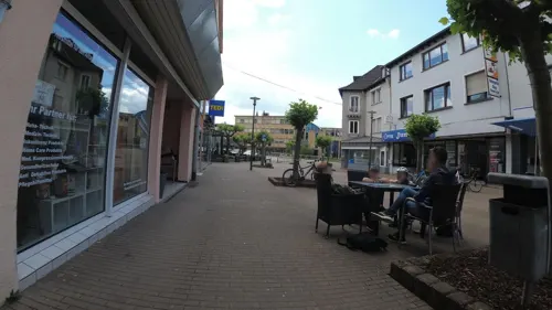
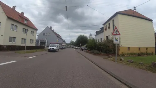
Zum Turnerheim Ottenhausen
Restaurant · German, Pasta, Pizza, Salad, Schnitzel · 4.3 km
200 Hauptstraße, Saarbrücken
Tu closed; PH,Mo,We-Su 11:30-15:00,18:00-22:00

Gasthaus Herrmann
Restaurant · Regional, Schnitzel · 4.2 km
1 Am Ottenhausener Berg, Saarbrücken
Mo-Tu,Th-Fr 17:00+; Sa-Su 11:00-14:00,17:00-22:00
Pizzeria Romantika
Restaurant · Italian · 2.3 km
46 Kleine Bergstraße, Völklingen
We-Mo 16:00-23:00
da Mario
Restaurant · Italian · 3.1 km
134 Provinzialstraße, Wadgassen
Tu-Su 18:00-22:30; We-Su 12:00-14:30


Gelateria Del Corso
Ice cream · 3.6 km
63 Provinzialstraße
Mo-Su 11:00-21:00
Gudd Stubb
Restaurant · Regional · 3.5 km
Mo-Sa 11:30-24:00; Su 17:00-24:00
165 more on the map.
History
In antiquity it was settled by Celtic tribes, then by the Romans. The Franks settled in the area between the 5th and 9th centuries. Völkingen was initially referred to as "Fulcolingas" by Durandis, Vice Chancellor to Louis the Pious in 822.
Peasants living in the area were subject to taxation by the Count of Saarbrücken. The peasants of Völkingen revolted against the Count of Saarbrücken in 1566, when he ordered the construction of the Homburger castle.
From the History section of Völklingen on Wikipedia, under CC BY-SA 4.0.
More about Völklingen
Geography
Völklingen is situated on the fertile alluvial plane at the confluence of the river Rossel and of the river Köller into the river Saar.
Völklingen has an oceanic climate (Köppen: Cfb; Trewartha: Dobk).
From the Wikipedia article Völklingen, under CC BY-SA 4.0.
Notable people from Völklingen
 Annegret Kramp-KarrenbauerGerman politician, former federal minister of defencePhoto: 9EkieraM1, CC BY-SA 3.0
 Lea AckermannGerman Roman Catholic nun and anti-forced-prostitution activist (1937–2023)Photo: Superbass, CC BY-SA 3.0
 Frank FranzGerman politicianPhoto: Sven Teschke, CC BY-SA 3.0 de
 Irene AltGerman politicianPhoto: Martin Kraft, CC BY-SA 3.0
 Manuel ZeitzGerman footballerPhoto: Sven Rech, CC BY 3.0
 Hertha Sieverts-DoreckGerman paleontologist (1899-1991)Photo: Unknown author Unknown author, Public domain
- Boris HenryGerman athletics competitor and trainer
- Hermann NeubergerGerman football official (1919–1992)
- Claus P. SchnorrGerman cryptographer
- Hermann RöchlingGerman steel industrialist (1872-1955)
- Lothar FriedrichGerman bicycle racer (1930-2015)
- Carsten BirkGerman association football player
Born in Völklingen, according to Wikidata (CC0). Each name links to its Wikipedia article.
Where to stay9
Churches and places of worship40
Auferstehungskirche
Church · Protestant · 1.9 km
62 Ludweilerstraße, Völklingen
Evangelische Kreuzeskirche
Church · Protestant · 1.5 km
17 Am Hasseleich, Völklingen
Shopping45
Gas and EV charging15
Schools, colleges and libraries29
Healthcare19
Map of Völklingen
250 places. The map loads OpenStreetMap tiles when you open it.
Getting there and nearby towns
Saarbrücken Airport (SCN) is the nearest airport with scheduled flights listed in OpenStreetMap, 19 km away.
- Püttlingen 4 km northeast, about 4 min by car
- Ludweiler-Warndt 5 km southwest, about 5 min by car
- Bous 5 km northwest, about 5 min by car
- Großrosseln 6 km south, about 6 min by car
- Wadgassen 6 km west, about 6 min by car
- Schwalbach 6 km northwest, about 6 min by car
- Riegelsberg 8 km northeast, about 8 min by car
- Ensdorf 8 km northwest, about 8 min by car
- Saarlouis 10 km northwest, about 10 min by car
- Saarbrücken 11 km east, about 11 min by car
Drive times are estimates from straight-line distance, not routes.
Towns near Völklingen


Keep exploring
Local news
Headlines from INDB.
Reviews, tips and questions
Loading what members have shared...
Sources and licences
- GeoNames (CC BY 4.0): population, coordinates, regions and time zone
- Mapillary (see each image): photos
- OpenStreetMap contributors (ODbL 1.0): places, airports, map data
- Wikidata (CC0 1.0): elevation, founding date, time zone, website, landmarks and historic places
- Wikimedia Commons (see each image): photos
- Wikipedia (CC BY-SA 4.0): overview and history text
Photo credits
- Heinestraße 5 Völklingen, Flocci Nivis, CC BY 4.0
- Völklingen, die Mühlgewannschule, Dguendel, CC BY 3.0
- Völklingen, Selimiye-Moschee, Kronleuchter, Dguendel, CC BY 3.0
- Völklingen, Selimiye mosque, inner view, Dguendel, CC BY 3.0
- Völklingen, Selimiye-Moschee, Innenansicht, Dguendel, CC BY 3.0
- Völklingen, die Selimiye-Moschee, Dguendel, CC BY 3.0
- Völklingen, the Reconciliation church, Dguendel, CC BY 3.0
- Völklingen, die Moltkestraße, Dguendel, CC BY 3.0
- Stolperstein Fritz Lieser (Hohenzollernstraße 28, 66333 Völklingen), LoKiLeCh, CC BY-SA 4.0
- Völklingen, the Moltkestraße, Dguendel, CC BY 3.0
- Völklingen, Moltkestraße, Blick zum Turm der Versöhnungskirche, Dguendel, CC BY 3.0
- 20200124Völklingen 07, Flocci Nivis, CC BY-SA 4.0
- Gebäude Poststr Völklingen von 1935, LoKiLeCh, CC BY-SA 4.0
- Völklingen, Versöhnungskirche, Figur "Arbeit", Dguendel, CC BY 3.0
- Völklingen, Versöhnungskirche, Figur "Liebe", Dguendel, CC BY 3.0
- 20201105 Altes Rathaus Völklingen, Flocci Nivis, CC BY 4.0
- Völklingen, das Alte Rathaus, Dguendel, CC BY 3.0
- Martin-Luther-Platz Völklingen, A. Josef Dernbecher, CC BY-SA 4.0
- Völklingen, die Versöhnungskirche, Dguendel, CC BY 3.0
- 20200124 Altes Rathaus Völklingen 05, Flocci Nivis, CC BY-SA 4.0
- Völklingen, Altes Rathaus, Fassade, Dguendel, CC BY 3.0
- 20200124Völklingen 05, Flocci Nivis, CC BY-SA 4.0
- Altes Rathaus Völklingen, LoKiLeCh, CC BY-SA 4.0
- Völklingen, Citypromenade und Altes Rathaus, Dguendel, CC BY 3.0
- Völklingen, Kirche St. Eligius, der Pfarrgarten, Dguendel, CC BY 3.0
- Völklingen, die Kirche St. Eligius, Dguendel, CC BY 3.0
- Völklingen, die Rathausstraße, Dguendel, CC BY 3.0
- MUSEE WENDEL, Alain meier, CC0
- Ludwigskirche, Wolfgang Staudt, CC BY 2.0
- Comeniushaus, Anna16, CC BY-SA 3.0
- Altes Rathaus Voelklingen, A. Josef Dernbecher, CC BY-SA 3.0
- Aerial image of the Völklingen Ironworks (view from the south), Carsten Steger, CC BY-SA 4.0
- Hexenturm Püttlingen 01, Anna16, CC BY-SA 4.0
- Völklingen Versöhnungskirche 01, atreyu, CC BY-SA 3.0
- Hermann-Neuberger-Stadion Völklingen Saarland, Amber16, CC BY-SA 3.0
- Kloster Bous, LoKiLeCh, CC BY-SA 4.0
- Warndtgymnasium B-Gebäude (Juni 2021), Saar-Seb, CC BY-SA 4.0
- Altenkessel St. Johannes Baptista 01, atreyu, CC BY-SA 3.0
- Altenkessel-Rockershausen St. Elisabeth 01, atreyu, CC BY-SA 3.0
- Wehrden, Evangelische Kirche (8), Cmcmcm1, CC BY-SA 3.0
- 20210821 Hühnerscheer Berg, Flocci Nivis, CC BY 4.0
- Eichengruppe Stadtwald Völklingen 06, Flocci Nivis, CC BY 4.0
- 20200124St. Michael Völklingen, Flocci Nivis, CC BY-SA 4.0
- 20200124 Bürgerpark Völklingen 02, Flocci Nivis, CC BY-SA 4.0
- 20200124Kleinsche Anlage 02, Flocci Nivis, CC BY-SA 4.0
- 20200124Schillerpark Völklingen, Flocci Nivis, CC BY-SA 4.0
- 20190711 Spitzkegelhalden Hermann und Dorothea, Flocci Nivis, CC BY 4.0
- 20200124Kleinsche Anlage 05, Flocci Nivis, CC BY-SA 4.0
- Albert Einstein Gymnasium Völklingen 01, Flocci Nivis, CC BY-SA 4.0
- 20200119 Grube Luisenthal 06, Flocci Nivis, CC BY 4.0
- 20201105 Evangelische Kirche Klarenthal 02, Flocci Nivis, CC BY 4.0
- 20200725 Wildpark Völklingen 04, Flocci Nivis, CC BY 4.0
- Fliehburg Rammelte 02, Flocci Nivis, CC BY 4.0
- 20201031 Kreuzkapelle Püttlingen 06, Flocci Nivis, CC BY 4.0
- Ottenhausen, Herz-Mariä (4), Cmcmcm1, CC BY-SA 4.0
- Fürstenhausen, Schmerzhafte Mutter (8), Cmcmcm1, CC BY-SA 4.0
- Dampfwagen Geislautern, Unknown. Forst uploader was Flodur44 at de.wikipedia, Public domain
- Püttlingen Hexenturm 01, atreyu, CC BY-SA 3.0
- Ev Kirche, Altenkessel Bild1, Alf van Beem, Public domain
- Eingangsbereich SHG-Kliniken Völklingen, Marc André Stiebel, CC BY 3.0
- Street-level photo, teddy73, CC BY-SA 4.0
- Street-level photo, soulcover, CC BY-SA 4.0
- Street-level photo, teddy73, CC BY-SA 4.0
- Street-level photo, changchun1, CC BY-SA 4.0
- Street-level photo, teddy73, CC BY-SA 4.0
- Street-level photo, changchun1, CC BY-SA 4.0
- Street-level photo, teddy73, CC BY-SA 4.0
- Street-level photo, teddy73, CC BY-SA 4.0
- Street-level photo, teddy73, CC BY-SA 4.0
- Street-level photo, teddy73, CC BY-SA 4.0
- Street-level photo, teddy73, CC BY-SA 4.0
- Street-level photo, teddy73, CC BY-SA 4.0
- Street-level photo, teddy73, CC BY-SA 4.0
- Street-level photo, teddy73, CC BY-SA 4.0
- Street-level photo, teddy73, CC BY-SA 4.0
- Street-level photo, teddy73, CC BY-SA 4.0
- Street-level photo, teddy73, CC BY-SA 4.0


Page built November 9, 2026. Spotted a mistake? Tell us or suggest a place.