


Why visit Regen
Townapedia lists 46 museums and landmarks, 11 parks and trails, 53 places to eat, 17 places to stay and 66 attractions in and around town.
Highlights include Kinocenter, Hofladen Inge Günthner, Niederbayerisches Landwirtschaftsmuseum and Burgruine Weißenstein.
Weather in Regen
Forecast from MET Norway (CC BY 4.0). Full forecast
About Regen
Regen (German pronunciation: [ˈʁeːɡn̩] ; Northern Bavarian: Reng) is a town in Bavaria, Germany, and the district town of the district of Regen.
From the Wikipedia article Regen (this version), under CC BY-SA 4.0.
Things to do66



54 more on the map.
Museums and landmarks46
Niederbayerisches Landwirtschaftsmuseum
Museum
2 Schulgasse, Regen
Mo-Fr 08:00-17:00; Sa, Su 10:00-17:00

Weißenstein Castle
Monument and historic site · 2.5 km
Building in Lower Bavaria, Germany



34 more on the map.
Parks, trails and playgrounds11



Eissportzentrum Franz-Zwiebel-Halle
Sports field and stadium · 1.9 km
45 Poschetsrieder Straße, Regen
Franz Zwiebel Eissportzentrum
Sports field and stadium · 1.9 km
45 Poschetsrieder Straße, Regen


Restaurants and cafes53

Pizzeria Adria
Restaurant · Italian · 6.8 km
7 Fahrnbacher Straße, Bischofsmais
Th-Sa 17:00-23:00; Su 11:00-14:00,17:00-23:00; We...
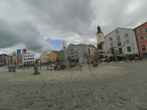
Hotel Brauereigasthof Falter
Restaurant · Regional
14 Am Sand, Regen
Mo-Fr 11:15-14:00,17:00-20:00; Sa-Su 11:15-14:00, 17:00-21:00
Berggasthof Hinhart
Restaurant · Regional · 0.9 km
Mo,Th-Sa 17:00-22:00; Su 11:00-22:00; PH 11:00-22:00; Tu,We off





Fischer GmbH Bäcker und Konditorei
Bakery · 6.9 km
17 Hauptstraße, Bischofsmais
Mo-Fr 05:30-12:30; Sa 05:30-12:00; Su 07:00-10:00

41 more on the map.
Where to stay17
Naturpension-Landgasthof Kalvarienberg
Motel and hotel · 0.8 km
51 Kalvarienbergweg, Regen
Churches and places of worship25
Shopping18
Gas and EV charging5
Schools, colleges and libraries9
Healthcare4
Map of Regen
250 places. The map loads OpenStreetMap tiles when you open it.
Getting there and nearby towns
Flugplatz Straubing-Wallmühle (RBM) is the nearest airport with scheduled flights listed in OpenStreetMap, 45 km away.
- Rinchnach 6 km southeast, about 6 min by car
- Bischofsmais 7 km southwest, about 7 min by car
- Zwiesel 9 km northeast, about 9 min by car
- Kirchberg 9 km southeast, about 9 min by car
- Straubing 42 km west, about 42 min by car
- Waldkirchen 44 km southeast, about 44 min by car
- Roding 51 km northwest, about 51 min by car
- Regenstauf 75 km west, about 1 h 15 min by car
- Regensburg 75 km west, about 1 h 15 min by car
- Vilsbiburg 81 km southwest, about 1 h 15 min by car
Drive times are estimates from straight-line distance, not routes.
Local news
Headlines from INDB.
Reviews, tips and questions
Loading what members have shared...
Sources and licences
- GeoNames (CC BY 4.0): population, coordinates, regions and time zone
- Mapillary (see each image): photos
- OpenStreetMap contributors (ODbL 1.0): places, airports, map data
- Wikidata (CC0 1.0): elevation, founding date, time zone, website, landmarks and historic places
- Wikimedia Commons (see each image): photos
- Wikipedia (CC BY-SA 4.0): overview and history text
Photo credits
- Regen stadtansicht, Papiermond 17:13, 8. Mai 2006 (CEST), CC BY-SA 3.0
- Kirchplatz 5 Regen, Konrad Lackerbeck, CC0
- Kirchplatz 24 Regen, Konrad Lackerbeck, CC0
- Pavillon Regen, H.Helmlechner, CC BY-SA 4.0
- Gedeckte Steintreppe Regen, Konrad Lackerbeck, CC0
- Stadtplatz Regen 01, H.Helmlechner, CC BY-SA 4.0
- Stadtplatz 7, Regen, H.Helmlechner, CC BY-SA 4.0
- Stadtplatz Regen 03, H.Helmlechner, CC BY-SA 4.0
- Stadtplatz Regen 04, H.Helmlechner, CC BY-SA 4.0
- St. Michael Regen 01, H.Helmlechner, CC BY-SA 4.0
- Kirchplatz 18 Regen, H.Helmlechner, CC BY-SA 4.0
- Mariensäule Regen 01, H.Helmlechner, CC BY-SA 4.0
- Stadtplatz Regen 02, H.Helmlechner, CC BY-SA 4.0
- Stadtplatz Regen 07, H.Helmlechner, CC BY-SA 4.0
- Am Platzl 5 Regen, H.Helmlechner, CC BY-SA 4.0
- Regen Bavaria Houses 80022, Jacquesverlaeken, CC BY-SA 4.0
- Regen Bavaria Marienbrunnen 80020, Jacquesverlaeken, CC BY-SA 4.0
- Regen, Stadtplatz. drumherum 2018, Christian König, CC BY-SA 4.0
- St. Michael Regen 02, H.Helmlechner, CC BY-SA 4.0
- Stadtplatz 19 Regen, H.Helmlechner, CC BY-SA 4.0
- Stadtplatz Regen 05, H.Helmlechner, CC BY-SA 4.0
- Stadtplatz 14 Regen, Konrad Lackerbeck, CC0
- 1 Regen - Marienbrunnen, W. Bulach, CC BY-SA 4.0
- 94209 Regen, Germany - panoramio, Otmar Merkel, CC BY 3.0
- Stadtplatz Regen 06, H.Helmlechner, CC BY-SA 4.0
- St. Michael Regen 03, H.Helmlechner, CC BY-SA 4.0
- Regen in Bayern (28556853421), Bernd Thaller from Graz, Austria, CC BY 2.0
- Stadtplatz 8 Regen, Konrad Lackerbeck, CC0
- St. Michael Regen 04, H.Helmlechner, CC BY-SA 4.0
- 2 Regen - Blick auf die Pfarrkirche St. Michael, W. Bulach, CC BY-SA 4.0
- Stadt Regen 2, Aisano, CC BY-SA 4.0
- Burgruine weissenstein, Papiermond, CC BY-SA 3.0
- Kloster Rinchnach aussen, High Contrast, CC BY 3.0
- Regen St. Johann, Konrad Lackerbeck, CC BY-SA 2.5
- Teufelstisch3, No machine-readable author provided. Hagen Graebner assumed (based on copyright claims)., CC BY 2.5
- Stadtpfarrkirche Regen Innenraum 1950er, fotographiert von meinem Großvater, Bild durch Erbschaft in meinem Besitz, Public domain
- Stadtplatz 7 Regen, Konrad Lackerbeck, CC0
- Pfarrkirche March, Konrad Lackerbeck, CC BY 3.0
- Weißensteiner Kapelle, Totenbretter - panoramio, Jürgen Schneider, CC BY-SA 3.0
- Pfarrkirche Langdorf-2, Konrad Lackerbeck, CC BY-SA 3.0
- Weißenstein3, LenZ (aka Christoph Käufl), CC BY-SA 3.0
- Stockwiesen bei Schollenried, Rosa-Maria Rinkl, CC BY-SA 4.0
- Spitalkirche Regen, Konrad Lackerbeck, CC BY-SA 2.5
- Waldmuseum Zwiesel - Fassade, Jimmy MacAnderson, CC BY 3.0 de
- Street-level photo, wegavision, CC BY-SA 4.0
- Street-level photo, wegavision, CC BY-SA 4.0
- Street-level photo, chuck, CC BY-SA 4.0
- Street-level photo, wegavision, CC BY-SA 4.0
- Street-level photo, wegavision, CC BY-SA 4.0
- Street-level photo, wegavision, CC BY-SA 4.0
- Street-level photo, highwayphotograph, CC BY-SA 4.0
- Street-level photo, highwayphotograph, CC BY-SA 4.0
- Street-level photo, chuck, CC BY-SA 4.0
- Street-level photo, chicc0, CC BY-SA 4.0
- Street-level photo, chicc0, CC BY-SA 4.0
- Street-level photo, chuck, CC BY-SA 4.0
- Street-level photo, highwayphotograph, CC BY-SA 4.0
- Street-level photo, heilbron, CC BY-SA 4.0


Page built November 8, 2026. Spotted a mistake? Tell us or suggest a place.