


Rheinau, Germany
Rheinau is a town of 10,997 people in Baden-Wurttemberg, Germany, founded in 1975.
Why visit Rheinau
Townapedia lists 80 museums and landmarks, 44 parks and trails, 48 places to eat, 6 places to stay and 8 attractions in and around town.
Highlights include Huschles Hofladen, Ziegenhof Maiwald, Museum für Rheinschifffahrt und Heimatkunde and Bunker verschüttet.
Weather in Rheinau
Forecast from MET Norway (CC BY 4.0). Full forecast
About Rheinau
Rheinau (German pronunciation: [ˈʁaɪnaʊ]; Low Alemannic: Rhinai) is a city in southwestern Baden-Württemberg, Germany and is part of the district of Ortenau. It is situated directly on the Rhine River, which forms the border with France, approximately 10 kilometers north of Kehl and 15 kilometers east of Strasbourg. The modern municipality was established in 1975 through the merger of nine former independent villages, including Freistett, Helmlingen, and Rheinbischofsheim. Rheinau is known locally for its annual asparagus festival (Spargelfest), reflecting the region's agricultural tradition of cultivating white asparagus.
From the Wikipedia article Rheinau (Baden) (this version), under CC BY-SA 4.0.
Things to do8


Achim Zimmer - landwirtschaftliche Erzeugnisse
Farm and orchard · 5.0 km
29 Dorfstraße, Rheinau
Museums and landmarks80



ehem. Jüdischer Friedhof "Judenstein"
Monument and historic site · 0.9 km
Friedhof und Gedenkstätte Panzergraben
Monument and historic site · 3.0 km
68 more on the map.
Parks, trails and playgrounds44








32 more on the map.
Restaurants and cafes48

Gasthaus zum Rössel
Restaurant · Regional · 6.5 km
6 Rösselstraße, Lichtenau
Tu-Fr 17:00-21:30; Sa 11:30-14:00, 17:30-21:30; Su 11:30-14:00; Mo off

Landgasthof zur Blume
Restaurant · German · 6.5 km
18 Landstraße, Lichtenau
Mo-Su 11:45-14:45,17:30-22:00

Gasthaus zum Waldhorn
Restaurant · German, Greek · 0.6 km
18 Bahnhofstraße, Rheinau
Tu-Sa 11:00-15:00, 17:00-00:00; Su 11:00-15:00, 17:00-22:00

Grüner Baum
Restaurant · German · 5.4 km
110 Dorfstraße, Rheinau
We-Th 16:00-22:00; Fr,Sa 11:00-22:00; Su,PH 10:00-22:00; Mo,Tu off
Hotel Restaurant Napoleon
Restaurant · Steak House · 1.4 km
210 Hauptstraße, Rheinau
Mo-Sa 16:30+; Su 11:00+
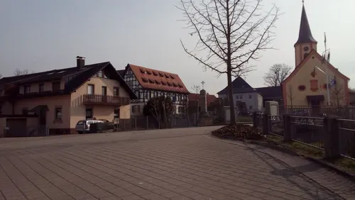
Zum Goldenen Anker
Restaurant · German
1 Inselstraße, Rheinau
Mo-Fr 17:00-21:00; Sa off; Su 17:00-20:30
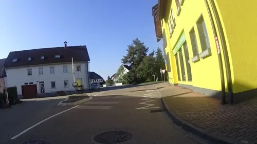
Bäckerei Schmidt
Bakery · 1.7 km
224 Hauptstraße, Rheinau
Tu-Fr 05:00-17:00; Sa 05:00-12:00; Su,PH off

Ess & Sporthaus Diersheim
Restaurant · 4.0 km
11 Rheinwaldstraße, Rheinau
Tu-Sa 17:00+; Su,PH 11:00-13:00, 17:00+
Hinter'm Saustall
Bar and pub · 4.3 km
8 Maiwald, Renchen
We,Th 16:00-22:00; Fr 13:00-24:00; Su 10:00-22:00


S'RhinKaechele
Restaurant · German, Regional · 2.9 km
week 1-14 Mo-Th 10:00-15:00; Fr,Sa 10:00-22:00; Su 10:00-21:00,...
36 more on the map.
History
The town of Rheinau was created during the Baden-Württemberg district reform in January 1975 through the combination of the formerly independent municipalities of Freistett, Rheinbischofsheim and Honau.
From the History section of Rheinau (Baden) on Wikipedia, under CC BY-SA 4.0.
Where to stay6
Churches and places of worship16
Shopping11
Gas and EV charging5
Schools, colleges and libraries12
Healthcare1
Map of Rheinau
231 places. The map loads OpenStreetMap tiles when you open it.
Getting there and nearby towns
Airport Karlsruhe/Baden-Baden (FKB) is the nearest airport with scheduled flights listed in OpenStreetMap, 16 km away.
- Achern 11 km east, about 11 min by car
- Kehl 14 km southwest, about 14 min by car
- Bühl 15 km east, about 15 min by car
- Oberkirch 18 km southeast, about 18 min by car
- Offenburg 21 km south, about 21 min by car
- Sinzheim 20 km northeast, about 20 min by car
- Baden-Baden 25 km northeast, about 25 min by car
- Rastatt 29 km northeast, about 29 min by car
- Gengenbach 30 km south, about 30 min by car
- Gaggenau 33 km northeast, about 33 min by car
Drive times are estimates from straight-line distance, not routes.
Local news
Headlines from INDB.
Reviews, tips and questions
Loading what members have shared...
Sources and licences
- GeoNames (CC BY 4.0): population, coordinates, regions and time zone
- Mapillary (see each image): photos
- OpenStreetMap contributors (ODbL 1.0): places, airports, map data
- Wikidata (CC0 1.0): elevation, founding date, time zone, website
- Wikimedia Commons (see each image): photos
- Wikipedia (CC BY-SA 4.0): overview and history text
Photo credits
- Rheinau-Freistett-04-Rathaus-Kriegerdenkmal-St Georg-gje, Gerd Eichmann, CC BY-SA 4.0
- Stolperstein Jenny Hammel Rheinau, Dd1gj, CC0
- Stolperstein Julchen Hammel Rheinau, Dd1gj, CC0
- Stolperstein Rosa Duttweiler Rheinau, Dd1gj, CC0
- Stolperstein Leo Braunschweig Rheinau, Dd1gj, CC0
- SV Linx SV Waldhof Hans Weber Stadion, Der pate, Public domain
- Mühlbach (Rench), Doktorpixel14, CC BY-SA 4.0
- Scherzheim-Kreuzkirche-08-gje, Gerd Eichmann, CC BY-SA 4.0
- Rheinau-Freistett-Heidenkirchel St Nikolaus-06-gje, Gerd Eichmann, CC BY-SA 4.0
- Rheinau-Freistett-St Georg-02-gje, Gerd Eichmann, CC BY-SA 4.0
- Rheinau-Helmlingen-evangelische Kirche-04-gje, Gerd Eichmann, CC BY-SA 4.0
- Rheinau-Memprechtshofen-evangelische Kirche-02-gje, Gerd Eichmann, CC BY-SA 4.0
- Wagshurst-St Johannes der Taeufer-118-suedwest-2025-gje, Gerd Eichmann, CC BY 4.0
- Honau st michael2, Didivo67, CC BY-SA 4.0
- Linx eglise4, Didivo67, CC BY-SA 4.0
- Hausgereut Nikolaus kapelle3, Didivo67, CC BY-SA 4.0
- Scherzheim-268-Landstr-Nr18-Zur Blume-2025-gje, Gerd Eichmann, CC BY 4.0
- Scherzheim zum Rössel 202, Jacquesverlaeken, CC BY-SA 4.0
- Rheinau-Helmlingen-10-Gruener Baum-gje, Gerd Eichmann, CC BY-SA 4.0
- Rheinbischofsheim-120-Schule-gje, Gerd Eichmann, CC BY-SA 4.0
- Judenstein Rheinbischofsheim 01 (fcm), Frank C. Müller, CC BY-SA 3.0
- Freistett interieur egliise st georges4, Didivo67, CC BY-SA 4.0
- Freistett memorial juif, Didivo67, CC BY-SA 4.0
- Bachstraße 8 (Freistett), Maarten Sepp, CC BY-SA 3.0
- Freistett, Germany - panoramio (2), Maarten Sepp, CC BY-SA 3.0
- Freistett, Germany - panoramio, Maarten Sepp, CC BY-SA 3.0
- Freistett memorial batellerie1, Didivo67, CC BY-SA 4.0
- Freistett memorial batellerie2, Didivo67, CC BY-SA 4.0
- Freistett 1870 monument morts2, Didivo67, CC BY-SA 4.0
- Freistett 1870 monument morts1, Didivo67, CC BY-SA 4.0
- Freistett 1870 monument morts3, Didivo67, CC BY-SA 4.0
- Freistett 1870 monument morts4, Didivo67, CC BY-SA 4.0
- Freistett monument morts WW1, Didivo67, CC BY-SA 4.0
- Rathaus Freistett - panoramio, imbirkenweg, CC BY-SA 3.0
- Freistett pierre tombale cimetière1, Didivo67, CC BY-SA 4.0
- Freistett pierre tombale cimetière2, Didivo67, CC BY-SA 4.0
- The Next Generation, Oliver Griebl, CC BY 3.0
- Field Of Gold, Oliver Griebl, CC BY 3.0
- Freistett, Germany - panoramio (1), Maarten Sepp, CC BY-SA 3.0
- Freistett, Germany - panoramio (3), Maarten Sepp, CC BY-SA 3.0
- Street-level photo, karthoo, CC BY-SA 4.0
- Street-level photo, karthoo, CC BY-SA 4.0
- Street-level photo, changchun1, CC BY-SA 4.0
- Street-level photo, ramap, CC BY-SA 4.0
- Street-level photo, mfa, CC BY-SA 4.0
- Street-level photo, mfa, CC BY-SA 4.0
- Street-level photo, karthoo, CC BY-SA 4.0
- Street-level photo, karthoo, CC BY-SA 4.0
- Street-level photo, ramap, CC BY-SA 4.0
- Street-level photo, bitnapper, CC BY-SA 4.0
- Street-level photo, karthoo, CC BY-SA 4.0
- Street-level photo, karthoo, CC BY-SA 4.0
- Street-level photo, karthoo, CC BY-SA 4.0
- Street-level photo, bitnapper, CC BY-SA 4.0
- Street-level photo, karthoo, CC BY-SA 4.0
- Street-level photo, mfa, CC BY-SA 4.0
- Street-level photo, karthoo, CC BY-SA 4.0
- Street-level photo, karthoo, CC BY-SA 4.0
- Street-level photo, klimakas, CC BY-SA 4.0
- Street-level photo, mfa, CC BY-SA 4.0
- Street-level photo, karthoo, CC BY-SA 4.0
- Street-level photo, karthoo, CC BY-SA 4.0
- Street-level photo, karthoo, CC BY-SA 4.0


Page built November 8, 2026. Spotted a mistake? Tell us or suggest a place.