


Steinau an der Straße, Germany
Steinau an der Straße is a town of 11,302 people in Hesse, Germany.
Why visit Steinau an der Straße
Townapedia lists 143 museums and landmarks, 47 parks and trails, 105 places to eat, 20 places to stay and 50 attractions in and around town.
Highlights include Theatrium Steinau, Seidenröther Warte, Teufelshöhle and Brüder Grimm-Haus Steinau.
Weather in Steinau an der Straße
Forecast from MET Norway (CC BY 4.0). Full forecast
About Steinau an der Straße
Steinau an der Straße (German pronunciation: [ˈʃtaɪnaʊ ʔan deːɐ̯ ˈʃtʁaːsə], lit. 'Steinau on the Route') is a town of around 10,000 inhabitants in the Main-Kinzig district, in Hesse, Germany. It is situated on the river Kinzig, 32 kilometres (20 mi) southwest of Fulda. The name Steinau refers to stones in the river; an der Straße, meaning on the road, refers to the historic trade route Via Regia from Leipzig to Frankfurt on which it was located. Steinau is best known for the Brothers Grimm who spent part of their childhood here.
From the Wikipedia article Steinau an der Straße (this version), under CC BY-SA 4.0.
Things to do50
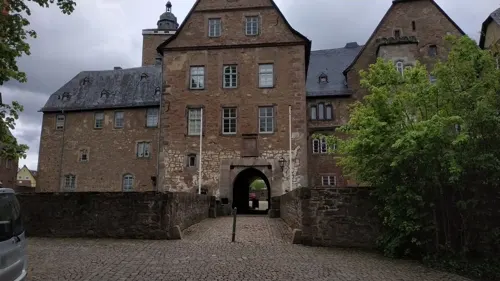

Seidenröther Warte
Scenic view · 2.7 km
Die Seidenröther Warte ist der Nachbau eines mittelalterlichen Beobachtungsposten und stand ursprünglich ca. 190 m nordöstlich von hier....




38 more on the map.
Museums and landmarks143

Teufelshöhle
Monument and historic site · 2.7 km
Cave in Germany
1 Mooshecke
Apr 20-Sep 30: Mo-Fr 11:00-17:00; Sa 11:00-18:00; PH,Su 10:00-18:00


Burgruine Stolzenberg
Monument and historic site · 7.2 km
Burgruine Stolzenberg, 1252 erstmals urkundlich erwähnt, Sitz der Hutten bis 1535 , danach nicht mehr bewohnt.

Huttenschloß
Monument and historic site · 7.3 km
6 Pacificusstraße, Bad Soden-Salmünster

Schleifrashof
Monument and historic site · 8.1 km
56a Frankfurter Straße, Bad Soden-Salmünster


Kloster Schlüchtern
Monument and historic site · 5.7 km
Im Kloster, Schlüchtern

Lauter'sches Schlösschen
Monument and historic site · 5.6 km
15 Schloßstraße, Schlüchtern

Schloss Steinau
Monument and historic site
1-7 Im SchIoß, Steinau an der Straße
131 more on the map.
Parks, trails and playgrounds47

Erlebnispark Steinau an der Straße
Sports field and stadium · 2.6 km
1 Thalhof, Steinau an der Straße
09:00-18:00
Spessart Therme
Sports field and stadium · 7.7 km
5 Frowin-von-Hutten-Straße, Bad Soden-Salmünster
Mo-Sa 09:00-22:00; PH,Su 09:00-20:00





Lietebach und Kelterberg von Ahlersbach und Hohenzell
Hiking and trails · 6.7 km

35 more on the map.
Restaurants and cafes105

Deutsches Haus
Restaurant · German, Pizza · 7.1 km
2 In der Ährecke, Steinau an der Straße
Mo-Fr 16:30-23:00; Tu off; We off; Sa 11:00-23:00; Su 11:00-21:30
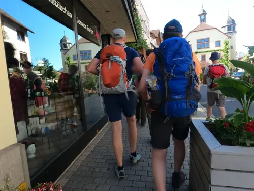
Gasthaus Hausmann
Restaurant · German, Hessian, Regional · 5.7 km
5 Obertorstraße, Schlüchtern
Mo-Sa 11:30-14:00; Mo-Tu 18:00-23:30; Th-Fr 18:00-23:30
La Vita
Restaurant · Italian · 5.9 km
Ristorante, Pizzeria
53 Krämerstraße, Schlüchtern
Tu-Fr, Su 11:00-14:00, 17:00-23:00; Sa 17:00-23:00
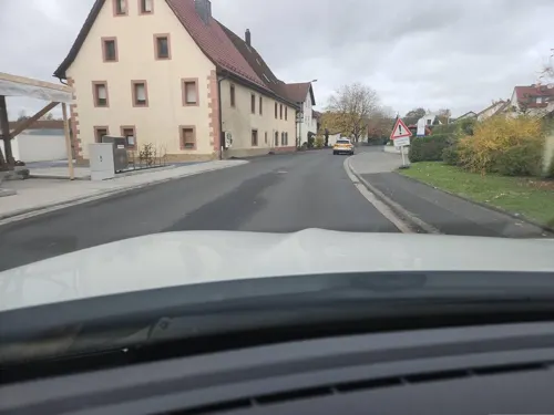
Zum Spessarttor
Restaurant · German, International · 7.6 km
44 Spessartstraße, Bad Soden-Salmünster
We-Su 11:30-14:00,17:00-22:30; PH 11:30-14:00,17:00-22:30
Bellingser Elephant
Restaurant · German · 3.0 km
4 Sportplatzweg, Steinau an der Straße
Tu 17:00-24:00; Su,PH 11:30-17:00
Brathähnchen Farm
Restaurant · 2.5 km
1 Im Ohl, Steinau an der Straße
Tu-Su 12:00-22:00; PH 12:00-22:00
Da Enzo
Restaurant · Italian · 7.5 km
10 Badestraße, Bad Soden-Salmünster
Su-Tu 11:30-14:30,17:00-23:00; Th-Sa 11:30-14:30,17:00-23:30; We off

Eis Café Paradice
Ice cream · 8.1 km
Eis Café mit Innen- und Außenbereich, und Eis zum Mitnehmen
17 Parkstraße, Bad Soden-Salmünster
Sa,Su 12:00-20:00; Mo 13:00-19:00; Tu-Fr 12:00-20:00
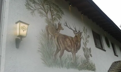


Fabrice Café
Cafe · Regional, Coffee Shop, Burger, Ice Cream, German, Breakfast, Noodle · 5.9 km
3 Breitenbacher Straße, Schlüchtern
Mo-Sa 05:30-18:00; Su 10:00-18:00
Gaststätte Bauernschänke
Restaurant · German, Burger
28 Ringstraße
Tu 18:00-23:30; We-Th 18:00-22:00; Fr-Sa 18:00-22:30
93 more on the map.
History
Archaeological evidence indicates that there was a small settlement in this area in the 8th century. The first church was built in the 9th century. In the mid-13th century, St. Catherine's Church was big enough to accommodate burials on its grounds.
On 4 July 1290, Emperor Rudolf von Habsburg granted a charter awarding Steinau the status of town and permitting it to hold a weekly market. This may have been motivated in part by Steinau's position on the Via Regia connecting Frankfurt and Leipzig. This charter is considered the municipality's founding document.
The town's heyday was in the 16th century, when the town church was rebuilt in Gothic style and increased in size. In 1528-55 the castle, since the 13th century a residence of the Counts of Hanau was rebuilt as a Renaissance palace. Schloss Steinau with its 35 metres (115 ft) high bergfried remains the town's landmark. In 1561, the town hall was built, followed a year later by the Amtshaus, seat of the Amtsmann, the local representative of the ruler. Like many other towns, Steinau suffered severely during the Thirty Years' War which brought plundering, fire and the plague. Another setback followed in the 18th century during the Seven Years' War. Only in the later part of that century did an economic upturn set in.
From the History section of Steinau an der Straße on Wikipedia, under CC BY-SA 4.0.
Where to stay20
Churches and places of worship29
Mariae Himmelfahrt
Church · Catholic · 7.2 km
12 An der Kirche, Steinau an der Straße
ev. Versöhnungskirche Salmünster
Church · Protestant · 8.2 km
53 Frankfurter Straße, Bad Soden-Salmünster
Shopping35
Gas and EV charging14
Schools, colleges and libraries15
Healthcare13
Praxisklinik Dr. med. Sonchai Tiyaworabun
Clinic and pharmacy · 5.9 km
7-9 Breitenbacher Straße, Schlüchtern
Map of Steinau an der Straße
250 places. The map loads OpenStreetMap tiles when you open it.
Getting there and nearby towns
Frankfurt Airport (FRA) is the nearest airport with scheduled flights listed in OpenStreetMap, 73 km away.
- Wächtersbach 14 km southwest, about 14 min by car
- Offenbach 55 km southwest, about 55 min by car
- Werneck 58 km southeast, about 58 min by car
- Frankfurt am Main 60 km west, about 1 h by car
- Wertheim 62 km south, about 1 h by car
- Veitshöchheim 61 km southeast, about 1 h by car
- Usingen 66 km west, about 1 h by car
- Würzburg 68 km southeast, about 1 h 15 min by car
- Darmstadt 76 km southwest, about 1 h 15 min by car
- Tauberbischofsheim 78 km south, about 1 h 15 min by car
Drive times are estimates from straight-line distance, not routes.
Local news
Headlines from INDB.
Reviews, tips and questions
Loading what members have shared...
Sources and licences
- GeoNames (CC BY 4.0): population, coordinates, regions and time zone
- Mapillary (see each image): photos
- OpenStreetMap contributors (ODbL 1.0): places, airports, map data
- Wikidata (CC0 1.0): elevation, founding date, time zone, website
- Wikimedia Commons (see each image): photos
- Wikipedia (CC BY-SA 4.0): overview and history text
Photo credits
- Steinau an der Straße, die Reinhardskirche, Dguendel, CC BY 3.0
- Steinau an der Straße, Brüder-Grimm-Straße 28 (1), Karsten Ratzke, CC0
- Steinau an der Straße - panoramio (1), Hans Stasse, CC BY-SA 3.0
- Steinau an der Straße, Haus Ziegelgasse 3, Dguendel, CC BY 3.0
- Steinau an der Straße, Brüder-Grimm-Straße 28, Karsten Ratzke, CC0
- Steinau an der Straße, Brüder-Grimm-Straße 28 (2), Karsten Ratzke, CC0
- Steinau an der Straße, Saubrunnen, Karsten Ratzke, CC0
- Steinau an der Straße, Brückentor 7, Tafel, Karsten Ratzke, CC0
- Steinau an der Straße, Brückentor 7, Karsten Ratzke, CC0
- Steinau an der Straße, Brückentor 7 (1), Karsten Ratzke, CC0
- Steinau an der Straße, Haus Brüder-Grimm-Straße 31, Dguendel, CC BY 3.0
- Steinau an der Straße, Haus mit Lüftlmalerei, Dguendel, CC BY 3.0
- Steinau an der Straße, Neugasse 2, Karsten Ratzke, CC0
- Steinau an der Straße, Neugasse, Zehntscheune, Karsten Ratzke, CC0
- Steinau an der Straße, Neugasse 4, Karsten Ratzke, CC0
- Steinau an der Straße, Neugasse, Zehntscheune (1), Karsten Ratzke, CC0
- Steinau an der Straße, Brüder-Grimm-Straße 43 (1), Karsten Ratzke, CC0
- Steinau an der Straße, VR-Bank, Karsten Ratzke, CC0
- Steinau an der Straße, Brüder-Grimm-Straße 43 (2), Karsten Ratzke, CC0
- Steinau an der Straße - Blick in die Brüder-Grimm-Straße NO, User:Mattes, Public domain
- Steinau an der Straße - Wohnhäuser Viehmarkt, User:Mattes, Public domain
- Steinau an der Straße, Brüder-Grimm-Straße 43, Karsten Ratzke, CC0
- Steinau an der Straße, Viehhof 2 (1), Karsten Ratzke, CC0
- Steinau an der Straße, Märzgasse, Brunnen, Karsten Ratzke, CC0
- Steinau an der Straße, die Brüder-Grimm-Straße am Rathaus, Dguendel, CC BY 3.0
- Steinau an der Straße, Viehhof 2, Karsten Ratzke, CC0
- Steinau an der Straße, Brüder-Grimm-Straße 70, Karsten Ratzke, CC0
- Steinau an der Straße, Brüder-Grimm-Straße 68, Karsten Ratzke, CC0
- Steinau an der Straße, Schloss, Katharinenkirche und Stadtbrunnen, Dguendel, CC BY 3.0
- Steinau an der Straße, die Katharinenkirche, Dguendel, CC BY 3.0
- Katharinenkirche Steinau an der Straße - Orgelprospekt, FauleBirne 007, CC BY 4.0
- Steinau an der Straße, der Gasthof "Burgmannenhaus", Dguendel, CC BY 3.0
- Steinau an der Straße, Viehhof 2, Rückseite, Karsten Ratzke, CC0
- Steinau an der Straße, das Rathaus, Dguendel, CC BY 3.0
- Märchenbrunnen Steinau an der Straße - Säule, User:Mattes, Public domain
- Schloss Steinau Panorama Fotos RL - Stitch GD, Fotografien von Rainer Lippert , zusammengefügt von mir, Grand-Duc, Public domain
- Steinau Brüder-Grimm-Haus 2016-04-10-12-06-37, Alexander Hoernigk, CC BY 3.0
- Kloster Schlüchtern Westfassade 1, Reinhard Dietrich, CC0
- Schleifrashof salmünster 05, Commander-pirx, CC BY-SA 4.0
- Lauterschlösschen vorne, Reinhard Dietrich, CC0
- Feuchtwiesen bei Ahl 5, Ersin Caylak, CC BY-SA 4.0
- NSG Neudorfwiesen bei Steinau 2022-03-09 02, Leonhard Lenz, CC0
- Schluechtern Elm Hainberg bei Elm SCI 555520983 may, UuMUfQ, CC BY-SA 3.0
- NSG Altholzinsel Gretenberg 2022-03-09 10, Leonhard Lenz, CC0
- Kloster und Hadermann, Alphasigma, CC BY-SA 4.0
- Versöhnungskirche Bad Soden-Salmünster 20230304 0175, Tilman2007, CC BY-SA 4.0
- Ev. Kirche Schlüchtern-Elm, FauleBirne 007, CC BY-SA 4.0
- Seidenrother Warte, Surveyor54, Attribution
- Bellinger Warte 2014, Surveyor54, Attribution
- Bad Soden - Burg Stolzenberg 0482 3 4, Sven Teschke, CC BY-SA 3.0 de
- Bad Soden - Huttenschloss 0473, Sven Teschke, CC BY-SA 3.0 de
- Bad Soden, das Rathaus, Dguendel, CC BY 3.0
- Romsthal Kirche St. Franziskus 01, Surveyor54, CC BY-SA 4.0
- Kirche Unbefleckte Empfängnis Mariae Ahl 001, R.Raab, CC BY-SA 4.0
- Die Bellingerwarte am Bellinger Berg, Ersin Caylak, CC BY-SA 4.0
- Gretenberg Spessart 2022-03-09 15, Leonhard Lenz, CC0
- Street-level photo, chuck, CC BY-SA 4.0
- Street-level photo, DerMaster0815, CC BY-SA 4.0
- Street-level photo, cello, CC BY-SA 4.0
- Street-level photo, bernd_niemann, CC BY-SA 4.0
- Street-level photo, ramap, CC BY-SA 4.0
- Street-level photo, chuck, CC BY-SA 4.0
- Street-level photo, chuck, CC BY-SA 4.0
- Street-level photo, chuck, CC BY-SA 4.0
- Street-level photo, chuck, CC BY-SA 4.0
- Street-level photo, ramap, CC BY-SA 4.0
- Street-level photo, igdb, CC BY-SA 4.0
- Street-level photo, chuck, CC BY-SA 4.0
- Street-level photo, chuck, CC BY-SA 4.0


Page built November 8, 2026. Spotted a mistake? Tell us or suggest a place.