


Why visit Schotten
Townapedia lists 27 museums and landmarks, 47 parks and trails, 66 places to eat, 18 places to stay and 51 attractions in and around town.
Highlights include Vogelpark Schotten, Eselhof-Wetterau, Alteburg and Alteburg.
Weather in Schotten
Forecast from MET Norway (CC BY 4.0). Full forecast
About Schotten
Schotten (German pronunciation: [ˈʃɔtn̩] ) is a town in the middle of Hesse, Germany. Larger towns nearby include Alsfeld in the north, Fulda in the east, Friedberg in the south and Gießen in the west.
From the Wikipedia article Schotten (this version), under CC BY-SA 4.0.
Things to do51





39 more on the map.
Museums and landmarks27
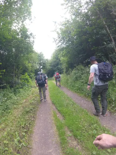



Eppsteiner Schloss
Monument and historic site
6 Schloßgasse, Schotten




Das alte Backhaus
Monument and historic site · 7.4 km
Das alte Backhaus - Anno 1887

15 more on the map.
Parks, trails and playgrounds47

Am Bilstein bei Breungeshain und Busenborn
Hiking and trails · 5.5 km






35 more on the map.
Restaurants and cafes66

Berggasthof Hoherodskopf
Restaurant · German · 7.1 km
11 Am Hoherodskopf, Schotten
We-Sa 11:30-20:30; Su 11:30-19:30
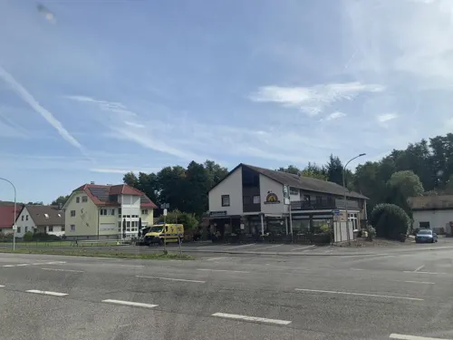
Frankenstube
Restaurant · German · 7.6 km
50 Frankenstraße, Nidda
Mo-Fr 11:00-14:00,17:00-22:00; Sa 12:00-22:00; Su 11:00-22:00
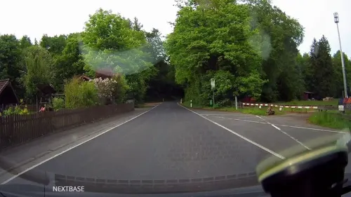
Hotel & Landgasthof "Laubacher Wald"
Restaurant · Regional · 7.7 km
1 Laubacher Wald, Laubach
Mo,We-Su 11:30-14:00,18:00-21:30
La Spiga D'oro
Restaurant · Italian
40 Kirchstraße, Schotten
Mo-Fr 17:00-22:00; Tu off; Sa,Su 11:30-14:00,17:00-22:00
Quattro Leoni
Restaurant · Italian
9 Marktstraße, Schotten
Mo-Sa 11:00-14:30,17:00-23:00,Su,PH 11:00-23:00
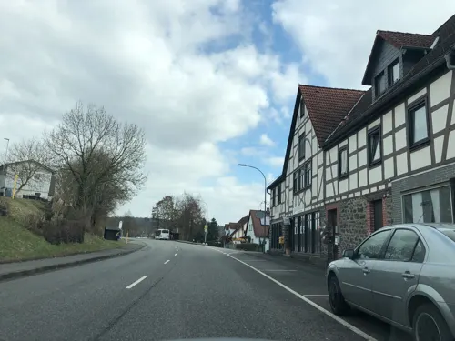
Ristorante Pizzeria 4Leoni
Restaurant · Pizza · 4.9 km
35 Frankfurter Straße, Schotten
Tu-Su 11:00-14:00,17:30-23:00


Ätna
Restaurant · Italian · 9.4 km
1 Marktstraße, Ulrichstein
Mo-Sa 11:00-14:00, Mo-Sa 17:00-23:00; Su 11:00-23:00

Café-Restaurant Vogelpark
Cafe · 1.6 km
212 Vogelsbergstraße, Schotten
Mo-Fr 12:30-17:30; Sa,Su,PH 12:00-17:30
Haus Sonnenberg
Restaurant · 0.6 km
25 Laubacher Straße, Schotten
"only for hotel guests, not for the public (temporarily)"
54 more on the map.
History
Archaeological finds from the Schotten area reach back to the New Stone Age. Several barrows bear witness to prehistoric times as do the "Alteburg" and "Wildhauskopf" ringwalls, whose building date is unknown.
Schotten had its first documentary mention in 778. The "Horstburg", a local castle near the constituent municipality of Rudingshain, may have stood in connection with the town's founding. There were digs at the ruins in the 1970s, and they were interpreted as having been a Carolingian royal court. Schotten is said to have been founded by Irish-Scottish monks. The Gothic Church of Our Lady was built in the 14th century.
In the Middle Ages, Schotten belonged to the Eppstein and Trimberg noble families. The Rhenish League of Towns, in a feud with these families, captured the town and destroyed the walls and the stately home. From 1403, Schotten belonged to the Hessian Landgraves. The current stately home, the Schotten Castle, dates from this time.
From the History section of Schotten on Wikipedia, under CC BY-SA 4.0.
Where to stay18
Churches and places of worship18
Evangelische Kirche
Church · Protestant · 6.9 km
11 Schulstraße, Ulrichstein
Evangelische Kirche
Church · Protestant · 9.4 km
2 Marktstraße, Ulrichstein
Ev. Kirchengemeinde Burkhards / Kaulstoß
Church · Protestant · 7.2 km
44 Niddergrund, Schotten
Evangelisches Pfarramt Gonterskirchen/Einartshausen
Church · Protestant · 7.4 km
5 An der Kirche, Laubach
Shopping10
Gas and EV charging1
Schools, colleges and libraries8
Healthcare5
Map of Schotten
250 places. The map loads OpenStreetMap tiles when you open it.
Getting there and nearby towns
Frankfurt Airport (FRA) is the nearest airport with scheduled flights listed in OpenStreetMap, 67 km away.
- Wächtersbach 30 km southeast, about 30 min by car
- Steinau an der Straße 32 km southeast, about 32 min by car
- Usingen 46 km southwest, about 46 min by car
- Offenbach 52 km southwest, about 52 min by car
- Frankfurt am Main 53 km southwest, about 53 min by car
- Steinbach am Taunus 54 km southwest, about 54 min by car
- Schwalbach am Taunus 58 km southwest, about 58 min by car
- Weilburg 61 km west, about 1 h by car
- Wiesbaden 78 km southwest, about 1 h 15 min by car
- Darmstadt 78 km southwest, about 1 h 15 min by car
Drive times are estimates from straight-line distance, not routes.
Local news
Headlines from INDB.
Reviews, tips and questions
Loading what members have shared...
Sources and licences
- GeoNames (CC BY 4.0): population, coordinates, regions and time zone
- Mapillary (see each image): photos
- OpenStreetMap contributors (ODbL 1.0): places, airports, map data
- Wikidata (CC0 1.0): elevation, founding date, time zone, website
- Wikimedia Commons (see each image): photos
- Wikipedia (CC BY-SA 4.0): overview and history text
Photo credits
- Schotten15-007, Bytfisch, CC BY-SA 4.0
- Alteburg Schotten Eingang, UuMUfQ, CC BY-SA 3.0
- Schotten15-004, Bytfisch, CC BY-SA 4.0
- Schotten15-005, Bytfisch, CC BY-SA 4.0
- Schotten15-006, Bytfisch, CC BY-SA 4.0
- Schotten15-010, Bytfisch, CC BY-SA 4.0
- Schotten15-001, Bytfisch, CC BY-SA 4.0
- Schotten15-008, Bytfisch, CC BY-SA 4.0
- Schotten15-009, Bytfisch, CC BY-SA 4.0
- Schotten Schotten Alteburgpark Fountain N, UuMUfQ, CC BY-SA 3.0
- Schotten15-002, Bytfisch, CC BY-SA 4.0
- Alteburg Schotten Rueckseite Graben, UuMUfQ, CC BY-SA 3.0
- Schotten Schotten Alteburgpark Moart E, UuMUfQ, CC BY-SA 3.0
- Schotten Schotten Alteburgpark Waterfall f, UuMUfQ, CC BY-SA 3.0
- Schotten Schotten Alteburgpark Waterfall o, UuMUfQ, CC BY-SA 3.0
- Schotten Schotten Schlossgasse NE, UuMUfQ, CC BY-SA 3.0
- Schotten Schotten Eppsteiner Schloss db SE, UuMUfQ, CC BY-SA 3.0
- Schotten Schotten Warte WW N f, UuMUfQ, CC BY-SA 3.0
- Schotten Schotten Warte i WW2 b, UuMUfQ, CC BY-SA 3.0
- Schotten Schotten Warte Pano Cyl E, UuMUfQ, CC BY-SA 3.0
- Schotten Schotten Warte i WW2 a, UuMUfQ, CC BY-SA 3.0
- Schotten Schotten Warte df WW, UuMUfQ, CC BY-SA 3.0
- Schotten Schotten Warte db S, UuMUfQ, CC BY-SA 3.0
- Schotten Schotten Warte W f, UuMUfQ, CC BY-SA 3.0
- Schotten Betzenrod SPA 555537664 Pasture Quercus, UuMUfQ, CC BY-SA 3.0
- Nidda in Schotten, Freak-Line-Community, CC BY-SA 4.0
- Schotten Betzenrod Natural monument Tilia Schellnberg 202410 a, UuMUfQ, CC BY-SA 4.0
- Bilstein Gipfelfelsen, J. Braukmann Milseburg, CC BY-SA 3.0
- Taufstein - Horst, J. Braukmann Milseburg, CC BY-SA 3.0
- Vogelsberg - Ulrichstein - Burg Ulrichstein - WLMMH 3627, Sven Teschke , Büdingen, CC BY-SA 3.0 de
- Schotten - Eppsteiner Schloss 0360, Sven Teschke, CC BY-SA 3.0 de
- Schotten - Evangelische Liebfrauenkirche, Sven Teschke, CC BY-SA 3.0 de
- Gonterskirchen Kirche Westen, Wikiwal, CC BY-SA 3.0
- Evangelische Kirche (Ulfa) 17, Cherubino, CC BY-SA 4.0
- Blockfelder am Taufstein, Thee uploader, CC BY-SA 3.0
- Ernstberg bei Sichenhausen, Felix Ritz, CC BY-SA 3.0
- Hoher Vogelsberg Breungeshainer Heide Geiselstein Goldwiese, UuMUfQ, CC BY-SA 3.0
- Auf der langen Galle bei Rudingshain, Felix Ritz, CC BY-SA 3.0
- NSG Eichköppel, KKarin67, CC BY-SA 4.0
- Nidda Michelnau Heissbachgrund NR 163617 Pasture b, UuMUfQ, CC BY-SA 3.0
- Oberes Niddatal Forellenteiche, Felix Ritz, CC BY-SA 3.0
- Am Bilstein bei Breungeshain und Busenborn, Felix Ritz, CC BY-SA 3.0
- Die Oberweide bei Breungeshain, Felix Ritz, CC BY-SA 3.0
- Ulrichstein Feldkruecken Schulstrasse Kirche d, UuMUfQ, CC BY-SA 3.0
- Mammutbaum Schotten, Rainer Lippert at de.wikipedia, Public domain
- Altes Backhaus (Eichelsdorf) 01, Cherubino, CC BY-SA 4.0
- Kümmelberg, Fernando Ferkelkraut, CC BY-SA 4.0
- Vogelsberg - Ulrichstein - Kirche - WLMMH 3623, Sven Teschke , Büdingen, CC BY-SA 3.0 de
- Schotten Schotten Warte Geotop Basalt a, UuMUfQ, CC BY-SA 3.0
- Hoher Vogelsberg Gackerstein Oberweide Breungeshain 344580 Vaccinium myrtillus Gramineae, UuMUfQ, CC BY-SA 3.0
- Ulrichstein Koelzenhain Hut BBQ Schleuningsteine 20250601 a, UuMUfQ, CC BY-SA 4.0
- Street-level photo, chuck, CC BY-SA 4.0
- Street-level photo, tasmaniadevil, CC BY-SA 4.0
- Street-level photo, derlipper, CC BY-SA 4.0
- Street-level photo, tmka, CC BY-SA 4.0
- Street-level photo, chuck, CC BY-SA 4.0
- Street-level photo, chuck, CC BY-SA 4.0
- Street-level photo, tasmaniadevil, CC BY-SA 4.0
- Street-level photo, tasmaniadevil, CC BY-SA 4.0
- Street-level photo, chuck, CC BY-SA 4.0
- Street-level photo, chuck, CC BY-SA 4.0
- Street-level photo, chuck, CC BY-SA 4.0


Page built November 8, 2026. Spotted a mistake? Tell us or suggest a place.