


Schmalkalden, Germany
Schmalkalden is a town of 19,553 people in Thuringia, Germany, founded in 1247.
Why visit Schmalkalden
Townapedia lists 52 museums and landmarks, 26 parks and trails, 92 places to eat, 22 places to stay and 113 attractions in and around town.
Highlights include Trusetaler Wasserfall, Koppenstein, Hochofenmuseum Neue Hütte and Museum Schloss Wilhelmsburg.
Weather in Schmalkalden
Forecast from MET Norway (CC BY 4.0). Full forecast
About Schmalkalden
Schmalkalden (German pronunciation: [ʃmalˈkaldn̩] ) is a town in the Schmalkalden-Meiningen district, in the southwest of the state of Thuringia, Germany. It is on the southern slope of the Thuringian Forest at the Schmalkalde river, a tributary to the Werra. As of 31 December 2022, the town had a population of 20,065.
From the Wikipedia article Schmalkalden (this version), under CC BY-SA 4.0.
Things to do113


Maßkopf
Scenic view · 6.2 km
View from the Maßkopf on Floh-Seligenthal and the Thuringian Forest

101 more on the map.
Museums and landmarks52
Hochofenmuseum Neue Hütte
Museum · 3.6 km
Technisches Museum
1 Neue Hütte, Schmalkalden
Apr-Oct: We-Su 10:00-17:00; Nov-Mar: Th-Su 11:00-16:00 || "für...




Historicum Zinnfigurenmuseum
Museum
1 Gillersgasse, Schmalkalden
Mo,Tu,Th,Fr 10:00-13:00,15:00-18:00; We 10:00-18:00; Sa 10:00-12:00


40 more on the map.
Parks, trails and playgrounds26

Ebertswiese
Park · 9.5 km
Part of the Spittergrund nature reserve in Thuringia, Germany



Stadion - Am Walperloh
Sports field and stadium · 1.7 km
Helenenweg, Schmalkalden
14 more on the map.
Restaurants and cafes92
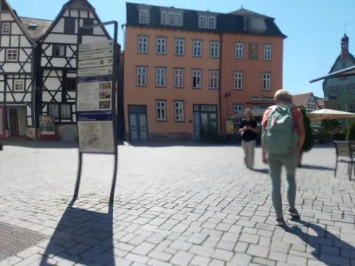
Backhaus Nahrstedt
Bakery · 0.6 km
3a Soldatensprung, Schmalkalden
Mo-Fr 07:00-17:00; Sa 07:00-12:00; Su 08:00-16:30

Viba
Restaurant · German, Cake, Mediterranean, Breakfast, Fish, Ice Cream, Brunch, Central European · 0.7 km
1 Nougat-Allee, Schmalkalden
Mo-Su 11:00-18:00

Cafeteria Mensa Blechhammer
Cafe · Fast Food, Regional, Coffee Shop, Burger · 1.5 km
9a Blechhammer, Schmalkalden
Mo-Th 11:30-16:00; Fr 11:30-15:30
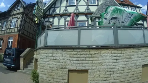
Gasthaus Höhnberg
Restaurant · German · 4.7 km
41 Tambacher Straße, Floh-Seligenthal
Mo,Tu 17:00-21:00; Fr,Sa 17:00-22:00; Su,PH...
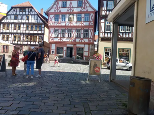
Maykels
Bar and pub · Burger, International · 0.7 km
1 Lutherplatz, Schmalkalden
Mo-Th 10:00-22:00; Fr-Sa 10:00-23:00
Milchhalle
Cafe · Coffee Shop, Bistro, Tea, Cake, Sandwich, Regional · 0.7 km
Café mit Co-Working Space
6 Weidebrunner Gasse, Schmalkalden
Mo,Fr 11:30-14:00; Tu,Th 11:30-17:00; We 11:30-20:00; Sa,Su off
Salvatore's Pizza & Pasta
Restaurant · Pizza · 0.8 km
28 Stiller Gasse, Schmalkalden
Mo-Fr 11:00-14:00,17:00-23:00; PH,Sa,Su 17:00-23:00
Backhaus Nahrstedt
Bakery · 7.6 km
3 Rathausstraße, Brotterode-Trusetal
Mo-Fr 07:00-19:00; Sa,Su 08:00-17:00


Zum Hopfengarten
Restaurant · Regional · 0.7 km
12 Weidebrunner Gasse, Schmalkalden
Mo off; Tu-Sa 17:00-23:00; Su off
Asia Bistro "Ms. Lee"
Restaurant · Vietnamese · 1.1 km
42 Kasseler Straße, Schmalkalden
Mo-Sa 10:30-15:00; Mo-Sa 16:00-20:30; Su 11:30-14:30; Su 16:30-20:30
80 more on the map.
History
First mentioned in an 874 deed, Smalcalta in the Frankish duchy of Thuringia received town privileges about 1180. When Landgrave Henry Raspe of Thuringia died without issue in 1247, it passed to the House of Henneberg-Schleusingen, while the major part of the landgraviate fell to the House of Wettin in Meissen. To secure their acquisition the Counts of Henneberg allied with the Landgraviate of Hesse, including the conclusion of an inheritance treaty. In 1360, together with Landgrave Henry II of Hesse they paid off Frederick V, Burgrave of Nuremberg, son of Elisabeth of Henneberg.
In 1531 the town hall of Schmalkalden was the site of the establishment of the Schmalkaldic League by Protestant princes under the lead of Landgrave Philip I of Hesse, in order to protect religious and political interests within their domains. In 1537 the Smalcald Articles were drawn up by Martin Luther, Philipp Melanchthon and other reformers.
When the Counts of Henneberg became extinct in 1583, their share was inherited by William IV, Landgrave of Hesse-Kassel. William made the town a residence and had Wilhelmsburg Castle erected, finished in 1590. The Lordship of Schmalkalden remained an exclave of Hesse, from 1868 on it was part of the Prussian province of Hesse-Nassau until it was incorporated into the Province of Saxony in 1944 and in 1945 became part of the State of Thuringia.
From the History section of Schmalkalden on Wikipedia, under CC BY-SA 4.0.
Where to stay22
Churches and places of worship30
Kirche Floh
Church · Protestant · 4.3 km
Schmalkalder Straße, Floh-Seligenthal
Dorfkirche Asbach
Church · Lutheran · 3.2 km
84 Talstraße, Schmalkalden
Kirche Niederschmalkalden
Church · Lutheran · 5.0 km
Karl-Marx-Straße, Schmalkalden
Kirche Schnellbach
Church · Protestant · 5.5 km
26 Nesselbergstraße, Floh-Seligenthal
Kirche St. Trinitatis
Church · Lutheran · 8.2 km
14 Kirchweg, Wasungen
Shopping35
Gas and EV charging8
Schools, colleges and libraries20
Healthcare10
Map of Schmalkalden
250 places. The map loads OpenStreetMap tiles when you open it.
Getting there and nearby towns
Flugplatz Eisenach-Kindel (EIB) is the nearest airport with scheduled flights listed in OpenStreetMap, 30 km away.
- Zella-Mehlis 17 km southeast, about 17 min by car
- Suhl 22 km southeast, about 22 min by car
- Waltershausen 21 km north, about 21 min by car
- Bad Neustadt an der Saale 47 km south, about 47 min by car
- Hünfeld 48 km west, about 48 min by car
- Erfurt 50 km northeast, about 50 min by car
- Bebra 54 km northwest, about 54 min by car
- Bad Hersfeld 54 km west, about 54 min by car
- Künzell 55 km west, about 55 min by car
- Fulda 57 km west, about 57 min by car
Drive times are estimates from straight-line distance, not routes.
Local news
Headlines from INDB.
Reviews, tips and questions
Loading what members have shared...
Sources and licences
- GeoNames (CC BY 4.0): population, coordinates, regions and time zone
- Mapillary (see each image): photos
- OpenStreetMap contributors (ODbL 1.0): places, airports, map data
- Wikidata (CC0 1.0): elevation, founding date, time zone, website, landmarks and historic places
- Wikimedia Commons (see each image): photos
- Wikipedia (CC BY-SA 4.0): overview and history text
Photo credits
- EK Schmalkalden, Stefan Kraul, CC BY 4.0
- Spaziergang durch Schmalkalden 08, Berlinschneid, CC BY-SA 4.0
- Spaziergang durch Schmalkalden 07, Berlinschneid, CC BY-SA 4.0
- Bahnhof Schmalkalden, Transalbi, CC BY-SA 4.0
- Spaziergang durch Schmalkalden 14, Berlinschneid, CC BY-SA 4.0
- Spaziergang durch Schmalkalden 09, Berlinschneid, CC BY-SA 4.0
- Spaziergang durch Schmalkalden 13, Berlinschneid, CC BY-SA 4.0
- Spaziergang durch Schmalkalden 11, Berlinschneid, CC BY-SA 4.0
- Spaziergang durch Schmalkalden 10, Berlinschneid, CC BY-SA 4.0
- 30438-Mittelstille-1984-Gasthof zum Thüringer Wald (Schmalkalden)-Brück & Sohn Kunstverlag, Brück & Sohn Kunstverlag Meißen, CC BY-SA 3.0
- Straße - Schmalkalden fm810784, Ludwig Bickell, Public domain
- Spaziergang durch Schmalkalden 01, Berlinschneid, CC BY-SA 4.0
- Spaziergang durch Schmalkalden 06, Berlinschneid, CC BY-SA 4.0
- Schmalkalden-Jüdischer-Friedhof-02, Störfix, CC BY-SA 3.0
- Steine des Gedenkens in Schmalkalden Auer Gasse 11, Gmbo 2013, CC0
- Schmalkalden-Jüdischer-Friedhof-04, Störfix, CC BY-SA 3.0
- Schmalkalden-Jüdischer-Friedhof-03, Störfix, CC BY-SA 3.0
- Schmalkalden-Jüdischer-Friedhof-01, Störfix, CC BY-SA 3.0
- Schmalkalden-Jüdischer-Friedhof-05, Störfix, CC BY-SA 3.0
- Jewish cemetery Schmalkalden 03, Aschroet, CC0
- Jewish cemetery Schmalkalden 02, Aschroet, CC0
- Jewish cemetery Schmalkalden 04, Aschroet, CC0
- Jewish cemetery Schmalkalden 01, Aschroet, CC0
- Jewish cemetery Schmalkalden 24, Aschroet, CC0
- Jewish cemetery Schmalkalden 23, Aschroet, CC0
- Jewish cemetery Schmalkalden 21, Aschroet, CC0
- Jewish cemetery Schmalkalden 22, Aschroet, CC0
- Spitterfall 2, Michael Fiegle, CC BY-SA 3.0
- Naturschutzgebiet Spittergrund Ebertswiese lub 2025-04-15 img09, Lukas Beck, CC BY 4.0
- Wilhelmsburg Schmalkalden, Michael Sander, CC BY-SA 3.0
- Trusetaler-wasserfall, Andysw, CC BY-SA 3.0
- Philipp-Melanchthon-Gymnasium (Schmalkalden) 20170702-01, Metilsteiner, CC BY-SA 3.0
- Wallenburgturm auf dem Hühnberg 2, Stephan van Helden, CC BY-SA 4.0
- SM Todenwarth 11, Metilsteiner, CC BY-SA 3.0
- Burg Maienluft, Lucas Friese, CC BY-SA 3.0
- SM Frauenbreitungen 01, Metilsteiner, CC BY 3.0
- Schwallungen-Die -Kemenate- von Nordosten in Übersicht-22092013, Robert Pietschmann, CC BY-SA 3.0
- Kirche in Asbach (Schmalkalden) 2, Aschroet, CC0
- Church of Niederschmalkalden, Thuringia, justnow., Lars Gebauer, CC BY-SA 2.0
- Kirche Wasungen, Lucas Friese, CC BY-SA 3.0
- SM St.Helena (Schmalkalden) 2, Metilsteiner, CC BY-SA 3.0
- Haindorf (Schmalkalden) 20170702-02, Metilsteiner, CC BY-SA 3.0
- Church Seligenthal, Floh-Seligenthal 10, Aschroet, CC0
- Church Floh, Floh-Seligenthal 11, Aschroet, CC0
- Church Schnellbach, Floh-Seligenthal 07, Aschroet, CC0
- SM Westendpark 6, Metilsteiner, CC BY-SA 3.0
- Schmalkalden St. Georg 19, ErwinMeier, CC BY-SA 4.0
- Street-level photo, sennewald63, CC BY-SA 4.0
- Street-level photo, natura, CC BY-SA 4.0
- Street-level photo, ramap, CC BY-SA 4.0
- Street-level photo, natura, CC BY-SA 4.0
- Street-level photo, ramap, CC BY-SA 4.0
- Street-level photo, natura, CC BY-SA 4.0
- Street-level photo, natura, CC BY-SA 4.0
- Street-level photo, bahnpirat, CC BY-SA 4.0
- Street-level photo, sennewald63, CC BY-SA 4.0
- Street-level photo, kopra, CC BY-SA 4.0
- Street-level photo, ramap, CC BY-SA 4.0
- Street-level photo, tian, CC BY-SA 4.0
- Street-level photo, zoegglmeyr, CC BY-SA 4.0
- Street-level photo, ramap, CC BY-SA 4.0
- Street-level photo, ramap, CC BY-SA 4.0
- Street-level photo, natura, CC BY-SA 4.0
- Street-level photo, natura, CC BY-SA 4.0
- Street-level photo, natura, CC BY-SA 4.0
- Street-level photo, bahnpirat, CC BY-SA 4.0
- Street-level photo, natura, CC BY-SA 4.0
- Street-level photo, ramap, CC BY-SA 4.0
- Street-level photo, ramap, CC BY-SA 4.0


Page built November 8, 2026. Spotted a mistake? Tell us or suggest a place.