


Why visit Zella-Mehlis
Townapedia lists 31 museums and landmarks, 14 parks and trails, 48 places to eat, 7 places to stay and 57 attractions in and around town.
Highlights include Bismarckturm Suhl, Fuchsstein, Gesenkschmiede Zella-Mehlis and Erlebnispark Meeresaquarium.
Weather in Zella-Mehlis
Forecast from MET Norway (CC BY 4.0). Full forecast
About Zella-Mehlis
Zella-Mehlis (German pronunciation: [ˈtsɛla ˈmeːlɪs]) is a town in the Schmalkalden-Meiningen district of Thuringia, Germany. It is situated in the Thuringian Forest, approximately 5 km north of Suhl and 20 km east of Meiningen.
From the Wikipedia article Zella-Mehlis (this version), under CC BY-SA 4.0.
Things to do57




45 more on the map.
Museums and landmarks31

Gesenkschmiede Zella-Mehlis
Museum · 2.7 km
4 Lubenbachstraße, Zella-Mehlis
Mo,Tu 10:00-17:00; Sa,Su,PH 10:00-16:00

Erlebnispark Meeresaquarium
Monument and historic site
16 Beethovenstraße, Zella-Mehlis
Mo-Su 10:00-18:00
Stadtmuseum in der Beschußanstalt
Museum
25 Anspelstraße, Zella-Mehlis
Mo,Tu,Th,Fr 10:00-17:00; Sa,Su 10:00-16:00; PH 10:00-16:00; We off
1713-1945 Gast-und Logierhaus Fröhlicher Mann
Monument and historic site · 3.9 km

19 more on the map.
Parks, trails and playgrounds14

Freibad Einsiedel
Sports field and stadium · 1.3 km
Schönauer Straße, Zella-Mehlis
May-Sep 10:00-20:00



2 more on the map.
Restaurants and cafes48

Bergbaude Veilchenbrunnen
Restaurant · Sausage, Regional · 4.1 km
14 Veilchenbrunnen, Oberhof
We-Su 10:00-17:00
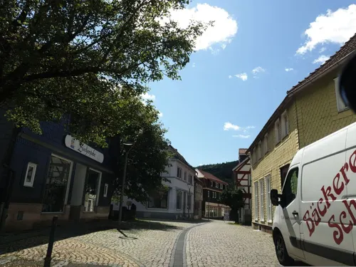
Bäckerei Scheidig
Bakery · 0.7 km
2 Mühlstraße, Zella-Mehlis
Mo-Fr 06:30-17:00; Sa 06:30-11:30; Su 07:00-10:30
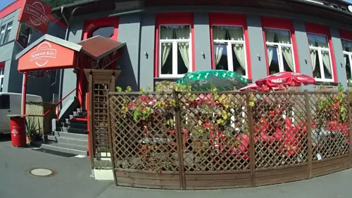
Schnitzel & Co.
Restaurant · German · 1.5 km
44 Meininger Straße, Zella-Mehlis
We-Th 11:00-15:00; Fr-Su 11:00-22:00
Bäckerei Scheidig
Bakery · 0.7 km
128 Hauptstraße, Zella-Mehlis
Mo-Fr 07:00-18:00; Sa 07:00-17:00; Su 11:00-17:00; PH off
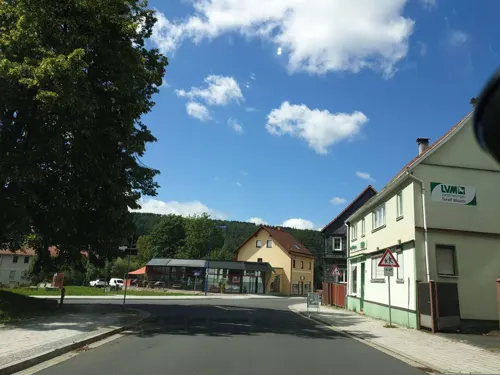
Cafe Scheidig
Cafe · 0.7 km
128 Hauptstraße, Zella-Mehlis
Mo-Fr 07:00-17:00; Sa,Su 11:00-17:00; PH off




36 more on the map.
History
Two of Germany's most notable firearm manufacturers, Walther and Anschütz, were founded in Zella-Mehlis. They operated there until the Soviet occupation of Eastern Germany at the conclusion of World War II caused both companies to move.
In January 2019, the former municipality of Benshausen was integrated into Zella-Mehlis, expanding the town's jurisdiction.
From the History section of Zella-Mehlis on Wikipedia, under CC BY-SA 4.0.
Where to stay7
Churches and places of worship5
Sankt Blasius
Church · Protestant · 0.7 km
130 Hauptstraße, Zella-Mehlis
Shopping19
Gas and EV charging14
Schools, colleges and libraries10
Healthcare5
Map of Zella-Mehlis
210 places. The map loads OpenStreetMap tiles when you open it.
Getting there and nearby towns
Flugplatz Eisenach-Kindel (EIB) is the nearest airport with scheduled flights listed in OpenStreetMap, 39 km away.
- Erfurt 44 km northeast, about 44 min by car
- Rödental 48 km southeast, about 48 min by car
- Neustadt bei Coburg 49 km southeast, about 49 min by car
- Coburg 49 km southeast, about 49 min by car
- Bad Neustadt an der Saale 49 km southwest, about 49 min by car
- Lichtenfels 63 km southeast, about 1 h by car
- Hünfeld 63 km west, about 1 h by car
- Bad Kissingen 65 km southwest, about 1 h by car
- Fulda 71 km west, about 1 h 15 min by car
- Jena 72 km northeast, about 1 h 15 min by car
Drive times are estimates from straight-line distance, not routes.
Local news
Headlines from INDB.
Reviews, tips and questions
Loading what members have shared...
Sources and licences
- GeoNames (CC BY 4.0): population, coordinates, regions and time zone
- Mapillary (see each image): photos
- OpenStreetMap contributors (ODbL 1.0): places, airports, map data
- Wikidata (CC0 1.0): elevation, founding date, time zone, website
- Wikimedia Commons (see each image): photos
- Wikipedia (CC BY-SA 4.0): overview and history text
Photo credits
- Rathaus in Zella-Mehlis - panoramio, qwesy qwesy, CC BY 3.0
- Häuser in Zella-Mehlis - panoramio (2), qwesy qwesy, CC BY 3.0
- Öffentlicher Bücherschrank Lerchenberg Zella-Mehlis, ThüringerChatte, CC BY-SA 4.0
- Forstgasse, 2, Zella-Mehlis, Landkreis Schmalkalden-Meiningen, GeorgDerReisende, CC BY-SA 4.0
- Forstgasse 21a, 1, Zella-Mehlis, Landkreis Schmalkalden-Meiningen, GeorgDerReisende, CC BY-SA 4.0
- Hauptstraße 91, 3, Zella-Mehlis, Landkreis Schmalkalden-Meiningen, GeorgDerReisende, CC BY-SA 4.0
- Hauptstraße 91, 2, Zella-Mehlis, Landkreis Schmalkalden-Meiningen, GeorgDerReisende, CC BY-SA 4.0
- Hauptstraße, 1, Zella-Mehlis, Landkreis Schmalkalden-Meiningen, GeorgDerReisende, CC BY-SA 4.0
- St. Blasii, 3, Zella-Mehlis, Landkreis Schmalkalden-Meiningen, GeorgDerReisende, CC BY-SA 4.0
- Zella-Mehlis, 4, Landkreis Schmalkalden-Meiningen, GeorgDerReisende, CC BY-SA 4.0
- Lubenbach, 8, Zella-Mehlis, Landkreis Schmalkalden-Meiningen, GeorgDerReisende, CC BY-SA 4.0
- Lubenbach, 9, Zella-Mehlis, Landkreis Schmalkalden-Meiningen, GeorgDerReisende, CC BY-SA 4.0
- Hauptstraße 93, 3, Zella-Mehlis, Landkreis Schmalkalden-Meiningen, GeorgDerReisende, CC BY-SA 4.0
- Hauptstraße 91 + 93, 1, Zella-Mehlis, Landkreis Schmalkalden-Meiningen, GeorgDerReisende, CC BY-SA 4.0
- Bücherzelle, 1, Zella-Mehlis, Landkreis Schmalkalden-Meiningen, GeorgDerReisende, CC BY-SA 4.0
- Hauptstraße 95, 3, Zella-Mehlis, Landkreis Schmalkalden-Meiningen, GeorgDerReisende, CC BY-SA 4.0
- St. Blasii, 4, Zella-Mehlis, Landkreis Schmalkalden-Meiningen, GeorgDerReisende, CC BY-SA 4.0
- Forstgasse, 1, Zella-Mehlis, Landkreis Schmalkalden-Meiningen, GeorgDerReisende, CC BY-SA 4.0
- Bushaltestelle Kirchstraße, 1, Zella-Mehlis, Landkreis Schmalkalden-Meiningen, GeorgDerReisende, CC BY-SA 4.0
- Am Rain, 1, Zella-Mehlis, Landkreis Schmalkalden-Meiningen, GeorgDerReisende, CC BY-SA 4.0
- Zella-Mehlis, 1, Landkreis Schmalkalden-Meiningen, GeorgDerReisende, CC BY-SA 4.0
- Zella-Mehlis, 2, Landkreis Schmalkalden-Meiningen, GeorgDerReisende, CC BY-SA 4.0
- Zella-Mehlis, 3, Landkreis Schmalkalden-Meiningen, GeorgDerReisende, CC BY-SA 4.0
- Schanzenanlage im Kanzelsgrund, Oberhof, Christoph Radtke, CC BY 3.0
- Gebrannterstein1, SehLax, CC BY-SA 3.0
- Heinrich-Ehrhardt-Gymnasium Zella-Mehlis, Jener13, CC BY-SA 3.0
- Ruppberg gesamt, SehLax, CC BY-SA 3.0
- Albrechts-Kirche-St-Nicolai, Störfix, CC BY-SA 3.0 de
- Kirche Mehlis 2, Jener13, CC BY-SA 3.0
- 20151010 xl P1000244 Suhl am Rennsteig und Umgebung, Molgreen, CC BY-SA 4.0
- Evangelische Pfarrkirche Zella St. Blasii, 1768-1774, Johann David Weidner - panoramio (1), qwesy qwesy, CC BY 3.0
- Katholische Kirche in Zella-Mehlis, Giorno2, CC BY 4.0
- 20151010 xl P1000226 Suhl am Rennsteig und Umgebung, Molgreen, CC BY-SA 4.0
- Zella-Mehlis-Stolperstein-Beate Goldmann-CTH, CTHOE, CC BY-SA 4.0
- Museum in der Beschußanstalt - panoramio, qwesy qwesy, CC BY 3.0
- Gedenkstein Beckerwiese, lutzto, CC BY-SA 3.0
- 05228-Mehlis-1904-Blick nach Mehlis - Fliegender Mann-Brück & Sohn Kunstverlag, Brück & Sohn Kunstverlag Meißen, CC0
- Zella-Blasiuskirche-3-CTH, CTHOE, CC BY-SA 4.0
- Zella-Blasiuskirche-5-CTH, CTHOE, CC BY-SA 4.0
- Street-level photo, ramap, CC BY-SA 4.0
- Street-level photo, canislupus, CC BY-SA 4.0
- Street-level photo, AR88, CC BY-SA 4.0
- Street-level photo, sixsixfive, CC BY-SA 4.0
- Street-level photo, AR88, CC BY-SA 4.0
- Street-level photo, canislupus, CC BY-SA 4.0
- Street-level photo, AR88, CC BY-SA 4.0
- Street-level photo, AR88, CC BY-SA 4.0
- Street-level photo, sennewald63, CC BY-SA 4.0
- Street-level photo, phitec, CC BY-SA 4.0
- Street-level photo, AR88, CC BY-SA 4.0
- Street-level photo, phitec, CC BY-SA 4.0
- Street-level photo, ramap, CC BY-SA 4.0
- Street-level photo, AR88, CC BY-SA 4.0
- Street-level photo, AR88, CC BY-SA 4.0


Page built November 8, 2026. Spotted a mistake? Tell us or suggest a place.