


Why visit Suhl
Townapedia lists 108 museums and landmarks, 28 parks and trails, 141 places to eat, 32 places to stay and 115 attractions in and around town.
Highlights include Tierpark Suhl, Bismarckturm Suhl, Fahrzeugmuseum Suhl and Jüdischer Friedhof.
Weather in Suhl
Forecast from MET Norway (CC BY 4.0). Full forecast
About Suhl
Suhl (German pronunciation: [zuːl] ) is a city in Thuringia, Germany, located SW of Erfurt, 110 kilometres (68 miles) NE of Würzburg and 130 kilometres (81 miles) N of Nuremberg. With its 37,000 inhabitants, it is the smallest of the six urban districts within Thuringia. Together with its northern neighbour-town Zella-Mehlis, Suhl forms the largest urban area in the Thuringian Forest with a population of 46,000. The region around Suhl is marked by up to 1,000-meter-high mountains, including Thuringia's highest peak, the Großer Beerberg (983 m), approximately 5 kilometres (3 miles) NE of the city centre.
From the Wikipedia article Suhl (this version), under CC BY-SA 4.0.
Travel tips from other travellers: Suhl on Wikivoyage (CC BY-SA 4.0).
Photos of Suhl


Things to do115


Suhler Marionettentheater
Cinema and theater
Tickets Touristinfo Suhl 03681-788405
1 Platz der Deutschen Einheit, Suhl



103 more on the map.
Museums and landmarks108


Rathaus Heinrichs
Monument and historic site · 2.9 km
89 Meininger Straße, Suhl

Besucherbergwerk "Schwarzer Crux"
Monument and historic site · 7.0 km
10:00+; Th off


Gesenkschmiede Zella-Mehlis
Museum · 7.2 km
4 Lubenbachstraße, Zella-Mehlis
Mo,Tu 10:00-17:00; Sa,Su,PH 10:00-16:00

Erlebnispark Meeresaquarium
Monument and historic site · 6.2 km
16 Beethovenstraße, Zella-Mehlis
Mo-Su 10:00-18:00
Stadtmuseum in der Beschußanstalt
Museum · 5.8 km
25 Anspelstraße, Zella-Mehlis
Mo,Tu,Th,Fr 10:00-17:00; Sa,Su 10:00-16:00; PH 10:00-16:00; We off
Herbert Roth-Museum
Museum · 7.0 km
11 Schmiedefelder Straße, Suhl
Mo-Th 09:00-14:00; Fr 09:00-12:00; Sa,Su,PH off
96 more on the map.
Parks, trails and playgrounds28


Freibad Einsiedel
Sports field and stadium · 6.7 km
Schönauer Straße, Zella-Mehlis
May-Sep 10:00-20:00


Spielplatz Neundorf
Playground · 1.1 km
An der Hasel zwischen Nr. 101 und 107
08:00-sunset
Waldbad Goldlauter - Heidersbach
Sports field and stadium · 4.2 km
Mo-Fr 13:00-19:00; Sa,Su,SH 12:00-19:00

16 more on the map.
Restaurants and cafes141

Goldener Hirsch
Restaurant · German · 1.0 km
91 An der Hasel, Suhl
Mo-Th 17:00-22:00, We,Th 11:00-14:00, Fr,Sa 11:00-22:00, Su 11:00-21:00

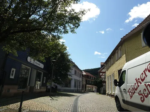
Bäckerei Scheidig
Bakery · 6.5 km
2 Mühlstraße, Zella-Mehlis
Mo-Fr 06:30-17:00; Sa 06:30-11:30; Su 07:00-10:30
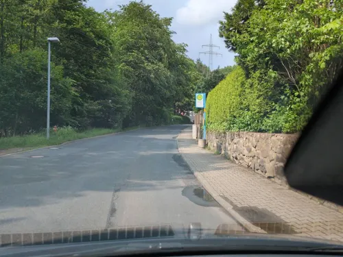
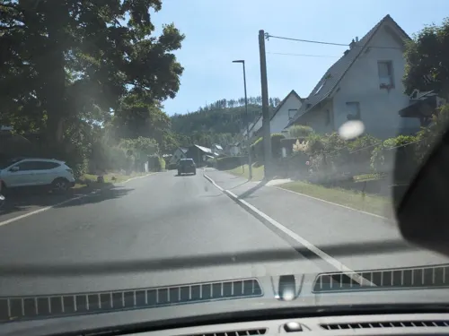
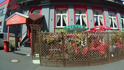
Schnitzel & Co.
Restaurant · German · 6.8 km
44 Meininger Straße, Zella-Mehlis
We-Th 11:00-15:00; Fr-Su 11:00-22:00
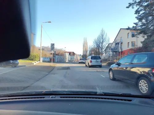

Haselgrund
Restaurant · Regional · 6.7 km
238 Hauptstraße, Suhl
Mo-Fr 11:30-14:30,17:00-21:00; Sa,Su 11:30-21:00
Waldgasthof "Zur Vesser"
Restaurant · Regional, German · 6.9 km
8 Stutenhausstraße, Suhl
We-Sa 11:30-14:00; Su,PH 11:30-14:00,15:00-17:00,17:30-19:00; Mo,Tu off
129 more on the map.
History
Though first appearing in a 1318 deed, several entries in the annals of Fulda Abbey already mentioned a place named Sulaha between 900 and 1155 AD. The coat of arms from 1365 shows two hammers, indicating the city's most important livelihood: metal processing. The region belonged to the territories held by the Franconian counts of Henneberg since the 11th century. Suhl was located on an important trade route from Gotha, Erfurt and Arnstadt passing the Thuringian Forest mountain range at Oberhof and continuing to the Henneberg's residence, Schleusingen.
From 1500 onwards, the Henneberg lands belonged to the Franconian Circle of the Holy Roman Empire. Suhl has been a Flecken (small market town) since 1445 and the full municipal rights were granted in 1527, making Suhl one of the youngest cities in present-day Thuringia. Iron ore mining created the basis for the development of Suhl as a centre of gunsmith trade.
Read more of the history
The Reformation was introduced in 1544. Several witch-hunts took place in the area from 1553 until the late 17th century. When the Henneberg counts became extinct in 1583, Suhl passed to the Wettin electors of Saxony, where it remained until 1815. Unlike most of present Thuringia, it didn't belong to the Ernestine line of the Wettins, but to the Albertine cadet branch of Saxe-Zeitz from 1660, so that it had been a Saxonian and later Prussian exclave within Thuringia for nearly 300 years.
During the 16th century, iron mining and metalworking saw a boom, finished by the Thirty Years' War, when marauding Croat mercenaries under Imperial general Johann Ludwig Hektor von Isolani burnt down the city in 1634. From about 1690, Duke Moritz Wilhelm of Saxe-Zeitz supported the reconstruction of Suhl as a mining town.
The Congress of Vienna in 1815 led to the Saxonian loss of Suhl, which became part of the Prussian Province of Saxony, where it remained from 1815 to 1944 and again shortly in 1945. Staying an exclave within Ernestine territories, Suhl was part of the Schleusingen district until the dissolution of Prussia in 1945.
The later 19th century brought the connection to the railway in 1882 and the industrialisation of the metalworking business. About 1920, Suhl has been a centre of left-wing revolutionary groups, so that the Reichswehr occupied the city (and the neighbour-town Zella-Mehlis) during the Kapp Putsch and ended the workers uprising. After 1935, the military industry saw another boom, caused by the Nazi armament. About 10,000 forced labourers had to work in the city's arms industry after 1940.
The US Army reached Suhl on 3 April 1945 and was replaced by Soviet troops on 1 July 1945. At the same year, Suhl became part of Thuringia, which was replaced by three Bezirks in 1952. Suhl became the capital of the south-western Bezirk Suhl, reaching from Bad Salzungen in the north-west to Sonneberg in the south-east with a population of 550,000. During the GDR period, the upgraded city saw rapid urban growth, which is defining until today.
After the German reunification in 1990, Suhl lost its administrative functions when Thuringia was refounded and replaced the Bezirks. Furthermore, the industry collapsed. Both led to a structural crises, which isn't overcome yet. The population of Suhl declined about 35% since 1988.
The metal processing of Suhl naturally led, during the Renaissance, to other major local industries, including gunsmithing and armoring. Suhl was a major producer of cannons throughout the seventeenth and subsequent centuries, and Suhl cannons were used by many European powers. A major arms company that was located in Suhl for almost 200 years was J.P. Sauer und Sohn GmbH, producer of hunting rifles, shotguns, and pistols, such as the Sauer 38H, until moving operations to Eckernförde at the end of World War II.
Simson (also known as BSW and then Gustloff Werke under Nazi rule and Ernst Thälmann Suhl under Communist rule)
Waffenfabrik August Menz, noted for having produced in the 1920s the Liliput pistol, one of the smallest semiautomatic handguns ever made.
The largest manufacturer producing firearms currently in Suhl is Merkel GmbH, which make both rifles and shotguns.
During the Cold War, the East German national shooting arena was located at Suhl, and hosted many top-level competitions, including the 1986 ISSF World Championships. Although surpassed in this respect in the unified Germany by the Olympic shooting centre at Munich, Suhl remains an important place to the sport. It hosts Germany's only school for armorers, and a well equipped museum of weapons.
From the History section of Suhl on Wikipedia, under CC BY-SA 4.0.
More about Suhl
Geography
Suhl is located on the south-western edge of the Thuringian Forest. To the south-west, the Small Thuringian Forest (some foothills of the Thuringian forest) is situated. The terrain is mountainous to all directions, some important mountains are: the Großer Beerberg (983 m, highest one in Thuringia) in the north-east, the Ringberg (745 m), the Döllberg (760 m), the Friedberg (649 m) and the Adlersberg (859 m) in the east, the Steinsburg (641 m) in the south, the Heiliger Berg (513 m), the Domberg (675 m) and the Berg Bock (709 m) in the north-west as well as the Bocksberg (609 m) and the Hoheloh (526 m) within the city. The centre itself is located in an elevation of 450 m and nearly the complete non-build on part of the municipal territory is forested. There are a few small rivers running through Suhl: The Hasel rises at Friedberg in the south-east and runs westward through Suhl, Heinrichs, Mäbendorf, Dietzhausen and Wichtshausen. The Lauter rises on the southern slope of Großer Beerberg mountain and runs through Goldlauter, Lauter and the city centre, before it joins the Hasel behind the station. The Mühlwasser rises on the western slope of Großer Beerberg and runs southward through the northern city parts before it joins the Lauter at the northern city centre.
Economy
Agriculture plays no role in Suhl, only 17% of the municipal territory are in agricultural use. The soil isn't very fertile and the climate is harsh, the most cultivated strains are maize and rapeseed, furthermore there is cattle farming on some areas. On the other hand, 63% of the territory is forest, so wood production does play a role in Suhl.
Suhl's industry has always been based on metalworking. In the past, the city was a leading arms producer in Germany and the vehicle production was another pillar of the local industry. After the reunification in 1990, the industry collapsed and the most factories got closed. Important companies of today are CDA, a producer of data replication media, Zimbo, a meat producer, Gramss, an industrial bakery, Paragon, a car parts supplier, and Merkel, the last remained arms producer in Suhl. In 2012, there were 27 companies in industrial production with more than 20 workers employing 2,000 persons and generating a turnover of €295 million.
Arts and culture
There are some museums and other cultural institutions in Suhl:
The Waffenmuseum at Friedrich-König-Straße shows an exhibition about the history of arms production in Suhl.
The Fahrzeugmuseum at Kongresszentrum hosts an exhibition of vehicles produced by Simson.
The Galerie im Atrium at Kongresszentrum shows temporary exhibitions of art.
The Schul- und Volkssternwarte Suhl is the city's observatory and planetarium, with the first ZEISS SKYMASTER ZKP 2 projector, which is still in use, at Hoheloh hill, south-west of the city centre.
The Tierpark Suhl is the zoological garden of the city at Carl-Fiedler-Straße on the eastern city border.
The municipal orchestra, founded in 1953 and based in the Kulturhaus at Friedrich-König-Straße was closed in 2009, rebuilt and now in use as city archive.
Education
There is only one Gymnasium school left in Suhl, after others were closed due to the decline of the number of children after 1990.
From the Wikipedia article Suhl, under CC BY-SA 4.0.
Notable people from Suhl
 Wilhelm CunoGerman chancellor (1876-1933)Photo: George Grantham Bain Collection, Public domain
 Sandra HüllerGerman actress (born 1978)Photo: Elena Ternovaja, CC BY-SA 3.0
 Corinna HarfouchGerman actressPhoto: Elena Ternovaja, CC BY-SA 3.0
 Erik LesserGerman biathletePhoto: Sandro Halank, CC BY-SA 3.0
 Johannes LudwigGerman lugerPhoto: Sandro Halank , Wikimedia Commons, CC BY-SA 3.0
 Mario KummerEast German racing cyclist and team managerPhoto: Eric HOUDAS, CC BY-SA 3.0
 Stephan Hockeski jumperPhoto: Bjoertvedt, CC BY-SA 3.0
 Toni EggertGerman lugerPhoto: Sandro Halank, Wikimedia Commons, CC BY-SA 4.0
 Jens FilbrichGerman cross-country skierPhoto: Martin Rulsch , Wikimedia Commons, CC BY-SA 4.0
 Andreas SchlütterGerman cross-country skierPhoto: Sandro Halank, CC BY-SA 3.0
 Sascha BeneckenGerman lugerPhoto: Sandro Halank , Wikimedia Commons, CC BY-SA 4.0
 Frank RommelGerman skeleton racerPhoto: Martin Rulsch , Wikimedia Commons, CC BY-SA 4.0
Born in Suhl, according to Wikidata (CC0). Each name links to its Wikipedia article.
Where to stay32
Churches and places of worship18
Bergkirche Vesser
Church · Protestant · 7.0 km
Breitenbacher Straße, Suhl
Kirche Altendambach
Church · Protestant · 5.7 km
75 Dambachtal, Schleusingen
Sankt Blasius
Church · Protestant · 5.4 km
130 Hauptstraße, Zella-Mehlis
Shopping46
Gas and EV charging23
Schools, colleges and libraries23
Healthcare15
Map of Suhl
250 places. The map loads OpenStreetMap tiles when you open it.
Getting there and nearby towns
Erfurt-Weimar Airport (ERF) is the nearest airport with scheduled flights listed in OpenStreetMap, 45 km away.
- Zella-Mehlis 6 km northwest, about 6 min by car
- Ilmenau 18 km northeast, about 18 min by car
- Meiningen 20 km west, about 20 min by car
- Hildburghausen 21 km south, about 21 min by car
- Schmalkalden 22 km northwest, about 22 min by car
- Arnstadt 31 km northeast, about 31 min by car
- Waltershausen 34 km north, about 34 min by car
- Mellrichstadt 34 km southwest, about 34 min by car
- Gotha 38 km north, about 38 min by car
- Bad Salzungen 39 km northwest, about 39 min by car
Drive times are estimates from straight-line distance, not routes.
Towns near Suhl


Keep exploring
Local news
Headlines from INDB.
Reviews, tips and questions
Loading what members have shared...
Sources and licences
- GeoNames (CC BY 4.0): population, coordinates, regions and time zone
- Mapillary (see each image): photos
- OpenStreetMap contributors (ODbL 1.0): places, airports, map data
- Wikidata (CC0 1.0): elevation, founding date, time zone, website
- Wikimedia Commons (see each image): photos
- Wikipedia (CC BY-SA 4.0): overview and history text
Photo credits
- Rimbachstraße 17 Suhl mit Abes Fahrradcenter Bild 1 2024-03-31, Strubbl, CC BY-SA 4.0
- Rimbachstraße 17 Suhl mit Abes Fahrradcenter Bild 2 2024-03-31, Strubbl, CC BY-SA 4.0
- 20151010 xl P1000271 Suhl am Rennsteig und Umgebung, Molgreen, CC BY-SA 4.0
- Töpferskulptur in der Gebäudepassage Topfmarkt Suhl 2025-10-18, Strubbl, CC BY-SA 4.0
- Lutherbuche Suhl im Herbst Bild 2 2025-10-18, Strubbl, CC BY-SA 4.0
- Gebäudepassage zur Backstraße am Topfmarkt Suhl 2023-12-27, Strubbl, CC BY-SA 4.0
- Suhl-Rimbachstraße 4, Störfix, CC BY-SA 3.0 de
- Untere Kirchgasse Suhl vom Topfmarkt aus mit Buchhandlung 2023-12-27, Strubbl, CC BY-SA 4.0
- Wandskulpturen in der Gebäudepassage Topfmarkt Suhl 2025-10-18, Strubbl, CC BY-SA 4.0
- Untere Kirchgasse in Richtung Rimbachstraße Suhl 2024-12-27, Strubbl, CC BY-SA 4.0
- Suhl St. Marien Orgel (01), Gemeinholzer, CC BY-SA 4.0
- Untere Kirchgasse in Richtung Rimbachstraße Suhl 2025-04-26, Strubbl, CC BY-SA 4.0
- Suhl St. Marien Orgel (02), Gemeinholzer, CC BY-SA 4.0
- Suhl-Kirchgasse 12, Störfix, CC BY-SA 3.0 de
- Pfarrstraße Suhl in Richtung Osten von Höhe Haus Nr. 7 aus 2023-12-26, Strubbl, CC BY-SA 4.0
- Gebäude Pfarrstraße 7 Suhl 2023-12-26, Strubbl, CC BY-SA 4.0
- 20151010 xl P1000214 Suhl am Rennsteig und Umgebung, Molgreen, CC BY-SA 4.0
- Suhl-Steinweg 3, Störfix, CC BY-SA 3.0 de
- 20151010 xl P1000217 Suhl am Rennsteig und Umgebung, Molgreen, CC BY-SA 4.0
- Gebäudepassage zwischen Topfmarkt 1 und 3 Suhl Bild 3 2025-10-18, Strubbl, CC BY-SA 4.0
- Gebäude Steinweg 13 Suhl Bild 2 2025-04-28, Strubbl, CC BY-SA 4.0
- 20151010 xl P1000215 Suhl am Rennsteig und Umgebung, Molgreen, CC BY-SA 4.0
- Gebäudepassage zwischen Topfmarkt 1 und 3 Suhl Bild 2 2025-10-18, Strubbl, CC BY-SA 4.0
- Gebäudepassage zwischen Topfmarkt 1 und 3 Suhl Bild 1 2025-10-18, Strubbl, CC BY-SA 4.0
- 20151010 xl P1000213 Suhl am Rennsteig und Umgebung, Molgreen, CC BY-SA 4.0
- Dianabrunnen Suhl Bild 1 2025-08-09, Strubbl, CC BY-SA 4.0
- Suhl-Marktplatz 12-13, Störfix, CC BY-SA 3.0 de
- Rotes Rathaus Suhl von der Pfarrstraße 2025-10-18, Strubbl, CC BY-SA 4.0
- Einkaufszentrum Am Steinweg Suhl mit dem Dianabrunnen davor 2023-04-07, Strubbl, CC BY-SA 4.0
- Einkaufscentrum Am Steinweg Suhl mit Dianabrunnen 2023-12-27, Strubbl, CC BY-SA 4.0
- Hauptkirche St. Marien Suhl vom Steinweg aus 2023-04-07, Strubbl, CC BY-SA 4.0
- Geschlossene Stände im Steinweg beim Suhler Chrisamel Mart 2024-12-27, Strubbl, CC BY-SA 4.0
- Treppen vom Steinweg zur Hauptkirche St. Marien Suhl 2023-04-07, Strubbl, CC BY-SA 4.0
- Rotes Rathaus vom Steinweg aus während des Suhler Chrisamel Mart 2024-12-27, Strubbl, CC BY-SA 4.0
- Ringberghotel Suhl 3, Derbrauni, CC BY-SA 4.0
- Adlersberg, user:SehLax, CC BY-SA 3.0
- Bundesarchiv Bild 183-D1004-0002-006, Suhl, Dölberg, Neubaugebiet, Wohnblocks cropped, Hans-Joachim Spremberg, CC BY-SA 3.0 de
- Paul-Greifzu-Schule, Suhl 2, Aschroet, CC0
- Heinrich-Ehrhardt-Gymnasium Zella-Mehlis, Jener13, CC BY-SA 3.0
- Suhl-Jüdischer-Friedhof4, Störfix, CC BY-SA 3.0 de
- Kirche Vesser, Benutzer:Hejkal, CC BY-SA 3.0 de
- Marienkirche Suhl Pano-3, Jonathan Haas, CC BY-SA 3.0
- Altendambach-Ev-Kirche, Störfix, CC BY-SA 3.0 de
- Heinrichs-Kirche-St-Ulrich, Störfix, CC BY-SA 3.0 de
- Offenes Eingangstor Tierpark Suhl 2025-02-23, Strubbl, CC BY-SA 4.0
- Stadtbibliothek Suhl durch die Bäume vom nördlichen Parkplatz aus 2024-08-22, Strubbl, CC BY-SA 4.0
- Mäbendorf-Kirche, Störfix, CC BY-SA 3.0 de
- Heidersbach-Kirche, Störfix, CC BY-SA 3.0 de
- Kirchegoldlauter, Jottvau at German Wikipedia, Public domain
- Dietzhausen-Kirche-St-Johannes, Störfix, CC BY-SA 3.0 de
- Albrechts-Kirche-St-Nicolai, Störfix, CC BY-SA 3.0 de
- Eingang ins CCS zum Fahrzeugmuseum Suhl 2025-04-26, Strubbl, CC BY-SA 4.0
- Neundorf-Kirche, Störfix, CC BY-SA 3.0 de
- Heinrichs-Meininger-Straße89, Störfix, CC BY-SA 3.0 de
- 20151010 xl P1000244 Suhl am Rennsteig und Umgebung, Molgreen, CC BY-SA 4.0
- Evangelische Pfarrkirche Zella St. Blasii, 1768-1774, Johann David Weidner - panoramio (1), qwesy qwesy, CC BY 3.0
- Kriegerdenkmal Suhl-Heinrichs, Giorno2, CC BY-SA 4.0
- Lauterbogen-Center Suhl Bild 2 2025-04-26, Strubbl, CC BY-SA 4.0
- Herbstbäume im Stadtpark Suhl Bild 1 2025-10-19, Strubbl, CC BY-SA 4.0
- Suhl-Friedensstraße 1, Störfix, CC BY-SA 3.0 de
- Gebäude An der Hasel 91-93 Suhl mit Restaurant und Hotel Goldener Hirsch 2023-04-09, Strubbl, CC BY-SA 4.0
- Gebäude Senfte 12 Suhl mit Asia Wok 2024-08-10, Strubbl, CC BY-SA 4.0
- City Hotel in der Friedrich-König-Straße 1 Suhl 2024-08-22, Strubbl, CC BY-SA 4.0
- Adler Apotheke im Gebäude Marktplatz 4 Suhl 2024-05-25, Strubbl, CC BY-SA 4.0
- 20151010 xl P1000226 Suhl am Rennsteig und Umgebung, Molgreen, CC BY-SA 4.0
- Suhler Marionettentheater 2024-08-22, Strubbl, CC BY-SA 4.0
- Großer Beerberg vom Salzberg Thüringer Wald-MSCE-2026-4, Martin Schmidt, CC BY-SA 4.0
- Statue Herbert König Suhler Original vor dem Waffenmuseum Suhl Bild 1 2025-04-26, Strubbl, CC BY-SA 4.0
- Horch - Audi - kein Museumsstück^ - gesehen beim Besucherbergwerk "Schwarzer Crux" bei Schmiedefeld - Rennsteig - Thüringer Wald - panoramio, Besenbinder, CC BY-SA 3.0
- Street-level photo, sixsixfive, CC BY-SA 4.0
- Street-level photo, sixsixfive, CC BY-SA 4.0
- Street-level photo, sixsixfive, CC BY-SA 4.0
- Street-level photo, sixsixfive, CC BY-SA 4.0
- Street-level photo, sixsixfive, CC BY-SA 4.0
- Street-level photo, ramap, CC BY-SA 4.0
- Street-level photo, sixsixfive, CC BY-SA 4.0
- Street-level photo, ramap, CC BY-SA 4.0
- Street-level photo, canislupus, CC BY-SA 4.0
- Street-level photo, AR88, CC BY-SA 4.0
- Street-level photo, phitec, CC BY-SA 4.0
- Street-level photo, sixsixfive, CC BY-SA 4.0
- Street-level photo, sixsixfive, CC BY-SA 4.0
- Street-level photo, sixsixfive, CC BY-SA 4.0
- Street-level photo, sixsixfive, CC BY-SA 4.0
- Street-level photo, sixsixfive, CC BY-SA 4.0
- Street-level photo, AR88, CC BY-SA 4.0
- Street-level photo, sixsixfive, CC BY-SA 4.0
- Street-level photo, sixsixfive, CC BY-SA 4.0
- Street-level photo, canislupus, CC BY-SA 4.0
- Street-level photo, sixsixfive, CC BY-SA 4.0
- Street-level photo, AR88, CC BY-SA 4.0


Page built November 9, 2026. Spotted a mistake? Tell us or suggest a place.