


Schwerte, Germany
Schwerte is a town of 50,399 people in North Rhine-Westphalia, Germany.
Why visit Schwerte
Townapedia lists 118 museums and landmarks, 40 parks and trails, 203 places to eat, 18 places to stay and 14 attractions in and around town.
Highlights include Florianturm, Neuer Kaiserberg, Ruhrtalmuseum and Magnetmuseum.
Weather in Schwerte
Forecast from MET Norway (CC BY 4.0). Full forecast
About Schwerte
Schwerte (German pronunciation: [ʃveːɐ̯tə] ; Westphalian: Schweierte) is a town in the district of Unna, in North Rhine-Westphalia, Germany.
From the Wikipedia article Schwerte (this version), under CC BY-SA 4.0.
Photos of Schwerte


Things to do14

Florianturm
Monument and historic site · 8.6 km
Telecommunications tower and landmark of Dortmund(Germany)



Hansa Theater Hörde
Cinema and theater · 6.6 km
Theater in Dortmund, North Rhine-Westphalia, Germany
Hofladen Böckelühr
Farm and orchard · 6.1 km
1 Gut Böckelühr, Schwerte
Tu,We,Fr 14:00-18:00; Sa 14:00-18:00; Su 11:00-18:00; "Feiertags...

2 more on the map.
Museums and landmarks118

Ruhrtalmuseum
Museum
Mittelalterlicher Rathausbau mit Markthalle, Grundstein von 1547, seit den 1930er Jahren als Stadt- und Heimatmuseum genutzt
14 Brückstraße, Schwerte
Tu-Su 11:00-17:00
Automobil Museum Dortmund
Museum · 6.0 km
50 Brandisstraße, Dortmund
We-Mo 12:00-18:00; "In Verbindung mit einem Essen im Restaurant...


Rohrmeisterei
Monument and historic site · Regional · 0.7 km
20 Ruhrstraße, Schwerte

Haus Steinhausen
Monument and historic site · 2.6 km
1999 abgebrannt
1 Steinhauser Weg, Dortmund


Gut Niederhofen
Monument and historic site · 4.9 km
Ehemalige Wasserburg

Haus Husen
Monument and historic site · 5.2 km
120 Syburger Dorfstraße, Dortmund

Haus Rutenborn
Monument and historic site · 2.9 km
39 Dorfstraße, Schwerte

106 more on the map.
Parks, trails and playgrounds40



28 more on the map.
Restaurants and cafes203
Delhi to Roma Pizzaservice
Restaurant · Pizza, Indian · 6.0 km
1 Wellinghofer Amtsstraße, Dortmund
Tu 11:00-14:30,16:45-21:45; We-Fr 11:00-14:45, We 17:00-21:45, Th...
Eislädchen & Manufaktur
Ice cream · Ice Cream · 4.3 km
291 Schwerter Straße, Dortmund
"Sommer täglich von 11:00-21:00 Uhr Bei Sonne bis diese untergeht...
El Greco Grill
Restaurant · Greek · 5.5 km
300 Schüruferstraße, Dortmund
Tu-Sa 11:30-22:00; Su,PH 12:00-22:00
Mythos Grillhaus
Restaurant · Grill · 5.4 km
156 Benninghofer Straße, Dortmund
Mo,We-Su 12:00-21:30; Tu off
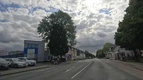
Pizzeria Paradiso
Restaurant · Italian, Pizza · 0.9 km
59a Hagener Straße
Mo-Tu, Th 11:00-22:00; Fr-Sa 11:00-23:00; Su 14:00-22:00
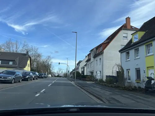
Pizzeria bei Marco
Restaurant · Italian, Pizza · 5.6 km
233 Schüruferstraße, Dortmund
Mo-Th 04:00-11:00, Fr 04:00-24:00, Sa 12:00-24:00, Su 12:00-11:00


Hotel Restaurant Menzebach
Restaurant · Greek
23 Ostenstraße, Schwerte
Tu-Th 17:00-23:30; Fr-Su 12:00-14:30,17:00-23:30
Masurenhof
Restaurant · Polish, German · 5.7 km
11 Hosbachstraße, Dortmund
Tu-Fr 15:00-22:00; Sa-Su 12:00-22:00
191 more on the map.
History
The railway facility in the eastern district of Schwerte became a branch of the Buchenwald concentration camp in April 1944. The camp had 445 prisoners in August and 670 in November 1944. The number of escapees was comparatively high; in November 1944 48 prisoners escaped. The camp in Schwerte was disbanded in December 1944 and the remaining prisoners were brought back to Buchenwald.
From the History section of Schwerte on Wikipedia, under CC BY-SA 4.0.
More about Schwerte
Geography
Schwerte is situated in the Ruhr valley, at the south-east border of the Ruhr Area. South of Schwerte begins the mountainous Sauerland region.
After the local government reforms of 1975 Schwerte consists of the following districts:
From the Wikipedia article Schwerte, under CC BY-SA 4.0.
Notable people from Schwerte
 Julian KochGerman footballerPhoto: Fuguito, CC BY-SA 3.0
 Lasse SobiechGerman football playerPhoto: Sandro Halank , Wikimedia Commons, CC BY-SA 3.0
 Johannes GoeddaeusGerman judgePhoto: Johannes Goeddaeus, Public domain
 Anke Kaysser-PyzallaGerman mechanical engineer (born 1966)Photo: Raimond Spekking, CC BY-SA 4.0
 Thomas Losse-MüllerGerman politicianPhoto: Frederik Digulla, CC BY-SA 4.0
 Frank Philipp AlbertGerman realtorPhoto: Michael Weinwurm, CC BY-SA 4.0
 Robert Allan JacobsAmerican architect and designerPhoto: Jim.henderson, Public domain
- Wolfgang KleffGerman footballer
- Rosemarie TrockelGerman artist (born 1952)
- Erwin RösenerGerman politician and SS General (1902-1946)
- Reinhard FabischGerman football manager (1950–2008)
- Dietmar KösterGerman politician
Born in Schwerte, according to Wikidata (CC0). Each name links to its Wikipedia article.
Where to stay18
Hotel-Restaurant Kroatia
Motel and hotel · Regional, International · 5.9 km
48 Marsbruchstraße, Dortmund
Churches and places of worship48
Shopping53
Gas and EV charging22
Schools, colleges and libraries38
Healthcare25
Map of Schwerte
250 places. The map loads OpenStreetMap tiles when you open it.
Getting there and nearby towns
Dortmund Airport (DTM) is the nearest airport with scheduled flights listed in OpenStreetMap, 9 km away.
- Holzen 3 km west, about 3 min by car
- Sölderholz 5 km northeast, about 5 min by car
- Wichlinghofen 5 km west, about 5 min by car
- Wellinghofen 6 km northwest, about 6 min by car
- Sölde 6 km north, about 6 min by car
- Syburg 6 km west, about 6 min by car
- Rombergpark-Lücklemberg 7 km west, about 7 min by car
- Holzwickede 8 km northeast, about 8 min by car
- Brackel 9 km north, about 9 min by car
- Dortmund 11 km northwest, about 11 min by car
Drive times are estimates from straight-line distance, not routes.
Towns near Schwerte


Keep exploring
Local news
Headlines from INDB.
Reviews, tips and questions
Loading what members have shared...
Sources and licences
- GeoNames (CC BY 4.0): population, coordinates, regions and time zone
- Mapillary (see each image): photos
- OpenStreetMap contributors (ODbL 1.0): places, airports, map data
- Wikidata (CC0 1.0): elevation, founding date, time zone, website, landmarks and historic places
- Wikimedia Commons (see each image): photos
- Wikipedia (CC BY-SA 4.0): overview and history text
Photo credits
- Rathaus Schwerte, Helfmann, CC BY-SA 3.0
- Schwerte-Rathausstr11-2-Asio, Asio otus, CC BY-SA 3.0
- Schwerte-Rathausstr11-1-Asio, Asio otus, CC BY-SA 3.0
- Schwerte-Kleppingstr7-2-Asio, Asio otus, CC BY-SA 3.0
- Schwerte-Kleppingstr7-1-Asio, Asio otus, CC BY-SA 3.0
- Schwerte-KarlGerhartsStr31-33-1-Asio, Asio otus, CC BY-SA 3.0
- Schwerte-Kleppingstr7-3-Asio, Asio otus, CC BY-SA 3.0
- Schwerte-BücherschrankPostplatz-1-Asio, Asio otus, CC BY-SA 3.0
- Schwerte-RobertKochStr15-1-Asio, Asio otus, CC BY-SA 3.0
- Schwerte-Hüsingstr1-2-Asio, Asio otus, CC BY-SA 3.0
- Schwerte-00028, Mbdortmund, Public domain
- Schwerte-Hüsingstr1-1-Asio, Asio otus, CC BY-SA 3.0
- Schwerte-Eintrachtstr1b-1-Asio, Asio otus, CC BY-SA 3.0
- Schwerte-Eintrachtstr1a-Asio, Asio otus, CC BY-SA 3.0
- Schwerte Brückstraße 4 20210921, Uwe Barghaan, CC BY-SA 3.0
- Schwerte-GrabmaleStadtpark-5-Asio, Asio otus, CC BY-SA 3.0
- Schwerte-GrabmaleStadtpark-1-Asio, Asio otus, CC BY-SA 3.0
- Schwerte Kampstraße Sperre Motorrad, Gmbo 2013, CC0
- Schwerte Große Marktstraße 11 20210921, Uwe Barghaan, CC BY-SA 3.0
- Schwerte Große Marktstraße 10 20210921, Uwe Barghaan, CC BY-SA 3.0
- Schwerte-100812-16470-Haus-cor, Mbdortmund, GFDL 1.2
- Schwerte-100812-16438-Calvin-Haus, Mbdortmund, GFDL 1.2
- Schwerte-100812-16466-Calvin-Haus, Mbdortmund, GFDL 1.2
- Schwerte-100812-16510-Altes-Rathaus, Mbdortmund, GFDL 1.2
- Schwerte-100812-16540-Altes-Rathaus, Mbdortmund, GFDL 1.2
- Schwerte-100812-16541-Altes-Rathaus, Mbdortmund, GFDL 1.2
- Schwerte-100812-16487-Ruhrlandmuseum-cor, Mbdortmund, GFDL 1.2
- Schwerte-100812-16465-Altes-Rathaus, Mbdortmund, GFDL 1.2
- Schwerte-SkulpturHelleKammer-2-Asio, Asio otus, CC BY-SA 3.0
- Schwerte-KarlGerhartsStr4-1-Asio, Asio otus, CC BY-SA 3.0
- Schwerte-100812-16496-St-Viktor-cor, Mbdortmund, GFDL 1.2
- Schwerte-100812-16471-St-Viktor, Mbdortmund, GFDL 1.2
- Schwerte-100812-16427-St-Viktor-cor, Mbdortmund, GFDL 1.2
- Schwerte-100812-16418-sT-vIKTOR-cor, Mbdortmund, GFDL 1.2
- Schwerte-100812-16500-Klinke, Mbdortmund, GFDL 1.2
- Schwerte-100812-16456-St-Viktor, Mbdortmund, GFDL 1.2
- Schwerte-KarlGerhartsStr4-2-Asio, Asio otus, CC BY-SA 3.0
- Schwerte-KarlGerhartsStr4-3-Asio, Asio otus, CC BY-SA 3.0
- Schwerte Kötterbachstraße 12 20210921, Uwe Barghaan, CC BY-SA 3.0
- NRW, Dortmund - Fernsehturm Florian 07, Островский Александр, Киев, CC BY-SA 3.0
- Do-Bittermark 2684a, Mbdortmund, GFDL 1.2
- Fernuni Hagen 3, Bärwinkel,Klaus, CC BY-SA 4.0
- Schwerte-00030, Mbdortmund, Public domain
- Aplerbeck Kirche St Georg, Itti, CC BY-SA 3.0
- Emscherquellhof 2006, Jens Seiler at de.wikipedia, CC BY-SA 2.0 de
- GadSA, Christian Lindecke, CC BY-SA 3.0
- Haus Niederhofen, Tbachner, CC BY-SA 3.0
- HausSteinhausenHolzen, Helfmann at German Wikipedia, CC BY-SA 3.0
- Haus Villigst, Stefan Didam - Schmallenberg, CC BY-SA 3.0
- Hennen-Johanneskirche4-Bubo, Bubo, CC BY-SA 3.0
- Steinbruch Schüren, Itti, CC BY-SA 3.0
- Dortmund - PO-Phoenix-See + Hörde (Kaiserberg) 02 ies, Frank Vincentz, CC BY-SA 3.0
- Rohrmeisterei IMGP0693 wp, smial, CC BY-SA 2.0 de
- Schwerte - Sankt-Victor-Kirche, Unknown author, Public domain
- St Ewaldi Kirche, Itti, CC BY-SA 3.0
- Marienkrankenhaus Schwerte, Kogge, CC BY-SA 3.0
- Stiftsschule Hörde 04, Joehawkins, CC BY-SA 4.0
- Naturschutzgebiet Niederhofer Holz, Smarties, CC0
- Haus Husen, Dortmund, Wohnturm, Detail, Torben Henke, CC BY-SA 2.5
- Haus Husen, Dortmund, Gutshaus, Torben Henke, CC BY-SA 2.5
- Hagen NSG-Alter Ruhrgraben, Bärwinkel,Klaus, CC BY 3.0
- Ebberg1 Mai 2017, VolkerF, CC BY-SA 4.0
- NSG DO-031, Aplerbecker Wald, 6, Aplerbeck, Dortmund, GeorgDerReisende, CC BY-SA 4.0
- Hengser Stausee in Holzwickede. Naturschutzgebiet Bahnwald, Sonnenschein 2511, CC BY-SA 4.0
- Eingang Elsebachtal aus Richtung Schwerte-Ergste, Xiomara88, CC BY-SA 3.0
- NSG In der Lake Schwerte Ruhr, Erich Ferdinand, CC BY 2.0
- 2020-06-17 Bachlauf, Wikimax500, CC BY-SA 4.0
- IMG 8114 Kopie-Alte-Kirche-Wellinghofen, Mathias Bigge, CC BY-SA 3.0
- Kreuzkirche Dortmund-Berghofen, Jan Cirullies, CC BY-SA 3.0
- St Peter Syburg Front, Unknown author, CC BY-SA 2.0 de
- IMG 7782-Kirche-Wellinghofen Kopie, Mathias Bigge, CC BY-SA 3.0
- Spezialkarte des östlichen Distrikts Hörde 16 Blatt XVI - Oberberg, Geisecke, Schlosshaus Haus Rutenborn 1790, Johann Friedrich Conrad Niemeyer (1759–1814), Public domain
- Street-level photo, VIA_KK, CC BY-SA 4.0
- Street-level photo, uwekoch, CC BY-SA 4.0
- Street-level photo, uwekoch, CC BY-SA 4.0
- Street-level photo, uwekoch, CC BY-SA 4.0
- Street-level photo, uwekoch, CC BY-SA 4.0
- Street-level photo, uwekoch, CC BY-SA 4.0
- Street-level photo, uwekoch, CC BY-SA 4.0
- Street-level photo, uwekoch, CC BY-SA 4.0
- Street-level photo, uwekoch, CC BY-SA 4.0
- Street-level photo, uwekoch, CC BY-SA 4.0
- Street-level photo, uwekoch, CC BY-SA 4.0
- Street-level photo, uwekoch, CC BY-SA 4.0
- Street-level photo, ptks, CC BY-SA 4.0
- Street-level photo, saschahaberkorn, CC BY-SA 4.0
- Street-level photo, teddy73, CC BY-SA 4.0
- Street-level photo, uwekoch, CC BY-SA 4.0
- Street-level photo, uwekoch, CC BY-SA 4.0
- Street-level photo, uwekoch, CC BY-SA 4.0
- Street-level photo, teddy73, CC BY-SA 4.0
- Street-level photo, uwekoch, CC BY-SA 4.0
- Street-level photo, uwekoch, CC BY-SA 4.0
- Street-level photo, cuspis, CC BY-SA 4.0
- Street-level photo, uwekoch, CC BY-SA 4.0
- Street-level photo, VIA_KK, CC BY-SA 4.0


Page built November 9, 2026. Spotted a mistake? Tell us or suggest a place.