


Why visit Syburg
Townapedia lists 22 museums and landmarks, 17 parks and trails, 43 places to eat, 6 places to stay and 10 attractions in and around town.
Highlights include Naturbühne Hohensyburg, Klusenberg, Burgruine Hohensyburg and Koepchenwerk.
Weather in Syburg
Forecast from MET Norway (CC BY 4.0). Full forecast
About Syburg
Syburg is a borough of the city of Dortmund in the Ruhr district of North Rhine-Westphalia, Germany. Since 1929, it has been a borough of Dortmund, located in the city's south. It is part of the Hörde district (Stadtbezirk).
From the Wikipedia article Syburg (this version), under CC BY-SA 4.0.
Things to do10




Museums and landmarks22


Koepchenwerk
Monument and historic site · 2.9 km
Koepchenwerk Pumpspeicherkraftwerk am Hengsteysee bei Herdecke
43 Im Schiffwinkel, Herdecke


Besucherbergwerk Graf Wittekind
Museum · 0.8 km
Das Besucherbergwerk "Graf Wittekind" wird vom "Förderverein Bergbauhistorischer Stätten Ruhrrevier e.V." ehrenamtlich betrieben....
"Nur nach Anmeldung"

Haus Husen
Monument and historic site · 1.2 km
120 Syburger Dorfstraße, Dortmund


Sigiburg
Monument and historic site · 0.6 km
Castle ruin in Dortmund, North Rhine-Westphalia, Germany


Kriegerdenkmal in Syburg, Gefallene 1914-1918
Monument and historic site · 0.6 km
Gefallendenkmal WW1+2, 1870

Zeche Schleifmühle
Monument and historic site · 0.9 km
Stollen der Zeche Schleifmühle. Gehört zum Besucherbergwerk Graf Wittekind. Infos und Anmeldung unter www.besucherbergwerk-dortmund.de
10 more on the map.
Parks, trails and playgrounds17



5 more on the map.
Restaurants and cafes43
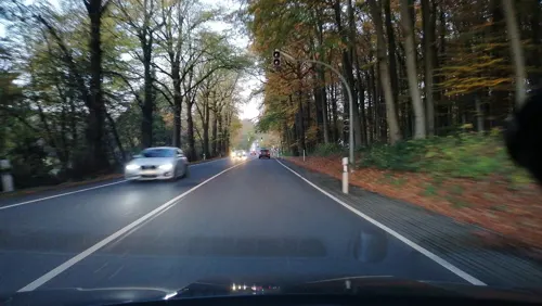
Blue Elephant
Restaurant · Asian, Thai · 1.7 km
65 Wittbräucker Straße, Herdecke
Mo, We-Sa 11:30-15:00, 17:00-23:00; Su 11:30-23:00

Wirtshaus Krämer
Restaurant · Regional, German · 2.3 km
251 Wannestraße, Dortmund
Tu-Sa 17:00-22:00; Su 09:30-22:00
Müller's Backes
Bakery · 1.5 km
2 Am Klusenberg, Dortmund
Tu-Fr 07:00-18:00; Sa 07:00-14:00; Su,Mo,PH off
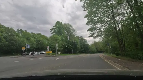
Road Stop
Restaurant
169 Hohensyburgstraße, Dortmund
Mo-Th 12:00-22:00; Fr-Sa 12:00-23:00; Su 12:00-20:30

Brotmanufaktur
Bakery · 2.8 km
100 Markhege, Dortmund
Mo-Fr 06:00-18:00, Sa 07:00-13:00, Su 07:00-16:00


31 more on the map.
History
Syburg was an independent settlement, part of the Amt Westhofen. In 1929, it became a borough of Dortmund, as part of the Wellinghofen district. From 1 January 1975 it was part of the Hörde district.
Syburg has been an excursion destination of Dortmund's citizens. It was connected to Hörde since the beginning of the 20th century by the Hörder Kreisbahn tram.
The Hohensyburg is above the Hengsteysee, a dam of the Ruhr. Syburg features a golf course, the Wannebach valley, several restaurants and Dortmund's only campground.
From the History section of Syburg on Wikipedia, under CC BY-SA 4.0.
Where to stay6
Churches and places of worship6
Shopping5
Gas and EV charging5
Schools, colleges and libraries4
Healthcare1
Map of Syburg
119 places. The map loads OpenStreetMap tiles when you open it.
Getting there and nearby towns
Dortmund Airport (DTM) is the nearest airport with scheduled flights listed in OpenStreetMap, 13 km away.
- Wichlinghofen 3 km north, about 3 min by car
- Herdecke 5 km southwest, about 5 min by car
- Wellinghofen 5 km north, about 5 min by car
- Schwerte 6 km east, about 6 min by car
- Hagen 7 km south, about 7 min by car
- Wetter 8 km southwest, about 8 min by car
- Dortmund 10 km north, about 10 min by car
- Witten 10 km west, about 10 min by car
- Dorstfeld 10 km northwest, about 10 min by car
- Brackel 12 km north, about 12 min by car
Drive times are estimates from straight-line distance, not routes.
Local news
Headlines from INDB.
Reviews, tips and questions
Loading what members have shared...
Sources and licences
- GeoNames (CC BY 4.0): population, coordinates, regions and time zone
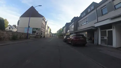
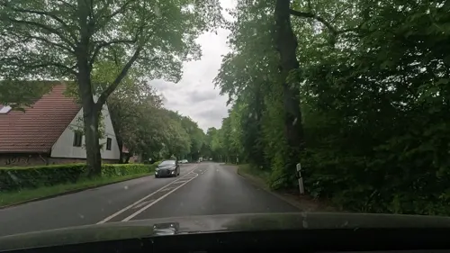
- Mapillary (see each image): photos
- OpenStreetMap contributors (ODbL 1.0): places, airports, map data
- Wikidata (CC0 1.0): elevation, founding date, time zone, website, landmarks and historic places
- Wikimedia Commons (see each image): photos
- Wikipedia (CC BY-SA 4.0): overview and history text
Photo credits
- Panorama Hohensyburg 2012-03-11-6155-6158, Slick, CC0
- Syburger Dorfstraße 7 (Dortmund) (2), DiAuras, CC BY-SA 4.0
- Syburger Dorfstraße 7 (Dortmund) (1), DiAuras, CC BY-SA 4.0
- Syburger Dorfstraße 7 (Dortmund) (3), DiAuras, CC BY-SA 4.0
- Syburger Dorfstraße 7 (Dortmund) (5), DiAuras, CC BY-SA 4.0
- Syburg Syburger Dorfstr7 Kloesterle SE 310 IMG 20230114 1552, Karlunun, CC0
- Syburger Dorfstraße 7 (Dortmund), DiAuras, CC BY-SA 4.0
- Syburger Kirchstraße 2 (Dortmund) (2), DiAuras, CC BY-SA 4.0
- Syburger Dorfstraße 7 (Dortmund) (4), DiAuras, CC BY-SA 4.0
- Syburger Kirchstraße 2 (Dortmund) (3), DiAuras, CC BY-SA 4.0
- Kirchhof St. Peter zu Syburg (5), DiAuras, CC BY-SA 4.0
- Dortmund-Syburg, Blick zum Asenberg und zum Ebberg, Tbachner, CC BY-SA 3.0
- St. Peter, Syburg (Dortmund) (5), DiAuras, CC BY-SA 4.0
- Syburg Kirchhof St Peter 15Jh 9946 20200413, Karlunun, CC BY-SA 4.0
- Syburger Kirchstraße 10, 12 (Dortmund), DiAuras, CC BY-SA 4.0
- Kirchhof St. Peter zu Syburg (6), DiAuras, CC BY-SA 4.0
- Syburger Kirchstraße 10, 12 (Dortmund) (1), DiAuras, CC BY-SA 4.0
- Syburger Kirchstraße 10, 12 (Dortmund) (2), DiAuras, CC BY-SA 4.0
- St. Peter, Syburg (Dortmund) (4), DiAuras, CC BY-SA 4.0
- Kirchhof St. Peter zu Syburg (3), DiAuras, CC BY-SA 4.0
- Syburg St Peter Turm S Fenster 9949 20200413, Karlunun, CC BY-SA 4.0
- St. Peter, Syburg (Dortmund) (1), DiAuras, CC BY-SA 4.0
- Kirchhof St. Peter zu Syburg (11), DiAuras, CC BY-SA 4.0
- Kirchhof St. Peter zu Syburg (17), DiAuras, CC BY-SA 4.0
- Hohensyburg- St. Peter - geo.hlipp.de - 27992, Ulrich Meier on geo.hlipp.de, CC BY-SA 2.0
- Kirchhof St. Peter zu Syburg (8), DiAuras, CC BY-SA 4.0
- St. Peter, Syburg (Dortmund) (8), DiAuras, CC BY-SA 4.0
- Kirchhof St. Peter zu Syburg (10), DiAuras, CC BY-SA 4.0
- Graveyard at Syburg - panoramio, SV Zanshin, CC BY-SA 3.0
- Kirchhof St. Peter zu Syburg (9), DiAuras, CC BY-SA 4.0
- Kirchhof St. Peter zu Syburg (7), DiAuras, CC BY-SA 4.0
- St. Peter, Syburg (Dortmund) (3), DiAuras, CC BY-SA 4.0
- Syburg StPeter SW 50 IMG 20230114 1549, Karlunun, CC0
- PS786Sankt Peter Syburg, Rainer Halama, CC BY 2.5
- Do-Bittermark 2684a, Mbdortmund, GFDL 1.2
- Fernuni Hagen 3, Bärwinkel,Klaus, CC BY-SA 4.0
- Hohensyburg Syburg, Arnold Paul, CC BY-SA 2.5
- St Peter Syburg Seite, Ralf Hüls, CC BY-SA 2.0 de
- Hengsteysee PodrPro a005, User PodrPro, CC BY-SA 3.0
- Koepchenwerk am Hengsteysee, Tbachner, CC BY 3.0
- Syberg & Hengstey lake at the Ruhr, Arnoldius, CC BY-SA 3.0
- Syberg 2012-03-11-6085, Slick, CC0
- Hengsteysee von Hohensyburg 2008 PS741, Rainer Halama, CC BY 2.5
- Hagen NSG Lenneaue Kabel, Bärwinkel,Klaus, CC BY 3.0
- Vincketurm an der Hohensyburg in Dortmund-Syburg 2014, Riessdo, CC BY 2.0
- Naturschutzgebiet Kleinholthauser Mark, Smarties, CC0
- Hagen-Kabel, St. Antonius-Kirche, Bärwinkel,Klaus, CC BY 3.0
- Naturschutzgebiet Fürstenbergholz (12), DiAuras, CC BY-SA 4.0
- Hagen D 26.07.2011 18-16-43, Rudko, CC0
- Syberg 2012-03-11-6122, Slick, CC0
- Haus Husen, Dortmund, Wohnturm, Detail, Torben Henke, CC BY-SA 2.5
- Haus Husen, Dortmund, Gutshaus, Torben Henke, CC BY-SA 2.5
- Syberg 2012-03-11-6076, Slick, CC0
- Petersbrunnen, User:Itti, CC BY-SA 3.0
- Syberg 2012-03-11-6154, Slick, CC0
- Ebberg1 Mai 2017, VolkerF, CC BY-SA 4.0
- Hagen NSG-Alter Ruhrgraben, Bärwinkel,Klaus, CC BY 3.0
- Bittermark 004, Tbachner, CC BY-SA 3.0
- Blick auf die Ruhr (Hengsteysee) von den Ruhrsteilhängen, Brd.de, CC BY-SA 3.0
- Wannebachtal c, Brd.de, CC BY-SA 4.0
- St Peter Syburg Front, Unknown author, CC BY-SA 2.0 de
- Kath Patroklikirche Do, Feathil, CC BY-SA 3.0
- Eingang Zoo Dortmund - panoramio, André Schneider, CC BY-SA 3.0
- Street-level photo, klaus100000, CC BY-SA 4.0
- Street-level photo, d3d9, CC BY-SA 4.0
- Street-level photo, uwekoch, CC BY-SA 4.0
- Street-level photo, uwekoch, CC BY-SA 4.0
- Street-level photo, thoschi, CC BY-SA 4.0
- Street-level photo, thoschi, CC BY-SA 4.0
- Street-level photo, teddy73, CC BY-SA 4.0
- Street-level photo, teddy73, CC BY-SA 4.0
- Street-level photo, heetENkoel, CC BY-SA 4.0
- Street-level photo, uwekoch, CC BY-SA 4.0
- Street-level photo, baldur80, CC BY-SA 4.0
- Street-level photo, teddy73, CC BY-SA 4.0
- Street-level photo, teddy73, CC BY-SA 4.0
- Street-level photo, d3d9, CC BY-SA 4.0
- Street-level photo, d3d9, CC BY-SA 4.0
- Street-level photo, teddy73, CC BY-SA 4.0
- Street-level photo, teddy73, CC BY-SA 4.0
- Street-level photo, uwekoch, CC BY-SA 4.0
- Street-level photo, saschahaberkorn, CC BY-SA 4.0
- Street-level photo, teddy73, CC BY-SA 4.0
- Street-level photo, teddy73, CC BY-SA 4.0


Page built November 9, 2026. Spotted a mistake? Tell us or suggest a place.