


Why visit Seesen
Townapedia lists 57 museums and landmarks, 22 parks and trails, 60 places to eat, 18 places to stay and 132 attractions in and around town.
Highlights include Bad Grund, Iberg Dripstone Cave, Bergbaumuseum Historische Silbergrube Lautenthals Glück and Städtisches Museum Seesen.
Weather in Seesen
Forecast from MET Norway (CC BY 4.0). Full forecast
About Seesen
Seesen (German pronunciation: [ˈzeːzn̩] ) is a town and municipality in the district of Goslar, in Lower Saxony, Germany. It is situated on the northwestern edge of the Harz mountain range, approx. 20 km (12 mi) west of Goslar.
From the Wikipedia article Seesen (this version), under CC BY-SA 4.0.
Things to do132

Bad Grund
Monument and historic site · 10.0 km
Municipality of Germany

Iberg Dripstone Cave
Monument and historic site · 9.6 km
Public cave and geology museum in Lower Saxony, northwestern Germany


120 more on the map.
Museums and landmarks57
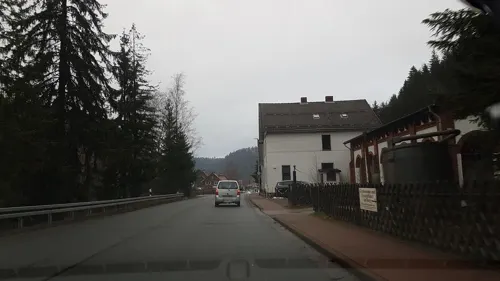
Bergbaumuseum Historische Silbergrube Lautenthals Glück
Museum · 7.8 km
17 Wildemanner Straße, Langelsheim
Mo-Su 10:00-17:00


Battle at the Harzhorn
Monument and historic site · 8.2 km
235 battle between Roman and Germanic troops (c.235)


Wilhelm-Busch-Haus
Museum · 5.6 km
7 Pastor-Nöldeke-Weg, Seesen
Mar 01-Oct 31: Th-Su 15:00-17:00; Nov 01-Feb 28: Sa,Su 14:00-16:00


ehem. herzogl. Jagdschloß Seesen
Monument and historic site
4 Wilhelmsplatz, Seesen

Ehemaliger Haltepunkt Lindthal
Monument and historic site · 6.8 km
Vor dem Bau der Innerstetalsperre verlief die Bahnstrecke Langelsheim-Altenau auf dem Gebiet des heutigen Sees. Bei Niedrigwasser...

Kochscher Hof
Monument and historic site
Der Kochsche Hof wurde 1671 von Oberst Johann von Koch erbaut.
34 Jacobsonstraße, Seesen

45 more on the map.
Parks, trails and playgrounds22

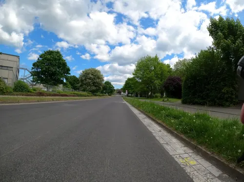
Sehusa Wasserwelt
Sports field and stadium · 1.4 km
3 Engelader Straße, Seesen
Tu,Fr 10:00-21:00; Sa,Su,PH 10:00-20:00; Mo,We,Th 12:00-21:00


Seglervereinigung Innerste Delligsen
Marina and boat launch · 7.3 km


10 more on the map.
Restaurants and cafes60


Akropolis Restaurant am See
Restaurant · Greek · 7.5 km
2 Innerstetalsperre, Langelsheim
Mo, We-Fr 11:30-20:00; Sa-Su 11:30-20:30

Bauernhof-Eis & Ferienwohnungen, Ebeling
Cafe · Ice Cream · 8.2 km
40 Wolperode, Bad Gandersheim
May 01-Sep 15: Mo-Sa 14:00-21:00, May 01-Sep 15: Su 11:00-21:00;...
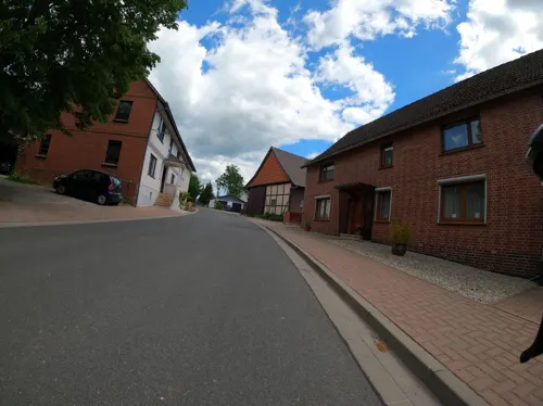
Gasthof zum Bergstübchen
Restaurant · Regional · 5.3 km
1 Am Bäckerberg, Seesen
Mo-Su 16:00-23:00; Tu off
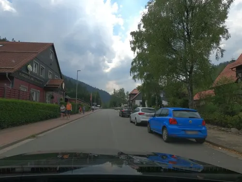
Pizzeria Ristorante Mamma Mia
Restaurant · Italian
44 Jacobsonstraße, Seesen
Mo off; Tu-Th, Su 11:00-14:30,17:30-21:00; Fr, Sa 11:00-14:30,17:30-22:00
Café Konditorei Kiene
Cafe
29 Jacobsonstraße, Seesen
Th-Fr 08:00-18:00;Sa 08:00-17:00;Su, PH 10:00-18:00
Roccos Lebenslust
Restaurant
50 Jacobsonstraße, Seesen
We, Th 17:30-22:00; Fr, Sa 17:30-23:00; Su 12:00-14:00; Su 17:30-22:00


48 more on the map.
History
The Saxon settlement of Sehusa was first mentioned in a 974 AD deed issued by Emperor Otto II and Chancellor Willigis, from 1235 on it belonged to the Welf dukes of Brunswick-Lüneburg who had a castle erected. In 1428 Seesen received town privileges by Duke Otto II the One-Eyed of Brunswick-Göttingen. On 17 July 1810 in Seesen, Israel Jacobson dedicated the first synagogue to use some German in its liturgy, and to employ an organ and a choir during prayer; that dedication date is celebrated in Reform Judaism worldwide as the founding of the denomination. In 1836 Heinrich Engelhard Steinweg (later named Henry E. Steinway) built his first grand piano in his kitchen in Seesen; the instrument is today on display at New York's Metropolitan Museum of Art.
From the History section of Seesen on Wikipedia, under CC BY-SA 4.0.
Where to stay18
Churches and places of worship26
Kapelle Hachenhausen
Church · Lutheran · 7.5 km
Hachenhausen, Bad Gandersheim
Neuapostolische Kirche Seesen
Church · New Apostolic · 1.1 km
36A Hochstraße, Seesen
Shopping20
Gas and EV charging13
Schools, colleges and libraries11
Healthcare6
Map of Seesen
250 places. The map loads OpenStreetMap tiles when you open it.
Getting there and nearby towns
Forschungsflughafen Braunschweig-Wolfsburg (BWE) is the nearest airport with scheduled flights listed in OpenStreetMap, 54 km away.
- Bad Gandersheim 11 km west, about 11 min by car
- Bockenem 14 km north, about 14 min by car
- Vienenburg 27 km east, about 27 min by car
- Hildesheim 33 km northwest, about 33 min by car
- Salzgitter 34 km northeast, about 34 min by car
- Wolfenbüttel 39 km northeast, about 39 min by car
- Göttingen 43 km southwest, about 43 min by car
- Vechelde 43 km north, about 43 min by car
- Uslar 46 km southwest, about 46 min by car
- Braunschweig 48 km northeast, about 48 min by car
Drive times are estimates from straight-line distance, not routes.
Local news
Headlines from INDB.
Reviews, tips and questions
Loading what members have shared...
Sources and licences
- GeoNames (CC BY 4.0): population, coordinates, regions and time zone
- Mapillary (see each image): photos
- OpenStreetMap contributors (ODbL 1.0): places, airports, map data
- Wikidata (CC0 1.0): elevation, founding date, time zone, website, landmarks and historic places
- Wikimedia Commons (see each image): photos
- Wikipedia (CC BY-SA 4.0): overview and history text
Photo credits
- Burg Sehusa, User Zahlenmonster on de.wikipedia, CC BY-SA 3.0
- Kochsche Gasse, 1, Seesen, Landkreis Goslar, GeorgDerReisende, CC BY-SA 4.0
- Jacobsonstraße, 7, Seesen, Landkreis Goslar, GeorgDerReisende, CC BY-SA 4.0
- Jacobsonstraße, 8, Seesen, Landkreis Goslar, GeorgDerReisende, CC BY-SA 4.0
- Bushaltestelle Obere Jacobsonstraße, 3, Seesen, Landkreis Goslar, GeorgDerReisende, CC BY-SA 4.0
- Bushaltestelle Obere Jacobsonstraße, 2, Seesen, Landkreis Goslar, GeorgDerReisende, CC BY-SA 4.0
- Jacobsonstraße, 11, Seesen, Landkreis Goslar, GeorgDerReisende, CC BY-SA 4.0
- Seesen Jacobsonstr 34 Wohnhaus 07 2025, ZornigeAmeise2017, CC BY-SA 4.0
- Seesen Jacobsonstr 34 Wohnhaus Eingang 07 2025, ZornigeAmeise2017, CC BY-SA 4.0
- Seesen Jacobsonstr 34 Torbogen 07 2025, ZornigeAmeise2017, CC BY-SA 4.0
- Bushaltestelle Obere Jacobsonstraße, 1, Seesen, Landkreis Goslar, GeorgDerReisende, CC BY-SA 4.0
- Bushaltestelle Obere Jacobsonstraße, 4, Seesen, Landkreis Goslar, GeorgDerReisende, CC BY-SA 4.0
- Bushaltestelle An der Landesbahn, 1, Seesen, Landkreis Goslar, GeorgDerReisende, CC BY-SA 4.0
- Harzstraße, 1, Seesen, Landkreis Goslar, GeorgDerReisende, CC BY-SA 4.0
- Zimmerstraße, 1, Seesen, Landkreis Goslar, GeorgDerReisende, CC BY-SA 4.0
- Lautenthaler Straße, 2, Seesen, Landkreis Goslar, GeorgDerReisende, CC BY-SA 4.0
- Jahnstraße, 1, Seesen, Landkreis Goslar, GeorgDerReisende, CC BY-SA 4.0
- Jacobsonstraße, 9, Seesen, Landkreis Goslar, GeorgDerReisende, CC BY-SA 4.0
- Bushaltestelle Jahnstraße, 1, Seesen, Landkreis Goslar, GeorgDerReisende, CC BY-SA 4.0
- Lautenthaler Straße, 3, Seesen, Landkreis Goslar, GeorgDerReisende, CC BY-SA 4.0
- Bismarckstraße, 1, Seesen, Landkreis Goslar, GeorgDerReisende, CC BY-SA 4.0
- Bismarckstraße, 2, Seesen, Landkreis Goslar, GeorgDerReisende, CC BY-SA 4.0
- Lautenthaler Straße, 4, Seesen, Landkreis Goslar, GeorgDerReisende, CC BY-SA 4.0
- Lautenthaler Straße, 1, Seesen, Landkreis Goslar, GeorgDerReisende, CC BY-SA 4.0
- Linnenstraße, 2, Seesen, Landkreis Goslar, GeorgDerReisende, CC BY-SA 4.0
- Kleine Reihe, 1, Seesen, Landkreis Goslar, GeorgDerReisende, CC BY-SA 4.0
- Kleine Reihe, 2, Seesen, Landkreis Goslar, GeorgDerReisende, CC BY-SA 4.0
- Drakenpfuhl, 2, Seesen, Landkreis Goslar, GeorgDerReisende, CC BY-SA 4.0
- Jacobsonplatz, 1, Seesen, Landkreis Goslar, GeorgDerReisende, CC BY-SA 4.0
- Jahnstraße, 2, Seesen, Landkreis Goslar, GeorgDerReisende, CC BY-SA 4.0
- Braunschweigische Südbahn, 1, Seesen, Landkreis Goslar, GeorgDerReisende, CC BY-SA 4.0
- Bushaltestelle Jahnstraße, 2, Seesen, Landkreis Goslar, GeorgDerReisende, CC BY-SA 4.0
- Braunschweigische Südbahn, 2, Seesen, Landkreis Goslar, GeorgDerReisende, CC BY-SA 4.0
- Braunschweigische Südbahn, 2 (2014), Seesen, Landkreis Goslar, GeorgDerReisende, CC BY-SA 4.0
- Seesen Stolperschwelle Jacobsonplatz, Migebert, CC BY-SA 4.0
- Seesen Stolperstein Max Gerson, Migebert, CC BY-SA 4.0
- Seesen Stolpersteine Jacobsonstraße Jacobsonplatz, Migebert, CC BY-SA 4.0
- Seesen Stolperstein Hanny Stern, Migebert, CC BY-SA 4.0
- Seesen Stolperstein Elsa Gerson, Migebert, CC BY-SA 4.0
- Seesen Stolperstein Helene Winter, Migebert, CC BY-SA 4.0
- BadGrund01s, Traveler100, CC BY-SA 3.0
- Iberger Tropfsteinhoehle, Siegbert Brey, CC BY-SA 4.0
- Harzhorn Ausgrabungsbereich, Axel Hindemith, CC BY 3.0
- Standort des Bergfrieds auf Burg Schildberg, Castritus, CC BY-SA 4.0
- Wohlenstein Bergfried Seite, User Axel Hindemith on de.wikipedia, Public domain
- Luchsstein, Hejkal, CC BY-SA 2.0
- Naturschutzgebiet Silberhohl 02, Ursula Bresler, CC BY-SA 4.0
- Merian Stauffenburg, User AxelHH on de.wikipedia, Public domain
- Maassener Gaipel 01, Matthias Becker, CC BY-SA 3.0
- Seesen Kirche kath 2011, Kirchenfan, CC0
- 2021-08-04 150144 Seesen Bilderlahe St. Michael, Tim Rademacher, CC BY-SA 4.0
- Seesen, die Sankt Andreaskirche IMG 4761 2018-07-03 12.09, Michielverbeek, CC BY-SA 4.0
- St.Romanus Dachreiter, Thomas Binder, CC BY-SA 4.0
- LautenthalChurch, Torbenbrinker, CC BY-SA 3.0
- Hachenhausen, FrankBothe, CC BY-SA 3.0
- Kapelle St. Martin Dannhausen Kirche, Okieh71, Public domain
- Harriehausen Kirche mit Zaun, Gustl Rigga, CC BY-SA 4.0
- Rhüden, die Sankt-Martini-Kirche IMG 4713 2018-07-02 16.46, Michielverbeek, CC BY-SA 4.0
- Seesen Jagdschloss, Presse03 ( talk ), CC BY-SA 3.0
- Museum seesen front nov 2010, Achim Bodewig, CC BY-SA 3.0
- Oberharzbahn, Pechristener File:Germany location map.svg : NordNordWest , Palosirkka , SokoWiki, CC BY-SA 2.0
- Street-level photo, Langfahrer, CC BY-SA 4.0
- Street-level photo, sunnyteater, CC BY-SA 4.0
- Street-level photo, Langfahrer, CC BY-SA 4.0
- Street-level photo, skjall, CC BY-SA 4.0
- Street-level photo, sunnyteater, CC BY-SA 4.0
- Street-level photo, Langfahrer, CC BY-SA 4.0
- Street-level photo, baldur80, CC BY-SA 4.0
- Street-level photo, baldur80, CC BY-SA 4.0
- Street-level photo, Hightower-, CC BY-SA 4.0
- Street-level photo, Friesmaker, CC BY-SA 4.0
- Street-level photo, baldur80, CC BY-SA 4.0
- Street-level photo, sunnyteater, CC BY-SA 4.0
- Street-level photo, Langfahrer, CC BY-SA 4.0
- Street-level photo, baldur80, CC BY-SA 4.0
- Street-level photo, baldur80, CC BY-SA 4.0
- Street-level photo, Friesmaker, CC BY-SA 4.0
- Street-level photo, 468p, CC BY-SA 4.0
- Street-level photo, StefanS79, CC BY-SA 4.0


Page built November 8, 2026. Spotted a mistake? Tell us or suggest a place.