


Why visit Seevetal
Townapedia lists 120 museums and landmarks, 47 parks and trails, 179 places to eat, 17 places to stay and 31 attractions in and around town.
Highlights include Harburger Theater, Fuchsberg, Sammlung Falckenberg and Filmmuseum Bendestorf.
Weather in Seevetal
Forecast from MET Norway (CC BY 4.0). Full forecast
About Seevetal
Seevetal (German pronunciation: [ˈzeːvətaːl]; Low German: Seevdaal; both lit. 'Seeve Valley') is a municipality in the district of Harburg, in Lower Saxony, Germany. It is situated approximately 20 km south of Hamburg, and 15 km west of Winsen (Luhe). Its seat is in the village Hittfeld. It is named after the river Seeve.
From the Wikipedia article Seevetal (this version), under CC BY-SA 4.0.
Photos of Seevetal


Things to do31



SB-Hofladen Renck
Farm and orchard · 5.2 km
Kartoffeln, Äpfel und Biomilchwaren aus der Region. Je nach Saison auch Honig und Konfitüre. Selbstbedienung ist angesagt
10 Sottorfer Dorfstraße, Rosengarten
Mo-Su 07:00-22:00

Wilken’s Hoflädle
Farm and orchard · 5.3 km
6 Buchholzer Straße, Rosengarten
Fr 16:00-19:00; Sa 10:00-16:00
Erdbeer und Spargel Verkaufsstand
Farm and orchard · 5.2 km
Saisonal werden hier Erdbeeren bzw. Spargel verkauft

19 more on the map.
Museums and landmarks120


Filmmuseum Bendestorf
Museum · 6.4 km
1 Hildegard-Knef-Platz, Bendestorf
Th 16:00-18:00, Su 15:00-17:00

Freilichtmuseum am Kiekeberg
Museum · 6.0 km
Tu-Fr 09:00-17:00; Sa-Su 10:00-18:00; PH 10:00-18:00; Jan 01, Dec...


Archäologisches Museum Hamburg und Stadtmuseum Harburg
Museum · 6.6 km
Archaeologic and local historic museum in Hamburg, Germany



108 more on the map.
Parks, trails and playgrounds47



Abenteuerspielplatz Harburg
Playground · 5.8 km
Offene Kinder- und Jugendarbeit, Bauspielplatz
42 Hohe Straße, Hamburg
Mo-Fr 14:00-18:00; Sa 10:00-15:00



35 more on the map.
Restaurants and cafes179
Lino
Restaurant · Portuguese · 5.6 km
20 Vinzenzweg
Tu-Th 12:00-21:00; Fr 09:00-13:00, 14:00-18:00; Sa 12:30-21:30; Su...
Món Việt
Restaurant · Thai · 5.1 km
116 Horster Landstraße, Seevetal
Tu-Fr 17:00-22:30; Sa-Su 12:00-23:00
PAN-NAM Restaurant
Restaurant · Asian · 4.5 km
35a Bahnhofstraße, Rosengarten
Mo 11:00-22:00, Tu-Su 11:00-22:00
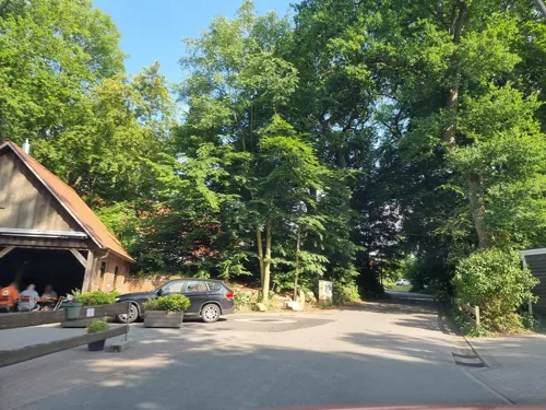
Restaurant Horster Mühle
Restaurant · German · 5.2 km
4 Zur Wassermühle, Seevetal
Mo-Fr 17:00+; Sa,Su 12:00+; Tu,We off
Rosengarten Grillhaus
Restaurant · Turkish · 5.1 km
39 Hauptstraße, Rosengarten
Mo-Fr 10:30-21:30; Sa-Su 11:00-21:30
Stoof Mudders Kroog / Pfarrwitwenhaus (M3)
Restaurant · German · 6.1 km
1a Am Kiekeberg, Rosengarten
Tu-Fr 12:00-17:00; Sa, Su 12:00-18:00

Pizza Fresh
Restaurant · Italian · 6.3 km
30a Bremer Straße, Hamburg
Su-Th 16:00-23:45, Fr-Sa 16:00-01:45
Restaurant Böttchers Gasthaus
Restaurant · German · 5.2 km
44 Bremer Straße, Rosengarten
Mo,Tu,Th-Sa 16:00-21:00; Su 12:00-16:00
167 more on the map.
History
On 1 July 1972, the administrations of 19 independent smaller municipalities were merged to form the Seevetal municipality.
The 19 towns and villages forming Seevetal are Beckedorf, Bullenhausen, Emmelndorf, Fleestedt, Glüsingen, Groß Moor, Helmstorf, Hittfeld, Holtorfsloh, Horst, Hörsten, Klein Moor, Lindhorst, Maschen, Meckelfeld, Metzendorf, Ohlendorf, Over and Ramelsloh.
Several of these towns have a rich history: the existence of Ramelsloh was first vouched in the year 845, Maschen was first mentioned in official documents in 1294, and Hittfeld celebrated its 900th anniversary in June 2007. The St. Mauritius church in Hittfeld dates back to the 12th century. Remarkable archaeological finds of the region are the Metzendorf-Woxdorf head burial dating to ca. 2200 BCE or the early Christian Maschen disc brooch which are in the permanent exhibition of the nearby Archaeological Museum Hamburg.
From the History section of Seevetal on Wikipedia, under CC BY-SA 4.0.
Where to stay17
Churches and places of worship28
Apostelkirche
Church · Evangelisch-Lutherische · 5.9 km
52 Hainholzweg, Hamburg-Harburg
Kirchengemeinde Nenndorf
Church · Evangelical · 5.2 km
1 Kirchenstraße, Rosengarten
Shopping51
Gas and EV charging52
Schools, colleges and libraries44
Healthcare16
Eidig Apotheke
Clinic and pharmacy · 4.5 km
1 Bürgermeister-Glade-Straße, Rosengarten
Map of Seevetal
250 places. The map loads OpenStreetMap tiles when you open it.
Getting there and nearby towns
Hamburg Finkenwerder Airport (XFW) is the nearest airport with scheduled flights listed in OpenStreetMap, 18 km away.
- Buchholz in der Nordheide 10 km southwest, about 10 min by car
- Stelle 10 km east, about 10 min by car
- Jesteburg 10 km south, about 10 min by car
- Neu Wulmstorf 14 km northwest, about 14 min by car
- Hamburg 17 km north, about 17 min by car
- Wulfsen 16 km southeast, about 16 min by car
- Winsen 17 km east, about 17 min by car
- Buxtehude 20 km northwest, about 20 min by car
- Oststeinbek 21 km northeast, about 21 min by car
- Tostedt 22 km southwest, about 22 min by car
Drive times are estimates from straight-line distance, not routes.
Towns near Seevetal


Keep exploring
Local news
Headlines from INDB.
Reviews, tips and questions
Loading what members have shared...
Sources and licences
- GeoNames (CC BY 4.0): population, coordinates, regions and time zone
- Mapillary (see each image): photos
- OpenStreetMap contributors (ODbL 1.0): places, airports, map data
- Wikidata (CC0 1.0): elevation, founding date, time zone, website, landmarks and historic places
- Wikimedia Commons (see each image): photos
- Wikipedia (CC BY-SA 4.0): overview and history text
Photo credits
- Harburg.helmsmuseum.strasse.wmt, User:Wmeinhart - Wolfgang Meinhart, Hamburg, CC BY-SA 3.0
- Harburg.helmsmuseum.vorplatz.wmt, User:Wmeinhart - Wolfgang Meinhart, Hamburg, CC BY-SA 3.0
- Sammlung Falckenberg, Deichtorhallen Hamburg, CC BY-SA 3.0
- RK 1709 1110128 Kiekeberg, Reinhard Kraasch, CC BY-SA 4.0
- Sinstorfer Kirche Ostseite 3, Dirtsc, CC BY-SA 3.0
- Ines Ausstellung; Kiekeberg 026, John N., CC BY-SA 3.0
- Hamburg Wilstorf Stadtpark@Nymphengraben, KaiBorgeest, CC BY-SA 4.0
- Ohlen Kuhlen nature reserve 2, Alexander Axmann, CC BY-SA 4.0
- Phoenix Center Hamburg-Harburg 005, GeorgHH, Public domain
- Alter Friedhof Harburg, 2019-02 I, ChristianSW, CC0
- Hittfelder Kirche, Gemeinde Seevetal, CC BY-SA 3.0
- Filmmuseum-bendestorf, Fonzie, CC BY-SA 4.0
- Kirche Marmstorf mit Pfarrhaus, Georg Bratsch, CC BY-SA 4.0
- Charlotte Stempel - Brunsstraße 10 (Hamburg-Harburg).Stolperstein.nnw, NordNordWest, CC BY-SA 3.0 de
- Haeckelstrasse 10 Birnberg, Warrel040, CC BY-SA 4.0
- Anna Zinke - Eddelbüttelstraße 35 (Hamburg-Harburg).Stolperstein.nnw, NordNordWest, CC BY-SA 3.0 de
- Apostelkirche Eissendorf Süd 1, Dirtsc, CC BY-SA 3.0
- Lutherkirche Eißendorf und Pastorat, Pauli-Pirat, CC BY-SA 4.0
- Eissendorfer Strasse 88 Voigts, Warrel040, CC BY-SA 4.0
- Alfons Teschke - Winsener Straße 30 (Hamburg-Wilstorf).Stolperstein.nnw, NordNordWest, CC BY-SA 3.0 de
- August Mondry - Ruststraße 11 (Hamburg-Eißendorf).Stolperstein.nnw, NordNordWest, CC BY-SA 3.0 de
- Stolperstein Friedhofstraße 11 - Auguste Devrient, Bernhard Diener, CC BY-SA 4.0
- Ohlen Kuhlen nature reserve 1, Alexander Axmann, CC BY-SA 4.0
- St Mauritius Kirche Hittfeld, Schizoschaf, CC BY-SA 3.0
- Eingangsgebäude des Freilichtmuseums, PresseKiekeberg, CC BY-SA 4.0
- Außenmühlenteich in Hamburg-Wilstorf (2), Pauli-Pirat, CC BY-SA 4.0
- Hh-harburg-blohm, Staro1 at German Wikipedia, CC BY-SA 3.0
- Alter Bahnhof - panoramio (3), hh oldman, CC BY 3.0
- Weg zum Bahnsteig - panoramio, hh oldman, CC BY 3.0
- Bildergallery im Bahnhofstunnel - panoramio, hh oldman, CC BY 3.0
- Privatsignale - panoramio, hh oldman, CC BY 3.0
- Privat Bahnhof Hittfeld - panoramio, hh oldman, CC BY 3.0
- Privat Garten - panoramio, hh oldman, CC BY 3.0
- Kriegerdenkmal Emmelndorf, Gesamtansicht von Norden, Christian Stam, CC BY-SA 4.0
- Kriegerdenkmal Emmelndorf, Detailansicht von Westen, Christian Stam, CC BY-SA 4.0
- Kriegerdenkmal Emmelndorf, Gesamtansicht von Norden2, Christian Stam, CC BY-SA 4.0
- Kriegerdenkmal Emmelndorf, Detailansicht von Norden, Christian Stam, CC BY-SA 4.0
- Kriegerdenkmal Emmelndorf, Detailansicht von Süden, Christian Stam, CC BY-SA 4.0
- Kriegerdenkmal Emmelndorf, Detailansicht von Osten, Christian Stam, CC BY-SA 4.0
- Kriegerdenkmal Emmelndorf, Gesamtansicht von Osten, Christian Stam, CC BY-SA 4.0
- Blick vom Fuchsberg Richtung Hamburg - panoramio, Axel Schnell, CC BY-SA 3.0
- RK 1709 1110132 Langer Stein, Reinhard Kraasch, CC BY-SA 4.0
- Street-level photo, hotteliene, CC BY-SA 4.0
- Street-level photo, DruideBizeps, CC BY-SA 4.0
- Street-level photo, ma_rt_in, CC BY-SA 4.0
- Street-level photo, veloroute_hamburg, CC BY-SA 4.0
- Street-level photo, hotteliene, CC BY-SA 4.0
- Street-level photo, hotteliene, CC BY-SA 4.0
- Street-level photo, ma_rt_in, CC BY-SA 4.0
- Street-level photo, ma_rt_in, CC BY-SA 4.0
- Street-level photo, hotteliene, CC BY-SA 4.0
- Street-level photo, geoft, CC BY-SA 4.0
- Street-level photo, tian, CC BY-SA 4.0
- Street-level photo, ma_rt_in, CC BY-SA 4.0
- Street-level photo, hotteliene, CC BY-SA 4.0
- Street-level photo, hotteliene, CC BY-SA 4.0
- Street-level photo, hotteliene, CC BY-SA 4.0
- Street-level photo, hotteliene, CC BY-SA 4.0
- Street-level photo, hotteliene, CC BY-SA 4.0
- Street-level photo, hotteliene, CC BY-SA 4.0
- Street-level photo, ma_rt_in, CC BY-SA 4.0
- Street-level photo, ma_rt_in, CC BY-SA 4.0
- Street-level photo, veloroute_hamburg, CC BY-SA 4.0


Page built November 9, 2026. Spotted a mistake? Tell us or suggest a place.