


Why visit Buxtehude
Townapedia lists 28 museums and landmarks, 31 parks and trails, 153 places to eat, 20 places to stay and 17 attractions in and around town.
Highlights include Herzapfelhof, Hofladen Obsthof Feindt, Museum Altes Land and Buxtehude Museum for regional history and art.
Weather in Buxtehude
Forecast from MET Norway (CC BY 4.0). Full forecast
About Buxtehude
Buxtehude (German pronunciation: [bʊkstəˈhuːdə] ; Low German: Buxthu, pronounced [bʊkstˈhu]), officially the Hanseatic City of Buxtehude (German: Hansestadt Buxtehude), is a town on the Este River in Northern Germany, belonging to the district of Stade in Lower Saxony. It is part of the Hamburg Metropolitan Region and attached to the city's S-Bahn rapid transit network. Buxtehude is a medium-sized town and the second largest municipality in the Stade district (Landkreis). It lies on the southern border of the Altes Land in close proximity to the city-state of Hamburg.
From the Wikipedia article Buxtehude (this version), under CC BY-SA 4.0.
Travel tips from other travellers: Buxtehude on Wikivoyage (CC BY-SA 4.0).
Photos of Buxtehude


Things to do17

Herzapfelhof
Farm and orchard · 6.4 km
102 Osterjork, Jork
Mo-Th,Sa 08:00-18:00; Su,PH 10:00-18:00; Fr 09:00-19:00
Hofladen Obsthof Feindt
Farm and orchard · 7.3 km
57 Westerjork, Jork
Mar-Dec: Mo-Sa 08:00-18:00; Su 09:00-18:00; Jan-Feb: Tu-Sa...

Hofladen Hoekers
Farm and orchard · 3.7 km
64 Inne Beek, Buxtehude
Tu,Fr 09:00-12:00,14:00-18:00

5 more on the map.
Museums and landmarks28


Buxtehude Museum for regional history and art
Museum · 1.1 km
11 St. Petri-Platz, Buxtehude
Tu-Fr 11:00-18:00; Sa,Su 11:00-18:00

Marschtorzwinger
Monument and historic site · 1.2 km
10 Liebfrauenkirchhof, Buxtehude
Tu-Fr 16:00-19:00; Sa,Su 11:00-18:00



Die Kleine Fleth-Philharmonie
Museum · 1.0 km
Konzertraum und Ausstellung lokaler Kunst. Der Zutritt zur Kunstausstellung ist kostenfrei.
Mo-Fr open "Für Zutritt zur Kunstausstellung klingeln"

16 more on the map.
Parks, trails and playgrounds31



Golf-Club Buxtehude
Golf course · 5.3 km
1 Zum Lehmfeld, Buxtehude
May-Sep: Mo 10:00-14:00; Apr-Oct: Tu-Fr 09:00-17:00; Apr-Oct:...

Heidebad
Sports field and stadium · 1.3 km
44 Estetalstraße, Buxtehude
Mo 13:00-20:00; Tu-Fr 06:00-20:00; Sa,Su 08:00-19:00

Themenspielplatz Baustelle
Playground · 7.1 km
Ganz dem Thema `Bauen´ verschrieben, wurden eine Schaukel und Transporter "Bobbi" mit unterschiedlichsten Spielmöglichkeiten aufgebaut,...
Lönsweg, Neu Wulmstorf


Buxtehuder Wassersportverein Hansa e.V.
Marina and boat launch · 1.4 km
5 Am Hafen, Buxtehude
19 more on the map.
Restaurants and cafes153
Asien Perle
Restaurant · 7.3 km
Asiatische Erlebnisgastronomie
35 Hauptstraße, Neu Wulmstorf
Mo-Sa 11:30-15:00, 17:30-22:30; Su 11:30-22:30
China Palace
Restaurant · Chinese
5 Georgstraße, Buxtehude
Mo-Sa 11:30-15:00, 17:30-23:00; Su 11:30-23:00; PH 11:30-23:00
DeinEigenerWein.de
Brewery and winery · 5.3 km
Online Handel für Wein, Sekt, Bier und Spirituosen mit deinem Eigenen Etikett und Sonderausstattungen.
37a Osterladekop, Jork
Online Handel
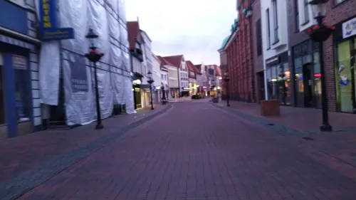
Dionysos
Restaurant · Greek · 1.1 km
4 Abtstraße, Buxtehude
Jan-Dec: Tu-Sa 17:30-22:00; Oct-Mar: Su 16:00-21:00; Apr-Sep: Su...
Hoddow's Gastwerk
Restaurant · International · 1.0 km
35 Westfleth, Buxtehude
We-Su 12:00-15:00,17:30-23:00, Mo-Tu "on appointment"
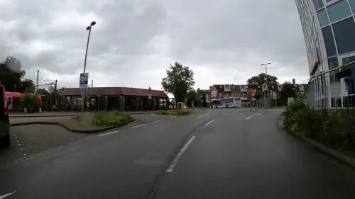
Meze Food & Kebap
Restaurant · Barbecue, Kebab
2 Stader Straße, Buxtehude
Su-Th 11:00-22:00; Fr,Sa 11:00-22:30
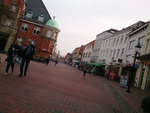

Hillert
Bakery · 0.8 km
Viverstraße, Buxtehude
Mo-Th 06:30-18:00; Fr 06:30-17:00; Sa, Su, PH 07:00-12:00

Eiscafe Piccola Venezia
Ice cream · Ice Cream · 7.1 km
2 Altländer Markt, Jork
Mo-Fr 11:00-19:00; Sa 11:00-18:00; Su 13:00-18:00

JA AN
Restaurant · Sushi, Asian · 7.1 km
1-4 Altländer Markt, Jork
Mo-Fr 11:30-22:30; Sa,Su 12:00-22:00
Oregano Kousina
Restaurant · Greek · 6.9 km
7 Schützenhofstraße, Jork
Mo, We-Fr 16:00-22:00; Sa-Su 12:00-22:00
141 more on the map.
History
Early signs of settlements are the Daensen folding chair from a Bronze Age tumulus near Daensen and the Ovelgönne bread roll from the Pre-Roman Iron Age of Northern Europe, which was found in a loam mine in Ovelgönne.
A settlement by the Este river is first recorded in 959. The manor of "Buochstadon" was given to the Abbey of Magdeburg. Soon a wharf, "Hude", is established.
In 1135 the settlement is mentioned as "Buchstadihude" in a reference to the success of trade from the quay.
In 1180 the Duchy of Saxony, to which "Buchstadihude" belonged, was conquered and dissolved. Buxtehude became part of the Prince-Archbishopric of Bremen, newly upgraded to imperial immediacy it became one of the many successor states of the Duchy of Saxony. Nevertheless, ecclesiastically Buxtehude remained part of the Diocese of Verden until Catholicism was overthrown in the Reformation with that diocese remaining vacant since 1644.
In 1197 two royal settlers founded a Benedictine monastery near the village. Owing to the fertile soil and a partial participation in the saline of Lüneburg wealth and population increased.
In 1280 the prince-archbishop Giselbert of Bremen ordered the settlement to be protected by defensive walls and fortifications including 5 zwingers, 7 peels and 3 town gates.
Read more of the history
In 1328 the town hall is mentioned for the first time and the settlement is granted full town privileges, based on the law of Hamburg. By now "Buxtehude" was self-governing and rapidly growing into a centre of trade.
In 1485 the immensely wealthy "Master Halepaghen", cousin and tutor of the burgomaster of Hamburg, died and donated his assets to the town for scholarships and charitable purposes.
In 1542 the town council of Buxtehude adopted Lutheranism within its domain.
In the 1600s Hanseatic trade declined with the most important area of trade being in cattle. Apart from Stade, Buxtehude was the only crossing point on the Elbe river.
In 1645 Buxtehude surrendered to the Swedish army and lost its independence. Trade and population decrease dramatically.
In 1648 the Prince-Archbishopric of Bremen was converted to the Duchy of Bremen, which was first ruled in personal union by the Swedes and from 1715 on by the Hanoverian Crown.
In 1823 the Duchy was abolished and its territory became part of the Stade Region.
In 1837 the link road through the town reanimates business and trade.
1845 is dominated by industrial boom with a paper factory being installed on the former cloister ground.
In 1945 the population grew to 14,000. Much living space in Hamburg was in ruins and people fled to the suburbs and surrounding towns and villages such as Buxtehude.
In 1958 Buxtehude became part of the plan for the reconstruction of Hamburg after the war and thus was heavily funded by the government.
Lower Saxony incorporates 9 neighbouring villages into the town in 1972 changing the structure of Buxtehude and creating a cluster of more than 30,000 inhabitants.
In 1990 Ribnitz-Damgarten in the former German Democratic Republic became the second twin town.
From the History section of Buxtehude on Wikipedia, under CC BY-SA 4.0.
More about Buxtehude
Economy
Since 1881 Buxtehude has had its own railroad station on the R50 line between Hamburg and Cuxhaven. In late 2007 this line was added to the rapid transit system of the Hamburg S-Bahn by the HVV.
Since 1928 there has also been a second railroad line crossing Buxtehude, the EVB (Eisenbahn- und Verkehrsbetriebe Elbe-Weser, Zeven) between Hamburg's outermost district and Bremerhaven on the coast of the North Sea.
The Este river connects the town to the important Elbe river 9.7 kilometres (6 mi) north. Earlier in history this connection was used to ship goods into the small harbour, which still exists but has become less accessible due to town developments and aggradation.
A major highway, scheduled for completion in 2012, is to connect the town to Hamburg.
Several major companies have production sites or headquarters in Buxtehude:
Airbus Operations GmbH - Cabin Electronics, the commercial aircraft manufacturer
Unilever, an Anglo-Dutch company in the personal care and food sector.
KID-Systeme GmbH, a Buxtehude-based supplier for aeroplane cabin electronics
Pioneer Hi-Bred, a subdivision of the US-based chemical producer DuPont, developer and exporter of seeds
Nord Kalksandsteinwerke, a German producer of lime sand bricks and other building material
Niederelbe Schifffahrtsgesselleschaft (NSB), German container shipping companies
Arts and culture
Buxtehude is sometimes called the "Fairytale Capital of the World," an epithet that it shares with Kassel. The tale of "The Hare and the Hedgehog" by the Brothers Grimm is set in this town. Furthermore, the name is used in numerous German tales. And thus some people claim that the town of Buxtehude does not actually exist. The German saying "nach Buxtehude jagen" (literally, "to chase somebody off to Buxtehude") means to exile someone to a far-away place.
German and Low Saxon, which is rarely spoken now but can be still heard spoken by older people. Also one of the local high schools Halepaghen-Schule holds a Low German reading contest each school year.
Besides the old part of town, the main church of Sankt Petri (St. Peter) and the Zwinger are also places to visit. The Altes Land adjacent to Buxtehude and the close Elbe river serve as locations for a bicycle tour or a long hike. Buxtehude can also be used as a hub for tours to the nearby cities of Hamburg and Bremen.
The Pistennacht is an event where bars, restaurants and clubs in the old part of town are open all night long. A stage downtown and some individual places offer live music.
Education
Hochschule 21, a private college with a renowned architecture program.
Halepaghen Grammar School, local highschool. Holder of the title "School without racism, School with courage", former member in the "Quality Network for Schools" in Lower Saxony, Humanitarian School and rating highest in the county.
Berufsbildende Schulen Buxtehude, public secondary schools for the sectors of economics, informatics and electrotechnics.
From the Wikipedia article Buxtehude, under CC BY-SA 4.0.
Notable people from Buxtehude
 Alexander NouriGerman footballer and managerPhoto: Hannover92, CC BY-SA 4.0
 Emily VogelGerman handball playerPhoto: Steffen Prößdorf, CC BY-SA 4.0
 Michael StolleGerman pole vaulterPhoto: Unknown author, Public domain
 Nils WinterGerman long jumperPhoto: M. Weitzel, CC BY-SA 3.0
 Jasper FrahmGerman cyclistPhoto: Nicola, CC BY-SA 4.0
 Nico MaternGerman association football playerPhoto: Hayden Schiff from Cincinnati, USA, CC BY 2.0
 Helga WexGerman politician (1924-1986)Photo: CDU, CC BY-SA 3.0 de
- Thomas WandschneiderGerman para badminton player
- Ralf DrecollGerman high jumper (1944–2012)
- Christian VietGerman association football player
Born in Buxtehude, according to Wikidata (CC0). Each name links to its Wikipedia article.
Where to stay20
Churches and places of worship19
Selam Moschee - Islamische Gemeinde Buxtehude e. V.
Place of worship · Sunni · 1.2 km
3 Schützenhofweg, Buxtehude
Freie evangelische Kirche
Church · Apostolic · 2.1 km
87 Apensener Straße, Buxtehude
Shopping50
Gas and EV charging19
Residenz Hotel Ladestation (nur Hotelgäste)
EV charging · 7.0 km
18 Bahnhofstraße, Neu Wulmstorf
Schools, colleges and libraries29
Healthcare18
Map of Buxtehude
250 places. The map loads OpenStreetMap tiles when you open it.
Getting there and nearby towns
Hamburg Finkenwerder Airport (XFW) is the nearest airport with scheduled flights listed in OpenStreetMap, 12 km away.
- Neu Wulmstorf 7 km east, about 7 min by car
- Jork 7 km north, about 7 min by car
- Horneburg 9 km northwest, about 9 min by car
- Wedel 13 km north, about 13 min by car
- Harsefeld 12 km west, about 12 min by car
- Sülldorf 14 km northeast, about 14 min by car
- Ahlerstedt 17 km southwest, about 17 min by car
- Buchholz in der Nordheide 19 km southeast, about 19 min by car
- Hansestadt Stade 20 km northwest, about 20 min by car
- Hamburg 22 km northeast, about 22 min by car
Drive times are estimates from straight-line distance, not routes.
Towns near Buxtehude


Keep exploring
Local news
Headlines from INDB.
Reviews, tips and questions
Loading what members have shared...
Sources and licences
- GeoNames (CC BY 4.0): population, coordinates, regions and time zone
- Mapillary (see each image): photos
- OpenStreetMap contributors (ODbL 1.0): places, airports, map data
- Wikidata (CC0 1.0): elevation, founding date, time zone, website
- Wikimedia Commons (see each image): photos
- Wikipedia (CC BY-SA 4.0): overview and history text
Photo credits
- Buxtehude Ewer Margareta, Presse03, CC BY-SA 3.0
- Bahnhof Buxtehude (23), TMbux, CC BY-SA 3.0
- Bahnhof Buxtehude, Grossergott, CC0
- Buxtehude Bahnsteigsignal - panoramio, hh oldman, CC BY 3.0
- Buxtehude - panoramio (6), TMbux, CC BY-SA 3.0
- Buxtehude - panoramio (4), TMbux, CC BY-SA 3.0
- Buxtehude - panoramio (5), TMbux, CC BY-SA 3.0
- Buxtehude - panoramio (3), TMbux, CC BY-SA 3.0
- Buxtehude Maria 6, Kirchenfan, CC0
- Buxtehude Maria 3, Kirchenfan, CC0
- Buxtehude Maria 5, Kirchenfan, CC0
- Buxtehude Maria 7, Kirchenfan, CC0
- Buxtehude Maria 4, Kirchenfan, CC0
- Buxtehude Maria 1, Kirchenfan, CC0
- Buxtehude Maria 2, Kirchenfan, CC0
- Buxtehude Maria 8, Kirchenfan, CC0
- Buxtehude Bahnhofstraße 07, ClausNe, CC BY-SA 4.0
- Buxtehude Maria 1973, Kirchenfan, CC0
- Buxtehude - panoramio (2), TMbux, CC BY-SA 3.0
- Buxtehude Bahnhofstraße 09, ClausNe, CC BY-SA 4.0
- Buxtehude-Amtsgericht1-Bubo, Bubo, CC BY-SA 3.0
- Buxtehude Bahnhofstraße 04, ClausNe, CC BY-SA 4.0
- ZOB Buxtehude - panoramio, hh oldman, CC BY 3.0
- Sterbender Krieger Buxtehude, Ulli 2mecs, CC BY-SA 4.0
- Buxtehuder Mühlenteich, smarties, CC BY-SA 4.0
- Hillert ZOB Buxtehude, Luca122345!, CC BY-SA 4.0
- HPS - Eingang - cropped, Boereck 12:21, 12 May 2006 (UTC), Public domain
- Mühlenmuseum Moisburg, aeroid, CC BY-SA 3.0
- Fassade der hochschule 21, Hochschule 21, CC BY-SA 3.0
- Nösler Grundoldendorf, DNösler, CC BY-SA 4.0
- Buxtehude Fischerstraße 02a, ClausNe, CC BY-SA 4.0
- StPetriKircheBuxtehude, Arne Hückelheim, CC BY-SA 3.0
- Neuklosterholz Waldweg, R2Dine ( Diskussion ), CC BY-SA 4.0
- Kirche zu Apensen 2019, Jan Laudahn, CC BY-SA 3.0 de
- Naturschutzgebiet Tide-Este, R2Dine ( Diskussion ), CC BY-SA 4.0
- Este bei Nindorf1, Wusel007, CC BY-SA 3.0
- Marschtorzwinger - panoramio, hh oldman, CC BY 3.0
- EstebrüggerKirche, Arne Hückelheim, CC BY-SA 3.0
- Moisburger Mühlenmuseum, smarties, CC BY-SA 4.0
- Neuenfelder Moor, Aeroid, CC BY-SA 4.0
- Buxtehude Museum, R2Dine ( Diskussion ), CC BY-SA 4.0
- Museum altes land, Morn the Gorn, CC BY-SA 3.0
- Street-level photo, veloroute_hamburg, CC BY-SA 4.0
- Street-level photo, akio, CC BY-SA 4.0
- Street-level photo, akio, CC BY-SA 4.0
- Street-level photo, mapillarymatt, CC BY-SA 4.0
- Street-level photo, matapiet, CC BY-SA 4.0
- Street-level photo, akio, CC BY-SA 4.0
- Street-level photo, calmapill, CC BY-SA 4.0
- Street-level photo, calmapill, CC BY-SA 4.0
- Street-level photo, calmapill, CC BY-SA 4.0
- Street-level photo, akio, CC BY-SA 4.0
- Street-level photo, matapiet, CC BY-SA 4.0
- Street-level photo, calmapill, CC BY-SA 4.0
- Street-level photo, calmapill, CC BY-SA 4.0
- Street-level photo, zoegglmeyr, CC BY-SA 4.0
- Street-level photo, nesshof, CC BY-SA 4.0
- Street-level photo, nesshof, CC BY-SA 4.0
- Street-level photo, calmapill, CC BY-SA 4.0
- Street-level photo, sashazykov, CC BY-SA 4.0
- Street-level photo, nesshof, CC BY-SA 4.0
- Street-level photo, calmapill, CC BY-SA 4.0
- Street-level photo, zoegglmeyr, CC BY-SA 4.0
- Street-level photo, calmapill, CC BY-SA 4.0
- Street-level photo, calmapill, CC BY-SA 4.0
- Street-level photo, calmapill, CC BY-SA 4.0
- Street-level photo, zoegglmeyr, CC BY-SA 4.0


Page built November 9, 2026. Spotted a mistake? Tell us or suggest a place.